Northwestern European Military Situation Maps from World War II
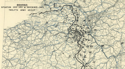
Created by the First United States Army Group and the Twelfth Army Group, this collection consists of 416 situation maps from World War II. The maps show the daily positions of Allied army units during the campaigns in Western Europe, from the D-Day invasion on June 6, 1944, through Allied occupation in July 26, 1945. There are also more than 100 reports from the campaigns.
Maps offer insight into daily activities, but also a broad view of movement over time. In addition, they highlight the incomplete nature of information available to commanders in the field during war time. Visitors can search the collection or browse the maps and reports by title, creator, subject, place, or date. The site also includes an interactive essay on the Battle of the Bulge. Visitors can select the desired zoom level and window size for viewing maps.
Related Topics
USC Archival Research Center
With over 126,000 photographs, maps, and other documents, this site offers a comprehensive look at the history of Los …
Experiencing War: Stories from the Veterans History Project

Presents video and audio oral histories and additional material from American veterans of 20th-century wars.