At a Glance
Description
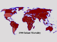
Compare global statistics on topics from infant mortality to literacy.
Producer
Historical Atlas of the Twentieth Century

Through a series of maps of the world, continents, and specific countries, users can trace large-scale demographic, economic, and political trends and developments covering the twentieth century. Topics charted on these maps include changes in agricultural workforce, infant mortality rates, life expectancy, literacy, persons with telephones, systems of government, alliances, borders between countries, and political violence, including wars. While examining any one map, click on buttons to find contextual information from additional maps. The site also includes informative timelines. Created by a librarian, the atlas provides a quick and easy way to see comparative change over time on a worldwide basis. Users should be aware, however, that the categorization scheme does not necessarily reflect the views of professional historians.