Campaign Atlases

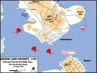
These 400 20th-century color maps of military campaigns cover a broad range of conflicts, from American colonial wars to U.S. involvement in Somalia in 1992—1993. Most of the maps represent conflicts in which the U.S. played a role, such as the "Battle of Bunker Hill" or the "Allied Landing in Normandy," although the collection also includes maps of the Napoleonic Wars, the Chinese Civil War, the Falkland Islands War, and Arab-Israeli conflicts.
Maps are indexed by war and may be enlarged, but are not annotated. The site is easy to navigate, although large maps may be slow to download. A bibliography lists eight atlases, published between 1959 and 1987, from which many of the maps were taken. The site is particularly useful for studying cartography and military history.