At a Glance
Topics
Website
Features
Duration
Grade(s)
Lesson Format
Download
Locate Yourself on a Map of the Americas
Young students locate themselves on a map and explore spatial relationships among geographic features.
Review

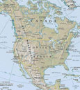
This is a straightforward lesson that introduces K-2 students to the concept of geographical location and scale. Using a variety of different maps, the lesson helps students understand the way that countries are situated within continents, states within countries, and cities within states.
Designed for a single-period, the lesson begins with students identifying the continent and country in which they live. Then, students begin to move to progressively more specific scales, locating the state or district in which they live, and eventually their school. Along the way, the plan calls for discussion of the number and size of states and districts, and the relative scale of different cities and towns.
The lesson is built around National Geographic’s MapMaker kit for the Americas—part of their larger MapMaker kit collection. For first-time users, video tutorials are available, and each kit enables the user to download, print, and assemble maps of varying scales. Map sizes range from “mega maps” designed for walls to one-page outline maps designed for individual study.
The strength of this lesson is that it introduces a key concept in historical thinking: geographical location and spatial relationships. By helping students understand the relationships between and among various locations, it establishes an important foundation for students in early elementary grades to learn about historical context. The website isn’t always the most intuitive to navigate, but persistence pays off with high-quality free resources.
Notes
| Field | Criteria | Comments | ||
|---|---|---|---|---|
| Historical Content | Is historically accurate? | N/A, the focus of this K-2 lesson is geography. |
||
| Includes historical background? | N/A |
|||
| Requires students to read and write? | No |
|||
| Analytic Thinking | Requires students to analyze or construct interpretations using evidence? | No |
||
| Requires close reading and attention to source information? | Yes, requires close reading of maps. |
|||
| Scaffolding | Is appropriate for stated audience? | Yes |
||
| Includes materials and strategies for scaffolding and supporting student thinking? | Yes |
|||
| Lesson Structure | Includes assessment criteria and strategies that focus on historical understanding? | Assessment checks for understanding of geographical relationships, no criteria. |
||
| Defines clear learning goals and progresses logically? | Yes |
|||
| Includes clear directions and is realistic in normal classroom settings? | Yes |
|||