The Early Conservation Movement bhiggs Fri, 04/20/2012 - 13:19
Article Body
Conservation and Environmental Change

Textbooks celebrate the conservation movement as an unalloyed success: New forestry laws prevented widespread clear-cutting, erosion, and fires. Game preservation laws protected wildlife from overhunting. Reclamation laws reformed the haphazard use of scarce water resources in the American West, enabling agricultural expansion. Preservation laws protected areas of scenic beauty from privatization and tacky commercial development. Yet historians have depicted the conservation movement much more broadly—and have assessed its legacy more critically. Why?

What Textbooks Say

Most textbook discussions of conservation begin by describing how industrialization marred the environment and wasted natural resources. They then describe how President Theodore Roosevelt secured new laws that gave the federal government power to curb environmental abuses and manage natural resources.

. . . [T]he conservation movement was significantly more diverse, both geographically and politically, than textbook accounts suggest.

To illustrate a key tension-dividing conservationists, most textbooks describe the competing influence of two men who influenced Roosevelt’s thinking. John Muir, a famous writer and wilderness advocate, took Roosevelt camping in Yosemite in 1903, where they discussed the value of wilderness and the need for government protections. By contrast, Gifford Pinchot—one of Roosevelt’s trusted advisers and the first Chief of the U.S. Forest Service—advocated managing natural resources to conserve them for future generations. Roosevelt chose Pinchot’s hands-on “conservation” over Muir’s hands-off “preservation,” and vigorously built the government’s capacity to manage timber, wildlife, and water resources more sustainably. This approach to conservation’s history captures several important truths. First, it highlights how new legislation and policies gave federal agencies and administrators the power to curb destructive practices and to manage natural resources. Second, it highlights the powerful influence of individuals like Theodore Roosevelt, John Muir, and Gifford Pinchot, who helped shape national debates and priorities. Third, it describes some of the environmental issues that motivated the conservation agenda, particularly in the West and on public lands.

Conservation in Context

Yet the conservation movement was significantly more diverse, both geographically and politically, than textbook accounts suggest. First, conservation was deeply enmeshed within the larger Progressive movement of the time. Progressives favored dropping older laissez-faire practices in favor of a more active federal role in managing the economy. They also sought to limit some of the harsher effects of industrial capitalism. The impulse to protect natural resources from waste, destruction, and despoliation at the hands of unregulated economic enterprise reflected this much broader push to reign in the many abuses of unfettered industrialization. Second, conservation activity flourished in areas not directed by the federal government, tied to federal legislation, or led by national figures. Textbooks focus overwhelmingly on federal activities in the American West, for example, but the conservation movement was national in scope, drawing support and generating activity in other regions of the country. Conservationists in industrial cities—many of whom were women—launched vigorous campaigns to limit air pollution. They also championed improved “municipal housekeeping” through activities like sewer installation, street sweeping, regular garbage pickup, and better street lighting (see Primary Source Mildred Chadsey, "Municipal Housekeeping" [1915]).

Human Costs

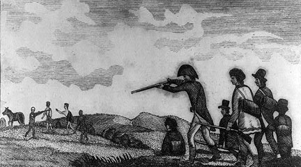
In addition to being much broader in scope than textbook accounts portray, the conservation movement also placed unequal and sometimes severe burdens on certain groups. Conservation laws that criminalized some uses of natural resources, for example, imposed harsh limits on socially and economically marginal segments of the population. Cutting down trees on public land to build log cabins became “timber theft.” Burning forests to clear land for agriculture or underbrush to attract game became “arson.” Hunting game for meat, except under carefully regulated conditions, became “poaching.” Not surprisingly, poor rural Americans often objected to conservation laws for cutting off access to natural resources that had long been a central (and celebrated) component of frontier life (see Primary Source Theodore Basselin, Testimony, 1891). According to these critics, conservation laws seemed designed to take from poor rural folks in order to benefit wealthy urban sightseers and sport hunters.

. . . [T]he conservation movement also placed unequal and sometimes severe burdens on certain groups.

Officially protecting public lands also had harsh effects on Native Americans, particularly when the boundaries of new national forests, parks, and monuments placed their traditional hunting, fishing, and gathering territories off limits. In some cases, as in Yosemite and the Grand Canyon, the new boundaries encompassed established Indian towns and villages, and insensitive officials used conservation laws to restrict Indian mobility, to alter traditional subsistence practices like hunting, fishing, gathering, and burning forest undergrowth, and even to evict Indians entirely from their homes (see Primary Source Captain Jim, Letter to Commissioner of Indian Affairs [1915]). Dam and irrigation projects in the American West also came with a price. Justified as a way to transfer the public domain to individual farm families, it was land speculators and established landowners—not new settlers—who reaped the most significant rewards from federal reclamation projects. When settlers did come, looking for an “irrigated Eden,” they often found instead a bureaucratically managed “hydraulic society” that served the “haves” much better than the “have-nots” (see Primary Source Thomas Means, “Discussion of Irrigation” [1909]).

Unintended Environmental Consequences

In addition to their human costs, conservation practices also had unanticipated ecological consequences. The U.S. Forest Service, for example, applied scientific principles to manage forests in ways they hoped would improve their health and ensure a sustained maximum yield of wood products. Yet even seemingly well-founded practices sometimes produced ecologically destructive results. In the Blue Mountains of eastern Oregon and Washington, for example, fire-suppression policies designed to prevent the needless waste of lumber irrevocably altered ecosystem dynamics in unexpected ways, making the forests more susceptible to disease, insect infestations, and catastrophic fires.

In addition to their human costs, conservation practices also had unanticipated ecological consequences.

Scientific game management practices designed to protect animals from the fate suffered by once-vast flocks of passenger pigeons and herds of bison also ran into problems. Game managers who killed off predators to ensure robust animal populations for hunters, also encountered problems. In the Grand Canyon National Game Preserve, for example, predator control caused deer populations to skyrocket in the early 1920s. Large herds overbrowsed their range, caused ecological damage, and ultimately undermined their own subsistence, causing mass starvation and a population collapse (see Primary Source “Report on Kaibab Deer Problem” [1931]). Game managers also learned that park boundaries did not always line up with the seasonal grazing ranges of animals. When they erected fences to keep elk and bison inside parks, they created unexpected problems during harsh winters, when limiting animals’ mobility threatened their very survival.

Conservation’s Legacy

Lessons from the conservation movement continue to animate modern-day environmentalists. Conservation illustrated the power of strong federal laws to protect nature, but also highlighted the capabilities of grassroots organizations. In addition, the conservation movement’s human costs underlined the need for socially equitable environmental policies, while conservation’s unintended environmental consequences have inspired environmentalists to emphasize more ecologically informed practices.

Source 1 Title

Mildred Chadsey, “Municipal Housekeeping” (1915)

Source 1 Annotation

In this article, Mildred Chadsey outlined the principles of municipal housekeeping. In an increasingly modern, interdependent world, she wrote, American cities had begun to face the same sorts of “housekeeping” tasks that homemakers faced every day. In crowded, polluted, unsanitary industrial areas, how could citizens work together to making cities “clean, healthy, comfortable, and attractive”?

Source 2 Title

Theodore Basselin, Testimony (1891)

Source 1 Text

Excerpt from "Municipal Housekeeping":
Housekeeping is the art of making the home clean, healthy, comfortable and attractive. Municipal housekeeping is the science of making the city clean, healthy, comfortable and attractive. Many tasks of housekeeping that were formerly performed by the individual householder are now performed by city officials. So gradually has the city taken over tasks that were once performed by the individual householders, and so many other tasks have been put upon it as it has grown into the complex and intricate thing that it is, and living in it has become such a co-related and interdependent process, that it is now confronted in a very real sense by the same problem on a highly magnified scale that confronts the individual housekeeper in making the home a clean, healthy, comfortable and attractive place in which to live.

Under modern conditions the homemaker does right to buy the household necessities, the furniture, the food, the clothes from the factory because they are made more cheaply and better there than she can have them made at home. She would be a social and economic failure if she did not adjust herself to the new industrial order of the factory system. She has not less human kindness and sympathy because she allows her sick to be cared for in the hospital, nor has she less maternal love because she sends her children out of the home to be educated. She merely recognizes that she is living in an age of specialization, and because she wants the best care and the best training for those she loves, she entrusts them to the care of specialists. It is not that she has failed to make home attractive that the older children seek their pleasure outside the home. It is because of their growing sociability, the result of the community life which leads them into broader fields of human interest and human endeavor than those set by the confines of the home. Such a home implies not independence, but interdependence. It establishes new bonds of human relationship, coordinated endeavor and community interests. Therefore many of the tasks that the individual housekeeper performed for her household have been projected into the community, both for the advantage of mutual service and of collective bargaining. . . .

The first and most important function of any housekeeper is to keep the home clean. The disposal of waste, such as garbage, rubbish, sewage, the cleaning of its street, the prevention of smoke and other noxious substances in the air, are all important measures in keeping the city clean. Yearly new methods of sewage disposal and sewage treatment are being devised by one group of experts while the dangers which result from failure to properly dispose of waste matter are being studied by another group. New problems in keeping the city clean are constantly presenting themselves for solution. Not only does the city in its effort to keep itself clean, establish departments that perform these duties, but it passes laws requiring individual property owners to maintain their premises in a cleanly condition and it restrains individuals from uncleanly acts, such as dumping refuse on streets or on other people's property, committing nuisances or expectorating on streets, and it employs inspectors whose duties it is to enforce these laws. Some one has said that the same God that wrote the decalogues wrote the sanitary code. Surely an efficient enforcement of it is a God-like task, and one that is just about as difficult to perform as other God-like tasks are when performed by mere man.

Source 2 Annotation

In his testimony before the New York State legislature in 1891, Theodore B. Basselin—a wealthy lumber magnate who had been appointed to New York’s Forest Commission—described the difficulties that government officials encountered in trying to implement new forest-protection laws. Locals long accustomed to cutting timber from public lands did not take kindly to the Forest Commission’s efforts to “educate those people” that “the State had assumed a different line of policy, the protecting of the forest, instead of cutting it off.”

Source 2 Text

Excerpt from Theodore Basselin's testimony:
[W]e also found that the people around about the borders of this wilderness had been educated from time immemorial, that is, from the first settlement of the country, that what belonged to the State was public property, and that they had a right to go in there and cut as they wanted to; that their fathers and forefathers had been doing that, and that they had a birthright there that no one could question; our endeavor and our efforts were all placed toward trying to educate those people in a different line; the State had assumed a different line of policy, the protecting of the forest, instead of cutting it off; now, in regard to the small depredators along the borders of the wilderness, who had looked upon it as a birthright, it was necessary for us to proceed carefully, as no one knew better than I did what danger an enemy or a man who had a spite could cause to the State by fires….

Source 3 Title

Captain Jim, Letter to Commissioner of Indian Affairs (1915)

Primary Source Annotated Bibliography

Roosevelt, Theodore. “Utilizing Our Natural Resources: Address Delivered Before the National Editorial Association in Jamestown, Virginia, June 10, 1907.” In The Roosevelt Policy: Speeches, Letters and State Papers, Relating to Corporate Wealth and Closely Allied Topics, of Theodore Roosevelt, President of the United States, Volume 2, 546-560. New York: Current Literature Publishing Company, 1908. President Theodore Roosevelt’s speech before the National Editorial Association in 1907 declared that “the reckless waste and destruction of much of our natural wealth” was “the fundamental problem which underlies almost every other problem of our national life.” Without the foresight, careful planning, and scientific management embodied in his conservation policies, Roosevelt predicted that the nation would “undermine [the] material basis” for the nation’s institutions and economic growth.

Pinchot, Gifford. The Fight for Conservation. New York: Doubleday, Page, and Company, 1910. This insider’s account of the conservation movement, written by the first Chief of the U.S. Forest Service, who was also one of President Theodore Roosevelt’s trusted advisers, offers perhaps the most-used definition of conservation: “Conservation means the greatest good to the greatest number for the longest time.”

Muir, John. The Yosemite. New York: The Century Co., 1912. John Muir, another towering figure in the conservation movement, was a prolific and eloquent writer. His books and essays about wild nature—including this one on his ramblings through the Yosemite Valley—profoundly influenced American ideas about conservation in general and the importance of preserving wild areas in particular.

Crane, Caroline Bartlett. “Municipal Housekeeping.” Reprinted from Proceedings of Baltimore City-Wide Congress, March 8, 9, 10, 1911. In this 1911 speech, Caroline Bartlett Crane—a Unitarian minister, reformer, and journalist who was widely known as “America’s housekeeper”—makes the case for the importance of keeping urban environments safe and clean, proclaiming that “housekeeping is, in fact, an extremely important function of city government.”

Leopold, Aldo. “Thinking Like a Mountain.” In A Sand County Almanac. New York: Oxford University Press, 1949. In this classic essay, a leading conservationist and wildlife manager tells the story of a day when he killed a wolf in the name of conservation—only to realize that his actions might not serve his actual goals. “I was young then, and full of trigger-itch,” he wrote; “I thought that because fewer wolves meant more deer, that no wolves would mean hunters’ paradise. But after seeing the green fire [in the wolf’s eyes] die, I sensed that neither the wolf nor the mountain agreed with such a view.”

Source 1 Citation

Chadsey, Mildred. "Municipal Housekeeping," The Journal of Home Economics, 7 (Feb. 1915).

Source 3 Annotation

When Congress created the Grand Cañon Forest Reserve, its boundaries completely surrounded the Havasupai reservation and encompassed the tribe’s traditional hunting, gathering, and grazing territories. Suddenly, when Native Americans hunted deer on their traditional lands, they were committing the crime of “poaching.” As state efforts to enforce game protection laws increased, they prompted this letter from a tribe member to the Commissioner of Indian Affairs, demanding permission to hunt so that there would “be no trouble with the Game Wardens.”

Secondary Source Annotated Bibliography

Hays, Samuel P. Conservation and the Gospel of Efficiency: The Progressive Conservation Movement, 1890-1920. Pittsburgh: University of Pittsburgh Press, 1999. First published 1959. This classic history of the conservation movement, which continues to influence historians today, focuses on the rise of technocratic expertise and the ways that conservation policies and their emphasis on the efficient use of natural resources reflected new ideas about political power and political structure in the United States.

Stradling, David, ed. Conservation in the Progressive Era: Classic Texts. Seattle: University of Washington Press, 2004. This edited collection pairs an introductory essay with primary documents written by activists within the conservation movement. Emphasizing the diversity of the movement, the documents reflect the ways that race, class, gender, and geography shaped the issues and concerns that motivated conservationists during the Progressive Era.

Warren, Louis. The Hunter’s Game: Poachers and Conservationists in Twentieth-Century America. New Haven: Yale University Press, 1997. Mixing social and environmental history, Warren analyzes the role that wildlife conservation laws—together with ecological change—played in catalyzing conflict between conservationists and locals, including Native Americans and poor whites.

Jacoby, Karl. Crimes Against Nature: Squatters, Poachers, Thieves, and the Hidden History of Conservation. Berkeley: University of California Press, 2001. Jacoby argues that conservation laws regulating cutting timber, setting fires, hunting animals, and claiming unsettled land created a host of new “crimes against nature”: timber theft, arson, poaching, and squatting. He also demonstrates how these new regulations benefited affluent tourists and professional land managers by placing disproportionate burdens on already marginalized groups.

Spence, Mark David. Dispossessing the Wilderness: Indian Removal and the Making of the National Parks. New York: Oxford University Press, 1999. In case studies of three national parks—Yellowstone, Glacier, and Yosemite—Spence documents the ways that the push to “preserve” these areas for national enjoyment required the eviction of their long-term Native American residents.

Langston, Nancy. Forest Dreams, Forest Nightmares: The Paradox of Old Growth in the Inland West. Seattle: University of Washington Press, 1995. Langston examines the history of professional forestry practices in the Blue Mountains of eastern Washington and Oregon, unpacking the paradoxes of how scientific land-management practices went awry in the face of rapid and unexpected ecological changes.

Fiege, Mark. Irrigated Eden: The Making of an Agricultural Landscape in the American West. Seattle: University of Washington Press, 1999. Fiege’s case study of Idaho’s Snake River Valley focuses on the hopes, labors, and dreams of settlers as they laid out a vast irrigation system to create a new agricultural order, emphasizing the ways the unexpected ecological changes compromised and sometimes short-circuited the best-laid plans of the irrigators.

Worster, Donald. Rivers of Empire: Water, Aridity, and the Growth of the American West. New York: Pantheon, 1985. This classic environmental history offers a history of the American West written through the lens of its water-management practices, emphasizing their role in structuring the environment and society of the West.

Steinberg, Ted. Down to Earth: Nature’s Role in American History. New York: Oxford University Press, 2002. This influential textbook account of American environmental history includes a concise chapter on “Conservation Reconsidered.”

Source 2 Citation

Basselin, Theodore. Testimony, February 17, 1891, in “Testimony Taken by the Assembly Committee on Public Lands and Forestry Concerning the Administration of Laws in Relation to the Forest Preserve by the Forest Commission, Etc,” Documents of the Assembly of the State of New York, Volume 114, Issues 74-82, New York State Legislature (Albany, NY: James B. Lyon, 1891).

Source 3 Text

Excerpt from Captain Jim's letter of September 15, 1915:
A long time ago the Gods gave the deer to the Indian for himself. The women and children all like deer meat very much. The Indian men like buckskins to trade for grub, saddles, horses, saddles, blankets, and money. A long time ago . . . the Indians all go out on the plateau and hunt deer for two or three months and then all come back to Supai [village] to stay. . . . Now the Indians are all afraid about the hunting and never go far away. I want you to send me a hunting license and tell me good and straight that I may hunt deer. . . . The white man should now help the Indians by giving him permission to hunt deer as there be no trouble with the Game Wardens. . . . This is all.

Source 4 Title

Thomas Means, "Discussion of Irrigation" (1909)

Source 3 Citation

Captain Jim. Letter to Commissioner of Indian Affairs, September 25, 1915, File 115, Havasupai Agency, Central Classified Files, 1907-39, Records of the Bureau of Indian Affairs, RG 75, National Archives, as quoted in Karl Jacoby, Crimes Against Nature (Berkeley, CA: University of California Press, 2001).

Source 4 Annotation

Federal reclamation projects in the arid West promised to transform unwatered land into an agricultural Eden, but settlers often found the work, expense, and risks of life on the irrigated frontier much more demanding than they expected.

Source 5 Title

“Report on Kaibab Deer Problem” (1931)

Source 4 Text

Excerpt from "Discussion of Irrigation":
The man in the gloomy back office in Chicago, who reads of the sunshine and freedom of the West, where a man can wear overalls and a flannel shirt and yet be respected, often overlooks the fact that he will have to wield the business end of a pitchfork in the hot sun, instead of a pen beneath the cheerful buzz of an electric fan. He thinks of the cool shade of a grape arbor and has an idea that, by sitting on the back porch, he can pull a string which will lift a gate and irrigate the back lot. When he gets into the real practice of irrigation, and his ditch breaks down and drowns half his crop and the other half dries up before the ditch is fixed, and his whole year's work is gone; or when, in the middle of a hot afternoon, the blinding sweat is pouring over his face as he pitches a few more tons of hay on the wagon, he thinks of that Chicago office with the electric fan as one of the most attractive places, and it is no wonder he becomes a bit discouraged.

Source 5 Annotation

Conservation-inspired predator control programs in the Grand Canyon National Game Preserve caused deer populations to skyrocket in the early 1920s. Large herds overbrowsed their range, caused ecological damage, and ultimately undermined their own subsistence, causing mass starvation and a population collapse.

Source 5 Text

Excerpt from "Report on Kaibab Deer Problem":
The Kaibab Investigative Committee has traveled approximately six hundred and fifty miles in the actual field examination of the Kaibab area during a period of eight days. Travel was greatly facilitated because of the numerous motor trails traversing the Kaibab Forest. The party, however, rode horses from Swamp Point in making the Powell Plateau trip, which is within the Grand Canyon National Park. The committee has observed practically every forest type and condition within the Kaibab area. . . .

The territory had long been a famous hunting ground for Indians and the settlers came here for much of their wild meat supply. Campaigns for the destruction of predatory animals were extended. Several hundred cougars, thousands of coyotes, as well as many wildcats, and the few gray wolves of the region were destroyed. The deer, relieved of the destructive effect of their wild and human enemies, swiftly began to show a marked increase in number.

By 1920 the officers of the Forest Service in charge of the Kaibab became concerned at the progressive deterioration of the range. In 1924 a committee of men not connected with the Forest Service was appointed to study the range conditions of the territory and determine whether there were more deer on the Kaibab than the food supply would sustain. This investigating committee reported that not only were there too many deer in the territory to subsist on the available food, but that the range had been so largely depleted that it was in imminent danger of being totally destroyed over large areas. It, therefore, recommended the removal of at least one-half of the deer at once. Although their recommendations were not immediately carried out by the State and Federal authorities, some reductions have been made every year by these agencies. In addition there has been much loss to the herd due to starvation on the winter range. . . .

It is the conclusion of the committee, after carefully reviewing the general condition of the Kaibab range, and also observing the degree of recovery within the fenced experimental plots that the Kaibab area is not now producing more than 10% of the available and nutritious forage that this range once produced. . . .

The forage of the entire Kaibab area is yet in a deplorable condition and with the exception of the east side winter range, it is doubtful whether there has been any considerable range recovery due to the reduction of the deer herd. It is believed, however, by those who have studied Kaibab conditions over several years, that in places there is a slight suspension of range deterioration because of the reduction of the deer and domestic stock.

Source 4 Citation

Means, Thomas. “Discussion of Irrigation,” Transactions of the American Society of Civil Engineers, 62 (1909): 44, as quoted in Donald Worster, Rivers of Empire (New York: Oxford University Press, 1985).

Source 5 Citation

Kaibab Investigative Committee. “Report on Kaibab Deer Problem.” 1931.

John Smith Map cpreperato Wed, 08/24/2011 - 12:53
Video Overview

Curator Barbara Clark Smith examines John Smith’s 1612 map of a section of Virginia, asking why Smith included what he did, why he left things out, and what he hoped people who saw this map would take away from it.

Video Clip Name
JohnSmith1.mov
JohnSmith2.mov
JohnSmith3.mov
JohnSmith4.mov
Video Clip Title
Exploring the Map
What is Important?
Different Perspectives
What Questions Can Students Ask?
Video Clip Duration
5:36
6:21
4:15
3:37
Transcript Text

This is a map drawn by John Smith who was one of the first English settlers at Jamestown. And it was first published in 1612 in England. Probably what’s most interesting about the map is just to stop and think: Who did it? Who’s it for? Why is he doing it? What’s he trying to do?

It shows us the worldview of the maker, John Smith, who draws the map. And of the audience, the people in England, members of the Virginia Company, who are investors trying to make money off of this colony of Virginia, who want to hear back that this is a good investment.

It’s a good idea to start out with a few basic orienting things. What’s the orientation? What direction are we coming from? When you look carefully at this map, you’ll see that north is not at the top of the map the way it is in most maps that we’re accustomed to and that most maps at the time in Europe would’ve done. North is to the right. If you stop and think about why that is, it really captures the point of view of somebody looking at the New World from Europe.

How would you approach it? Well, you get a hint with the picture of the ship down in the bottom left. You’re coming on a ship from Europe and this is the European point of view. There are some places, which are named clearly for European figures—Cape Charles, Cape Henry. Jamestown itself, of course, is named for King James. But most of the names are not English names. And this shows how densely populated this area was in the early 17th century by Native peoples.

It tells us something about the style of life in which you live in many different groups with different names. It isn’t clear that all of these Indian groups would’ve thought of themselves as having a common identity beyond owing political allegiance to Powhatan.

Mostly it’s an effort to get information across to the investors in the Virginia Company, who are funding his explorations. The investors did give instructions to the first group of settlers and explorers, saying, “Set up your town and then travel out from there and find out everything.” He’s particularly interested in showing this as a good investment.

He shows the Indian groups that are settled in different areas in order to convince them that there are people there to trade with, people there who can live off of this land. It’s a good land; it sustains life. He’s trying to give them information, but he’s also trying to encourage them to invest more, to have faith in this colony, to support him and the other adventurers. He is trying to be accurate. It’s one of the things you always want to know. How much is this person trying to tell accurate information to the audience. Or are they trying to give a very rosy or maybe a very negative view?

Archeological work confirms that he’s pretty accurate. There seem to be villages where he indicates villages. Maps certainly have to do with laying claim to the territory. Among European powers, the country that has drawn a map of an area does that as part of saying, “this is ours.” Smith isn’t entirely claiming this area. The English have already claimed it, although the Spanish had claimed it earlier.

And as you can see from all the different groups, lots of people claimed it earlier. All these native groups, this is their land. Smith isn’t really contesting at this point whether it’s the Indians’ land or not. Knowledge of where the people are is important in order to understand how much trade can take place in this area.

It says at the top, “Virginia,” although it doesn’t actually cover all the area that the Virginia Company claims to be Virginia.

Powhatan—that’s a name of the chief, but it’s also the name for the group of people who are parts of the empire that Powhatan rules. He’s the leader and he has all these tribes whom he protects. And they pay him tribute, tax, in the form of corn, trade goods, pelts. And that’s what makes him the powerful figure that the English have to deal with.

This helps us understand why it’s limited to this area. It’s not a map of Virginia from the point of view of the Virginia colony and its aspirations to own a great deal more of the continent. And it’s not a map of Jamestown where the English people are settled. It’s a map of Senecomaca, Powhatan’s kingdom.

There’re a couple of answers we come across from the written records. One reason he’s not showing you beyond Powhatan’s area is he’s relying on Powhatan’s Indian guides. They showed him all of the area where they could go freely. When they get to the fall line, you can see that there’re other tribes—the Manahoacs, the Monocans. The Powhatan guides aren’t going to take Smith into enemy territory. So all he can do at that point is take a record and say, “This is where these other Indians are.”

We find out from records of the Virginia Company and letters from Smith and other people in England about what they’re doing and why it’s a good idea to go to Virginia. They’re basing their idea of colonization on what the Spanish did for nearly a century in Mexico and in Peru and in the Caribbean. The Spanish go and find settled Indian groups. They’d like them especially to be rich, like the Incas or the Mayas, to have gold or silver. Then the Spanish conquer them, either through warfare or through diplomatic treaties.

They try to take over at the top so all of the gold, all of the corn, all of the beaver skins, all of the wealth that normally has gone to the dominant chiefs, the Spanish want that to come to them. And they ship that out to Spain. And that’s how they get wealthy. That’s what the English think they’re going to do in Virginia.

It’s an incredibly expensive thing to colonize. The King of England didn’t put up all the money to go settle Virginia, although the King claimed the land. They chartered a private company. In this case the Virginia Company, in which you get investors and they put in money. And they decide to support John Smith and other men who are going to go out and stake a claim and explore what’s there.

The idea of landing in Jamestown is you’ll set up a little town where you can live, and from there you’ll travel out and you’ll find wealth and riches. You’ll find Indian groups with whom you can make alliances. Find out who the important political leaders are. See if you can conquer them or get them to follow you. And see if you can follow the rivers to see if you can get farther into the continent and maybe even to the other side.

Why would Smith want to tell people in England about all these different Indian groups and their names? Aren’t these Indian groups taking up all the land that the English might take up when they come over? And the answer is, initially, that’s not the way the English are looking at it.

They’re looking at it as, “These are people whose wealth we can gain, we can get their crops, the animals they hunt.” And that’s shown up in the map.

In the upper right-hand corner, there’s part of the legend describing what’s on the map. Kings’ houses are a certain size and ordinary houses are another size. Smith is showing there’re all these chiefs and that means this an important political unit. There must be some wealth here. And that’s why this is a good place to settle.

One other aspect of the map that Smith spends a lot of time on is the rivers, showing you the bends and the ups and downs—where it’s wide, where it’s narrow. And that really shows us how he expects the Europeans to enter into the country. They enter in on ships. This is also how they will be transporting the trade goods that they’re getting from these different Indian groups.

It’s very important to the English to think about how they will get wealth back to England. They’re not yet seeing America as, “Here’s a place where we’re going to go and settle and stay.“ Instead, it’s a place we’re going to go, find riches, and return those riches back to England. Some of us may live there on these little outposts such as Jamestown, but most of us will not. And certainly the investors who’re trying to make money, most of them will not actually travel. The closest they get to adventure is reading about it and looking at Smith’s map.

In the upper left is Powhatan, the chief political leader of this time period in this area. It says underneath his name “Powhatan held this state [in] fashion,” meaning he sat and held this meeting in this way. Powhatan is the one with the pipe in his hand. Tobacco ceremonies are part of the diplomacy of the Powhatan people. And he’s got the feathers on his head and he’s wearing some beads or some decoration. And he’s up on a platform. So he’s clearly the big political leader. And beneath him are other people with a fire in this house or building.

The other Indian off to right side is a Susquehannock and he looks rather different. What it says underneath is “The Susquehannahs are a giant-like people and thus attired,” or dressed like this. He’s carrying a bow. He’s carrying a club in his other hand. He’s got an Indian pelt. So he’s depicted as a hunter.

We have here images of two different Indian groups. The suggestion is that one of these groups, the Susquehannahs, are primarily hunters and that what’s important about them is this individual hunting out in the forests. What’s important about the Powhatans is that they are a political group with this important leader.

It’s worth spending some time seeing how different those images are, particularly because we know from other sources that the Susquehannahs also had a political organization. They had chiefs; they had hierarchy. And the Powhatans also hunted. And that was one of the things the English were interested in—how do we get those pelts and furs that might be worth money back in England?

It’s a question that the map presents us with. Why is one group presented this way and the other group presented that way? The map is giving information, but it’s giving selected information about these Indian groups. If we didn’t know from other sources, we might think the Powhatans weren’t primarily hunters or the Susquehannocks didn’t have political institutions.

A choice was made by the mapmaker to emphasize something about these different groups. It tells us that he saw the Susquehannahs in one way, beyond the boundaries of the settled area, out there hunting. And he saw the Powhatans another way, in terms of their political hierarchy.

Powhatan, the paramount chief or political leader of this area, has an idea when the English arrive, too. Which is, “Here’s another tribe; maybe I can add them to the group of tribes with whom I’m allied and to whom I give protection and they will pay me tribute.” So his notion is they may be a useful additional group. They have iron goods. They have guns. They have some really useful things that would make you want to ally with them. They have copper, which is a beautiful good and a good material for making pots that last longer than earthenware. It’s what anthropologists called a “prestige good.” It makes clear that you have access to powers far away. It’s really the same as the Queen of England wearing beaver coats, which show that she has connections and control over the New World.

So from the Powhatan point of view, here’s these new people and they’re kind of interesting. They seem odd because they don’t seem to have any women. It’s hard to understand groups that don’t have women. But I think it’s quite intriguing to think of John Smith on the one hand thinking, “All right, how do I get control of Powhatan and his empire.” And Powhatan thinking on the other hand, “How do I get control of John Smith and his people.” And recognizing that they need help. These are explorers; they’re not farmers. They certainly don’t know how to grow the kind of corn that is grown in North America. The main thing they know how to do is fight and draw maps and explore. The English absolutely need the Indians to help them out.

It certainly isn’t the first place they come to. They come to Cape Charles and Cape Henry and they could’ve gone anywhere up the Chesapeake Bay or any of these other rivers. They go up the river in order to make sure it’s a little bit safer from the Spanish. The Spanish are constantly patrolling the shore of the Atlantic.

Virginia doesn’t really attract the Spanish. They’re happy with their gold from South America and Mexico and the plantation economies in the Caribbean. But they don’t really want the English to get wealthy and become greater competitors. The English know that and they go up the river far enough so they’re not really exposed.

They’re also on the river in case they need to retreat from Indians. Although they expect to be at peace with the Indians and to dominate the Indians, they also know that’s not always going to be true. So they settle right on the water, but up from the coast. It’s deep enough there. It’s not so far up that big ships can’t dock there. Those ships will supply them with food, with tools, and with new settlers. They want to set up a kind of post from which ships will go back and forth to England carrying the wealth that the settlers will be gathering from the countryside.

At the very beginning, it was much less successful than they expected. They suffered immensely from diseases and also they suffered from hunger. There was a drought, so the Indians had less corn themselves than they had normally had to trade and give to the English settlers.

The other aspect was the English settlers were so unprepared to be farmers themselves. They expected both to get food from the Indians and to be able to just gather food from the forest or gather fish from the rivers. And they did do some of that, but it turned out it was a lot harder to live than they thought. So they really needed the support of the Indians.

There was this period historians call the “Starving Time.” You can imagine being an investor in England and thinking this was not a good idea.

Part of the history behind this map is to represent the area as able to sustain life. It’s been a successful settlement so far because we’ve been able to travel throughout and gather this information. Let’s reassure the investors that there’s promise here.

After looking for gold the English try lots of different resources to send back. What they really discover is that tobacco will grow and tobacco becomes this much sought-after item in the 1620s. You can get really rich off tobacco, assuming that you can control enough land and enough labor to work it. Over the next decades, as it turns out that Virginia’s going to become a plantation economy, a society which grows tobacco, it changes the relationships tremendously with the Indians.

Within a couple of decades, there are plantations up and down the James River and it causes great conflict with the different Powhatan groups because those are lands that they use. They may not live on them in settled houses, but they use them for farming or they use them for hunting or they use them to fish along the river.

And the English have no understanding of, or respect for, the Indian’s ideas of ownership and use of the land. So over time, it becomes really clear to the Powhatans that there are more and more English. They’re here to stay. They want more and more land. And so you get a series of wars in the 1620s up through 1640s, when the Powhatans are pushed back.

I would start out with point of view. When you draw the map, you have to stand somewhere and look at the area that you’re mapping. I might ask students where Smith is standing. I guess he’s standing in the Atlantic Ocean or maybe on shipboard. He’s assuming you’re approaching from Europe.

The other thing about every map is it’s a small image of a big area. So the mapmaker had to leave a lot of things out. I would ask what kinds of things got put in and maybe what got left out. For example, we could imagine other things that Smith could’ve put on his map. We could say, well, “Why did he put on the rivers, not roads?” Well, they don’t have roads. There’re certainly paths, but the way you’re going to travel is by water.

He could’ve put on the different kinds of trees or animals that lived here. Or the different kinds of soil. There’re any number of physical features that he could have emphasized. But he was really interested in all these different Native American groups. Students could speculate: Why is that what’s most important or most interesting to the people back in England? Maybe if there had been gold, he would’ve done a map showing that.

You could ask students, to put themselves in the Native Americans’ position. What kind of map would you draw? At the very least it would be turned around, and you’d have some ships coming towards you off the Atlantic instead of sailing away from you. And the English would be this little group over here in Jamestown.

It might not look too different in some ways, but instead of these Indians, they might have images of the English settlers. And it would say, “The English are a giant people and they are thus attired. They carry these odd guns. They have no women.”

Google Earth

Image
What is it?

Google Earth uses images obtained from satellite imagery and aerial photography to map the Earth and compliment its Google Maps tool. Users with computers that run Windows XP (and above), Mac OS X 10.5 (and above), and Linux 4.0 (and above) can download the latest version of Google Earth to their desktops for free.

Google Earth's main benefit is its ability to put the world's geographic information in the reach of students and educators, allowing them to manipulate and create their own geography-based visuals to augment historical learning. In the Showcase section, history teachers can browse through products focusing on "U.S. Presidents" or "Historical Imagery" to familiarize themselves with Google Earth.

The Google Earth for Educators site also contains classroom activities that apply geographic concepts in order to better teach history, culture, literature, and other disciplinary areas—perfect for integrating history across many other curriculum areas. This section also provides tips and tricks for using Google Earth as a teaching tool and student work showcase, as well as ideas for how to integrate Google Earth into grant projects. Of particular note is the classroom resources section, which provides a basic overview of how Google Earth can be used by history students and teachers, as well as links to lesson plans. Additionally, teachers can use the forum to discuss with fellow teachers how to use Google Earth in innovative ways.

Getting Started

The first step is to install Google Earth on computers that will be used by students. Teachers should consult with the Instructional Technology specialist at school, or at the school district office, before trying to install Google Earth on school computers.

Examining New Orleans between 2005 to the present helps students understand the destruction of Hurricane Katrina and the recovery efforts that have helped the city prosper once again.

Once installed, it can be easy to become overwhelmed with all the tools available. The historical imagery tool is a good place to begin. Google provides simple and effective web tutorials for each tool, and the tutorial video for historical imagery will help users become familiar with what can they can learn by viewing cities and how they change over time. For example, satellite images of Washington DC, dating back to 1948, reveal the growth of the Smithsonian museums and the national monuments on the Mall. As mentioned in the tutorial video, images of Las Vegas from the last 60 years reveal the city's growth and can open up conversations about urban planning, 20th-century migration to the "Sun Belt," or even Las Vegas's history of gambling and organized crime in the post-Prohibition era. Examining New Orleans between 2005 and the present helps students understand the destruction of Hurricane Katrina and the recovery efforts that have helped the city prosper once again. Another useful feature to explore is the "layers" function. After selecting a location, expand the "layers" menu on the left panel to reveal 10 categories (borders & labels, places, photos, roads, 3D buildings, ocean, weather, gallery, global awareness, and more)—eight of which contain several subcategories. The "gallery" category, in particular, provides educators with a seemingly endless list of possibilities by taking advantage of the resources provided by National Geographic, NASA, New York Times, the Discovery network and many other partners. Displaying layers of streets, landmarks, and photos, for example, would help elementary social studies teachers enrich lessons about the community in the early grades. High school teachers can use these layers to examine military battlefields such as Gettysburg, or urban areas of historical interest such as New York post-9/11. Google Earth also allows users to create new placemarks, polygram shapes, and pathways, and to import images as an overlay. In addition to using the historical imagery tool, users can also select the day/night function to visualize locales at different times of day. Other functions found on the top row include viewing selections in Google Maps, emailing Google Earth images to other people, and printing visualizations. Teachers can use these tools to email students specific geographic visuals ahead of a particular lesson or to print Google Earth images for a handout or worksheet. Finally, the recorded tour feature is helpful for student presentations and projects. Students can prepare their tour by creating historical placemarks and pathways, as well as inserting historical images as overlays. Once all the pieces are in place, they can select the "record a tour" function from the top row of menus. Students can also select layers they would like to be visible, such as the name of roads or photos, and then zoom in to their desired view. At the bottom of the screen a record button will appear to begin recording. If students would like to provide a voice recording for an audio tour, a second button is also available (note: teachers should test any built-in or plug-in microphones beforehand). The "tour" tutorial is a must-see video before working with students on developing their own tour.

Examples

Although it has bot been updated for a few years, Google Earth Lessons has quite a list of ideas on how to use Google Earth and Google Maps in the classroom. One good use for the elementary classroom is to use Google Earth to map out a "Flat Stanley" project. This can be easily modified to a treasure hunt, "where's Waldo?", or other scavenger activities. Both Google Earth and Google Maps allow students to create place marks and pathways that can follow Stanley or Waldo in their travels.

Lesson plans can also make use of geo-mapping tools like Google Earth. In "Slavery, Exploitation, and Slave Trade Routes," a 5th-grade lesson plan guides students in analyzing the slave trade. It includes a structure for developing the final product in Google Maps. From this lesson, students can create an interactive map with placemarks for key areas in the Atlantic slave trade, as well as routes for slave ships and transportation of goods between Africa, Europe, and the Americas. By inserting images that illustrate slave ship conditions and sugar mills in the Caribbean, for example, students can make good use of the tools in Google Earth.

Teachers may want to explore both Google Earth and Google Maps in order to see what each tool offers. Because Google Earth is a bit more complex for younger students and requires installation on computers, teachers may choose to use Google Maps as an alternative tool if they are planning on using basic map functions in their lesson activities.

A gallery of Google Earth products is also available for teachers and students to view and use for brainstorming project ideas.

For more information

Locate Yourself on a Map of the Americas

Teaser

Young students locate themselves on a map and explore spatial relationships among geographic features.

lesson_image
Description

Young students locate themselves on a map and explore spatial relationships among geographic features.

Article Body

This is a straightforward lesson that introduces K-2 students to the concept of geographical location and scale. Using a variety of different maps, the lesson helps students understand the way that countries are situated within continents, states within countries, and cities within states.

Designed for a single-period, the lesson begins with students identifying the continent and country in which they live. Then, students begin to move to progressively more specific scales, locating the state or district in which they live, and eventually their school. Along the way, the plan calls for discussion of the number and size of states and districts, and the relative scale of different cities and towns.

The lesson is built around National Geographic’s MapMaker kit for the Americas—part of their larger MapMaker kit collection. For first-time users, video tutorials are available, and each kit enables the user to download, print, and assemble maps of varying scales. Map sizes range from “mega maps” designed for walls to one-page outline maps designed for individual study.

The strength of this lesson is that it introduces a key concept in historical thinking: geographical location and spatial relationships. By helping students understand the relationships between and among various locations, it establishes an important foundation for students in early elementary grades to learn about historical context. The website isn’t always the most intuitive to navigate, but persistence pays off with high-quality free resources.

Topic
Geographical location and spatial relationships
Time Estimate
50 Minutes
flexibility_scale
3
Rubric_Content_Accurate_Scholarship

N/A, the focus of this K-2 lesson is geography.

Rubric_Content_Historical_Background

N/A

Rubric_Content_Read_Write

No

Rubric_Analytical_Construct_Interpretations

No

Rubric_Analytical_Close_Reading_Sourcing

Yes, requires close reading of maps.

Rubric_Scaffolding_Appropriate

Yes

Rubric_Scaffolding_Supports_Historical_Thinking

Yes

Rubric_Structure_Assessment

Assessment checks for understanding of geographical relationships, no criteria.

Rubric_Structure_Realistic

Yes

Rubric_Structure_Learning_Goals

Yes

Google Maps

Image
What is it?

Google Maps allows users to place markers, upload pictures of specific locales, draw lines and shapes, and provide descriptions—helpful for constructing historical maps or geography-based lessons.

Getting Started

Working with Google Maps is simple enough, but users will (of course) need to establish a Google account in order to create a map. After signing in, the first step is to provide the map with a title and description, as well as establish privacy and share settings; the map is already in edit mode. Text can be entered in plain or rich text—great for inserting links. Users will see three icons in the left corner of the map: a hand (navigation tool), a marker pin (with over 90 icons), and a jagged line (to draw lines and shapes). To create a marker, select the corresponding icon and select style and click on the desired location on the map. After entering a title, users can select the rich text format to not only insert hyperlinks but also add images to the marker by selecting the image's URL address. In addition, you can embed a Google Video or YouTube clip by copying the embed code and pasting it into the description field. To create a line, users can simply click at the beginning point, click at subsequent locales, and double click to finalize the desired route. Creating lines using existing roads may be a useful for tracing travel and trade routes.

Google Maps facilitates collaborative learning and helps teachers extend and refine their lessons through an interactive medium that promotes critical decision making.

Two more tool options are found at the top of the left bar, above the title of the map: "collaborate" and "import." The collaborate function—which allows users to invite others to help create and edit a map—is ideal for group projects. Teachers can also use this function to collaborate with colleagues teaching a similar course. Either way, Google Maps facilitates collaborative learning and helps teachers extend and refine their lessons through an interactive medium that promotes critical decision making. The import option allows users to add map data from a KML, KMZ, or GeoRSS file. This is a very useful tool if teachers are able to find good historical "overlays" for their maps. A brief search for historical KMZ files yielded several good imports, such as battles of the Civil War, significant cities of the Civil Rights Movement, and U.S. presidential elections (using search terms like "historical maps KMZ" or "KMZ historical places" is a good way to start . . . but the development of these types of files is still growing so it may take some searching). Google Maps does have some glitches. Creating routes using the "line drawing" tool is tricky. Starting points do not always appear where you click to select, and editing an existing route is difficult; the pointer on the screen does not always match the marker boxes designed to click and drag to a new point on the map. In creating our own map, we also ran across an interesting problem. We created a map with markers and descriptions, but when we accessed it at a later date, the information appeared but all the markers on the map disappeared. Furthermore, the links in the information panel were no longer active. We would recommend creating a database on an Excel spreadsheet first, using columns such as "latitude, "longitude," "name,", and "icon." Then you can convert the Excel document into a KML file by using an online site such as Earth Point, which does an excellent job of providing a step-by-step process on how to create a "KML-friendly" Excel spreadsheet, lists the various ways to enter longitude and latitude coordinates, provides the numbers for hundeds of different marker icons, and also has a feature where you can make the conversion on the Earth Point site. A new KML file will be downloaded onto your computer, which can then be imported in Google Maps. Voila! All the markers appear, with descriptions in place.

[Note: it is highly recommended to use the decimal format for coordinates. Excel spreadsheets only accept negative values in the decimal-coordinate format. Any location in the Western and Southern hemisphere is a negative coordinate.] Although such a process sounds tedious, we found that this extra step is useful if you want to continue editing a map, or, more importantly, if a glitch causes the information on Google Maps to disappear. You can import the KML file into your Google Map at any time and replace the old one. Consider the KML file a Google Maps "backup" file.

Examples

One good site to examine the potential of map overlays is Dave Rumsey's site. In an 1861 historical overlay, we see an old map of Washington, DC over a Google Map in Satellite View. By clicking on "Washington DC 1861" on the right, users can make the map come and go as they please. Likewise, by clicking on "transparent map", users can add and remove modern street names and locales.

Historypin is another good site to see what users can do with pin markers, photographs, and other information that can make history come alive.

Another good site to examine student-produced Google Maps projects is Google Historical Voyages and Events. By clicking on "historical events" on the left sidebar menu, several student-created projects are available for browsing. One useful starting point is to select "Major Events of the Civil War" and browse various class projects in Google Maps. "Major Events of the Civil War," a 5th-grade class project, also includes detailed for educators to gain ideas of how to use Google Maps in the classroom across grades 5-12.

For more information

Helpful tips and tutorial for users new to Google Maps.
A useful primer on KMZ and KML files.
10 minute video of how Google Apps work for the K-12 classroom.

Using Old Maps as Tools to Explore Our World

Image
Article Body
What Is It?

In this bulletin board activity, students work collaboratively to explore sections of old maps. By closely examining these unique historical documents, students learn to see maps as more than just tools for locating places. And, whatever the grade level, this activity prompts students to grapple with the basic elements of the social studies: people, space, time, meaning, and purpose.

Rationale

Maps are essential tools in modern life but they also are primary source documents reflecting the people, time, and culture that produced them. They can be read at different levels and used for various purposes. In every case, however, some fundamentals of social learning can come into focus when a class looks carefully at a single map. Visual literacy, critical analysis, synthetic learning, and interdisciplinary thinking all come into play. But, maps are often too large to use at student desks. So a bulletin board activity based on cutting the map into manageable section—a "divide and conquer" strategy—provides a way out. If the map is not too big, enlarging it on a copy machine to clarify its details will often increase its pedagogical value.

Description

After selecting a map, the teacher should photocopy it with two concerns in mind:

  1. It should be a suitable size for an available bulletin board or display area. AND
  2. It should be divisible into a number of equal parts.

In the classroom, groups of students will work with single sections of the map, using a specific procedure (see Handout 1) that will help them uncover meaning in the map. When the separate pieces are reassembled at the end of the activity, the class will have a unique final product: a historical map with accompanying narrative captions that explain its significance. The bulletin board display can then be read by others in the school’s community, including other classes, teachers, parents and the general public.

Teacher Preparation
Maps, after all, can be compelling visual resources offering various ways to turn a class into a learning community.
  1. Scheduling: Place this lesson into your school’s curriculum and your course calendar. Decide if you want to do it once or several times with a series of maps distributed throughout the academic year.
  2. Determining goals: Choose the type of map that would be most appropriate for your learning objectives. For example, if your goal is to use maps at several different scales, you could feature four activities in the    course of the year using maps of the world, nation, state, and local community.
  3. Finding a map: Although current maps might be readily available, old maps are preferred because students will be able to see how they are "dated." By "datedness" we mean how they reflect not only past geographies and technologies, but also a former cultural and historical context. Help in finding suitable maps is available both on web pages and at your local library, historical society, community college, or state university’s map library.
  4. Exploring meaning: Once you have selected a map, find out as much about it as possible for    your own benefit. Why did you select it? What intrigues you about it? Make a list of    questions it raises, and keep a record of how you went about gathering information to help    you understand the map. Remember that the essence of your preparation is to provide a model for your students.
  5. Enlarging and dividing it: Enlarge the map using a photocopy machine. At the same time, divide it into manageable sections. If you have 36 students in class and want them to work in groups of six, you will need six sections to the map. Make at least two copies of these board-size segments so you can proceed without interruption if one of them is damaged.
  6. Making copies: If you have enough resources, make a small 8½ x 11 inch version of the whole map for each group or student.
  7. Gathering supplies: Make sure you have enough supplies for coloring the map (if necessary); stiff paper for making panels for call outs; ribbons for connecting points on the map with these commentaries; and tacks, pins, or tape to attach everything.
  8. Practice makes perfect: A "trial" mounting of the bulletin board at least a day before the lesson will point out potential problems.
  9. Planning evaluation: Along with your lesson plan, develop some type of evaluation procedure so that you will be prepared to share this lesson with colleagues and interested parties (a curriculum director, parents, or even a local newspaper). Photographs of the end result as well as the lesson's stages of development might prove to be of great value. Maps, after all, can be compelling visual resources offering various ways to turn a class into a learning community. You will know you are on your way to success as students begin to see maps as more than devices to locate places.
In the Classroom

NOTE: The below steps are outlined in Handout 1 which students can use to guide their work.

A draft is seldom good enough for a presentation copy, both in the classroom and in real life.
  1. Preparing students: First take a few minutes to set up the lesson, show students the focus map, explain how it fits into the curriculum, outline the six stages of the lesson using Handout 1, and then describe the end result. Then the class as a whole should develop a context for the map    by addressing the four questions in part one of the handout.
  2. Student groups: During Part Two divide the class into small groups, each of which will focus on one part of the map, developing questions and searching for answers as directed on Handout 1.
  3. Calling out details: Part Three centers on students developing "call outs" to point to some detail of interest on the map. If this device is new to the class, start by providing an example of a call out ("look how small that state is" or "what is the strange symbol?"). Also help students realize the importance of questions in reaching for understanding. Pairing students is one possible way to encourage them to exchange ideas.
  4. Monitoring presentations: Part Four offers several opportunities for you to step back into a leadership role as needed, perhaps rephrasing a group's tentative statements or emphasizing that a map is constructed by selecting some details and omitting others (e.g., a map's "silences").
  5. Writing commentaries: At this stage each student should "read" the map in his or her own way and make a statement about the map's meaning or purpose. Extend the lesson by editing these commentaries. All of them could be made available (on a rotating basis) at the side or bottom of the display.
  6. Polishing the apple: A draft is seldom good enough for a presentation copy, both in the classroom and in real life. You will need to decide how much time to spend here. In any event, "Polishing the Apple" offers opportunities for evaluation, assessment, and involving students with special needs or talents.
Common Pitfalls
  • The map selected may prove too challenging for some classes. This might be a good time to walk the students through the lesson and then use the map bulletin board approach again later in the term with a different map.
  • Mounting an attractive bulletin board that collects input from every student can be a daunting task. Seek help and guidance from art and English teachers. A media specialist might also be very helpful.
  • This lesson has the potential to grow like Topsy, so careful advance planning and time management are essential.
Example Maps
  • Community Map: Youngstown, OH, 1905-1906 This example is from an old "Quadrangle," map—a series produced by the U.S. Geological Survey since the 1890's. Every part of the nation is covered at once in this series of large-scale topographic maps. Other maps with this type of detailed local coverage can be found in county atlases, local history books, insurance atlases, and governmental records. Check with your community library to find a suitable map, especially one which includes the site of your school. This example is a detail from the Youngstown Quadrangle, edition of April 1908. It shows the Ohio city as it was in 1905-1906, the date of the survey. The small squares indicate residences.
  • State Map: Highway Map of Southern California, 1924 Secure an old highway map of your state. (These are often available at flea markets, second-hand shops, libraries, historical societies, on the internet, or from antique automobile enthusiasts.) This example is a detail from the "Highway Map of Southern California" given away by the Security Trust & Savings Bank of Los Angeles. The Automobile Club of Southern California produced the map in 1924 through the Clason Map Company of Los Angeles.
  • A Map of the United States, 1864 This map of the United States, entitled "Map of the Rebellion, As It Was in 1861 and As It Is in 1864" appeared in Harper’s Weekly, the leading news magazine of the time. The issue was dated March 19, 1864.
  • A World Map, 1792 The Abbe Gaultier developed this map in England. The author was a French educational reformer who believed that schools should be fun. It was produced in England because the author had fled from the French Revolution. Students can use this display copy to answer a series of questions asked by the teacher, receiving points according to the quality of their answers. Note that the map presents the geographical situation and knowledge of the time.
For more information

Cartography Associates. David Rumsey Map Collection. 2009. http//www.davidrumsey.com/. 20,000 antique maps.

Greenhood, David. Mapping. Chicago: University of Chicago Press, 1964. Originally published in 1944, this revised edition is still the best general introduction to maps.

Teachinghistory.org. "Featuring Maps!" History Education News 5, (2010). http://teachinghistory.org/files/HEN/HEN-05.pdf (accessed June 1, 2010).

Wood, Denis. The Power of Maps. New York: Guilford, 1992. An artist and designer looks at maps through modern eyes. In 2010 he will sharpen his perspective in Rethinking the Power of Maps.

And listen to Danzer explain map analysis at the Roy Rosenzweig Center for History and New Media's History Matters.

Building the Erie Canal

Teaser

Cutting through New York from the ocean to the Great Lakes, the Erie Canal changed lives.

lesson_image
Description

How would the Erie Canal have changed your life and the lives of those around you? Politics, trade, and the land itself were all affected.

Article Body

This lesson from Teachers’ Domain examines how the construction of the Erie Canal affected the geographic, economic, and political landscape of the United States. In exploring these issues, students are presented with four computer-based activities.

The first two activities—viewing documentary video clips—are engaging, brief, and informative. These clips could be projected to the whole class if a teacher does not have access to multiple computers.

The third—an interactive graphic organizer—allows students to categorize different consequences of the construction of the Erie Canal in terms of geographic, political, and economic effects. The interactive graphic organizer allows students to draw connections between consequences in different categories and explain how they are interconnected in a pop-up comment box. After they are done, students can print out the graphic organizer.

The final activity in the lesson, which requires students to read and write, can be done either on a computer or not. It asks students to synthesize information from the video clip and a background reading (available in two different reading levels), and students can choose from three different writing assignments.

Topic
Erie Canal
Time Estimate
1 day
flexibility_scale
5
Rubric_Content_Accurate_Scholarship

Yes
Featured video contains interviews with reputable scholars.

Rubric_Content_Historical_Background

Yes
Historical background provided in videos and handouts.

Rubric_Content_Read_Write

Yes
Students take notes throughout the assignment and write a short essay evaluating the major changes resulting from the construction of the Erie Canal.

Rubric_Analytical_Construct_Interpretations

Yes
Using evidence from the documentary video and a background reading, students assess and examine the economic, political, and geographic effects of the Erie Canal on the nation.

Rubric_Analytical_Close_Reading_Sourcing

No

Rubric_Scaffolding_Appropriate

Yes
Two versions of background handout are included for different grade levels.

Rubric_Scaffolding_Supports_Historical_Thinking

Yes
A graphic organizer helps students organize their ideas and draw connections between the various effects resulting from the Erie Canal’s construction.

Rubric_Structure_Assessment

Yes
Students can write an essay on the canal’s effects on America or New York State. Students can write a journal from the perspective of someone who experienced the effects of the Erie Canal five years after its construction.

Rubric_Structure_Realistic

Yes

Rubric_Structure_Learning_Goals

No
Requires access to multiple computers, but can be adapted for classroom use in which only one computer and a projector are needed to stream the video.

Geo-Literacy Project: Students Explore Their World

Image
Article Body

Edutopia's Geo-Literacy Project is an interdisciplinary, project-based, approach to teaching local history that can be adapted for different locations. The goal of the project was to develop students' literacies. Throughout the project, students were guided by the essential question, why is the preservation of a local historical site—in this case, Rush Ranch—important? They explored the site from a number of perspectives, working with local experts and community partners to understand the local environment. They then built websites using primary sources, images, videos, and student-created reports. Older students helped them prepare the content for this website and use the technologies. Specifically, this project demonstrates two promising practices:

  • Using local history resources and issues to engage and challenge students.
  • Using technologies in the history/social studies classroom to further learning
Throughout the extensive project, students were investigating, using primary sources of information, problem solving, and finally, communicating their findings.
What's Notable?

This project-based approach teaches students to think about how the past relates to their own lives and how geography, geology, and history interact. Further, because the project asks students to present their findings through multimedia, web-based accounts, the project presents an opportunity to meaningfully use technology in the history/social studies classroom and share what they have learned with a larger audience.

Viewing Instructions

To view this example, either play it directly on the website or download it for free in iTunes.

Lewis and Clark: Same Place, Different Perspectives

Teaser

How geography influenced interactions among Lewis, Clark, & Native Americans.

lesson_image
Description

In small groups, students analyze short excerpts from primary sources and secondary information that describe an encounter between the Lewis and Clark expedition and a Native American tribe. They share their analysis with the class and consider how varied locations influenced the ways in which the explorers and the various Native tribes interacted.

Article Body

Encouraging students to work collaboratively in groups, this lesson asks students to think and write about history from multiple viewpoints. The primary source excerpts, primarily from the expedition members’ journals, are a bit challenging, but they are brief and informative. Short expository passages describe different Native American groups and their encounter with the expedition. The absence of primary documents from the Native American perspective provides an opportunity to discuss what sources of information make up the historical record.

Additionally, and maybe more importantly, the lesson engages students in geographic analysis. Using geographic indicators, students must locate each encounter at a specific site on expedition maps. Students consider the varied physical environments that Lewis and Clark encountered and how these connect to cultural variations between the Native American tribes whom they met. This lesson pays special attention to the differences between Native American cultures, countering a common student belief that all Indians lived alike.

We like the closing activity where each group reports back to the whole class before a large group discussion on the similarities and differences between the encounters. The suggested assessment asks students to write about one of the encounters from the perspective of Sacagawea, Lewis and Clark’s Native American guide, or York, a slave on the expedition. Unless this lesson is taught in conjunction with the film or other rich resources providing additional background information, this assessment seems ill-suited as students likely need more background to complete these essays successfully.

Topic
Lewis and Clark Expedition
Time Estimate
1 class period
flexibility_scale
4
Rubric_Content_Accurate_Scholarship

Yes Uses primary sources from the Lewis and Clark expedition.

Rubric_Content_Historical_Background
No We recommend that teachers include additional background information.
Rubric_Content_Read_Write

Yes Students read about environments, resources, and daily life in different places and write about how and why people from different groups perceived events differently.

Rubric_Analytical_Construct_Interpretations

Yes Students' historical and geographic analysis skills are fostered through interpretation of primary and informational texts and maps.

Rubric_Analytical_Close_Reading_Sourcing

Yes Students must read documents and maps closely in order to compare different perspectives.

Rubric_Scaffolding_Appropriate

Yes Some of the document prose is challenging, but grouping students by mixed ability can help address comprehension issues.

Rubric_Scaffolding_Supports_Historical_Thinking

No Teachers may need to create scaffolding questions to guide their students during group work.

Rubric_Structure_Assessment

No Assessment is vague. Teachers may wish to design their own assessments that involve students in viewing the expedition from multiple viewpoints or considering how location influences cultural variation.

Rubric_Structure_Realistic

Yes The directions are clear and all of the materials available on the web are easily reproducible for classroom use

Rubric_Structure_Learning_Goals

Yes Activities require students to examine an event from multiple viewpoints. Students also have the opportunity to see how geography influenced both Native American groups and the expedition members .

Using Maps as Primary Sources

Image
Article Body

This website shows a 4th-grade teacher in northern Virginia teaching a lesson focused on a map drawn by John Smith that was published in 1612. Source Analysis, a feature created for the Loudoun County (Virginia) (TAH) website, has three sections focused on this primary source: scholar analysis, teacher analysis, and classroom practice. The latter two sections show a standards-based lesson that asks students to answer the question: What is important to John Smith? The teacher carefully plans activities so students look closely at the map and consider how this primary source helps them answer the central question. The site provides examples of two promising practices:

  • Engaging young students in close, careful observation and reading of a primary source document (using student pairs and a comparative document); and
  • Using students' observations to inform and guide analysis and connect the source to larger questions and topics in the curriculum.
The Lesson in Action

In the Classroom Practice section, we see the lesson in action. The teacher introduces the lesson question and then takes time to ensure that students understand the question by introducing synonyms for "important" and reviewing word meanings. She passes out the maps to assigned student pairs and asks them, "What do you see?" Students have time to look carefully at the map and notice words (e.g., "Jamestown" and "Powhatan"), the Chesapeake Bay and its tributaries, living structures, trees, how particular words vary in size and spacing, and so on. The teacher further facilitates the students' observation by juxtaposing the 1612 map with a contemporary textbook map of the same region. This juxtaposition helps students see the choices John Smith made in drawing this map that they might have missed without the comparative source. The teacher then uses what students notice about these maps to help them think about what the details and differences mean. Students start to identify what was important to John Smith and subsequently to the Virginia Company, given the evidence in front of them. Throughout this instruction, the teacher uses feedback, a logical sequencing of activities, and clear and accessible questions to ensure access to the learning activities for all of her students.

Thinking Like Historians

This teacher shows how carefully structured lessons that use primary sources can engage students in the process of thinking like historians. Students slow down and carefully read and look at the map, noticing things that they might otherwise have missed. They then consider what the contents of the map mean and what the map tells us about John Smith and the Virginia Company's worldview. The 1612 map becomes a window into the past that only reveals its slice of the landscape with close reading. Also on this site is a Teacher Analysis section in which the teacher explains some of what preceded this lesson and her instructional choices—a useful complement to the classroom videos. Each of these sections presents information in a set of videos that are clearly titled and visually interesting.