American Turning Point: The Civil War in Virginia
Image
Annotation
American Turning Point is an online companion to a Virginia Sesquicentennial of the American Civil War Commission exhibit examining the events and impact of the Civil War within the state of Virginia. The travel schedule may permit you to plan a field trip for your class to see the physical exhibit. If not, explore the website (or visit and use the website to reinforce the experience).
Characters gives faces to some of the people who lived through the war in Virginia, while Objects provides access to digital collections and curated items such as weapons, portraits, prints, military orders, and a pocket watch. Virginia Home Front divides the state into federal occupation, no-man's-land, Confederate Virginia, and the Confederate frontier. Each is mapped, and can be selected for additional information including personal accounts from the Civil War period.
Another section, Resources, is similarly worth exploring. The page offers links to lectures, websites, and articles on the Civil War and Civil War collections. The teacher resources largely consist of traveling trunks and outreach programming. Finally, if you're interested in the Confederate capital, consider listening to more than 10 one-minute history audio programs on Richmond.
1804 Inventory
Bibliography
Image Credits
Video 1:
- "Estate Inventory, Estate of Thomas Springer." 1804. Museum of American History, Smithsonian Institution.
- Advertisement for Property, Milltown, DE. c.1817.
- Photo. "English Victorian Manor House." 2006.
- Photo. "Historic American Buildings Survey. Photocopy made from photograph from the Smithsonian Institution, Washington, D.C. DELAWARE LOG HOUSE EXHIBIT INSTALLED IN THE 'HALL OF EVERYDAY LIFE IN THE AMERICAN PAST,' MUSEUM OF HISTORY AND TECHNOLOGY, SMITHSONIAN INSTITUTION, Robinson-Murray House, Limestone Road, Milltown, New Castle County, DE." Library of Congress, Prints and Photographs Division. Reproduction No. HABS DEL,2-MILTO.V,1--8.
- Photo. "Lynam Log House." c.1958.
Video 2:
- Map. U.S. Department of Commerce. "Delaware River, Wilmington to Philadelphia, 1942." Private Collection of William Krispin, The Athenaeum of Philadelphia.
Video 3:
- Cover. Reilly, Robin. Wedgwood: The New Illustrated Dictionary. New York: Antique Collector's Club, 1995.
- Photo. "View of the Masterworks Gallery, DeWitt Wallace Decorative Arts Museum." Annual Report, 2006.
- Advertisement. Josiah Wedgwood & Sons, Ltd.
- Photo. "Sauceboat and Stand from the Green Frog Service, Wedgwood,1773–1774." Courtesy of The State Hermitage Museum, St. Petersburg, Russia.
- Photo. "Pieces from the Green Frog Service, Wedgewood, 1773–1774." Courtesy of The State Hermitage Museum, St. Petersburg, Russia.
- Photo. Red Queensware cup, c.1810.
- Map. Pomeroy & Beers. "Mill Creek." Delaware State Atlas. 1868.
Video 4:
- Photo. Case, Daniel. "Wales House, Hyde Park, New York." 2008.
- Photo. Grey, Gerri. "The Farnham Mansion, Oneida, New York." 2010.
- Photo. "Little Parlor. Gunston Hall, Mason Neck, VA."
- Photo. "Central Passage. Gunston Hall, Mason Neck, VA."
- Photo. "Gunston Hall, Mason Neck, VA."
Video Overview
An inventory—a list of someone's belongings made at his or her death—can tell you something about a person's life. But what does it leave out? Barbara Clark Smith examines an 1804 inventory, asking what it does and does not record.
Video Clip Name
csmith1.mov
csmith2.mov
csmith3.mov
csmith4.mov
Video Clip Title
What questions do you bring to reading a document like this?
What do you learn by reading this inventory?
How do you contextualize material objects in an inventory?
Are you curious about anything after reading the inventory?
Video Clip Duration
1:57
4:11
2:23
2:28
Transcript Text
This is an inventory. An inventory and appraisement of the goods and chattel of a man named Thomas Springer in 1804. And an inventory is a list of the possessions of someone that's taken after that person dies. It's usually the head of the household because that's who owns the possessions. Therefore most of the inventories we have are inventories of men. And it's a document that's created by the fact that wealth in the late 18th, early 19th century, is not so much in the form of things in the bank or things in the stock market, but real estate and actual moveable goods. So when someone dies, the county court appoints appraisers, local men, to go out and look at an estate, see what's there, list it, and estimate its value. And these documents are of immense interest to people who want to know about the possessions and the living standards of people in the past. Particularly about people who aren't famous, or whose things were not saved. You can get a sense of what did this man own at least at the time of his death. What was in his household?
Thomas Springer is someone I got interested in—his possessions are something I got interested in, as a museum curator. It was my job to figure out what this man owned because we, at the Smithsonian, owned the house that he lived in. This was a house built in the 1790s and it's built of logs. And it was collected some time ago. My job was to go back and find out everything I could about the people who lived in this house. Not just Thomas Springer, but his wife, Elizabeth. It's hard to find out about Elizabeth—she doesn't have the inventory. Although there may be hints in here about her life, too.
Like many of these inventories it begins with the wearing apparel of the deceased. The basic thing is coats, jackets, shirts, trousers, hats, boots, drawers. Those are valuable items. You can see that clothing are valuable. They're valued here in 1804 at 30 dollars. You can look at the list of how things are valued and get a sense of what were expensive things and what were cheap things. Many inventories are like this. They're simply a straight list. A few go room by room. They list different rooms. They say, "In the parlor, there was this." Those are usually the inventories of the most well-to-do people because they have a lot of rooms. This man lives in a one-room house, perhaps with a loft upstairs. So you have to picture the inventory men coming through and as you read their list you can get a sense, to some degree, not just of what Thomas Springer may have owned, but of how it may have been arranged or organized.
As you go through you begin to see a place where they tell us certain things about particular belongings. I'd ask the question, "What's really surprising?" Well, one thing is this man owned one thing worth 40 dollars. It's a piece of furniture which is a really expensive item and that's an eight-day clock. One looking glass worth one dollar and an eight-day clock: 40 dollars. So that's kind of interesting. That's a luxury item. And it's certainly a luxury for a farmer to own a clock. You don't need the clock to know when to milk the cows. And that's a sign that this man doesn't live too far from Wilmington, where he's very likely to have purchased this clock. And he's interested in what is a scientific piece of equipment and an expensive one. There's a point as you go down through the list you can learn about . . . unfortunately you get to read something like this in many inventories: "a lot of books, 50 cents." And I'd love to know what the books were. My guess is a bible, okay, what else? I'd love to know what he was reading. But it does suggest people in this household were literate. It doesn't simply say, "a family bible" which might be there whether people read or not. This suggests some people are reading.
You certainly get a picture of a few of their behaviors. They have teacups and a tea table, so they're probably partakers in the afternoon or evening ceremony of tea. There's a part where it seems they've gone from the house, outside. After a lot of "Queensware," which is ceramic ware, you start finding "saddles, saddlebag, blanket and bridle, axes, maul and wedges, sledges, and a crowbar." Here, maybe we've moved to the barn. Maybe we've moved to an outside building of some sort. "Two spinning wheels." Alright, there we're getting a sense possibly, of what women in the Springer household may have done. Maybe that tells us a little something about Elizabeth.
The most shocking thing in the list, that takes you up short, is we find listed, right among the artifacts, people. "One Negro man, named A something-something-Ace." "Nine years to serve. Valued at 180 dollars." Below that, "one old Negro man, a slave, 66 years old named Will, valued at zero." One's first response I think is, as I say, just of shock, that we've been listing horses and bridles and now we've got people, and it reminds us about this time period, that that's a routine, this is a possession. But there's also something else in this list that's interesting. There is one, one of these people is a slave. This is in Delaware in 1804 where slavery is really dying out. It's not as profitable as it is to the South. But here's the "Negro man named Ace, nine years to serve." And that suggests to us that what Ace did was what a lot of African Americans did which was that they negotiated for their freedom in the years after the American Revolution. And that he had some form of agreement with the Springers. That he would work for a certain amount of time, for his freedom, or he would work for a certain amount of time for a set amount of money at the end of it.
To begin with you have to figure out what they are, which in some cases is really hard. A corner cupboard, I sort of have an image of, or thought I did. "Decanters, jars." But something like "Queensware" is worth going and looking up—either in a dictionary or in a local museum or in a ceramics history. "Queensware" is imported ceramics, kind of middling. You can find images of it. Again, you'd always want to compare. That is, in many cases there are very fine examples of something and not so fine examples of something. So you'd want to get a sense of what did most people own. Is this person typical or atypical? Looking at the artifacts themselves is a great help.
The other thing I should mention about moving to artifacts is that there is a wealth of knowledge that people who've studied material culture have about what was typical in certain regions at certain times. And that doesn't mean that your one inventory may not be atypical because he may, his six leather-bottomed chairs, maybe they're a family heirloom and they came down from somebody in some other part of the country. That's possible. But given what we know about how expensive it is to transport things over land or to put chairs on a ship and ship them out, that's unlikely. They are likely to be fairly locally made or at least locally sold. They may have been brought in by boat from say, Philadelphia to Wilmington. And there's a lot of studies that material culture scholars have done to figure out what specifically did people own.
I think probably the main thing about these inventories is that they're most valuable when you have a great number of them and many of the studies of them have been quantitative. So we know what people in say a given county—if you could go to this entire Hundred, Mill Creek Hundred, of New Castle County in Delaware, in a 10-year time period and go through and see what different people owned, that would give you a good idea about what some of these things were. And which of these things were typical, which of these things were extraordinary to this family, if anything. If that's the same or different than it is in other parts of the country, you'd want to know that.
The first thing I'd want to do is know a good deal more about Thomas Springer. It's really hard to know much about him with only this. So, I'd go track down . . . luckily I can find him in tax lists, find out what he's listed as owning at different moments, how much he paid, find his will. I can find a record of his marriage, and his children's birth in the local church. And I can find the deeds of his sales. So I'd want to find out as much as I can about him. And then I want to find out about other people who live in Mill Creek Hundred, or New Castle County, those other people on the tax lists. What their lives are like, how much land they own, what possessions they have. So that I can tell, is this man typical or is he exceptional in some way? And for that I'd want to then locate the document in the context of other documents, particularly in this region. And compare this inventory with the inventory of other people in Northern Delaware in this time period. Maybe take a 10-year period of time and see, of people who die, and paying attention to how old they are when they die. What do they own? How much is it valued at? So I think, that, first Thomas Springer, find out more about him. And then find out more about the other people around him in his community and what's going on in the region in general.
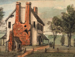
I think what's interesting; the other final context is the context of change in material culture. And probably what's most interesting there is the house itself. Because it's very easy to have an image of 18th-century houses and early 19th-century houses as being several different rooms, high style, with separate parlors, bedrooms. A central hall in the Georgian style. That's what you see when you go to most historic houses because the ones that have been saved are these very nice houses of well-to-do people. And here's a really ordinary house. It's small. We'd have a hard time being comfortable living in this space. And there's no evidence particularly, that Tom Springer or Elizabeth Springer or their children had a hard time living in this space. And this as it turns out is extremely typical. Most people in the early 19th century are still living in one- or two-room houses made of wood. Not made of brick, not fancy, nothing permanent, nothing meant to last all that long.
1853 Daguerreotype
Bibliography
Image Credits
Video 1:
- Photo. "Tourists Posing at Niagara Falls." c.1875. Robert N. Dennis Collection of Stereoscopic Views, New York Public Library Digital Gallery, Record ID# 738271.
- Photo. "American Falls From Foot of Incline." c.1898. Library of Congress, Prints and Photographs Division, #LC-USZC2-1238.
- Photo. Soule, John P. "Niagara Falls, from Point View." New York Public Library Digital Gallery, Record ID# 738565.
- Photo. Langenheim, Loyd & Co. "Niagara, General View from American Side (Winter)." New York Public Library Digital Gallery, Record ID# 737693.
Video 2:
- Photo. Babbitt, Platt. "Tourists Visiting Niagara Falls." c.1855.
- Photo. Babbitt, Platt. "Whirlpool Falls."
- Photo. "A Photographer Appears to be Photographing Himself in a Photographic Studio." c.1893. Library of Congress, Prints and Photographs Division, Reproduction No. LC-USZ62-19393.
- Photo. Babbitt, Platt. "Niagara Falls." c.1854. Library of Congress, Prints and Photographs Division, Reproduction No. LC-USZC4-4611.
- Photo. Babbitt, Platt. "Tourists Viewing Niagara Falls From Prospect Point." c.1855. George Eastman House Collection.
- Photo. Babbitt, Platt. "Niagara Falls." c.1855. George Eastman House Collection.
- Photo. Mason, Samuel J. "Portrait of two men posing at the top of Niagara Falls." New York Public Library Digital Gallery, Record ID# 737735.
- Photo. "Tourists Looking Over the Falls, Prospect Point." c.1860. New York Public Library Digital Gallery, Record ID#738351.
- Photo. Soule, John P. "Niagara Falls, from Point View." New York Public Library Digital Gallery, Record ID# 738565.
- Photo. Bierstadt, Charles. "Point View, Niagara, N.Y." New York Public Library Digital Gallery, Record No. 736614.
- Photo. "Tourists Posing at Niagara Falls." c.1870. New York Public Library Digital Gallery, Record No. 738398.
- Photo. "Niagara Falls (View of man standing on the bank looking down at the falls)." New York Public Library Digital Gallery, Record No. 736614.
- Photo. Langenheim, Loyd & Co.."Niagara, General View from American Side (Winter)." New York Public Library Digital Gallery, Record ID# 737693.
Video 3:
- Photo. "American Falls From Foot of Incline." c.1898. Library of Congress, Prints and Photographs Division, #LC-USZC2-1238.
- Photo. Blase, Saffron. "A view of the American, Bridal Veil and Horseshoe Falls from the Presidential Suite of the Sheraton Fallsview Hotel, Niagara Falls, Ontario, Canada."
- Photo. Landy Studios. "Platt D. Babbitt."
- Photo. "Prospect Point and Platt D. Babbitt's Photostand." c.1860. Kiwanis Collection, Niagara Falls (Canada) Public Library.
- Photo. "Tourists Posing at Niagara Falls." c.1870. New York Public Library Digital Gallery, Record No. 738398.
- Photo. "Tourists Posing at Niagara Falls." c.1870. New York Public Library Digital Gallery, Record No. 738272.
- Photo. "Tourists Posing at Niagara Falls." c.1859-1885. New York Public Library Digital Gallery, Record No. 738274.
- Langenheim, Loyd & Co. "Niagara, General View from American Side (Winter)." New York Public Library Digital Gallery, Record ID# 737693.
- Photo. "Niagara Falls (View of man standing on the bank looking down at the falls.)" New York Public Library Digital Gallery, Record No. 736614.
- Photo. "The Falls, from Point View, American side." New York Public Library Digital Gallery, Record No. 737051.
- Photo. "American Falls from Luna Island." New York Public Library Digital Gallery, Record No.737836.
- Photo. Babbitt, Platt. "View of Niagara Falls, reversed view." c.1853–1860. Library of Congress Prints and Photographs Division, Reproduction No. LC-USZC4-4770.
- Photo. "Looking Up The Rapids, From The Bridge, Goat Island." c.1860. New York Public Library Digital Gallery, Record No. 737013.
- Photo. "The Only Route via Niagara Falls & Suspension Bridges." c.1876. Library of Congress, Prints and Photographs Division, Reproduction No. LC-DIG-pga-03608.
- Photo. "International Hotel, Niagara Falls." 1876. ibrary of Congress, Prints and Photographs Division, Reproduction No.LC-USZC4-4528.
Video 4:
- Photo. Ronne & Washburn. "Aerial View of Niagara Falls, New York." c.1922. Library of Congress, Prints and Photographs Division. Reproduction No. LC-USZ62-116274.
- "Photo. Prospect Point and Platt D. Babbitt's Photostand." c.1860. Kiwanis Collection, Niagara Falls (Canada) Public Library.
- Cover. Brown, James Francis. Niagara Falls, Nature's Throne. Denver, Co.: The Williamson-Haffner Co, 1907.
- Title page. Friend, Washington. The Falls of Niagara. London: T. Nelson & Sons, 1860.
- Photo. "The Only Route via Niagara Falls & Suspension Bridges." c.1876. Library of Congress, Prints and Photographs Division, Reproduction No. LC-DIG-pga-03608.
- Advertising for the Great Canadian Scenic Route-Niagara Falls. c.1900. Kiwanis Collection, Niagara Falls (Canada) Public Library.
- Photo. "The Falls of Niagara-On the Brink." Harper's Weekly, September 11,1875. New York Public Library Digital Gallery, Record No. 696570.
- Photo. Rickhardt, F. "Niagara Falls From The American Shore." Niagara Falls (Canada) Public Library Collection.
- Photo. Soule, John P. "Niagara Falls, from Point View." New York Public Library Digital Gallery, Record ID# 738565.
- Photo. "Early view of visitors to Prospect Point, Platt D. Babbitt's photostand in background." c.1860. Francis J. Petrie Collection, Niagara Falls (Canada) Public Library.
- Photo. D.L. Glover. "The Great International Railway Suspension Bridge over the Niagara River." c.1859. Moynihan Collection, Niagara Falls (Canada) Public Library.
- "Great Western Railway Advertisement." Buffalo, NY: Commercial Advertisers Print, 1881.
- Photo. Southworth and Hawes. "Niagara Suspension Bridge." c.1855. Still Photo Archive, George Eastman House.
- Photo. "Suspension Bridge (Niagara Falls, Railroad Tracks)." c.1864–1866. New York Public Library Digital Gallery, Record No. 738323.
Video Overview
What does an 1853 daguerreotype have to say? Plenty, says Frank Goodyear. He examines a photograph taken at Niagara Falls and shows how, with a little analysis and research, the photograph fits into the context of the growth and spread of new technologies in the U.S. (including photography and railroads) and the tourist industry.
Video Clip Name
goodyear1.mov
goodyear2.mov
goodyear3.mov
goodyear4.mov
Video Clip Title
What did you first notice about this image?
What is your general approach to reading photographs?
What additonal questions would you ask of this photograph?
Where would you find evidence to give context to this image?
Video Clip Duration
1:57
3:06
3:57
3:21
Transcript Text
This particular image struck me, not only because of its early date—this particular image was done in 1853, less than 15 years after the introduction and invention of the photographic medium—but also because of its size. Most 19th-century photographs that you look at are quite small. And this is a full-plate daguerreotype that has been encased in this gilded frame. Obviously a tremendous amount of care has gone into constructing this image. This would not have been something that would have been bought for next to nothing. Somebody would have invested a certain amount of money and that the photographer has gone to extraordinary lengths to try to create, some type of souvenir maybe, a document that speaks to these tourists' experience at this very special American landmark—Niagara Falls.
When I saw it the first time, it of course reminded me of snapshots that we all take of family members on vacation at scenic landmarks whether it be Yosemite, Yellowstone, here the example being Niagara Falls. But as I looked at it more and more, it was obvious that this was a very carefully constructed image that was not simply spontaneously done. That it follows certain pictorial traditions in terms of the visual iconography of Niagara Falls, and that there was nothing spontaneous at all about it.
When reading photographic texts, I typically follow three lines of inquiry. And let me just review very briefly what those questions are. The first question of course is: "What is it?" For there is not one photography, but there are many 'photographies.' It is important, I think, to have students acknowledge or to understand the great variety of different formats, techniques, approaches; so it's very important to look very closely at what it is. In this case, "it" being a full-plate daguerreotype from 1853.
A second question would be: "How has the photographer figured his or her subject?" Indeed, what is the relationship between the photographer and his subject? What decisions has the photographer made in creating this image?
And a third series of questions that I would ask of a picture like this would be: "How is this photograph being used? What is the context in which this image is being seen?" Photographs are not made in a vacuum, there are reasons for taking pictures like this and I think it's important that—and this is what makes me excited as an historian—to try to unearth what this picture is about, why it was created, how it was used, how this subject that was depicted here was understood.
If we go inside the picture itself, you'll notice how a group of these tourists have been lined on the very brink of the American Falls. One of the things that strikes me as particularly curious is the fact that all these characters have their backs to us. They're not facing the camera, as we might typically do if we were standing at a tourist landmark today. One all of a sudden asks, "Are these people even aware they're being photographed? Has the photographer somehow surreptitiously taken their photograph?"
And as an historian, we don't necessarily have the answer—I don't have the answer for that question. But what I do know, of course, is that there's a long visual tradition of posing figures in front of sublime landscapes that goes back to 18th-century English landscape aesthetics. One of the things is the great number of these pictures that are absolutely identical to each other, except for the very fact that there are different configurations of characters here at the brink of the falls. Obviously you begin to understand that this particular image is not unique, it’s part of a well-constructed formula that the photographer has set out.
Actually the photographer has made, in this case, a great number of very deliberate decisions. So what are those decisions? Well, first of all he's decided to take pictures at this particular site itself. Why Niagara Falls as opposed to Trenton Falls, or the Potomac River? Well, Niagara Falls is this sort of "National Icon"; it is a landmark that Americans have invested with a great deal of significance—patriotic significance.
Other decisions that the photographer perhaps is making include what he has chosen to include and to leave out. I find it particularly interesting in this view that he does include a tree on the left-hand side of the image. It sort of frames the picture; it suggests that this is the left-hand margin of our picture. That he has also within the frame tried to capture the panoramic sweep of the falls. If you've ever been to the falls, you know that there are…it's not just one single fall, it's a series of three or four individual falls—American Falls, Horseshoe Falls—and here the photographer has tried to provide information about the entire panoramic sweep. That's another, I think, very deliberate decision.
Who exactly is Platt Babbit? Where did he come from? What is his background? Does he have artistic training? What type of business does he run? How has he gotten to this site? And, what of course is his relationship to the subjects that he's photographing?
A little bit of research will reveal that Babbit carved out a very successful career as a commercial landscape photographer in the service of tourism. Which provides a nice bridge in to a fourth concern, which would be that this photograph participates in the cultural practice of tourism; a phenomenon that grew into a mass-market phenomena in the mid-nineteenth century at places like Niagara Falls. And I would argue that photography was instrumental in defining the boundaries of the modern tourist experience. For photography taught people where to go, what was worth seeing. Photography educated the eye of the tourist, showing him or her how to see a particular site.
And last of all, photography served as one of the central rituals of one's tourist experience. These people are tourist who have traveled—as records from hotel registries at Niagara Falls indicate—from as far away as, not only New York and Boston, but also London and Paris. Niagara Falls, thanks to photography—and at the same time the promotional efforts of other tourists developers like the railroads and the hotels are responsible for advertising places like this to a clientele that reaches not only throughout the United States, but as far away as Europe as well. And these are those who have the disposable income at the time and the inclination to go to a place like Niagara Falls.
First of all would be to Niagara Falls itself, and to try to understand what this landscape actually looks like. I mentioned earlier that photographs are very interesting documents because they seem to be transparent windows into this site. And yet, at the same time, this is not all that Niagara is, that this transparency is not so…this is a very constructed image. So, I would sort of understand…where else could he have set up his camera? What other perspectives could he have used to shoot this picture? I'd also look at guidebooks—guidebooks to Niagara Falls. Where are the tourist developers, the hotels, the railroads, encouraging people (visitors) to go to see these particular images? For often times there are elaborate descriptive texts that shape how one navigates one's experience at a place like Niagara Falls. Interestingly, many of these tourist guidebooks were illustrated with engraved reproductions of photographs—by Babbit—in a sense holding out the photograph, "Here it is. This is what you're looking for. This is your goal," in a sense.
And then of course, another level of research involves trying to understand Babbit as a businessman. How did he make a living? Is all that he did landscape photography? Was there a market in the 1850's for simply landscape photography? Who was underwriting him? What is the machinery responsible for creating the tourism infrastructure at a place like Niagara Falls? One thing right away that you think about, of course, is the railroads. And there is some evidence that in looking at railroad archives related to lines that went to the falls, that Babbit was being commissioned to take photographs; that these railroads were buying his images to be used in their promotional materials.
I think looking at local newspapers, that speak to his sort of business at this very specific site, and what you learn, of course—if you do that type of archival research—is that Babbit had a thriving studio right on Main street in Niagara Falls. That he had commercial arrangements with souvenir shops at the site itself. That he had a little business pavilion, right next to his pavilion here at the brink of the falls. So that though we only see in the image itself a bunch of tourists lined up at the falls, in fact behind the picture is a vast world of information about Babbit, that I think allows us to better understand how we get to this [i.e. to the picture].
Massive Resistance Political Cartoons
Video Overview
Historian J. Douglas Smith contextualizes and analyzes two political cartoons commenting on Virginia government's reactions to Brown vs. Board of Education and the call for desegregation.
Video Clip Name
MassRes1.mov
MassRes2.mov
MassRes3.mov
MassRes4.mov
Video Clip Title
Cartoons and Newspapers
Segregation
Looking at the Cartoons
Teaching Massive Resistance
Video Clip Duration
5:05
6:15
5:23
4:33
Transcript Text
These are political cartoons, which typically do appear on the editorial page and are a comment on the major political events of the day. The first cartoon from May of 1954 entitled "Now What," was drawn and published in the immediate aftermath of the Supreme Court’s Brown decision.
Typically, the editorial cartoonists will reflect the editorial position of the newspaper. Certainly in the Richmond Times-Dispatch in the 1950s, the cartoonists would’ve more or less reflected the editorial position of the newspaper. By the time you get to the ’50s, you cannot avoid talking about massive resistance, you can’t avoid commenting on the Brown decision, you can’t avoid commenting on the imminent closing of the public schools. These are single images that convey a quite bit of information. Once you really begin to look deeply at this, you start to understand and to see where Virginia has gone in the four years from the Brown decision.
Virginius Dabney was the editor of the Times-Dispatch from the ’30s until late 1960s. And he recognized that massive resistance itself was not going to lead to anything productive, but the publisher of the paper, the Bryan family, were firm supporters of massive resistance, and so the bargain that essentially was worked out is that Dabney just didn’t say much about massive resistance. He certainly didn’t editorialize against it.
This is actually, I think, quite typical of the elites in Virginia, He was certainly amongst those, but Virginius Dabney once famously described massive resistance as an aberration from Virginia’s heritage of sound leadership and forward-looking thought. So, he was able to sort of dismiss this four- or five-year period as a blip on an otherwise excellent record when, in fact in many, many ways, massive resistance is the logical culmination of a particular type of race relations that people like Virginius Dabney did support.
Dabney is a complicated figure in this in that he was somebody who always editorialized for the better treatment of African Americans in Virginia. But within this paternalistic vein that had developed in Virginia; at one point in time he was seen as a liberal in the '30s because he was advocating better treatment of blacks and anti-lynching. By the '40s he’s more moderate, by the late '50s and '60s he’s actually seen as quite conservative.
Richmond had two papers. There was the Times-Dispatch which was the morning paper and then the News Leader which is the afternoon paper. The editor of the News Leader was James Kilpatrick who was one of the real leaders of massive resistance in many ways. In Norfolk, you have the Norfolk Virginian-Pilot, the other major paper in the state and it was the only one of the white papers that opposed massive resistance. Not that they embraced and desired integration, but that they recognized that the Supreme Court was the law of the land, that the Justice[s] had spoken and it was a responsibility to adhere to those decisions.
The Norfolk Journal & Guide and the Richmond Afro-American were black papers of the time. They were weeklies, and they had a relatively small readership. I think that most African Americans felt they had the Supreme Court ruling on their side and that ultimately that would have to prevail, but getting there wasn’t easy. Richmond was the capital, the power center, and so the Richmond paper certainly was the most important in the state and then the Norfolk paper after that in terms of overall readership.
The 13th Amendment simply abolished slavery towards the end of the Civil War. The 14th Amendment said that no citizen of the United States can be denied the equal protection of the laws. What was so important about the 14th Amendment was that it basically said that any citizen of the United States is first and foremost a citizen of the United States and secondarily, a citizen of their individual state and therefore it meant that no state could deny any individual any of the guarantees that were made by the federal government.
The 15th Amendment said that no person could be denied the right to vote based on race or previous condition of servitude. It doesn’t say that you can’t be denied the right to vote for other reasons, so what you end up with is the implementation of Jim Crow. Because of the 15th Amendment, no state could pass a law which said blacks can’t vote, but what they did instead was come up with all sorts of other methods for achieving essentially the same purpose.
Understanding clauses were educational tests where it was up to individual registrars to decide who passed certain tests. One of the problems with the literacy tests and understanding clauses is that there were in fact many uneducated whites who might have failed those tests. This is where you get grandfather clauses in which states would pass a law which said that if your grandfather could vote, then you can vote. There was no black person whose grandfather could vote because you’re talking about the slave era.
It was under the guise of the 14th Amendment that in Brown, the Supreme Court basically says that the court in Plessy was wrong, that equal protection laws do not allow for segregation. The 14th and 15th Amendment are quite important in terms of understanding the whole edifice of white supremacy and of Jim Crow. It’s not until 1965 with the Voting Rights Act that the vestiges of the disfranchisement laws are finally put to rest.
In the late 19th century you have the implementation of series of state laws, many of them begin with railroad transportation and quickly spread to other aspects of public life. As public schools come into being, they are fully segregated. The segregation laws tend to have to do with public separation of the races in public places.
The whole notion of Plessy v. Ferguson in 1896 when the Supreme Court gives its permission for the South to maintain and build a segregated state. Homer Plessy, who was a man who was one-eighth black, wanted to test the law. The state of Louisiana had passed a law which said that the races could not sit together on railroad cars. He did so anyway. He was arrested, charged with a violation of the law.
The case went to the Supreme Court and by an eight-to-one decision, the Supreme Court said that laws that mandated segregation were okay as long as facilities for both blacks and whites were equal and so the phrase separate but equal comes out of this, talking about parks, playgrounds, schools, trolley cars, then later buses, railroad cars, any sort of place of where the public might mingle.
The standards definition of desegregation is the abolishment of racial segregation and integration, as the full equality of all races in the use of public facilities. A distinction I often find helpful especially in the context of understanding massive resistance, and even more so with what happens after massive resistance is that I think that in many respects desegregation means the end of state-sponsored segregation. Desegregation comes to mean the absolute minimum necessary to comply with the law. What really happens in the wake of massive resistance is that you end up with token integration, at least for another decade until another series of court decisions force more complete integration.
On a national level Brown v. Board of Education was the culmination of a nearly two-decade campaign led by the NAACP to attack segregated education at the professional and graduate school—the whole notion of Plessy v. Ferguson in 1896 when the Supreme Court gives its permission for the South to maintain and build a segregated state.
The NAACP began winning a series of precedents: in the Maryland courts, then Missouri, in Texas, Oklahoma. NAACP recognized that they could keep doing this forever and ever, they basically were arguing that there was nothing equal about segregation, that the states were failing to meet their constitutional mandate under Plessy. The hope was not that they’ll simply increase funding and we’ll have a separate but equal society, but that they would recognize that to do so would be so prohibitively expensive, that real meaningful change would have to take place.
The case of Brown v. Board of Education, which was five cases which all examined the question of segregation in the public schools at the pre-collegiate level—these cases worked their way through the different courts and then finally they were bundled together by the Supreme Court and we know them as Brown v. Board of Education.
In the early ’50s we know Virginia provided one of the cases that was bundled in Brown, the case out of Prince Edward County which started when a group of young students led by Barbara Johns, who was a junior at Moton High School—the facilities in Farmville are horrific and the students finally say enough. Many of their parents are scared because their parents’ jobs depend upon not causing trouble and so the students don’t tell their parents about this. One day they march down to the superintendent’s office and have a protest of their own.
It would be simply wrong to suggest that African Americans in Virginia weren’t demanding more change. Even though the Brown case comes out of Kansas, it’s every bit as much about life in Virginia. People often assume that the Brown decision dealt with segregation and all of its guises and aspects, but the Brown decision actually was limited to segregation in the schools.
Part of the problem with Brown and part of what why we end up with massive resistance is that the court they’re obviously worried about the reaction in the South. So they actually did not in 1954 issue an actual implementation ruling. They could have said all public schools in the South must be desegregated beginning in September, but they did not. They left it up to the district courts and they said they must move with quote unquote “all deliberate speed” and this provides the context for massive resistance.
The NAACP basically said look you’ve got to do this now, or else the white South is going to stall and certainly the NAACP proved to be quite right about this. So, the court decision comes down in May of 1954 and the initial response in Virginia is sort of like this cartoon suggests. The Virginia constitution guarantees every child the right to a public education. So, there were some who thought well maybe if we get rid of that guarantee then we don’t have to run public schools. There were others who thought you know that was going a bit too far. So you have this ferment in the summer or fall of 1954 who are trying to figure out what to do.
We have an ocean with no land in sight whatsoever, but a giant rock sticking up right in the middle. It says "Supreme Court Segregation Decision," in reference to the Brown decision which declared segregation of the schools unconstitutional. The ship itself is sitting on top of the rock. It’s on the point of the rock so you could imagine if the weight shifted too much one way or the other that it would fall into the ocean. The water itself is pretty still.
The ship is an old wooden vessel labeled The South. Inside the ship there is a schoolhouse. It says public schools. In the front, presumably the captain of the ship is a man that looks like a throwback from the Confederate era. He’s got the trademark long moustache and long, pointed beard. The big top hat, almost a 10-gallon hat except we’re not in Texas but otherwise similar to that. Almost the type of man that you would imagine as a model for Colonel Sanders of Kentucky Fried Chicken fame. This is an old Confederate general, the embodiment of the myth of the lost cause if you will, of the Southern confederacy, and yet here he is in 1954 at the helm of the ship The South standing at the front, but firmly inside the boat, gazing out to sea to look and see whether or not help might be coming.
The overall message is that the Supreme Court decision has put the South in a very difficult spot with regard to the public schools, but disaster is not necessarily imminent. There may yet be a way out of this. The ship is not breaking apart as far as we can see. It’s stuck but not coming apart. The title of the cartoon itself “Now What” suggests some ambivalence about where things are headed.
The Byrds would have to be considered the most prominent political family in Virginia in the 20th century. Harry Byrd, Sr., was the dominant political figure in Virginia from the early 1920s until his death in the mid 1960s. He was elected governor in 1925 as a very young man. Recognized as the head of what comes to be known as the Organization—a small tightly-knit group of important political figures that revolved around the county courthouse the county clerk and the county judge and the county sheriff. He was brilliant at maintaining contact with people, at knowing how to relate with people. People around the state loved Harry Byrd and he was as a governor in some respects progressive for the time, but certainly on issues of race and many others, quite, quite conservative. He went to the U.S. Senate, until 1965 when he became very ill and he actually resigned his seat so that the governor could appoint his son, Harry Byrd, Jr., and then Harry Byrd, Jr., occupied that Senate seat until he retired in 1982.
It’s interesting to note the ways in which the political dynamics of Virginia and the South shifted. Up until the 1960s, Virginia, like every other Southern state, was virtually all Democrats. The Democrats were the party of white supremacy, which makes sense if you think about the Republicans as the party of Lincoln and of Reconstruction. The Democrats regained control in the late 19th century, and it was very much a one-party state until the advent of the civil rights movement when the national Democratic party embraces civil rights beginning in 1948 and then accelerating in the 1960s, you begin to see many southern Democrats switching parties.
A lot of the South was watching to see what Virginia would do. In the fall, the governor appoints what’s known as the Gray Commission in November of 1955. The Gray Commission issues a report. The key provision, and the most controversial one, was a recommendation that the state begin to make available tuition grants so that any white family that objected to sending their child to a school which was integrated could get a tuition grant from the state to go to private school. In January of 1956 the state overwhelmingly voted to amend the Constitution to allow for tuition grants.
The Gray Commission would actually have allowed some integration in places. It was very clear that Arlington especially was ready to integrate its schools. Also, the mountainous parts of Virginia, there’re very few African Americans and they would’ve made financial sense to integrate the schools because running two separate school systems was costly. So the fear was that there were parts of the state that would in fact comply with the court decision and for a lot of people in the southern part of the state, that was untenable.
So, it’s in the spring/summer of 1956 that Harry Byrd and others began to try to formulate a plan and this leads to the real showdown in August and September of 1956 when the governor calls a Special Session of the legislature and what come to be known as the Massive Resistance Laws are passed. The most important components of Virginia’s Massive Resistance Laws were that the people placement was taken out of the hands of local officials and put in the hands of a state people placement board, so that meant that people in Arlington, for instance, could not automatically send to a formerly white school a handful of black students.
Secondly, the Massive Resistance Laws provided for tuition grants. Most importantly, though, what the Massive Resistance Laws did is that they empowered the governor to take control of and close down any schools which integrated as a result of court orders.
On the other side of the issue, there were various people who made very clear that they were more committed to public education than they were to segregation. I think if you had surveyed most white Virginians at the time of the Brown decision they would have preferred to maintain segregation, but that doesn’t mean they’re necessarily willing to defy the Supreme Court. If forced to choose between segregation and public education, they would prefer public education.
The portions of the state, which had the heaviest concentration of African Americans, most of whom were prevented from voting by a variety of reasons, were vastly overrepresented in the Virginia legislature. In the 1956 Special Session when the Massive Resistance Laws were implemented, the key vote in the state Senate was 21 to 17. The 17 who voted against massive resistance actually represented more Virginians than did the 21 who voted to implement the law.
The second cartoon is from late September 1958 and clearly things are quite different. The ship is still intact but somehow it has managed to get off the rock. We have huge waves. There’s massive lightning bolts which appear that they might be headed towards the ship even if they haven’t hit quite yet. The storm is clearly in full force and presumably the waves have risen high enough to pull the ship off of the rocks.
The title "Riding Out the Storm" suggests that there is a way out of this. The fact that the ship has not turned over. It’s still upright. We still have the Confederate-era gentlemen at the helm. He’s now identified specifically as Virginia as opposed to the South. He’s looking out to see what’s ahead, and the presumption is that there is a possibility of still riding out the storm, however severe it now seems to be.
This isn’t a cartoon that has an image of an integrated classroom that somehow leads to some catastrophe. But it certainly suggests that it’s important to maintain segregated schools. Integration is seen as a cause of a storm that’s going to somehow damage or change the way of life.
The character is the same person in both cartoons and yet in the first cartoon, it says "The South," certainly a sense that the South as a whole is sort of stuck looking for a way out, whereas in the second one, it doesn’t say "The South" anywhere. It does say "Virginia" and so in that case it’s more a sense of this is Virginia’s path because by 1958 much of the rest of the South is watching to see what Virginia will do. The message of the first cartoon is that the Supreme Court decision has caused some problems for the South. It’s not entirely clear what’s going to happen next, but what does that actually mean in practical terms.
By 1958, four years later, quite a lot has happened, both on the national level but especially in Virginia. Those who are most committed to keeping the schools segregated have now taken quite a different step. Instead of the ship saying "The South" on the side, it actually now says "public school closing." This is the point just a few weeks before schools actually are closed. There’s still a message here that Virginia can navigate its way through the waters. Despite the Supreme Court edicts, this is somehow a viable strategy to get through this crisis, although it’s become much more problematic.
This was a public relations disaster for the state. Histories of massive resistance are often quick to credit a group of businessmen and bankers in Richmond who quietly said you’ve got to do something to stop this, this is hurting the state’s reputation, it’s hurting business.
I think we should be very careful because these individuals said nothing for four years, so to give them credit for stepping in when they should’ve done so much earlier I think is problematic. By the end of 1958, early 1959, the NAACP and others were challenging the constitutionality of the Massive Resistance Laws in both federal and state courts. In January of 1959, both state and federal courts ruled the Virginia Massive Resistance Laws unconstitutional.
So in the spring of 1959, you have a final showdown between those who want to return to the local option, but with tuition grants, always giving white students the option of getting out of integrated schools at state expense and then those who continued to resist despite all the court decisions. What you really end up with is very token integration. The percentage of black students attending white schools is quite small until the late 1960s. In 1968, the Supreme Court finally said enough of 'all deliberate speed.' It’s been 15 years since the Brown decision.
Start with what appears to be the obvious and then draw out from that what the different components represent. What does this ship represent? What does the person at the helm represent? What is it that’s going on in the sea here? What might the cartoonist not be telling us or not sharing with us? Asking them to explain what do they see here, what do they think is likely to happen?
I think it's important to pay attention to all of the details, to really look at each particular component both on its own and also collectively. See how these pieces fit together. You could look at the cartoons without the caption at the top and it would be interesting to see whether the caption is one that you would necessarily come up with yourself based on the image. In reading any cartoon or any image it's important also to ask what’s not in the picture. And one way you might answer that question is think about how would other newspapers have portrayed the series of events. And in Virginia certainly if you looked at either of the African American newspapers you would have gotten a very different perspective.
The northern Virginian Pilot is the only major white newspaper in the state that opposed massive resistance. And certainly if you were to compare this to cartoons that they had at the time you would see a very different image. They would’ve suggested what they argued editorially, which is that it was doomed to fail. That it could not possibly pass constitutional muster. That by prolonging the inevitable, you’re simply heightening tensions.
It would be very interesting to compare the cartoons with the actual written editorials of those papers. It would be interesting to think about the different ways in which public opinion is reflected. Newspapers aren’t necessarily always accurate. Public documents, to compare what a newspaper is reporting with what the actual public statements are, whether it’s a press release of the governor or looking at the actual laws, looking at election returns. One of the things that’s quite fascinating is to look at private letters, what people are saying behind the scenes. What is the cartoon telling us about the event versus what does it tell us about the person who’s actually created the image. The more sources you can find the better because you’re going to often get conflicting points of view and then it’s important to try to understand those sources in a way that makes those seeming disparities make sense.
John Smith Map
Video Overview
Curator Barbara Clark Smith examines John Smith’s 1612 map of a section of Virginia, asking why Smith included what he did, why he left things out, and what he hoped people who saw this map would take away from it.
Video Clip Name
JohnSmith1.mov
JohnSmith2.mov
JohnSmith3.mov
JohnSmith4.mov
Video Clip Title
Exploring the Map
What is Important?
Different Perspectives
What Questions Can Students Ask?
Video Clip Duration
5:36
6:21
4:15
3:37
Transcript Text
This is a map drawn by John Smith who was one of the first English settlers at Jamestown. And it was first published in 1612 in England. Probably what’s most interesting about the map is just to stop and think: Who did it? Who’s it for? Why is he doing it? What’s he trying to do?
It shows us the worldview of the maker, John Smith, who draws the map. And of the audience, the people in England, members of the Virginia Company, who are investors trying to make money off of this colony of Virginia, who want to hear back that this is a good investment.
It’s a good idea to start out with a few basic orienting things. What’s the orientation? What direction are we coming from? When you look carefully at this map, you’ll see that north is not at the top of the map the way it is in most maps that we’re accustomed to and that most maps at the time in Europe would’ve done. North is to the right. If you stop and think about why that is, it really captures the point of view of somebody looking at the New World from Europe.
How would you approach it? Well, you get a hint with the picture of the ship down in the bottom left. You’re coming on a ship from Europe and this is the European point of view. There are some places, which are named clearly for European figures—Cape Charles, Cape Henry. Jamestown itself, of course, is named for King James. But most of the names are not English names. And this shows how densely populated this area was in the early 17th century by Native peoples.
It tells us something about the style of life in which you live in many different groups with different names. It isn’t clear that all of these Indian groups would’ve thought of themselves as having a common identity beyond owing political allegiance to Powhatan.
Mostly it’s an effort to get information across to the investors in the Virginia Company, who are funding his explorations. The investors did give instructions to the first group of settlers and explorers, saying, “Set up your town and then travel out from there and find out everything.” He’s particularly interested in showing this as a good investment.
He shows the Indian groups that are settled in different areas in order to convince them that there are people there to trade with, people there who can live off of this land. It’s a good land; it sustains life. He’s trying to give them information, but he’s also trying to encourage them to invest more, to have faith in this colony, to support him and the other adventurers. He is trying to be accurate. It’s one of the things you always want to know. How much is this person trying to tell accurate information to the audience. Or are they trying to give a very rosy or maybe a very negative view?
Archeological work confirms that he’s pretty accurate. There seem to be villages where he indicates villages. Maps certainly have to do with laying claim to the territory. Among European powers, the country that has drawn a map of an area does that as part of saying, “this is ours.” Smith isn’t entirely claiming this area. The English have already claimed it, although the Spanish had claimed it earlier.
And as you can see from all the different groups, lots of people claimed it earlier. All these native groups, this is their land. Smith isn’t really contesting at this point whether it’s the Indians’ land or not. Knowledge of where the people are is important in order to understand how much trade can take place in this area.
It says at the top, “Virginia,” although it doesn’t actually cover all the area that the Virginia Company claims to be Virginia.
Powhatan—that’s a name of the chief, but it’s also the name for the group of people who are parts of the empire that Powhatan rules. He’s the leader and he has all these tribes whom he protects. And they pay him tribute, tax, in the form of corn, trade goods, pelts. And that’s what makes him the powerful figure that the English have to deal with.
This helps us understand why it’s limited to this area. It’s not a map of Virginia from the point of view of the Virginia colony and its aspirations to own a great deal more of the continent. And it’s not a map of Jamestown where the English people are settled. It’s a map of Senecomaca, Powhatan’s kingdom.
There’re a couple of answers we come across from the written records. One reason he’s not showing you beyond Powhatan’s area is he’s relying on Powhatan’s Indian guides. They showed him all of the area where they could go freely. When they get to the fall line, you can see that there’re other tribes—the Manahoacs, the Monocans. The Powhatan guides aren’t going to take Smith into enemy territory. So all he can do at that point is take a record and say, “This is where these other Indians are.”
We find out from records of the Virginia Company and letters from Smith and other people in England about what they’re doing and why it’s a good idea to go to Virginia. They’re basing their idea of colonization on what the Spanish did for nearly a century in Mexico and in Peru and in the Caribbean. The Spanish go and find settled Indian groups. They’d like them especially to be rich, like the Incas or the Mayas, to have gold or silver. Then the Spanish conquer them, either through warfare or through diplomatic treaties.
They try to take over at the top so all of the gold, all of the corn, all of the beaver skins, all of the wealth that normally has gone to the dominant chiefs, the Spanish want that to come to them. And they ship that out to Spain. And that’s how they get wealthy. That’s what the English think they’re going to do in Virginia.
It’s an incredibly expensive thing to colonize. The King of England didn’t put up all the money to go settle Virginia, although the King claimed the land. They chartered a private company. In this case the Virginia Company, in which you get investors and they put in money. And they decide to support John Smith and other men who are going to go out and stake a claim and explore what’s there.
The idea of landing in Jamestown is you’ll set up a little town where you can live, and from there you’ll travel out and you’ll find wealth and riches. You’ll find Indian groups with whom you can make alliances. Find out who the important political leaders are. See if you can conquer them or get them to follow you. And see if you can follow the rivers to see if you can get farther into the continent and maybe even to the other side.
Why would Smith want to tell people in England about all these different Indian groups and their names? Aren’t these Indian groups taking up all the land that the English might take up when they come over? And the answer is, initially, that’s not the way the English are looking at it.
They’re looking at it as, “These are people whose wealth we can gain, we can get their crops, the animals they hunt.” And that’s shown up in the map.
In the upper right-hand corner, there’s part of the legend describing what’s on the map. Kings’ houses are a certain size and ordinary houses are another size. Smith is showing there’re all these chiefs and that means this an important political unit. There must be some wealth here. And that’s why this is a good place to settle.
One other aspect of the map that Smith spends a lot of time on is the rivers, showing you the bends and the ups and downs—where it’s wide, where it’s narrow. And that really shows us how he expects the Europeans to enter into the country. They enter in on ships. This is also how they will be transporting the trade goods that they’re getting from these different Indian groups.
It’s very important to the English to think about how they will get wealth back to England. They’re not yet seeing America as, “Here’s a place where we’re going to go and settle and stay.“ Instead, it’s a place we’re going to go, find riches, and return those riches back to England. Some of us may live there on these little outposts such as Jamestown, but most of us will not. And certainly the investors who’re trying to make money, most of them will not actually travel. The closest they get to adventure is reading about it and looking at Smith’s map.
In the upper left is Powhatan, the chief political leader of this time period in this area. It says underneath his name “Powhatan held this state [in] fashion,” meaning he sat and held this meeting in this way. Powhatan is the one with the pipe in his hand. Tobacco ceremonies are part of the diplomacy of the Powhatan people. And he’s got the feathers on his head and he’s wearing some beads or some decoration. And he’s up on a platform. So he’s clearly the big political leader. And beneath him are other people with a fire in this house or building.
The other Indian off to right side is a Susquehannock and he looks rather different. What it says underneath is “The Susquehannahs are a giant-like people and thus attired,” or dressed like this. He’s carrying a bow. He’s carrying a club in his other hand. He’s got an Indian pelt. So he’s depicted as a hunter.
We have here images of two different Indian groups. The suggestion is that one of these groups, the Susquehannahs, are primarily hunters and that what’s important about them is this individual hunting out in the forests. What’s important about the Powhatans is that they are a political group with this important leader.
It’s worth spending some time seeing how different those images are, particularly because we know from other sources that the Susquehannahs also had a political organization. They had chiefs; they had hierarchy. And the Powhatans also hunted. And that was one of the things the English were interested in—how do we get those pelts and furs that might be worth money back in England?
It’s a question that the map presents us with. Why is one group presented this way and the other group presented that way? The map is giving information, but it’s giving selected information about these Indian groups. If we didn’t know from other sources, we might think the Powhatans weren’t primarily hunters or the Susquehannocks didn’t have political institutions.
A choice was made by the mapmaker to emphasize something about these different groups. It tells us that he saw the Susquehannahs in one way, beyond the boundaries of the settled area, out there hunting. And he saw the Powhatans another way, in terms of their political hierarchy.
Powhatan, the paramount chief or political leader of this area, has an idea when the English arrive, too. Which is, “Here’s another tribe; maybe I can add them to the group of tribes with whom I’m allied and to whom I give protection and they will pay me tribute.” So his notion is they may be a useful additional group. They have iron goods. They have guns. They have some really useful things that would make you want to ally with them. They have copper, which is a beautiful good and a good material for making pots that last longer than earthenware. It’s what anthropologists called a “prestige good.” It makes clear that you have access to powers far away. It’s really the same as the Queen of England wearing beaver coats, which show that she has connections and control over the New World.
So from the Powhatan point of view, here’s these new people and they’re kind of interesting. They seem odd because they don’t seem to have any women. It’s hard to understand groups that don’t have women. But I think it’s quite intriguing to think of John Smith on the one hand thinking, “All right, how do I get control of Powhatan and his empire.” And Powhatan thinking on the other hand, “How do I get control of John Smith and his people.” And recognizing that they need help. These are explorers; they’re not farmers. They certainly don’t know how to grow the kind of corn that is grown in North America. The main thing they know how to do is fight and draw maps and explore. The English absolutely need the Indians to help them out.
It certainly isn’t the first place they come to. They come to Cape Charles and Cape Henry and they could’ve gone anywhere up the Chesapeake Bay or any of these other rivers. They go up the river in order to make sure it’s a little bit safer from the Spanish. The Spanish are constantly patrolling the shore of the Atlantic.
Virginia doesn’t really attract the Spanish. They’re happy with their gold from South America and Mexico and the plantation economies in the Caribbean. But they don’t really want the English to get wealthy and become greater competitors. The English know that and they go up the river far enough so they’re not really exposed.
They’re also on the river in case they need to retreat from Indians. Although they expect to be at peace with the Indians and to dominate the Indians, they also know that’s not always going to be true. So they settle right on the water, but up from the coast. It’s deep enough there. It’s not so far up that big ships can’t dock there. Those ships will supply them with food, with tools, and with new settlers. They want to set up a kind of post from which ships will go back and forth to England carrying the wealth that the settlers will be gathering from the countryside.
At the very beginning, it was much less successful than they expected. They suffered immensely from diseases and also they suffered from hunger. There was a drought, so the Indians had less corn themselves than they had normally had to trade and give to the English settlers.
The other aspect was the English settlers were so unprepared to be farmers themselves. They expected both to get food from the Indians and to be able to just gather food from the forest or gather fish from the rivers. And they did do some of that, but it turned out it was a lot harder to live than they thought. So they really needed the support of the Indians.
There was this period historians call the “Starving Time.” You can imagine being an investor in England and thinking this was not a good idea.
Part of the history behind this map is to represent the area as able to sustain life. It’s been a successful settlement so far because we’ve been able to travel throughout and gather this information. Let’s reassure the investors that there’s promise here.
After looking for gold the English try lots of different resources to send back. What they really discover is that tobacco will grow and tobacco becomes this much sought-after item in the 1620s. You can get really rich off tobacco, assuming that you can control enough land and enough labor to work it. Over the next decades, as it turns out that Virginia’s going to become a plantation economy, a society which grows tobacco, it changes the relationships tremendously with the Indians.
Within a couple of decades, there are plantations up and down the James River and it causes great conflict with the different Powhatan groups because those are lands that they use. They may not live on them in settled houses, but they use them for farming or they use them for hunting or they use them to fish along the river.
And the English have no understanding of, or respect for, the Indian’s ideas of ownership and use of the land. So over time, it becomes really clear to the Powhatans that there are more and more English. They’re here to stay. They want more and more land. And so you get a series of wars in the 1620s up through 1640s, when the Powhatans are pushed back.
I would start out with point of view. When you draw the map, you have to stand somewhere and look at the area that you’re mapping. I might ask students where Smith is standing. I guess he’s standing in the Atlantic Ocean or maybe on shipboard. He’s assuming you’re approaching from Europe.
The other thing about every map is it’s a small image of a big area. So the mapmaker had to leave a lot of things out. I would ask what kinds of things got put in and maybe what got left out. For example, we could imagine other things that Smith could’ve put on his map. We could say, well, “Why did he put on the rivers, not roads?” Well, they don’t have roads. There’re certainly paths, but the way you’re going to travel is by water.
He could’ve put on the different kinds of trees or animals that lived here. Or the different kinds of soil. There’re any number of physical features that he could have emphasized. But he was really interested in all these different Native American groups. Students could speculate: Why is that what’s most important or most interesting to the people back in England? Maybe if there had been gold, he would’ve done a map showing that.
You could ask students, to put themselves in the Native Americans’ position. What kind of map would you draw? At the very least it would be turned around, and you’d have some ships coming towards you off the Atlantic instead of sailing away from you. And the English would be this little group over here in Jamestown.
It might not look too different in some ways, but instead of these Indians, they might have images of the English settlers. And it would say, “The English are a giant people and they are thus attired. They carry these odd guns. They have no women.”
Roosevelt's Tree Army
field_image
Question
I'm looking for projects in Onondaga and surrounding counties in New York done by the Civilian Conservation Corps or the Works Progress Administration, especially monuments, parks or buildings still in existence.
Answer
The Civilian Conservation Corps (CCC) began in early 1933, under its FDR-appointed director, Robert Fechner, a union leader who had previously been the vice president of the International Association of Machinists. The CCC was a public work relief program for unemployed young men, aged 18-25, who worked on government-owned lands, mostly on natural resource conservation projects. The U.S. Army ran the program, which was therefore sometimes jocularly referred to as “Roosevelt’s Tree Army.” It ended in 1942. The CCC’s Second Corps Area included New York and New Jersey, and in these two states there were 75 camps, most of which resembled rustic World War I Army camps. Some of them were essentially tent towns and were occupied only during the warmer seasons, but others served as winter quarters as well and were constructed of timber buildings and masonry. The enlistees who served in each camp generally came from all over the country. The young men who enlisted from Onondaga County, for example, were transported by train to Fort Dix, New Jersey, where they were given some very basic training before being assigned to CCC camps around the country.
Corps Work in Onondaga County
The CCC, from its winter quarters at Camp 55 on the south side of Upper Green Lake State Park near Fayetteville, worked on the construction of the Green Lakes golf course a half-mile away. The course is still open. The Fayetteville Free Library has an online exhibit about the work of the CCC at Green Lakes State Park, which includes interesting photos of the CCC at work on the park. In Pratt’s Falls County Park, in Manlius, 6 miles southeast of Syracuse, the CCC worked throughout the park on stone retaining walls, roads, trails, buildings, and bridges. In Morgan Hill State Forest the CCC planted millions of conifer trees from seedlings trucked in from the Corps’ tree nursery near Albany. On the Onondaga Reservation, the National Youth Administration and the WPA funded a community center built in 1940 by Indian youth, as well as a model program for training Indians who were then employed as youth camp counselors in the region. Except for the emergency occasioned by a forest fire in October 1935, when 150 CCC men from nearby camps were brought in to help fight the fire, the main CCC did not extend its work into the reservation. Instead, a separate organization—in keeping with the tribe’s sovereignty—called the Indian Emergency Conservation Work Program (IECW), which was renamed the Civilian Conservation Corps-Indian Division (CCC-ID) in 1937—was run by the Bureau of Indian Affairs, but with all projects cleared by the tribal council and employing Indian workers. These projects included the development of forest land, clearing brush, the straightening of roads, watershed protection, boundary demarcation, flood control and soil erosion measures, and the construction of drainage ditches between 1935 and 1937.
Corps Work in Other Counties Nearby
Near CCC Camp 15, known as “Cross Clearing Camp,” at Tupper Lake, in Franklin County, the WPA had undertaken a project in 1933-34 to reconstruct the dam on the Lower Racquette River to control the water level. Soon afterward, the CCC had their enlistees clearing rocks, stumps and debris out of the river course to allow navigation on the river and to make it possible to float logs downstream. The site of the Tupper Lake CCC camp is apparently still discernible and directions for finding it are in a 2006 article by Tupper Lake town historian Bill Frenette. A list of other CCC camps in the Adirondacks (and so generally northeast of Onondaga County), is on history researcher Marty Podskoch’s Civilian Conservation Corps Stories website. A CCC camp was established at Gilbert Lake State Park, in the town of New Lisbon, north of Oneonta in Otsego County. Nowadays the park features the New York State Civilian Conservation Corps Museum, one of 12 CCC museums around the country. It displays photos and memorabilia from CCC work at the park and elsewhere. The Corps built many of the park’s 221 campsites and 33 cabins that are still in use today. At Camp 31 at Chittenango Falls State Park, in Madison County, near Cazenovia, the CCC worked on the park’s trails and roads and built the stone facilities and shelters that are still there. At Camp 20 at Selkirk Shores State Park, near Pulaski in Oswego County on Lake Ontario, the CCC cleared trees and brush for public campsites (still open) and created a swimming beach (now closed), reforested conifers, straightened small streams, and cleared the bank of the Salmon River for public access. Also in Oswego County, the WPA and CCC planted conifers in land around Kasoag and built Mosher, Whitney and Long Ponds by constructing small dams. One of the lasting effects of the CCC, which is certainly still "visible" in a sense, not only in rural New York but also throughout the country, was its fostering of a basic kind of conservationist view of America's wilderness areas among its enlistees and their families. As a consequence, it played a strong part in the birth of what we know regard as the environmental movement.
For more information
Neil M. Maher, Nature’s New Deal: The Civilian Conservation Corps and the Roots of the American Environmental Movement. New York: Oxford University Press, 2008. Alfred E. Cornebise, The CCC Chronicles: Camp Newspapers of the Civilian Conservation Corps, 1933-1942. Jefferson, NC: McFarland, 2004. Joseph M. Speakman, “Into the Woods: The First Year of the Civilian Conservation Corps,” Prologue Magazine 38.3 (Fall 2006).
Bibliography
“CCC Job Army Braves Bitter Winds in Nearby Camps Before Being Ordered Into Warmer Winter Quarters,” Syracuse Herald, November 19, 1933. [On the Chittenango Falls Camp] “Camp 55 CCC Settles Comfortably Into New Quarters, 14 Buildings at Green Lake State Park,” Syracuse Herald, December 20, 1933. “Syracuse and County Youths Enlist for Winter Service at CCC Camps,” Syracuse Herald, November 3, 1933. Laurence Hauptman and Laurence M. Hauptman, The Iroquois and the New Deal. Syracuse: Syracuse University Press, 1988.[book preview]
The Ways West
field_image
Question
My ancestors migrated in the 1830s from Bradford County, Pennsylvania to Carroll County, Illinois. Is it likely that they used the Erie Canal and the Great Lakes to get there?
Answer
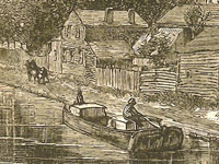
From the early 1830's, emigrants from rural northeastern Pennsylvania traveling to northwestern Illinois had two possible routes that were widely used. The most popular of these was to take the Erie Canal.
A Northern Route
The first route: They would have loaded on a canal boat at Elmira, NY, just north of Bradford County, PA. From there they would have traveled on the Chemung Canal, completed in 1831. This would have taken them up to Watkins Glen at the southern tip of Seneca Lake. At the northern end of the lake in a portage called Geneva they would have picked up the Cayuga and Seneca Canal which was completed in 1830. This would have taken them up to the Erie Canal at Montezuma (near Cayuga), from where they would have traveled west along the Erie Canal to Buffalo. From Buffalo, they could have gone to Chicago via Lake Erie and Lake Michigan (a circuitous route of a thousand miles) on a steamboat. A route that could only be navigated when the lakes were not frozen over in the winter. After about 1833, another possibility was to get off the boat in Detroit (rather than Chicago) where they could have transferred their goods to a wagon or stagecoach which followed the Chicago Road. This path stretched from Detroit to Chicago across Michigan above its southern border and around the south of Lake Michigan.
either of two routes would have been likely
From Chicago, if it was still the very beginning of the decade of the 1830s, they could have floated up the Chicago River and portaged over to the Des Plaines River on a short draft flatboat—or they could have followed the portage route by stage or wagon, depending on the seasonal water level—and from there they could have connected with the Illinois River and floated down to join the Mississippi at Grafton, IL, above St. Louis. From there, they could have taken a steamboat north along the Mississippi to Savanna, IL, in Jo Daviess (later called Carroll) County. However, by the middle of the 1830s, when many new settlers were pushing into Illinois to find farmland, they would almost certainly have taken another route from Chicago, which was the State Road that went more or less directly from Chicago, through Elgin and Rockford, IL, and then ended at Galena, in Jo Daviess County.
A Southern Route
The second route: They could have floated down the Susquehanna River (or used the canal system that supplemented and paralleled the river) south to Harrisburg. They would then have transferred their goods to a Conestoga wagon or a stagecoach, and from there they would have turned west and traveled across south central Pennsylvania by way of the Pennsylvania Road (the Old State Road), which went from Philadelphia to Pittsburgh. At Pittsburgh, they would have transferred their goods to a boat and floated or steamed down the Ohio River to where it joined the Mississippi River at Cairo, IL. Then north by steamboat up the Mississippi to Savanna or Galena, IL (steamboats began regular service between St. Louis and Galena in 1827).
A Third Possibility
Another less probable route existed: Depending on how much they intended to bring with them, they might have considered whether it would be cheaper to travel with their goods to New York or Philadelphia—perhaps by way of the North Branch Canal or the Delaware and Hudson Canal and by toll road—and then to ship to New Orleans. From there to transfer it all to a steamboat bound up the Mississippi River as far as Galena. This may seem like a very roundabout way; however in the early 1830s shipping a lot of freight by road over the mountains of Pennsylvania and across Michigan and Illinois was more expensive than shipping it by water around the Eastern seaboard and up the Mississippi. The completion of the Erie Canal changed the calculation.
shipping a lot of freight by road over the mountains ... was more expensive than shipping it by water
Circumstances Determined Choice of Route
Their choice of route may have taken into account what they intended to carry with them, how much they could spend on their travel, as well as the local conditions along the various routes, insofar as they could foresee them. They would also have considered their strength and health, and whether they could endure pushing a stuck wagon over a mountain road or living in a makeshift tent on the upper deck of a steamship. If they were already farmers and planned on bringing livestock, tools, and household goods to the farmland of Illinois, that would have constrained their choices in a way that prospective miners, who also flocked to the region around Galena, did not experience simply because miners were not likely to have brought any of the tools of their livelihood with them when they moved. In planning their trip, they might have picked up a copy of Illinois pioneer and Baptist missionary John Mason Peck’s, Guide for Emigrants (1836), which recommended routes for prospective settlers from the East and even lists steamboat, stage, and canal fares. Also useful in planning their trip, if they were leaving in 1837 or later, would have been a copy of Samuel Mitchell’s, Illinois in 1837.
For more information
Gerard Koeppel, Bond of Union: Building the Erie Canal and the American Empire. Cambridge, Mass.: Da Capo Press, 2009. William J. Petersen, Steamboating on the Upper Mississippi. New York: Dover, 1995. 1st ed. published in 1937. The New York State Archives’ Erie Canal Time Machine.
Bibliography
John Mason Peck, A New Guide for Emigrants to the West: Containing Sketches of Michigan, Ohio, Indiana, Illinois, Missouri, Arkansas, with the Territory of Wisconsin and the Adjacent Parts. Boston: Gould, Kendall & Lincoln, 1836, pp. 371-381. Samuel Augustus Mitchell, Illinois in 1837; A Sketch Descriptive of the Situation, Boundaries, Face of the Country, Prominent Districts, Prairies, Rivers, Minerals, Animals, Agricultural Productions, Public Lands, Plans of Internal Improvement, Manufactures, &c of the State of Illinois. Philadelphia: S. Augustus Mitchell, 1837. Henry Wayland Hill, An Historical Review of Waterways and Canal Construction in New York State. Buffalo: Buffalo Historical Society, 1908, p. 150. Beverly Whitaker’s website, Early American Roads and Trails for information on the Pennsylvania Road and the Chicago and State Roads. W. B. Irwin, The Routes of Migration between the Atlantic Seaboard and the Midwest. Burbank: Southern California Genealogical Society, 1966.
Intertwined Development: Railroads and Political Parties
field_image
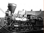
Question
How did railroads affect the political systems in 1870-1914?
Answer
Railroads and the political system have been intertwined since the first rail systems in the 1830s and 1840s when in the name of “internal improvements” the Whig Party supported government funding for start-up railroad companies. It was, however, during its rapid expansion in the post-Civil War era that the industry’s ties to the political system became controversial.
The federal government gave railroad companies thousands of acres of land on which to run their tracks. Men like Jay Gould, Cornelius Vanderbilt, E. A. Harriman, James J. Hill, and J.P. Morgan controlled a powerful industry. They wielded political power, too, by demanding the federal government send troops in to break up railroad strikes in 1877 and 1894. Meanwhile farmers began to protest the railroad’s monopoly over transportation rates. Congress responded with the Interstate Commerce Act (1887), which sought to prevent “pools” of interests from dominating industries. But given that both Republican and Democratic leaders benefited from gifts given by the railroad companies, real reform, it seemed, was going to have to come from outside the two-party system.
The People’s Party, or the Populists, emerged in the 1890s calling for strict regulation to rein in railroad companies’ power. By the early 1900s, self-styled “progressives” in both parties had picked up on the Populists’ and organized labor’s attacks on the railroads. During Theodore Roosevelt’s presidency, progressive Republicans and Democrats joined forces to pass the Elkins Act (1903), the Hepburn Act (1906) and, during William Howard Taft’s term as president, the Elkins-Mann Act (1910) and the Railroad Valuation Act (1913) all of which regulated the industry. Conservative Republicans pushed back by denying Roosevelt the nomination in 1912, thus causing a rift in the party and guaranteeing Woodrow Wilson’s election.
For more information
Central Pacific Railroad Photographic Museum Connolly, Michael J. Capitalism, Politics, and Railroads in Jacksonian New England (Columbia: University of Missouri Press, 2003). Martin, Albro. Railroads Triumphant (Oxford: Oxford University Press, 1992). Stover, John F. American Railroads (Chicago and London: The University of Chicago Press, second edition, 1997). Summers, Mark W. Railroads, Reconstruction, and the Gospel of Prosperity (Princeton, New Jersey: Princeton University Press, 1984.
Bibliography
Martin, Albro. Railroads Triumphant (Oxford: Oxford University Press, 1992).
The National Atlas of the United States of America. "Presidential Elections 1908-1920." Last modified August 03 2010.