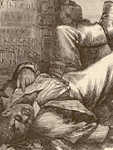
After Slavery

Image
Annotation

Textbooks often present a quick, uncomplicated overview of Reconstruction—a vast oversimplification of a time of social upheaval, tension, and violence. After Slavery: Race, Labor and Politics in the Post-Emancipation Carolinas, a joint project of Queen's University Belfast, the University of Memphis, and the University of London, provides primary sources that take a closer look at the time period.

Focusing on the themes of labor, race, and citizenship, After Slavery presents sources from North and South Carolina as examples of trends nationwide. A 2,500-word Introduction explores Reconstruction and the rationale for choosing the Carolinas as the project's focus. About the Project explains the structure and rationale behind the website's learning units.

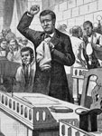
The Learning Units form the heart of the site. Ten units cover topics including emancipation, mobilization, land and labor, black soldiers, conservative reactions, justice, gender, poverty and white supremacy, coercion and resistance, and the Republican Party. Each unit includes a 400-word introduction and six or more primary documents with three to eight discussion questions each. Units can be viewed online or downloaded as PDFs. An introductory essay explains the mission behind creation of the units, and Recommended Reading lists more than 80 books, 50 articles, and 15 primary sources.

As of December 7, 2012, other materials on the site are still content-light. Interactive Maps uses Google Maps to pinpoint only two events—the Hamburg Massacre and the Cainhoy Riot—with five to seven subevents included in each, as well as five-item lists of related sources.

Interactive Timelines includes three timelines with one-sentence descriptions on each item. Timelines look at general Reconstruction history as well as Reconstruction in North and South Carolina. Teacher Resources currently features links to more than 30 digital collections and exhibits, research tools, military records, audiovisual resources, and more. The section notes that lesson plans will be added in the future.

A valuable resource for teachers looking to complicate the textbook narrative on Reconstruction, and for teachers covering North or South Carolina history.

Creating a More Perfect Union: 1861-1865

Image
Annotation

During the Civil War, the Survey of the Coast found a new purpose—preparing secret reports on the waters along the Atlantic seaboard to improve Union blockades. This website collects and shares materials from the United States Coast Survey, 1861 through 1865.

You can, for example, read any of nine Notes on the Coast of the United States, prepared by the Blockade Strategy Board. These detail sailing conditions and geography for use by Union captains and generals. Summaries, located under the "Documents" heading, cover the process of creating these lengthy reports.

Additional features include a brief biography of Alexander Dallas Bache, U.S. Coast Survey supervisor; an 1861 map showing slave population density; short overviews of some of the other members of the survey team during the Civil War; and a 33-page PDF concerning the history of the Coast Survey between 1843 and 1867. The PDF contains several maps and photographs.

Using the search box on the main page will retrieve Civil War-era maps of cities, camps, works, battlefields, and more.

Politics of a Massacre: Discovering Wilmington 1898

Image
Annotation

On November 10, 1898, Wilmington, NC, experienced what has come to be known as the only coup d'etat in United States history, when white supremacist members of the Democratic Party overthrew the municipal government and killed anywhere between six and 100 African Americans in the city, which at that time had a large, thriving African American population supported by the biracial Republican Party.

This website narrates the history of this event, from the rising racial tensions surrounding the passing of the 14th and 15th Amendments and court disputes over miscegenation and interracial marriage, through the contentious election politics of 1898 that pitted the Democratic Party, supported by white supremacists, against the Republican and Populist Parties that represented African American interests at the local level, and the riot on November 10, through the legacy of the riot in the months and years to come, including the rise of segregationist Jim Crow laws.

Each section is illustrated with links to primary sources, including political cartoons, newspaper clippings, laws, court cases, and photographs of prominent Wilmington African Americans.

The website also includes the 1898 Wilmington Race Riot Report published in 2006 by the North Carolina Department of Cultural Resources' Wilmington Race Riot Commission, which includes maps, photographs, and other primary source materials, and a link to an interactive map allowing visitors to visualize the events of November 10, 1898.

The Wright Brothers in Photographs

Image
Annotation

More than 400 items, including approximately 380 photographs, on the Wright Brothers' "early inventive period documenting their experimental gliders and flight testing in both North Carolina and Ohio." Most of the materials date from 1897 to 1908. Approximately half of the photographs were taken in the Outer Banks, NC. In addition to recording the Wrights' aviation trials, these images provide "a valuable record of their home life, camp life, and the flora and fauna" of the area.

More than 70 images were taken at Le Mans, France, and approximately 25 at Fort Myer, VA. The Wrights themselves produced more than 180 photos, and fellow flight pioneer Octave Chanute shot approximately 35. The site, which promises future additions, allows browsing by date, object type, place, and creator, and is fully searchable. Primarily of interest for those studying early flight history.