David Rumsey Map Collection
Image
Image for David Rumsey Historical Map Collection
Annotation

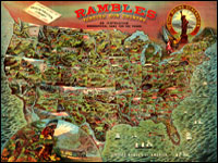
This private collection presents more than 15,800 rare historical maps with a focus on North and South America. The collection is accessible via several formats. A standard browser (the "directory") is designed for use by the general public. In addition to two browsers and a "collections ticker" requiring Insight software (available for free download), a GIS browser shows detailed overlays of maps and geospatial data for the more serious researcher.

Many of the U.S. maps are from the late 19th and early 20th centuries and are often notable for their craftsmanship. Materials include atlases, globes, books, maritime charts, pocket and wall maps, and children's maps. Users can zoom in to view details. Overlay capabilities make this site valuable for its ability to convey how locations have changed over time.

Okeechobee Main Street, Inc. [FL]

Description

The Okeechobee Main Street program is designed to improve all aspects of the Okeechobee downtown district. Its main goals are to improved economic management, strengthen public participation in downtown events, recruit new businesses, rehabilitate buildings and building facades, and expand parking for visitors. The organization has three main projects, the facade program which seeks to improve the look and feel of downtown through building restoration, the beautification program which improves upon landscaping downtown, and guidelines for the painting of murals downtown.

The site offers detailed information and documents regarding all organization programs, an events calendar, and links to visitor information regarding Okeechobee.

This is a community revitalization organization.