David Rumsey Map Collection

Image
Image for David Rumsey Historical Map Collection
Annotation

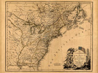
This private collection presents more than 15,800 rare historical maps with a focus on North and South America. The collection is accessible via several formats. A standard browser (the "directory") is designed for use by the general public. In addition to two browsers and a "collections ticker" requiring Insight software (available for free download), a GIS browser shows detailed overlays of maps and geospatial data for the more serious researcher.

Many of the U.S. maps are from the late 19th and early 20th centuries and are often notable for their craftsmanship. Materials include atlases, globes, books, maritime charts, pocket and wall maps, and children's maps. Users can zoom in to view details. Overlay capabilities make this site valuable for its ability to convey how locations have changed over time.

Osher Map Library

Image
Image for Osher Map Library
Annotation

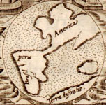
These 14 exhibitions include more than 600 maps and related documents on aspects of history revealed through the study of maps. The website provides well-integrated essays of up to 8,000 words for each exhibit and some annotated bibliographies.

Exhibits focusing on American history include "Mapping the Republic," on conflicting conceptualizations of the U.S. from 1790 to 1900; "Exodus and Exiles," on Diaspora experiences of Jews and African Americans; "The American Way," a collection of 20th-century road maps and guidebooks; "Carto-Maine-ia," on popular uses of maps; and "Maine Wilderness Transformed," that examines "the creation of a landscape of exploitation."

In addition, "The Cartographic Creation of New England," addresses European exploration and settlement, "The 'Percy Map,'" presents a significant Revolutionary War map; and "John Mitchell's Map" offers insight into diplomatic disputes. These maps are especially valuable for studying exploration and cartography in American history.

Map Collections: 1500-2003

Image
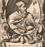
Image, Historia general..., Antonio de Herrera y Tordesillas, c. 1601-1615, LoC.
Annotation

This large collection of maps from the 16th century to the present day focuses on Americana and cartographic treasures.

Materials are organized into seven thematic categories—Cities and Towns, Conservation and Environment, Discovery and Exploration, Cultural Landscapes, Military Battles and Campaigns, Transportation and Communication, and General Maps. Sections include five special presentations.

Users may download maps or zoom in to view details. Seventeen specific map collections contained within this larger site that are of particular importance for the study of American history include "Discovery and Exploration," "The American Revolution and Its Era," "Railroad Maps, 1828–1900," "American Colonization Society Collection: Maps of Liberia, 1830–1870," "Panoramic Maps, 1847–1929," "Civil War Maps," and "Mapping the National Parks."
Developing Cartographic Literacy with Historic Maps

Description

This 3-week seminar led by James Akerman (The Newberry Library) and Gerald Danzer (Emeritus, The University of Illinois at Chicago) is designed to develop cartographic literacy and encourage effective use of map documents in the classroom through study in the history of cartography. A program of seminars based on recent scholarship in the history of cartography and guided individual research will allow teachers to explore the relevance of map study to their own interests and curricular needs. Workshops will serve as forums for refining and applying the skills necessary to read maps as products of science, artistic creations, storytellers, wayfinding tools, and expressions of power; and as representations of worldviews and local landscapes.

Contact name
Frank, Sarah
Contact email
Registration Deadline
Sponsoring Organization
Newberry Library
Phone number
312-255-3659
Target Audience
K-12
Start Date
Cost
Free; $2,600 stipend
Contact Title
Program Assistant
Duration
Nineteen days
End Date

American Shores: Maps of the Middle Atlantic Region to 1850

Image
Annotation

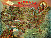
This attractive site explores the mid-Atlantic region and history with maps created before 1850. An extensive collection offers more than 1,852 historical maps of many different types. In addition to numerous regional and state maps, these include land surveys, coast surveys, nautical charts, military maps, ornamental maps, and city maps.

An overview provides historical context for reading the maps of the geographic regions. In addition, the site offers several special features. "Basics of Maps" explains such cartographic terms and features as orientation, scale, and the cartouche. "Maps Through History" highlights particular maps and map genres from the collection, including a look at New York Harbor, the Hudson River, nautical charts, maps revealing early transportation routes, and maps of American Revolution battle sites. "Geographical Areas" highlights many kinds of maps and what information they offer. Visitors can click on thumbnail images to view enlarged maps and pan and zoom the maps.