How to Read a Landscape bhiggs Mon, 10/17/2011 - 12:06
Article Body

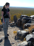
This site is the product of a project led by Professor William Cronon of the University of Wisconsin at Madison. It offers guidance for those interested in learning how to perform original research in environmental history, including how to “read” a landscape as a historical source. The site provides a number of suggestions for how students might see a landscape in different ways, ranging from “visit your landscape throughout the year” to “think about the relation between landscape and modes of production and consumption.” More specific suggestions are offered for landscapes of four types: wild environments, rural areas, cities and towns, and historical ruins.

Making the Most of Maps

Image
Watercolor, Viewing the coasts by the Chart, 1838-1839, William H. Meyers, NYPL
Question

When a group of students has no prior experience or knowledge of using geography and maps in a social studies class, what are some ways that map/geography skills can be incorporated into a lesson?

Answer
Elementary Students

To some extent the answer to this question depends on the age of the children you are teaching. Given the abstract nature of maps, formal introduction to map skills is likely best done after age six. For these young learners, I suggest that you look at the newly redesigned National Geographic Education website that includes a mini-lesson on "What is a Map." This lesson introduces the concept of a map as a simplified model of reality. From there one of the best ways to introduce map reading is to create a map of a familiar area (such as the classroom) together. That and other elementary geography projects can be found on this teacher-created site.

For slightly older students map skills should include learning the vocabulary of maps: words and concepts such as legends, scales, and compass roses. Instruction can also begin to focus on the concept that mapmakers must be selective and can show only a limited number of things on each map. Try this lesson from the United States Geological Survey that gets to this point. In any case, it is important to teach students about maps and how to use them before asking them to read and analyze content-specific maps.

Once students have a basic understanding of maps, teachers can begin to explore the use of maps to highlight important historical concepts. Elementary school is not too early to begin this type of lesson. A video example of using maps to teach history in a 4th-grade classroom can be explored here. The main goal in this lesson is to engage students in actively asking questions of the primary source document (in this case John Smith's map of Tidewater Virginia) and interpreting and understanding what they are seeing.

Finding the Right Map for Your Classroom

The Library of Congress has a large collection of maps that can be used for historical study. The site also has a self-directed professional development module for teachers about how to access and use maps in social studies lessons. This module is useful if you are new to using maps to teach history. To learn even more about what to look for in historical maps I encourage you to read the short demonstration essay "Making Sense of Maps" by David Stephens of Youngstown State University.

Older Students
As with other print media, students must learn to ask why was this document made, for whom, and in what context.

High school students with weaker geography backgrounds may require a review of terms and fundamental spatial concepts. But it is even more important for this age group for you to teach dynamic geographic analysis skills. See this Teaching Guide that includes an easy-to-use 12-step handout to guide questioning about a map. It not only lists what to look for in a map, but also engages students in asking their own questions about what is represented (and what is not) and how that influences our understanding of the map. As with other print media, students must learn to ask why was this document made, for whom, and in what context.

Finally, I am excited by the new uses for older maps that are afforded by the new Geographical Information Systems (GIS) technologies. An example of a high school lesson plan using interactive mapping features can be found here. This is just one of several history lesson plans based on GIS technology that are becoming available.

Creativity is Key

In sum, a myriad of historical maps can now be found on the Internet and their use is just beginning to be fully explored by teachers. There are so many kinds of maps. Let your imagination run free. Become familiar with the types of materials that are out there and the ways in which they might be used and then try them out with your classes. A good starting point for looking for maps can be found online here, here, and here as well as at the Library of Congress. As a geography buff, I love the number and quality of teaching materials that are now available. Kids like to work with maps and geography is fun to teach. Good luck!

For more information

You may also enjoy reading our Tech for Teachers article on using Google Maps in the classroom.

Early Washington Maps: A Digital Collection

Image
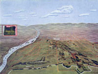
Map, "Hermiston Oregon," Umatilla Project Development League, 1910
Annotation

The nearly 1,000 maps available on this site document the conflict between Great Britain and America for ownership of the region. They also illustrate the transformation of the physical boundaries of the Pacific region and the efforts of its inhabitants to control the land. The site includes a valuable interactive timeline that presents the maps in historical perspective. The collection contains large-scale geographic maps of the land and sea and small hand-drawn sketches of settlements. The maps are very detailed and most were created in the late-19th- and early-20th-century. Maps are primarily concerned with geography, transportation, climate, population, culture, politics, and tourism and there is a searchable index that is organized according to 21 themes, such as forests, Puget Sound, railroads, Seattle, Washington State University, and Native American reservations.

A drop-down menu allows users to examine and enlarge thumbnail images of each map. Biographical and detailed descriptive text (most between 20 and 500 words) is presented with each image, and the text is searchable by keyword. Created as a resource to help students, teachers and researchers understand the history and development of the state of Washington, this site will appeal to those interested in Washington, historical geography, and the development of cartography.

Making Sense of Maps Anonymous (not verified) Thu, 01/17/2008 - 15:57
Article Body

Making Sense of Maps offers a place for students and teachers to begin working with maps as historical evidence. Written by David Stephens, this guide offers an overview of the history of maps and how historians use them, a breakdown of the elements of a map, tips on what questions to ask when analyzing maps, an annotated bibliography, and a guide to finding and using maps online.

Fee Free Days for National Parks

Date Published
Image
Photo, DSCF6212.JPG, Oct. 28, 2007, mbeldyk, Flickr
Article Body

No time or money in the budget for field trips? Encourage your students to visit historic sites on their own. High school teacher James A. Percoco has incorporated "Individual Field Trips" (IFT) into his teaching for more than two decades. Each IFT requires students to visit a historic site or exhibit related to what they are learning in the classroom and to record and share their experiences. When students study the American Revolution and George Washington, they visit Mount Vernon. When they study the wars of the 20th century, they visit the war memorials on the National Mall in Washington, DC. These visits help students understand history as a living force, physically present in their communities and constantly being interpreted and reinterpreted.

If you have national parks and historic sites near you, take advantage of their Fee Free Days!

Think you're too far away from major historic sites for IFTs to benefit your students? Students can benefit as much from exploring local history as they can from exploring national and state history! Turn to local museums, libraries, and historical associations with suggestions from Teachinghistory.org's Daisy Martin.

If you have national parks and historic sites near you, take advantage of their Fee Free Days. According to the National Park Service (NPS), 264 of its more than 390 parks don't charge admission fees, but don't be intimidated if the NPS sites you'd most like your students to visit do charge fees. Plan ITF assignments so that students have the option to visit sites on one of several days every year that all NPS locations waive visitor fees.

Want your students to visit a museum? Consider planning your IFT around Smithsonian Magazine's Museum Day Live! On September 29, admission to any participating museum is free if students print out and bring along a downloadable ticket.

Whichever sites you choose for your students, make certain to visit the places yourself first. As you explore a site, consider what you want your students to see and how you want them to see it. What connections do you hope they'll make? What aspects of the place might they overlook without guidance? By visiting the site ahead of time, you can plan pre- and post-visit materials and activities that make your students' IFT experience more than just a day out.

Coal and the Industrial Revolution Anonymous (not verified) Wed, 04/07/2010 - 17:47
Question

How can the story of coal help students understand the nature of today's fossil-fueled world?

Textbook Excerpt

Most textbooks explain the phenomenal growth of the American economy during the industrial revolution by some combination of immigration, urbanization, the rise of mass production, the inventiveness of great scientists, the development of extensive infrastructure, the rise of corporations, government subsidies, the "laissez-faire" legal environment, and the bounty of America's natural resources.

Source Excerpt

Sources reveal a society suffering from growing pains, with environmental and human rights concerns not yet keeping pace with the huge demand for raw coal and power to support rapidly expanding systems of infrastructure and industry. A nationwide dependency on mining sprang up unplanned, at the root of many of the changes in the U.S.'s culture and economy.

Historian Excerpt

Historians also treat economic growth during the industrial revolution as the product of many factors, but some seek out explanations and track changes beyond the few tidy categories laid out in textbooks. How, for instance, did the U.S. transition to coal power, and how was that transition both driving and driven by urbanization, mechanization, and a growing infrastructure? What effect did it have on the environment and living conditions?

Abstract

Why did the American economy take off in the late 19th century? What were the consequences of the nation's industrial ascendancy? Textbook treatments of what some historians call the "second industrial revolution"—the period of rapid and tumultuous economic expansion that stretched from the 1860s into the 1900s—can seem superficial and unsatisfying in comparison to neighboring sections on social change, political conflict, and cultural ferment. A better understanding of the story of coal, too often ignored by textbook authors, can provide students with important understandings about the nature of today's fossil-fueled world.

Integrating History and Maps

Video Overview
Terri Ruyter and Michele Yokell discuss their experiences with the Becoming Historians TAH Grant project, in which they sought creative ways to help urban New York City students understand the natural landscape traversed by colonists and pioneers.
Video Clip Name
LL_Terri1.mov
LL_Terri3.mov
LL_Terri2.mov
LL_Terri4.mov
Video Clip Title
Mapping Western Expansion
Integrating History and Maps
Mapping Colonial New York
Learning Outside the Classroom
Video Clip Duration
3:45
3:37
1:54
1:46
Transcript Text

We work with a Teaching American History Grant called Becoming Historians. It's working with elementary school kids, and one of the units of study in the New York City curriculum for 5th grade is this idea of westward expansion, and we came up with this—we realized that we had a bit of a stumbling block because when you're talking westward expansion, it's a pretty traditional model and teachers are doing Oregon Trail. And our kids who live in New York City have no conceptual knowledge of what a plain is or a mountain or a mountain pass. They have very little understanding, even, of what happens upriver. So while we were getting ready to do this work around westward expansion and what's out there, we wanted to help the kids make pictures in their minds to really have good empathy and historical imagination of what's going on. We realized we needed to do some foundational work on mapping.

. . . when you're talking westward expansion, it's a pretty traditional model and teachers are doing Oregon Trail. And our kids who live in New York City have no conceptual knowledge of what a plain is or a mountain or a mountain pass.

So I contacted an elementary-school/middle-school teacher at Bank Street College of Education, Sam Brian, who's done a lot of work on geography teaching and young children. And he does this terrain model map and it's a generic model with mountains and valleys and you flood it and you can see how islands are formed from mountains that are connected to the land, but then they become submerged. So the kids can see all this stuff actually happening.

So they're getting that kind of general vocabulary, but then they're also getting specific vocabulary about mountains and peaks and passes and ranges and river valleys and estuaries and all that other kind of language that our children need.

So we had Sam work with us on the terrain models, and then the idea is you go from the terrain model to a map that the children draw, a two-dimensional map the children draw, of the terrain model.

They look at maps of the actual physical world and they trace river routes and they figure out where the Continental Divide is, because you have rivers draining into one ocean or the other, and so there must be something high up in between that's causing the water to flow downhill. So: "Aha! Those must be mountains." So then you draw in the mountains and then you label all the places. So there's a lot of really rich background work that takes place.

And from that point we went into maps of the Oregon Trail, historic maps from 1843 that we found on the Library of Congress website. And so the kids are doing critical map reading because now they have the knowledge to say, “Oh, it's a pass. It's a butte. It's a bluff.” They're reading those labels on the map and it means something to them because they've seen pictures of it and a three-dimensional model of it. Because it's hard for us in the city to take our kids to places that represent these things.

They're reading those labels on the map and it means something to them because they've seen pictures of it and a three-dimensional model of it.

So then we looked at the Oregon Trail maps and talked about those maps and used the NARA forms to analyze the map: Who is the author? What was the purpose? What was happening at the time? And then we took diaries of peoples' westward journeys and traced those journeys along the maps so the kids could start making the connection between, "Oh, on June first, July second, we passed Independence Rock." And on, "We went through Devil's Gate." And all those places are labeled on the maps, so the kids are then tracing the progression of the individual who wrote the diary along the map and trying to get in their head what it's all about.

Rethinking the Oregon Trail

Terri: We had a plan for the content, but it was kind of vague. And then coming out of conversations with teachers and making observations in classrooms and figuring out what resources we could pull together, we—like, my original idea for westward expansion was not to do the Oregon Trail, it was to crack it open and do stuff about black pioneers and Exodusters and stuff, but all the teachers are doing this Oregon Trail thing. So I decided to, like, put my desires aside, and then focus on the Oregon Trail thing to think about: How can we make this a more rich experience? How can we enhance what they're already doing in the classroom, so that they're not, like, tossing the baby out with the bathwater? To start with something totally new, or just going to my workshop and learning about the Exodusters and then filing it away and continuing on with their Oregon Trail stuff.

I mean, that's what—the resources in their classroom are largely Oregon Trail, which is why it's taught. So we use that to retool it and then we brought in this idea of mapping and that came from talking with teachers about what their kids needed and me trying to think about what resources I knew were in the city and how could we make this more engaging, more interesting.

Preventing Learning Fragmentation

We're really working on mapping the curriculum to see how it spirals up, so that you're introducing this idea of a grid maybe in 3rd or 4th grade, and then in 5th grade you're starting to introduce the ideas of latitude and longitude. When you're looking at the Oregon Trail maps, the grid becomes not "A, B, C, 1, 2, 3," it's "degrees north and south" that the kids are actually using to orient themselves on the map.

So it's a way of, you know—they understand the idea of grid, and then they go into the more complicated thing of latitude and longitude. And then we're trying to think about—break it apart. What's on the maps, the historic maps that they're actually using, and then how do we scaffold that so that it aligns with the history curriculum and the geography curriculum so that the kids are not doing the geography unit and then it's, like, done with that, knock that one off the list, let's go to history now.

. . . the kids are not doing the geography unit and then it's, like, done with that, knock that one off the list, let's go to history now.

'Cause Sam's been doing this work since the early mid-90s, I think, and he says that that's the one thing that he's consistently struggling with teachers to get them to do is to make that transition between the work that you do with the terrain models and the imaginary land maps, and then taking it back into social studies and having the teachers actually use it and have the kids apply the information and the ideas that they've gotten from the first part of the work. And so that's really what we're trying to make a little bit more obvious and to make it more articulate.

Michele: To give the teachers the knowledge, the actual content knowledge, to reinforce that because it's not just their field. You know, you have to really study up on it and know what you're teaching and know it in depth so that you actually understand yourself what you're teaching the kids and not be afraid to go a little bit further. We know how to do this very well in the language arts, because that's what New York City has been really focusing on, and understandably. But now it's time to put that focus into history, into geography, and to integrate it.

Terri: The Wildlife Conservation Society has a very cool project happening using historic maps to determine what New York City, Manhattan in particular, looked like in 1609 when Henry Hudson sailed up for the first time.

So Sam came and did the same work with the 4th-grade teachers. Instead of focusing on interior landforms, they focused on coastal landforms. So they thought about peninsulas and coves and bays and the river systems, so that that's all very immediately transferred to New York City and New York State geography, and it leads the kids very nicely into 5th grade. And then they did—they looked at historic maps of early colonial New Amsterdam and New York.

Bringing History Home

Michele: Kids are working in partnerships, we put transparencies over the flat version and then we actually go over where the rivers were, where the bluffs were, where the canyons are, where the coast is, so that they get a three-dimensional view on this flat map of what it was like before the skyscrapers, and also where our school is, where their houses are in relation to this. And then we look at it next to Manhattan now. Like: what’s happening now, what happened then.

Terri: Right. And since you did it on transparency, you can take this—

Michele: Right.

Terri: And lay it on top, and you can see how the shape of Manhattan has changed over time. 'Cause you can see that all the hills that were down on the Lower East Side are flattened and the marshes are filled in and the coastline has changed and the rivers are paved over, and you can see all that stuff on the map.

Michele: Along with the mapping, the idea of taking them on trips that reinforce what they're learning two-dimensionally.

Terri:: There's a living museum along the Hudson River called Philipsburg Manor, and it interprets colonial New York history from an enslaved person's perspective. So we thought of, like, taking the train up along the Hudson. You get to see the width of the Hudson. You see the Palisades on the New Jersey side. You can see that there are hills on the New York side, so that there's stuff you can see to, like, "Oh, right. That's a river. And there's a really long bridge going over that river. A couple of them."

Michelle: And also even when we got there, there are, like, sort of culverts where you see that the—go underneath the sidewalks. I mean, you can actually tell that there was water under there, you know? And when you look at these huge expanses of land, except for Central Park, we don't really have huge expanses of land. So—

Terri: Right. And all our rivers are—all of the rivers that are on these British headquarter maps are all gone.

I think that when you do tie together these 3D models and you actually have them make their own maps and you have them take the trips and then tie in the history that goes with it, it gives a much better experience than just trying to read a standard text. . .

Michele: I think that when you do tie together these 3D models and you actually have them make their own maps and you have them take the trips and then tie in the history that goes with it, it gives a much better experience than just trying to read a standard text, which really is what people failed with. And because of this previous failure, I think teachers shied away. And now we're really giving alternatives to text, which are much better.
Cintia Cabib's Interdisciplinary Gardening

Date Published
Image
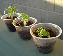
Photography, Plants are Coming Along, 31 May 2007, Tim Patterson, Flickr CC
Article Body

Soaring food prices, a hunger for locally grown produce, high obesity rates, and the desire by people to reconnect with nature and with each other have sparked a national renaissance in community gardening. As part of this movement, school gardens are sprouting up everywhere. Teachers are using these green spaces to teach a variety of subjects, including horticulture, nutrition, history, science, math, writing, and art.

The School Garden Movement

The idea of incorporating gardens in schools began in the late 19th century when Henry Lincoln Clapp, a teacher at the George Putnam Grammar School in Boston, MA, established the first school garden. Inspired after visiting school gardens in Europe, Clapp created a wildflower and vegetable garden at Putnam in 1891 with support from the Massachusetts Horticultural Society. The establishment of school gardens soon spread throughout the state and eventually became a nationwide movement, with an estimated 75,000 school gardens by 1906.

For garden advocates, integrating school gardens in the public schools served many purposes. It was a way to get city children outside, engage them in physical activity, and instill in them a sense of pride and teamwork as they cultivated and maintained their gardens. Gardening classes provided students with vocational and agricultural training. Teachers taught a variety of subjects through garden activities. Students practiced writing by keeping planting journals and writing compositions about the garden. Math skills were acquired by counting seeds, measuring garden plots, and determining the appropriate soil depth for planting. Students learned botany and entomology by observing plants and insects and their interrelationships. Geography and history came into play when students studied the origins of fruits and vegetables and planting customs among different cultures. The gardens provided inspiration for drawing, painting, and performing music. In 1914, the federal government established the Bureau of Education’s Office of School and Home Gardening, which promoted school gardens and provided “how-to” pamphlets and course guides.

The School Garden Army

Children’s involvement in gardening took on a new urgency when the United States entered World War I in 1917. In order to provide food to European allies facing a food crisis and to U.S. troops fighting overseas, citizens were encouraged to grow food for domestic consumption as part of the war garden campaign. Children were enlisted to join the School Garden Army, which adopted the motto, “A garden for every child, every child in a garden.” Students became important contributors to the garden campaign, growing thousands of dollars worth of produce in their school and home gardens.

Victory Gardens of World War II

When the United States entered World War II, children once again played an active role in growing fruits and vegetables to assist in the war effort. During the war, citizens were encouraged to establish victory gardens in their backyards, vacant lots, and schools to provide food for civilians and troops. Gardening was also promoted to boost morale, encourage physical activity and healthy eating and to help Americans deal with the stresses of war. The U.S. Office of Education encouraged victory gardening at schools and promoted school lunch programs that served locally grown fresh fruits and vegetables. The Boy Scouts of America, 4-H clubs, parks and recreation departments, churches, and many civic organizations were involved in victory gardening programs for children. In 1944, the U.S. Department of Agriculture reported that victory gardens produced 40 percent of the vegetables that were consumed nationally.

Community Garden Movement of the 1970s

The post-war suburban housing boom of the 1950s and 1960s generated more interest in backyard gardening than in community gardening. This changed in the 1970s when rising food prices, an increase in environmental awareness, and a desire by citizens to revitalize neighborhoods plagued by crime and neglect sparked a new community garden movement. Citizens and non-profit groups, such as Boston Urban Gardeners and New York’s Green Guerillas, turned vacant lots into colorful, productive green spaces. The U.S. Department of Agriculture initiated the Urban Garden Program in 1976 to help residents in major cities grow their own food. Educators and activists who were concerned that children were disconnected from nature and unaware of where their food came from reached out to young people and encouraged them to participate in neighborhood, youth, and school gardens. In a 1974 article in the Washington Post, writer Henry Mitchell noted that in Washington, DC, “there are 1,000 small gardens about town in which children grow such plants as the radish, the onion, and (as the weather stops being barbarous) the tomato.”

Growing Popularity of School Gardens

Since the 1970s, the popularity of school and youth gardens has grown steadily. California took the lead in 1995 by launching the “Garden in Every School” program. As in the school garden movement of the late 19th and early 20th centuries, teachers are utilizing these outdoor classrooms to teach a wide range of academic subjects through hands-on experiential activities. In addition, educators are using school gardens to encourage a healthier lifestyle, promote environmental stewardship and provide students with the opportunity to develop leadership and team-building skills.

These free resources provide ideas on how to incorporate school gardens into the academic curriculum, including social studies:

Bibliography

Lawson, Laura. City Bountiful: A Century of Community Gardening in America. Berkeley: University of California Press, 2005.

Mitchell, Henry. “A Child’s Garden in The City.” The Washington Post, May 19, 1974.

School Gardens with Constance Carter. Library of Congress webcast.

For more information

Test your knowledge of (modern) historical gardening with our quiz on victory gardens!

Nature Transformed: The Environment in American History

Image
Detail, Nature Transformed
Annotation

This collection of essays, commissioned from distinguished scholars, is designed to deepen content knowledge and offer fresh ideas for teaching. Essays begin with a thorough overview of the topic. “Guiding Discussion” offers suggestions on introducing the subject to students, and “Historians Debate” notes secondary sources with varied views on the topic. Notes and additional resources complete each essay. Essays include links to primary sources in the National Humanities Center’s Toolbox Library and are part of the larger TeacherServe project.

Visitors can browse 17 essays, divided into "Native Americans and the Land," "Wilderness and the American Identity," and "The Use of the Land." These focus on the changing ways in which North Americans have related to the natural world and its resources. Topics include, among others, “The Columbian Exchange,” “The Effects of Removal on American Indian Tribes,” “Cities and Suburbs,” and “Environmental Justice for All.”

Useful for teachers looking to expand their content knowledge beyond the information and viewpoints presented in textbooks, and to get a taste of historians' debate over the interpretation of history.

Resources for Earth Day Anonymous (not verified) Thu, 03/08/2012 - 17:13
Date Published
Article Body

With its origins in the rising environmental awareness of the 1960s and '70s, Earth Day gives students a chance to consider how human relationships with the natural environment have changed over time. How did pre-colonial and colonial North Americans relate to nature? How were their lives shaped by it? How did the industrial revolution in the U.S. change these relationships? What changes have occurred since then?

If you're looking for resources to teach the relationship of geography and natural science to U.S. history, visit our Earth Day spotlight page. You'll find website reviews, teaching strategies for using maps and the environment, quizzes, and more.

Many other organizations also offer Earth Day resources. Here are some ideas to keep you browsing:

  • Discover events and volunteer opportunities nationwide on the U.S. Environmental Protection Agency (EPA)'s Earth Day page.
  • Browse articles, primary source collections, links, and more related to conservation history and present-day science with the Library of Congress's Earth Day reference guide.
  • Head back to the '70s with the National Archives and Records Administration's collection of Documerica photographs. (Documerica, an EPA project, asked freelance photographers to capture environmental problems on film.)
  • Explore the parks of the National Park Service (NPS), and learn about the history of the NPS on the PBS website The National Parks: America's Best Idea (a companion to Ken Burns's documentary of the same name).
  • Read presidential proclamations from past Earth Days on the White House's website.
  • Learn about the life of President Theodore Roosevelt, including his support of conservation, in the Gilder Lehrman Institute of American History's journal History Now.
  • Introduce students to Earth Day with National Geographic Education's "Think Green" resource collection.
  • Follow a timeline on the history of Earth Day and watch videos on environmental science at History.com.
  • Learn how Earth Day got its start and explore environmental awareness activities at publisher Scholastic's Celebrate Earth Day hub.