U.S. Fish and Wildlife Service

Article Body

As stated on the U.S Fish and Wildlife Service (FWS) website, the organization's "mission is to work with others to conserve, protect and enhance fish, wildlife and plants and their habitats for the continuing benefit of the American people."

While the menu for the FWS website is daunting, skip the "Kids, Educators, Parents" section, and try "History." The former is aimed toward the exploration of nature and the biological sciences, and would need modification for the history classroom.

For starters, under "History," educators can find four virtual exhibits, covering the National Conservation Training Center, Pelican Island, conservationists Olaus and Mardie Murie, and an FWS vessel, the Otter. The exhibits are small and largely text-based, although the exhibit on Pelican Island provides historical images. While specialized, the exhibits may prove of use for regional West Virginia history or information on conservation movement founders.

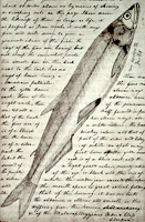
Additional resources include nine small historical images; period documents related to Rachel Carson, the U.S. Commission of Fisheries, and professional jargon; articles on topics ranging from fishery history to the limits of agroecology; law enforcement and FSW timelines; lists, including individual stations' centennial time capsule contents (what did employees feel best represented their station?); and oral history transcripts. Note that there are links to larger document databases, including FWS news releases dating as far back as 1914, under documents. This is easy to overlook, as other featured items are more prominent.

The Fallen Comrades list also provides insight into historical events. Listed deaths include the 1958 disappearance of the F.W.S. Grumman Goose N-720 and an employee, Lindgren, murdered by Italian hunters in 1922. Lindgren's death was used by journalistic factions to increase anti-immigration fervor.

Additional information of historical significance, particularly statistics, is tucked throughout the site. Try reading about climate change, wildfires, and wetlands trends.

If your students are animal lovers, consider having them select an endangered species, perhaps from their state. Each species' page includes federal documents related to their identification and recovery. These documents display how government interacts, not just with society, but with the country's fauna, a component of history which often goes unremarked.

Earth Day

Teaser

The environment has shaped human lives and been shaped by them. This Earth Day, learn and teach about the role of geography and nature in U.S. history.

Evolution of the Conservation Movement, 1850-1920

Image
Image for Evolution of the Conservation Movement, 1850-1920
Annotation

These published works, manuscripts, images, and motion picture footage address the formation of the movement to conserve and protect America's natural heritage. Materials include 62 books and pamphlets, 140 Federal statutes and Congressional resolutions, 34 additional legislative documents, and excerpts from the Congressional Globe and the Congressional Record. An additional 360 presidential proclamations, 170 prints and photographs, two historic manuscripts, and two motion pictures are available.

Materials include Alfred Bierstadt paintings, period travel literature, a photographic record of Yosemite, and Congressional acts regarding conservation and the establishment of national parks. An annotated chronology discusses events in the development of the conservation movement with links to pertinent documents and images.

National Park Service

Article Body

The National Park Service oversees a wealth of places and resources to visit and for hands-on and classroom instruction in American history.

For Teachers introduces educational materials focusing on history and culture available through the National Park Service.

Teaching with Historic Places offers lesson plans, classroom activities, and professional development opportunities to help educators bring places on the National Register of Historic Places into the classroom and to prepare for local field trips. Curriculum modules are based on national U.S. History Standards.

Teaching with Museum Collections is a guide to teaching history with material culture.

Teacher Resources for Archaeology show how to explore archaeology to bring the earliest history of North America alive.

Discover Our Shared Heritage lists America's historic places, alphabetically and state-by-state.

A Place for Kids and Teachers links to professional development opportunities for educators.

Traveling Trunks names hands-on artifacts and describes learning kits to borrow and/or purchase for classroom use.

History: The National Park Service

Image
Logo, NPS History and Culture website
Annotation

Historical aspects of many of the 384 areas under the National Park Service's stewardship are presented in this expansive site. A "Links to the Past" section contains more than 25 text and picture presentations on such diverse history-related topics as archeology, architecture, cultural groups and landscapes, historic buildings, and military history. Of particular interest to teachers, a section entitled "Teaching with Historic Places" features more than 60 lesson plans designed "to enliven the teaching of history, social studies, geography, civics, and other subjects" by incorporating National Register of Historic Places into educational explorations of historic subjects. Examples include an early rice plantation in South Carolina; the lives of turn-of-the-century immigrant cigar makers near Tampa, Florida; a contrast between the Indianapolis headquarters of African-American businesswoman Madam C. J. Walker and a small store in Kemmerer, Wyoming, that grew into the J. C. Penney Company, the first nationwide department store chain; the Civil War Andersonville prisoner of war camp; President John F. Kennedy's birthplace; the Liberty Bell; Finnish log cabins in Iowa; and the Massachusetts Bay Colony's Saugus Iron Works. Especially useful for teachers interested in connecting the study of history with historic sites.

Journals of the Lewis and Clark Expedition Anonymous (not verified) Fri, 01/25/2008 - 22:21
Image
Image, Page from the journals, Journals of the Lewis and Clark Expedition
Annotation

This well-designed site presents the Nebraska edition of the Lewis and Clark journals, edited by Gary E. Moulton. The site provides the complete text of all the journals from the 1803–1806 expedition, as well as introductions, prefaces, and sources. The material is searchable by keyword and phrase.

There are 29 scholarly essays about the expedition. An image gallery offers 124 images of pages from the journals, 95 images of people and places, and 50 images of plants and animals encountered on the expedition. The maps section includes 12 explanatory maps and nine images of maps from the journals. Additionally, there are 27 audio excerpts of journal readings and eight video interviews with the editor of the project. The website stands as an outstanding resource for researching the history of the Lewis and Clark expedition.

Harvesting the River

Image
Color offset lithograph, "Whistling In," Bartlett Kassabaum, 1980
Annotation

Presents a narrative in exhibit format—with hyperlinks to archival documents and photographs—on the cultural and economic life of the people who came to the Central Illinois River region from 1875 to 1950. Organized into three sections on the harvesting of fish, waterfowl, mussels, and natural ice; transportation by boat, railroad, and plank roads; and the settlement and development of six area river towns. The site delivers oral histories (audio and video), as well as illustrations and photographs. It may serve as a useful introduction to those studying this particular region and regional history in general.

American Notes: Travels in America, 1750-1920

Image
Title graphic, American Notes: Travels in America, 1750-1920
Annotation

This site is a collection of 253 travel narratives written between 1750 and 1920. The narratives were written by American citizens and foreign visitors about their travels in America. Some of the accounts were written by famous Americans (James Fenimore Cooper and Washington Irving, for example), but most of the authors were not famous. The narratives include their observations and opinions about American people, places, and society; and are valuable sources for the study of early American attitudes. Most accounts are viewable either as scanned images or as transcribed texts. Also included is the 32-volume set of manuscript sources entitled Early Western Travels, 1748-1846. The collection is searchable by keyword, and may be browsed by subject, author, and title. Students and teachers will find these primary sources invaluable for research and study of the late 18th and 19th centuries.

National Park Service: Links to the Past

Image
Image, History & Culture, http://www.nps.gov/history/.
Annotation

Visitors to this site are invited to explore historical aspects of the roughly 200 National Park Service locations designated important to U.S. history and prehistory. Materials are organized by "cultural resource subjects," including archeology, architecture and engineers, cultural groups, cultural landscapes, historic buildings, mapping, maritime and military history, and "cultural resource programs," such as the American Indian Liaison Program and Heritage Preservation Services.

Visitors can search for information on more than 2.5 million Civil War soldiers and sailors; more than 71,000 properties listed in the National Register of Historic Places; and approximately 240,000 reports on federal archaeological projects in the National Archaeological Database. National Register Travel Itineraries provide historic guides to 18 cities and communities. The National Underground Railroad Network to Freedom contains information on 51 sites of importance and on slavery and antislavery efforts.

Also of interest are bibliographies on the African American west and public history, and full-text publications on the Antiquities Act of 1906 and the promotion of the city of Seattle during the gold rush era. The homepage—"History and Culture"—presents several topical, comprehensive historical exhibits including the "Eisenhower Virtual Museum."

Historic USGS Maps of New England jmccartney Wed, 10/07/2009 - 15:00
Image
Map, "Mystic, CT-NY-RI Quadrangle," 1944
Annotation

A collection of more than 1,100 topographical maps created by the United States Geological Survey from the 1890s to the 1950s covering all of New England—Maine, New Hampshire, Vermont, Rhode Island, Massachusetts, and Connecticut—and selected areas of New York. The maps—which reveal roads, buildings, rail lines, bodies of water, and elevations—occur in 15-minute and 7.5-minute quadrangle series (a minute is one-sixtieth of a degree of latitude or longitude). In addition, the collection includes six maps with 30-minute quadrangles.

For states other than New York, users can view a state image map and select a point within a grid marked off in 15-minute increments to find listings for available images accompanied by dates the maps were surveyed, created, and revised. Towns within each quadrangle are also listed along with names of adjacent areas. Users also may search an alphabetical list of towns within each state. For New York, only an index of quadrangles names is available. Maps are presented in JPEG format. According to the site, "Each image is typically 2 megabytes, so download times are likely to be slow." A useful site for those studying changes in the New England landscape during the first half of the 20th century.