Lewis and Clark: Maps of Exploration 1507-1814

Image
Logo, Lewis & Clark, The Maps of Exploration
Annotation

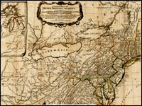
This 1995 exhibition presents approximately 70 maps designed to help "understand [Thomas] Jefferson's views of the West and the nature of the quest to the Pacific," and to "show the evolution of cartographic knowledge of North America up to the time that [Meriwether] Lewis and [William] Clark set out."

Arranged into five sections, it treats the period from the arrival of Columbus in North America to Lewis and Clark's 1803 voyage.

Well-written background essays describe relevant monographs and journals, explain the role of technology in mapmaking, and elucidate the social and intellectual contexts of Western exploration.

The site, which offers both European and American perspectives, also furnishes eight related links and a 31-title bibliography.

Particularly useful for understanding the evolution of geographic knowledge about North America and for tracing the history of cartography during this period.

Envisaging the West: Thomas Jefferson and the Roots of Lewis and Clark

Image
Image for Envisaging the West: Thomas Jefferson and the Roots of Lewis and Clark
Annotation

By the time Thomas Jefferson became the third President of the United States in 1801, interest in exploring the West had begun to shape U.S. policy. This chronological narrative traces Jefferson's life, participation in politics, and accumulation of scientific geographical knowledge from 1735 to 1804. There are four main sections: "The Jeffersons and Their Frontier Virginia Neighborhood," "From Colony to Commonwealth," "Science and Statecraft at Home and Abroad," and "Public Servant to the Early Republic."

This narrative is accompanied by an archive of 169 letters, statues, books, treaties, maps, and journals providing primary source insight into Jefferson's thoughts about the West and the Lewis and Clark expedition in particular. Three interactive maps from the 1700s, overlaid with historical data about cities, private dwellings, natural features, courthouses, and waterways, provide important insight into the geographic and social environment at the time.

Historic Topographic Maps of California

Image
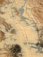
Map, San Francisco 15-minute Quadrangle, 1895
Annotation

Provides historical United States Geological Survey maps of the San Francisco Bay area, from Point Reyes in the north to Half Moon Bay, and east to San Jose. Includes maps from different time periods—the earliest is from 1895, the latest 1997—covering each 7.5-minute and 15-minute quadrangle of the area. Users may zoom in to see minute details. Searchable by quadrangle or place name. Of value for those studying change over time in the development of the Bay Area during the 20th century.

Conservation and Environmental Maps

Image
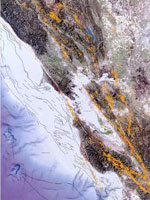
Map, Earthquakes and faults in the San Francisco Bay Area (1970-2003)
Annotation

A collection of historical and modern maps, this site features more than 150 maps showing early exploration and subsequent land use. The maps show a variety of information, including landscape changes over time, natural and man-made features, recreation and wilderness areas, geologic features, topography, wetlands, vegetation, and wildlife. A series of conservation maps focuses especially on the growth and development of national parks.

The maps have been categorized by purpose, and fit into one of seven categories: Conservation and Environment, Discovery and Exploration, Immigration and Settlement, Military Battles and Campaigns, Transportation and Communication, Cities and Towns, and General Maps.

Historical Maps Online

Image
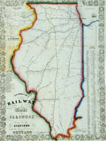
Map, D.B. Cooke & Co.'s railway guide for Illinois...
Annotation

This website offers more than 400 images of historic maps charting 400 years of development in Illinois and the northwest territory. The collection of maps can be browsed by state or geographic area or by categories such as early maps, topographic maps of Illinois, Indians of North America, waterways, and transportation. Types of maps include maps showing roads and canals, topographical maps, French and Spanish colonial maps, maps of railways, city maps, county and township maps, maps showing regions of settlement, and sectional state maps.

A zoom and pan feature allows the map images to be examined in detail and bibliographic information is provided with each map image. A keyword search is available. An excellent source of historic maps.

Map Collections: 1500-2003

Image
Image, Historia general..., Antonio de Herrera y Tordesillas, c. 1601-1615, LoC.
Annotation

This large collection of maps from the 16th century to the present day focuses on Americana and cartographic treasures.

Materials are organized into seven thematic categories—Cities and Towns, Conservation and Environment, Discovery and Exploration, Cultural Landscapes, Military Battles and Campaigns, Transportation and Communication, and General Maps. Sections include five special presentations.

Users may download maps or zoom in to view details. Seventeen specific map collections contained within this larger site that are of particular importance for the study of American history include "Discovery and Exploration," "The American Revolution and Its Era," "Railroad Maps, 1828–1900," "American Colonization Society Collection: Maps of Liberia, 1830–1870," "Panoramic Maps, 1847–1929," "Civil War Maps," and "Mapping the National Parks."

National Museum of Natural History

Article Body

The National Museum of Natural History, as stated on its website, "inspire[s] curiosity, discovery, and learning about nature and culture through outstanding research, collections, exhibitions, and education."

Natural history. That probably doesn't sound particularly useful to a teacher of history, which is so often centered on humanity, rather than the earth. That said, don't write the NMNH off without giving it some thought. True, many of the offerings are decidedly scientific. However, the museum includes anthropology alongside biology and geology.

Be sure to take a look at the virtual exhibits. More than 30 topics are presented, with highlights including Alaska Native Collections: Sharing Knowledge, Camping With the Sioux: Fieldwork Diary of Alice Cunningham Fletcher, Lakota Winter Counts, and Lewis and Clark: Mapping the West.

The museum also provides a variety of lesson plans, for use in the classroom and during field trips. Also, consider looking into the teacher and classroom resources under "Human Culture and Diversity." Resources range from bi-annual anthropological research publications (including teaching activities and methods) to the National Museum of Natural History's anthropological collections.

Speaking of anthropology, the department provides 24 online exhibits and three databases, including the museum collections.

Workshops provide an opportunity for educators to focus on specific topics of interest.

If you live in the DC area, consider planning a field trip. Hands-on learning opportunities are in no short supply!

U.S. Geological Survey

Article Body

The U.S. Geological Survey exists as a federal organization created to study the nation's flora, fauna, biology, geography, bodies of water, geology, and geospatial information.

The USGS provides access to their entire photographic collection, which is sub-divided into portraiture, photographers, "pioneer photographers," and images of earthquakes; mines, mills, and quarries; national parks; and Mt. St. Helens.

In addition, educators can access nine sub-sites and resources optimal for K-6 education, covering land use and exploration. Sample topics include "A Satellite View of the Journey of Lewis and Clark" and "Urban Growth in American Cities." Twelve resources, also addressing land use and exploration, are available for grades 7-12.

Available teacher packets, like the majority of the site, will primarily be of use to science educators. However, the three packets on maps could be used in conjunction with units on westward expansion or exploration.

National Oceanic and Atmospheric Administration

Article Body

The National Oceanic and Atmospheric Administration (NOAA) provides online exhibits, video clips, photographs, artifacts, interviews, and essays to provide a glimpse into maritime history, the history of science and technology, and its pivotal role in peace and war.

Hurricane History tracks the path of selected notable hurricanes since 1900; each description includes an interactive map.

NOAA administers the Monitor National Marine Sanctuary, preserving the wreck of the Civil War ironclad USS Monitor at Hampton Roads, VA.

Other historical resources are scattered around the NOAA site, retrievable through the search feature using the basic keyword, "history."

Researching the Role of the Map in History Teaching

Image
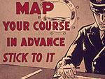
oster, Map Your Course. . . , 1941-1945, Office of Emergency Mgm't., NARA
Question

I am doing some research on the use of maps to teach history. Any suggestions for research or theory would be helpful.

Answer

To get oriented to how maps can be used to teach history and begin exploring links to relevant websites, this newsletter can be a useful first stop. You will find links to videos of teachers using historical maps, checklists for what to focus on when teaching with maps, reviews of best practices, and links to teaching modules. The fundamental idea behind these resources is that geography can provide the context for sophisticated historical thinking if students are encouraged to actively think about what maps show and why they show it.

One of the clearest rationales for using maps to teach history that I have seen can be found in a recent book by David Rumsey(1) and Meredith Williams entitled Historical Maps in GIS. The authors argue that:

Historical maps often hold information retained by no other written source, such as place-names, boundaries, and physical features that have been modified or erased by modern development. Historical maps capture the attitudes of those who made them and represent worldviews of their time.

Geographic Information System (GIS) is an exciting new tool for history and geography educators that has been the focus of some recent research. If this is of interest you might begin your exploration of the benefits of using GIS by reading "Using GIS to Answer the 'Whys' of 'Where' in Social Studies" by Marsha Alibranadi and Herschel M. Sarnoff. In the article, the authors discuss not only the pedagogical and social benefits of using GIS, but also use real classroom examples to reflect on the challenges that the technology poses.

[. . . S]tudies might show how to develop map reading skills, but they rarely show how to interrogate the map as a document. . .

The most recent research on using maps to teach traditional geography that I could find was Ava L. McCall's "Promoting Critical Thinking and Inquiry through Maps in Elementary Classrooms" published in The Social Studies. The critical thinking that is promoted by this work is very similar to contextualized historical thinking. This is a key point. One of the difficulties in finding research on using maps in history education is that researchers often aren't looking for the dynamic recursive relationships between history and geography that are critical to both disciplines. For instance, studies might show how to develop map-reading skills, but they rarely show how to interrogate the map as a document as a means of determining why it was created and for whom, or how it helps us understand the past. There is very little research using this orientation to historical and geographical relationships.

Depending on your specific research interests, you may want to consult the following resources. You may not have access to all of the materials but if you see something of interest you can contact your librarian. Or you may try a trial membership. The large national database on educational research can be accessed here. Two journals (Theory and Research in Social Education and The History Teacher) devoted to history and social educational research can be accessed here and here. And finally, if you are interested in international research in geography education you may want to look at the Review of International Geographic Education Online or back issues of the journal Research in Geographic Education.

Good luck with your research and let us know if you discover anything.
(1)Rumsey is a map aficionado who has compiled an enormous database of historical map images that he has posted for free on the Internet. It's worth exploring.