Mormons and Westward Expansion: A Guide for Pre-Service Teachers

What is it?
The founding of the Church of Jesus Christ of Latter-day Saints (whose followers are often referred to as Mormons) is a significant event in U.S. history. The publication of the Book of Mormon in 1830 led to the formation of what became the Church of Jesus Christ of Latter-day Saints and the eventual creation of a Mormon settlement in the American West. It represents both the founding of a religion that as of 2020 counted over 16 million adherents worldwide and an important episode in the westward expansion of the country. By looking closer at this history, students can better understand the religious movements that grew out of the Second Great Awakening as well. One crucial dimension of the birth of the Mormon Church is the role of place. Early Mormons moved multiple times to find a favorable location to grow the church before establishing a community far from any other white settlement. This settlement of the west would eventually lead to the creation of the state of Utah in 1896 only after the church formally abandoned the practice of polygamy. In the activity below, students will build a digital story map that incorporates primary sources from the Library of Congress related to the history of Mormonism. Note: Tutorials for teachers on how to use digital mapping platforms are linked below.
Key Points:
- This activity will take one 90-minute period or two 45-minute periods. It is appropriate for a high school U.S. history classroom, but can be modified for a variety of learners.
- Students will analyze, interpret, and evaluate primary sources.
- Students will learn about the origins of Mormonism, an important religious movement in antebellum America.
- Students will learn about the westward migration of Mormons to present-day Utah, a key event in the westward expansion of Americans.
Approaching the Topic
In this activity, students will engage with a variety of primary sources to create an interactive digital map. Students should pay particular attention to the time and place in which each source represents in order to place it on their map. It will be useful for students to have some background information on the Second Great Awakening. Resources on this topic can be found in this exhibit from the Library of Congress. Teachers may also decide to place this activity in the context of westward expansion. Resources here from the Library of Congress are helpful for providing this context. Also a review of these topics in a standard history textbook would also be sufficient for this activity. The guide will also contain tips for teaching about religion generally to help teachers engage students with what can be a challenging topic to teach.
Description
This activity facilitates students’ engagement with primary sources as they explore the early history of the Mormon church in the United States. Students will examine sources carefully, note details, particularly the time and place associated with the source. Note that several of the sources were created several decades after the event they depict. Students should take this into account as they interpret the source. Students work together to create an interactive digital map using three or four of the sources to communicate how movement and place shaped the history of this religion.
Teacher Preparation
Make the primary sources below available to students either through links, if using electronic devices, or by printing them out. According to your students’ needs, for text sources you may need to guide students to the relevant excerpts or share the excerpts separately. These excerpts are included below.
The story map students create in this activity can be done on a variety of platforms including StoryMapJS or Google My Maps. An overview of StoryMapJS can be found here. An overview of Google My Maps can be found here. A helpful tutorial for using StoryMapsJS with students created by the Gilder Lerhman Institute can be found here: https://www.gilderlehrman.org/sites/default/files/inline-pdfs/storymapjs_tutorial.pdf. A tutorial for Google My Maps can be found here: https://jessicaotis.com/tutorials/google-maps/
Teachers will want to familiarize themselves with whatever platform they choose to use. In creating a digital map, students will learn how place and location affect history and how to communicate that history succinctly but accurately in an interactive digital presentation.
Differentiation note: Depending on students reading abilities, teachers may want to consider accommodations for engaging with the primary sources below. Excerpts from text sources have been included along with annotations to highlight the most relevant passages. Teachers may also elect to read excerpts out loud to students or to assign smaller chunks of texts for students to examine in small groups.
Primary sources
The Book of Mormon
https://www.loc.gov/item/77352721/
Annotation: The Book of Mormon was published by Joseph Smith in March of 1830 in Palmyra, New York and is a central religious text of the Latter Day Saint movement. Palmyra is in western New York, an area known in the early 1800s as the “Burned-over district” due to the intensity of religious revivals in the region which were a major part of the Second Great Awakening. In addition to the establishment of the Mormon Church by Smith, religious groups such as the Millerites and the Oneida Colony were founded in this region and other groups like the Shakers and the Ebenezer Society were active as well.
For Latter-Day Saints, the Book of Mormon represents a new revelation something the text itself makes the case for new holy texts and new revelations:
“Thou fool, that shall say: A Bible, we have got a Bible, and we need no more Bible. Have ye obtained a Bible save it were by the Jews? Know ye not that there are more nations than one? Know ye not that I, the Lord your God, have created all men, and that I remember those who are upon the isles of the sea; and that I rule in the heavens above and in the earth beneath; and I bring forth my dword unto the children of men, yea, even upon all the nations of the earth?”
Book of Mormon 2 Nephi 29:6-7
O my father
https://www.loc.gov/item/jukebox-67865/
An important hymn for the Latter-Day Saints, “O my father” was written by Eliza Snow in 1845. The hymn introduces some innovative elements of Mormon theology, such as the notion of a "Mother in Heaven" and the belief in an individual’s spiritual pre-existence prior to being born as seen in the following lyrics:
O my Father, thou that dwellest
In the high and glorious place,
When shall I regain thy presence
And again behold thy face?
In thy holy habitation,
Did my spirit once reside?
In my first primeval childhood
Was I nurtured near thy side?
Snow was also one of Joseph Smith’s plural wives. Smith’s advocacy of men having more than one wife, a practice known as polygamy, was controversial at the time within the church. The church’s practice of polygamy also made the church more controversial to many non-Mormons.
The Mormon Temple at Kirtland, Ohio - (59 x 79 feet), cost $70,000, dedicated March 27, 1836. | Library of Congress
https://www.loc.gov/item/2018651591/
Annotation:
In 1831, Joseph Smith moved the church headquarters to Kirtland, Ohio and there decreed that a temple should be built. The structure was large for its time, one of the larger buildings in northern Ohio. Smith received a revelation to, in his words, "Establish a house, even a house of prayer, a house of fasting, a house of faith, a house of learning, a house of glory, a house of order, a house of God." The architecture of the Kirtland Temple is a mixture of Federal and Gothic style.
Joseph Smith's original temple, Nauvoo, Ills. - digital file from original print | Library of Congress
https://www.loc.gov/resource/pga.03332/
Annotation: After the church in Ohio collapsed due to a financial crisis and dissensions, in 1838, Smith and the body of the church moved to Missouri. However, they were persecuted and the Latter Day Saints fled to Illinois. In Nauvoo, Illinois another temple was constructed this one larger than the previous temple in Kirtland. At 128 feet long by 88 feet wide and a total height of 165 feet the second temple 60 percent larger than the first reflecting both the growing membership and power of the Morman Church. Note that the Nauvoo Temple was considerably more ornate than the Kirtland Temple and the architecture is a departure as well being in the Greek Revival style.
Martyrdom of Joseph and Hiram Smith in Carthage jail, June 27th, 1844 / G.W. Fasel pinxit ; on stone by C.G. Crehen ; print. by Nagel & Weingaertner, N.Y. | Library of Congress
https://www.loc.gov/item/96508302/
Annotation: In Nauvoo, more conflicts arose between members of the Mormon Church and non-members in the community. The one issue that caused the most controversy was the Mormon practice of polygamy — a practice where one man could have more than one wife. The practice was allowed by Smith while viewed as immoral under most other Protestant religions. Members of Smith's own church broke with him over this issue as well. In Nauvoo in 1844, a local newspaper denounced Mormons and Smith for polygamy and in response the Nauvoo City Council, controlled by Mormons loyal to Smith, ordered the newspapers printing press to be destroyed. Smith in turn was charged with inciting a riot. Smith and his brother Hyram surrendered and were taken to the jail in Carthage, Illinois, but the jail was attacked by an anti-Mormon mob and Smith and his brother were killed. The death made Smith into a martyr as far as the Mormon Church was concerned — a person within a religious faith who was killed because of their faith. The violence also convinced many Mormons that they needed a new home far away from settlements that might object to their religious practices.
Bird's eye view of Salt Lake City, Utah Territory 1870. | Library of Congress
https://www.loc.gov/item/75696611/
Annotation: The Mormon Church split into factions after the death of Joseph Smith, but one group under the leadership of Brigham Young left Nauvoo to journey across the continent and settle in what the Mormons called Deseret, in present day Salt Lake City, Utah. Here is a birds eye view map of Salt Lake City in 1870, 22 years after the settler arrived. The Mormon Temple built here was larger and more ornate than the one in Nauvoo and it’s very prominent on the map. Even though the Mormon Movement under Young had gone to great lengths to put distance between themselves and settlements of non-Mormons, the controversy surrounding the practice of polygamy still resulted in conflict. The state of Utah would not be granted statehood until 1896 - over 50 years after the arrival of Mormons in the territory and only after the Mormon Church officially renounced the practice of polygamy.
In the Classroom
Warm up (5 minutes)
When teaching the history of religion it is important to communicate to students that they are learning about religion to better understand people who lived in the past. Thus the goal is not to judge the validity of those beliefs or to accept or reject them.
To warm up, introduce the following source for the class: Route of the Mormon pioneers from Nauvoo to Great Salt Lake, Feb'y 1846-July 1847. https://www.loc.gov/item/gm69002272. If students have their own tablets or laptops encourage them to explore the map, zoom in, and ask what details they notice. Prompt questions might include:
- What does this map depict?
- Where does the journey begin and end?
- What details are given about the journey?
- Why do you think these settlers moved west? For the same reasons as other settlers or does this move seem different?
- Why might it have been important for this map maker to note where the pioneers stopped each day and how long each day’s journey was?
The purpose of this warm-up is two-fold. First to model primary source analysis for students by working through the source as a class. Students should be encouraged to slow down their thinking, notice details, and reflect on what those details might mean. Second, to get students thinking about how the migration of Mormons to Salt Lake City is central to the history of the religion as evidenced by the fact that this map documents every stop and every mile of every day of the journey.
Step One: (30 minutes)
Introduce the sources to students. The annotations included with the links above can be used to help frame the sources for students. Each source relates to the early history of the Mormon Church beginning with the founding of the Church and publication of the Book of Mormon by Joseph Smith in upstate New York, then to the Mormon relocation to Nauvoo, Illinois, and finally to the migration to present day Salt Lake City, Utah.
After introducing the sources, inform students that their goal will be to create a digital interactive map using these sources to explore the history of the early Mormon Church. Examples of these kinds of maps can be found here:
https://storymap.knightlab.com/#examples
Pass out the sources (or provide students with links) giving each student one of the sources to start. They can either jot these down as notes or if more scaffolding is needed, you may have them complete a primary source analysis sheet for their source. Have students read/examine 3 sources total.
Step Two (40 minutes)
Note: If done over two periods this step can be started on day one and completed on day 2.
To create their digital maps, students may work in small groups or individually. To create the map they should choose 3-4 sources and place them on the map using the search feature of the platform. For each slide or pin in the map, students should attach the source and write a 1-2 sentence description based on their analysis of the source. The goal of the digital interactive map is to communicate the history of the Mormon Church and how movement and place shaped that history.
Step Three (20 minutes)
Virtual gallery walk. Create a google doc for students to post their links and share it with the class. Have students take the time to examine their classmates’ maps. Alternatively, teachers could set up technology stations in the classroom with different student maps on each and have students do a physical gallery walk.
General Tips for Teaching Controversial Subjects
Teaching history inevitably means teaching about topics that generate strong reactions from a wide range of people. While not every reaction can be anticipated, the following tips can provide a strong basis for a rationale for your learning activities:
- Center activities on primary sources. Primary sources are tangible evidence that allow students to engage directly with history. These primary sources in particular were preserved and digitized by the Library of Congress because they were deemed important to the history of the United States.
- Discussion and analysis of these sources can be wide ranging, but within each class those discussions can always be turned back to the source itself.
- The sources are also, by definition, only pieces of a puzzle. They bring us closer to understanding the past but there is always room for doubt and uncertainty.
- Questions, Observations, and Reflections should come from students. These are primarily student-directed learning activities. It is the instructor's role to create a space for inquiry and empower students to drive the inquiry.
- Linking to state or national standards can provide support and justification for classroom activities such as these. Westward expansion is explicitly mentioned in many state standards for example. The activities in this guide also link to NCSS Themes including Theme 1: Culture ("How do various aspects of culture such as belief systems, religious faith, or political ideals, influence other parts of a culture such as its institutions or literature, music, and art?") and Theme 3: People, Places, and Environments ("study the causes, patterns and effects of human settlement and migration")

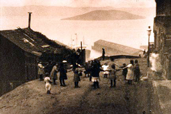
 In her diary, 18-year-old Emmeline B. Wells describes her experiences on the trail from Nauvoo, IL, to Garden Grove, IA. In 1846, Mormons, followers of the Church of Latter-day Saints, began to migrate west from their settlement in Nauvoo due to persecution, following a trail that, for much of its length, closely followed the Oregon Trail. Wells's diary describes the first half of this journey; as 1846 ended, the Mormons would winter in Iowa and then continue on to the territory that would become Utah. Wells relates experiences both general to all trailgoers and specific to women—the diary ends with her husband unexpectedly abandoning her, and her grief at the event.
 Lee Summers Whipple-Haslam, near the end of her life, wrote a memoir of her experiences as a child traveling to and living in California during the Gold Rush. Whipple-Haslam's parents brought her to California in 1850, where her mother ran a boarding house and her father prospected. Critics accused the memoir, published in 1925, of being more nostalgic fantasy than precise memory, but it still provides one woman's latter-life interpretation of the Gold Rush and California settlement.
  In this excerpt from her September 23, 1881 diary entry, ethnologist Alice Fletcher describes her assumption of a Sioux Dakota name before spending a month and a half studying the lives of Native Americans in the Dakota Territory. Fletcher, a woman from a well-off family, had developed a vocational interest in ethnology that led her to undertake this study. Like many other male and female reformers of the day, she would go on to attempt to "civilize" Native American culture through education and political action.
 Read the