Picturing John James Audubon
No details available.
No details available.
The America's Industrial Revolution workshop at the Henry Ford will draw together K12 educators with leading humanities scholars and museum staff for unique enrichment exercises centered on the impact of industrialization. The workshop is designed to encourage participant curiosity and deepen knowledge on the subject, engage participants with innovative methods of transmitting enthusiasm and content to students, and empower participants to use cultural resources to enliven the teaching and learning of history. Participants will explore the diverse ways that Americans experienced social change between the 1760s and the 1920s through lecture/discussions and by visiting with museum curators at 12 of the 80 historic sites interpreted in Greenfield Village, including Thomas Edison's Menlo Park Laboratory, Hermitage Plantation Slave Quarters, 1760s Daggett Farm, 1880s Firestone Farm, a railroad roundhouse, and a 19th-century grist mill. In addition, time is set aside each day for exploration of archival sources in the Benson Ford Research Center and to work on individual lesson plans for implementation back home. The week's activities will culminate with a visit to a related National Historic Landmark, the Ford Motor Company's Rouge Industrial Complex.
During this workshop, participants will experience engaging hands-on lessons that address the standards, including online history simulations, writing exercises, and brain-based learning. Participants will leave with access to resources to support teaching and learning of both tested and non-tested state indicators in Kansas, U.S., and world history.
No details provided.
No details provided.
The Nunda Historical Society records and teaches the history of Nunda, NY, founded in 1808 in New York's Allegany County. The name comes from the Seneca Indian tribe who lived in the area and means roughly "Where the valley meets the hills".
While the society has no museum or historic site to visit, their website offers lesson plans on local history as well as a wealth of online resources for teachers.
The society does not offer a physical site for visitation. The above entry was pre-existing.
"The St. Louis Building Arts Foundation promotes public awareness of the crucial role of architecture, construction, and urban design in the history and future of greater St. Louis. The Foundation's work engages not only the field of architectural history but pressing civic issues. It aims to shape the built environment today by preserving and promoting the finest traditions in the building arts." The foundation seeks to accomplish these aims through aiding local preservation projects, creating a research library, and creating a National Architectural Arts Center.
The site offers information on library resources and current preservation projects.
The above is a pre-existing entry. The foundation does not offer a physical site for visitation. The organization does own a sizable research library, which may be accessible to the public in the future.

A project of the University of Wisconsin—Milwaukee, The March on Milwaukee Civil Rights History Project preserves the history of the Civil Rights Movement in Milwaukee, WI. In the late 1960s, the open housing movement worked to break down housing restrictions that segregated the city's population. Milwaukee residents of all ages and walks of life supported or opposed this movement.
The site features more than 150 digitized primary sources from the period, including oral histories, letters to organizations, support and hate letters, meeting minutes, Henry Maier's 1967 mayor's log, speeches, press releases, photographs, official reports and research studies, video clips, curriculum and programming from Freedom Schools (alternative schools children could attend during school boycotts), and more. Sources can be searched by keyword and browsed by media type (audio, documents, photos, or video) or collection (materials are divided into 10 collections by relationship to prominent individuals and groups in the movement). Visitors can add sources to "My Favorites" and review them as they browse.
In addition, a downloadable map shows the division of Milwaukee neighborhoods in 1967 and the path of the Aug. 28 open housing march, and a timeline tracks local and national events from 1954 to 1976. A glossary of key terms gives the context for more than 60 acronyms, names, places, and other terms, and a bibliography lists more than 40 primary sources and more than 50 secondary sources.
Teachers may need to do a little extra legwork to contextualize the primary sources, but the collection can bring Civil Rights Movement history home to Wisconsin students, particularly those in Milwaukee and the surrounding area. Teachers nationwide can use the materials to explore the work of the Congress of Racial Equality (CORE), NAACP Youth Council, and local institutions like Freedom Schools and integration committees.

The Lincoln-Douglas Debates of 1858 website covers precisely what it sounds as if it would—the famed debates between senatorial candidates Abraham Lincoln and Stephen Douglas.
Navigation is simple, divided into sections by primary source type. Debate Text from Nicolay and Hay< includes "transcriptions" of the debates recreated by two of Lincoln's secretaries circa 1894, as well as debate-related publications by the same two individuals. The transcriptions are based on Lincoln's own writings and newspaper accounts of the debates. Debate Text from Newspapers provides links to newspaper versions of the debate. The website notes that newspapers were affiliated with a political party, and that it can be intriguing to compare Democratic and Republican accounts of the same speech. Debate Commentary from Newspapers is similar to the newspaper debate text section except that it covers period observations on the debates rather than the words spoken.
Additional sections contain video commentary on the debates, maps, relevant images, and two lesson plans. Note that the lesson plans do not specify appropriate grade levels.

My ancestors migrated in the 1830s from Bradford County, Pennsylvania to Carroll County, Illinois. Is it likely that they used the Erie Canal and the Great Lakes to get there?
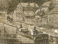
From the early 1830's, emigrants from rural northeastern Pennsylvania traveling to northwestern Illinois had two possible routes that were widely used. The most popular of these was to take the Erie Canal.
The first route: They would have loaded on a canal boat at Elmira, NY, just north of Bradford County, PA. From there they would have traveled on the Chemung Canal, completed in 1831. This would have taken them up to Watkins Glen at the southern tip of Seneca Lake. At the northern end of the lake in a portage called Geneva they would have picked up the Cayuga and Seneca Canal which was completed in 1830. This would have taken them up to the Erie Canal at Montezuma (near Cayuga), from where they would have traveled west along the Erie Canal to Buffalo. From Buffalo, they could have gone to Chicago via Lake Erie and Lake Michigan (a circuitous route of a thousand miles) on a steamboat. A route that could only be navigated when the lakes were not frozen over in the winter. After about 1833, another possibility was to get off the boat in Detroit (rather than Chicago) where they could have transferred their goods to a wagon or stagecoach which followed the Chicago Road. This path stretched from Detroit to Chicago across Michigan above its southern border and around the south of Lake Michigan.
From Chicago, if it was still the very beginning of the decade of the 1830s, they could have floated up the Chicago River and portaged over to the Des Plaines River on a short draft flatboat—or they could have followed the portage route by stage or wagon, depending on the seasonal water level—and from there they could have connected with the Illinois River and floated down to join the Mississippi at Grafton, IL, above St. Louis. From there, they could have taken a steamboat north along the Mississippi to Savanna, IL, in Jo Daviess (later called Carroll) County. However, by the middle of the 1830s, when many new settlers were pushing into Illinois to find farmland, they would almost certainly have taken another route from Chicago, which was the State Road that went more or less directly from Chicago, through Elgin and Rockford, IL, and then ended at Galena, in Jo Daviess County.
The second route: They could have floated down the Susquehanna River (or used the canal system that supplemented and paralleled the river) south to Harrisburg. They would then have transferred their goods to a Conestoga wagon or a stagecoach, and from there they would have turned west and traveled across south central Pennsylvania by way of the Pennsylvania Road (the Old State Road), which went from Philadelphia to Pittsburgh. At Pittsburgh, they would have transferred their goods to a boat and floated or steamed down the Ohio River to where it joined the Mississippi River at Cairo, IL. Then north by steamboat up the Mississippi to Savanna or Galena, IL (steamboats began regular service between St. Louis and Galena in 1827).
Another less probable route existed: Depending on how much they intended to bring with them, they might have considered whether it would be cheaper to travel with their goods to New York or Philadelphia—perhaps by way of the North Branch Canal or the Delaware and Hudson Canal and by toll road—and then to ship to New Orleans. From there to transfer it all to a steamboat bound up the Mississippi River as far as Galena. This may seem like a very roundabout way; however in the early 1830s shipping a lot of freight by road over the mountains of Pennsylvania and across Michigan and Illinois was more expensive than shipping it by water around the Eastern seaboard and up the Mississippi. The completion of the Erie Canal changed the calculation.
Their choice of route may have taken into account what they intended to carry with them, how much they could spend on their travel, as well as the local conditions along the various routes, insofar as they could foresee them. They would also have considered their strength and health, and whether they could endure pushing a stuck wagon over a mountain road or living in a makeshift tent on the upper deck of a steamship. If they were already farmers and planned on bringing livestock, tools, and household goods to the farmland of Illinois, that would have constrained their choices in a way that prospective miners, who also flocked to the region around Galena, did not experience simply because miners were not likely to have brought any of the tools of their livelihood with them when they moved. In planning their trip, they might have picked up a copy of Illinois pioneer and Baptist missionary John Mason Peck’s, Guide for Emigrants (1836), which recommended routes for prospective settlers from the East and even lists steamboat, stage, and canal fares. Also useful in planning their trip, if they were leaving in 1837 or later, would have been a copy of Samuel Mitchell’s, Illinois in 1837.
Gerard Koeppel, Bond of Union: Building the Erie Canal and the American Empire. Cambridge, Mass.: Da Capo Press, 2009. William J. Petersen, Steamboating on the Upper Mississippi. New York: Dover, 1995. 1st ed. published in 1937. The New York State Archives’ Erie Canal Time Machine.
John Mason Peck, A New Guide for Emigrants to the West: Containing Sketches of Michigan, Ohio, Indiana, Illinois, Missouri, Arkansas, with the Territory of Wisconsin and the Adjacent Parts. Boston: Gould, Kendall & Lincoln, 1836, pp. 371-381. Samuel Augustus Mitchell, Illinois in 1837; A Sketch Descriptive of the Situation, Boundaries, Face of the Country, Prominent Districts, Prairies, Rivers, Minerals, Animals, Agricultural Productions, Public Lands, Plans of Internal Improvement, Manufactures, &c of the State of Illinois. Philadelphia: S. Augustus Mitchell, 1837. Henry Wayland Hill, An Historical Review of Waterways and Canal Construction in New York State. Buffalo: Buffalo Historical Society, 1908, p. 150. Beverly Whitaker’s website, Early American Roads and Trails for information on the Pennsylvania Road and the Chicago and State Roads. W. B. Irwin, The Routes of Migration between the Atlantic Seaboard and the Midwest. Burbank: Southern California Genealogical Society, 1966.