Boone's Lick State Historic Site [MO] Anonymous (not verified) Tue, 01/08/2008 - 13:34
Description

In 1804, Lewis and Clark reported the presence of many saltwater springs in the area that now comprises Howard, Cooper, and Saline counties. The largest of these salt springs was the Boone's Lick. The area around this spring was ideal for settlement and for many years "Boone's Lick Country" was a primary destination for pioneers moving west. Nathan and Daniel Morgan Boone, sons of famous frontiersman Daniel Boone, formed a partnership with James and Jesse Morrison in 1805 to produce salt. Brine water was poured into iron kettles and heated to boiling on a stone furnace. As the water evaporated, salt crystallized in the bottom of the kettle. The salt was shipped by keelboat on the Missouri River to St. Louis. Salt, which was indispensable at the time for preserving meat and tanning hides, was produced at the site until approximately 1833. Today, the 52-acre site features picnic facilities and a short trail that winds its way to the spring site, where wood remnants of the salt works and an iron kettle are still visible. Outdoor exhibits interpret this unique saltwater environment and center of frontier industry. Artifacts from the salt manufacturing industry were excavated at the site, and some are on display at the Arrow Rock State Historic Site visitor center in Arrow Rock.

The site offers exhibits and occasional recreational and educational events.
William Clark and the Shaping of the West Anonymous (not verified) Fri, 01/04/2008 - 14:03
Description

Landon Y. Jones, vice president of the National Council for the Lewis and Clark Bicentennial, covers the life history of William Clark, including his life after the expedition, when he took part in the seizing of the West from Native Americans.

American West: Lewis and Clark Expedition Anonymous (not verified) Fri, 01/04/2008 - 14:03
Description

Author and performer Clay S. Jenkinson gives an in-character presentation of the life and explorations of Lewis Meriwether, focusing particularly on the Lewis and Clark Expedition. He follows the presentation with an in-character question-and-answer session.

Lewis and Clark Expedition: The Forgotten French Canadians Anonymous (not verified) Fri, 01/04/2008 - 14:03
Description

French-Canadian reporter Richard Hetu details the roles of French Canadians in the Louis and Clark Expedition. Hetu focuses particularly on Toussaint Charbonneau, husband of Sacagawea. The presentation includes slides.

The lecture's audio is also available for download as a mp3 file.

Journals of the Lewis and Clark Expedition Anonymous (not verified) Fri, 01/25/2008 - 22:21
Image
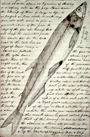
Image, Page from the journals, Journals of the Lewis and Clark Expedition
Annotation

This well-designed site presents the Nebraska edition of the Lewis and Clark journals, edited by Gary E. Moulton. The site provides the complete text of all the journals from the 1803–1806 expedition, as well as introductions, prefaces, and sources. The material is searchable by keyword and phrase.

There are 29 scholarly essays about the expedition. An image gallery offers 124 images of pages from the journals, 95 images of people and places, and 50 images of plants and animals encountered on the expedition. The maps section includes 12 explanatory maps and nine images of maps from the journals. Additionally, there are 27 audio excerpts of journal readings and eight video interviews with the editor of the project. The website stands as an outstanding resource for researching the history of the Lewis and Clark expedition.

Envisaging the West: Thomas Jefferson and the Roots of Lewis and Clark

Image
Image for Envisaging the West: Thomas Jefferson and the Roots of Lewis and Clark
Annotation

By the time Thomas Jefferson became the third President of the United States in 1801, interest in exploring the West had begun to shape U.S. policy. This chronological narrative traces Jefferson's life, participation in politics, and accumulation of scientific geographical knowledge from 1735 to 1804. There are four main sections: "The Jeffersons and Their Frontier Virginia Neighborhood," "From Colony to Commonwealth," "Science and Statecraft at Home and Abroad," and "Public Servant to the Early Republic."

This narrative is accompanied by an archive of 169 letters, statues, books, treaties, maps, and journals providing primary source insight into Jefferson's thoughts about the West and the Lewis and Clark expedition in particular. Three interactive maps from the 1700s, overlaid with historical data about cities, private dwellings, natural features, courthouses, and waterways, provide important insight into the geographic and social environment at the time.

U.S. Geological Survey aharmon Thu, 09/03/2009 - 12:25
Article Body

The U.S. Geological Survey exists as a federal organization created to study the nation's flora, fauna, biology, geography, bodies of water, geology, and geospatial information.

The USGS provides access to their entire photographic collection, which is sub-divided into portraiture, photographers, "pioneer photographers," and images of earthquakes; mines, mills, and quarries; national parks; and Mt. St. Helens.

In addition, educators can access nine sub-sites and resources optimal for K-6 education, covering land use and exploration. Sample topics include "A Satellite View of the Journey of Lewis and Clark" and "Urban Growth in American Cities." Twelve resources, also addressing land use and exploration, are available for grades 7-12.

Available teacher packets, like the majority of the site, will primarily be of use to science educators. However, the three packets on maps could be used in conjunction with units on westward expansion or exploration.

Cape Disappointment State Park and Lewis and Clark Interpretative Center Anonymous (not verified) Tue, 01/08/2008 - 13:27
Description

Cape Disappointment State Park is a 1,882-acre camping park on the Long Beach Peninsula, fronted by the Pacific Ocean. The park offers 27 miles of ocean beach, two lighthouses (the North Head Lighthouse and the Cape Disappointment Lighthouse), the Victorian Colbert House Museum, an interpretive center, and hiking trails. Visitors enjoy beachcombing and exploring the area's rich natural and cultural history. The Lewis and Clark Interpretive Center stands high on the cliffs of the park, 200 feet above the pounding Pacific surf. A series of mural-sized "timeline" panels guides visitors through the westward journey of the Lewis and Clark Expedition using sketches, paintings, photographs, and the words of Corps members themselves. The center also features short film presentations, a gift shop and a glassed-in observation deck with views of the river, headlands, and sea. Additional displays focus on local maritime and military history.

The park offers exhibits, tours, and occasional recreational and educational events.
The Journeys of Lewis and Clark

Description

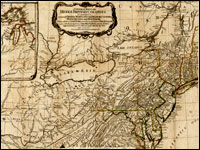
Many Americans think Lewis and Clark were sent west simply to explore the newly-acquired Louisiana Purchase. In fact, the Lewis and Clark Expedition was part of an international contest to control North America and exploit its wealth and an important part of Thomas Jefferson's plan for the development of the United States and the future of its Native American population.

Dr. Dan Thorp of Virginia Tech explores the nature of earlier European activities in the North American West and how they shaped the timing and nature of the Lewis and Clark Expedition.

Missouri Headwaters State Park [MT]

Description

This park encompasses the confluence of the Jefferson, Madison, and Gallatin Rivers. Lewis and Clark anticipated this important headwaters all the way up the Missouri River. An easy three-mile drive off Interstate 90 at Three Forks, this undeveloped park provides outdoor interpretive signs, picnic spots, short hiking trails, a small campground, and—just as the Corps of Discovery found—plenty of mosquitoes!

The site offers occasional recreational and educational events.