Mass Moments

Image
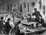
Engraving, Filling Cartridges, Brooklyn Museum, Gift of Harvey Isbitts
Annotation

On May 15, 1602, English explorer Bartholomew Gosnold dropped anchor off the Massachusetts coast, and due to the abundance of cod fish in the waters surrounding his ship, named the location Cape Cod. This is the first of 365 moments in Massachusetts history presented at this website.

The majority of moments cluster in the 19th and 20th centuries, and include events of relevance to political, economic, social, and cultural history, including the incorporation of the town of Natick in 1781, the opening of Boston's African Meeting House in 1806, and the release of the movie Good Will Hunting in 1997.

Each moment is described in roughly 750 words, and is accompanied by an excerpt from a primary source. The text is also available in audio format. The moments are keyword searchable, as well as browseable through the website's Timeline and Map features.

Elementary, middle, and high school teachers will find the Teachers' Features section especially useful, as it includes several comprehensive lesson plans, on labor, women's rights, the African American experience in Massachusetts, and early contact between settlers and indigenous peoples in Plymouth.
Re-Imagining the U.S. Civil War: Reconnaissance, Surveying & Cartography (Part I)

Description

Video background from The Library of Congress Webcasts site:

"Cartographers during the U.S. Civil War invented new techniques and mapped the country—both Union and Confederate territories—more accurately than ever before in the nation's history. The morning session of this day-long conference included presentations on 'Hidden Patterns of the Civil War,' 'Mapping the Strength of the Rebellion' and 'We Were Profoundly Ignorant of Our Country: The Struggle to Provide Accurate Maps During the U.S. Civil War.'"

For the video of the afternoon session of this conference, click here.

Re-Imagining the U.S. Civil War: Reconnaissance, Surveying and Cartography (Part II)

Description

Video background from The Library of Congress Webcasts site:

"Cartographers during the U.S. Civil War invented new techniques and mapped the country—both Union and Confederate territories—more accurately than ever before in the nation's history. The afternoon session of this day-long conference included presentations on 'Mapping the New Coasts of War,' 'Shedding a Little Light: Early Photographic Techniques Used to Reproduce Maps' and a reenactment and demonstration of the surveying and cartographic methods of the period, using original equipment."

For the video of the morning session of this conference, click here.

Carriers' Addresses

Image
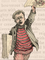
Image, Introductory graphic, Carrier's Addresses
Annotation

Limited in scope, this site provides an introduction to the study of Carriers' Addresses, which were poems or broadsides read by American newsboys to their customers on New Years' Day. The carriers read the poems, which often emphasized the diligence and hard work of the newsboys, expecting to receive a tip from the customer.

The site includes a 2,500-word explanatory essay and a collection of more than 400 digitized addresses from 1772–1912. The site is searchable, and visitors may browse the collection alphabetically by subject, title, or creator. Each address indicates the name of the newspaper, the date, and the name of the newsboy if known.

Perry Visits Japan

Image
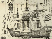
Woodcut, America Torai Okatame Ezu, 1853, Perry Visits Japan
Annotation

This website brings together two unique historical holdings with the work of students to highlight the cultural interaction between Japan and the U.S. in the 19th century. The first holding is a 12-panel painted Japanese scroll by an anonymous artist that illustrates U.S. Navy Commodore Matthew Perry's 1854 landing in Japan, the first official contact between the two countries and the beginning of Japan's emergence as a world power. The second holding is a set of six lithographs by William Heine, the official artist of the Perry expedition, that depicts an American view of the events of Perry's landing.

In addition, there are images of three Japanese broadsides about the visit, often accompanied by student essays interpreting the images, and excerpts from the official narrative and essays by accompanying officers—including two from Commodore Perry's accounts and one from Heine's account. Also included are a bibliography with seven books, one journal article, and three links to related websites. For teachers, there is a sample lesson plan (10th grade) using the website. A useful resource for anyone interested in Perry's visit to Japan or for those researching Japanese-American relations or cultural contact.

Brooklyn in the Civil War

Image
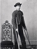
Photo, Private Charles Mitchell, Matthew Brady, c. 1862
Annotation

This website is focused on exploring and teaching the history of Brooklyn and Brooklyn's people during the Civil War through primary sources, essays, and instructional materials. More than 100 primary sources focus on Brooklyn's role in the Civil War, including letters, maps, newspaper articles, photographs, and illustrations. Additionally, the document collection can be explored through four thematic presentations on soldiers, women, slavery, and daily life. Each presentation features a short introduction and each document is accompanied by a brief description and links to related material.

Lesson plans, available as word or .pdf documents include 11 on soldiers, six on slavery, eight on women, and nine on daily life. There are also links to the Brooklyn Public Library's lists of books and related websites, resources for children, and resources for teenagers. An interactive map and timeline are also available. A useful resource for those teaching or researching Brooklyn, NY, or northern states during the Civil War.