Martin Luther King, Jr., Part Two

Description

Professor Lucas E. Morel reviews the life and views of Martin Luther King, Jr., focusing on the March on Washington and King's "I Have a Dream" speech. This lecture continues from the lecture Martin Luther King, Jr., Part One.

For the lecture, scroll down to the third seminar of Wednesday, August 4. Readings, available for download, accompany the lecture.

An older version of this lecture can be found here.

Martin Luther King, Jr., Part One

Description

Professor Lucas E. Morel reviews the life and views of Martin Luther King, Jr., examining his views of race relations, his religious beliefs, and his definition of civil disobedience, as suggested in his writings and speeches. This lecture continues in the lecture Martin Luther King, Jr., Part Two.

For the lecture, scroll down to the second seminar of Wednesday, August 4. Readings, available for download, accompany the lecture.

An older version of this lecture can be found here.

Gilded Age Plains City

Image
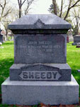
Gravestone of John Sheedy, Gilded Age Plains City
Annotation

Gilded Age Plains City: The Great Sheedy Murder Trial and the Booster Ethos of Lincoln, Nebraska tackles the issue of urban development through the lens of a nationally-followed murder case.

A document archive provides a rich variety of related primary sources—39 legal documents, 225 newspaper articles, 39 newspaper illustrations, 129 photographs, and 42 postcards. Documents range from items directly related to the Sheedy murder trial to sources depicting parts of the city or describing Lincoln culture and society.

One practice worth applauding on this site is it's loyalty to the concept of scaffolding. The first page offers links to vocabulary, an extensive list of Lincoln personages, and a similarly detailed timeline.

Selecting "Explore the City" brings up an introductory essay on Lincoln, Nebraska in the 1890s, as well as an interactive map. The map shows many buildings in red or yellow. Yellow buildings offer period images of the structure, as well as a description of its purpose. Red buildings only have the explanation. The most fascinating feature of the map is that it allows you to select a subsection of the city, such as "demimonde," "physician," "boosters," or "transportation." Each of these options alters the map so that only buildings within that particular subcategory are shown in red or yellow. This lets you see how food distribution and transportation, for example, are grouped in different parts of the city. Each subcategory also has an accompanying essay offering more on the social clime of 1890s Lincoln, Nebraska.

"Spatial Narratives" offers a series of texts on the location and nature of various city subcultures—practitioners of law, boosters, men, African Americans, women, the working class, and university students. Obviously, these subcultures overlapped both in body and in spatial terms within the city.

At this point, one might wonder where the Sheedy case comes into the picture. The third major site section "Interpretation and Narrative" introduces the murder. The narrative includes links to relevant newspaper articles.

Taken as a whole, the site is likely not particularly useful in the K-12 classroom. However, when used in pieces, it can be seen as an example of the ways in which cities develop, racial and moral tensions of the 1890s, or media "spin" of the period versus that of today.

Diversity, Urbanization, and The Constitution, Part One: The Great Migration, Urbanization, and the Constitution

Description

Eric Arnesen, Professor of History and African American Studies at the University of Chicago addresses the interplay between the African-American experience between Reconstruction and the Great Migration, the U.S. Constitution, and shifting democratic ideals.

Audio and video options are available.

Amy Trenkle on Glogging Class Greats

Date Published
Image
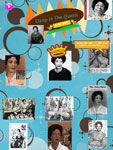
Student glog, Dorie Miller
Article Body

This school year, each of my classes chose a person to represent them and become their class name. Instead of having blocks 3 and 4 or periods 6 and 7, I've had my Alice Paul and Daisy Bates classes on A Day and Dorie Miller and Rosie the Riveter on B Day.

At the beginning of the year, I gave my students the task of reading a biography in small groups. Student glog, Daisy BatesI chose historical figures in U.S. history, some well known and others lesser known to them, and created biographies no longer than a page, by cutting and pasting from credible websites or by using biographies from History Makers (published by Rada Press). After each group read their biography, they summarized what their person did and why they are in the history books. They then presented their findings to the class, as well as what characteristics their person possessed that would make them a great name to adopt for the class. Students cited such qualities as perseverance, tenacity, and strength. After the class heard all of the biographies, they voted on which name they wanted to adopt.

During the course of the year, I made sure each class had an activity outside of the curriculum that connected with their class name. Alice Paul, named after one of the founders of the National Women's Party, had a museum educator from the Sewall-Belmont House come in and speak about Paul. We then walked to the house and saw just how close the National Women's Party headquarters are to our school! Student glog, Dorie MillerDorie Miller, who had taken the name of the first African American to receive the Navy Cross, had a museum educator from the National Portrait Gallery come to our class to share World War II posters, with an emphasis on the Dorie Miller poster. She created a lesson that had students then write their own historic labels, like you would find in a museum, for the poster. Rosie the Riveter visited the Smithsonian National Museum of American History’s "The Price of Freedom: Americans at War" exhibit and had a tour, emphasizing Rosie! The kids even practiced riveting! Daisy Bates, who had taken the name of the civil rights activist, traveled to the National Museum of American History in February and heard from veteran Freedom Riders. While there wasn't a direct connection to Daisy, they heard from civil rights leaders who fought alongside of Daisy Bates.

Memorializing History with Glogs

I've decided that I will definitely continue this for next year’s classes, but that I could never have another Dorie, Daisy, Alice, or Rosie class. So, my last assignment for each class this year was for them to create glogs memorializing their class names. Students worked individually or in pairs to create a glog.

The class then voted on which glog was the best. I will print the final, winning glog for each class in poster form and hang it in my room to teach future classes with and to remind me of the legacy of these classes.

What is a Glog?

Student glog, Dorie MillerBut what's a glog? This is a question that my students had.

At first, they thought I said they were creating a blog—like a blog entry—since they were used to doing that. I clarified and enunciated the word "glog" again. There were confused looks.

A glog, as I explained to my students, is a multimedia poster, created on the computer. On a glog you can add text, photos, videos, music, audio recordings, documents—you name it!

Student glog, Daisy BatesOne of the first things we did was find a Plan B. Glogster, a glog creation tool and community, is blocked by my school district. Having explored Glogster at home, I did know that they have a teacher's address. I directed my students to edu.glogster.com and had them create accounts as "Basic" members (it's free!). The students were soon underway!

Students were to create posters about their class name, and incorporate photos, a quote about or from their person, a brief summary of what their person did, and at least one multimedia clip (a video or music).

When the students were done with their posters, they published them and then emailed me their blog with the "email friends" feature. I did this activity over two days. The second day, I was much more clear about my expectations for inclusion of elements on the glog, and they turned out much better, content-wise, for more groups. I think it was helpful for students to have to think about the various elements to incorporate and served as a review of primary sources for them.

The Impact of Glogs

Student glog, Daisy BatesI can definitely say that this was a hit among the students. They really enjoyed learning about the new technology and many said they were going to go home and play with it. They became engrossed in looking for sources that others wouldn’t find so that their posters would be unique.

The technology was very intuitive for the students, and I learned a lot from watching them. While I had spent time learning how to glog myself, I watched my students just fly with it! Before I knew it, they were asking each other questions about how to add something or asking their friends to look at what they did on their screens. They clearly were enthusiastic for not only their class name, but for creatively sharing the history of their person through their glogs for future classes.

Evelyn MacPherson, one member of the two-person winning Alice Paul glog team, said the following about making her glog:

I enjoyed making the poster, it was a lot of fun to create something that could be used as a learning tool that required you to use creativity. We knew that you had to balance out the facts with things that would draw people to your poster, such as a theme, or pictures. It required some trial and error, but it was a lot of fun.

I really enjoyed this activity and hope to use glogs more in the future. Glogster was easy to use, and this activity required critical thinking skills from my students and integrated technology and history in an engaging way for them . . . and me!
For more information

Our bloggers have many ideas for using visuals in the classroom! Once you've learned how to glog, take a look at Jennifer Orr on using art in a 1st-grade classroom, Diana Laufenberg on tying visuals and visualizations in at the high school level, and Joe Jelen on Google's Art Project.

Tech for Teachers can introduce you to more online tools—including Glogster—and our articles on copyright can help you (and your students) understand the complexities of locating and using images online.

Open Yale Courses

Image
Photo, Professor Joanne B. Freeman, Open Yale Courses
Annotation

Yale University has made a sampling of their courses available for listeners, viewers, and readers.

As of writing, the history subsection contains six courses—two of which relate directly to U.S. history ("The American Revolution" and "The Civil War and Reconstruction Era, 1845-1877") and one which touches on relevant issues, "Epidemics and Western Society Since 1600." Each of these courses offers links to individual pages for each lecture. Lecture pages contain short text overviews of the topic at hand; a list of any reading which was required for the day; and links to lecture audio, video, and transcriptions.

Our site links you directly to the Yale's history courses. However, consider exploring other topics as well. Maybe a lecture on Roman architecture will give you background for discussing monuments in Washington, DC, or an economics course will give you a new way of thinking about the American Revolution. Interdisciplinary possibilities are endless.

Fort Negley [TN]

Description

Fort Negley was the largest fortification built by the occupying Union Army in Nashville and the largest inland stone fort built during the Civil War. Measuring 600 feet by 300 feet, Negley covered four acres and was constructed from October to December 1862. The stronghold was constructed by conscript laborers, both slaves and free blacks, of stone, logs, earth, and railroad iron. More than 2,700 African American men worked to build Fort Negley; only 300 were paid for their labor. The Visitor Center features exhibits, monthly activities, annual events, and self-guided tours of Fort Negley Park.

The fort offers tours, exhibits, educational programs, and occasional recreational and educational events (including living history events).

Forty Acres and a Mule

field_image
General William Tecumseh Sherman
Question

I'm trying to find a map of the land Sherman set aside in Special Field Order No. 15. I wanted to be able to make a transparency to show students what we are talking about before we delve deeper into what took place. I have no problem getting the text of the order, but even my school librarians had difficulty with this.

Answer

I have not found a map of it either, but that may be partly because the field order itself was ambiguous about the area as well as about what exactly it authorized.

Sherman Defines the Area

General William Sherman issued Special Field Order No. 15 from his temporary headquarters in Savannah on January 16, 1865. It defined an area along the coast north and south of where he had encamped his army: “The islands from Charleston south, the abandoned rice fields along the rivers for thirty miles back from the sea and the country bordering the St. John River, Florida.” A broad interpretation of this would take it to include a continuous 30-mile-wide swath of land extending along the coast south from Charleston, South Carolina, as far as Jacksonville, Florida, and including all the Sea Islands. I have cropped a section of an 1854 map from Wells’ McNally’s System of Geography and tinted this area light red.

This is the region of South Carolina, Georgia, and Florida that is known as the “low country.” You can show your students why it is called that by looking at the satellite version of the Google map for the region, which shows that it is a deep shade of green.

sherman-reserve.jpg

It is flat and almost entirely just above sea level. It was an area where large rice plantations flourished. Growing rice was an extremely labor intensive occupation and the plantation owners owned many slaves. The slave population of the area therefore far exceeded the white population, which, of course, constituted the landholders.

a continuous 30-mile-wide swath of land extending along the coast

From the North’s point of view, it was not only the epicenter of the most egregious form of the unjust slave system, wherein a large number of black slaves labored entirely for the profit of white slave owners, but it was also (not coincidentally) the epicenter of the secession movement that precipitated the beginning of the war at Fort Sumter.

The purpose of Sherman’s order was to set aside a large area within which freed blacks could be settled. The area came to be popularly known as the “Sherman Reservation.”

Abandoned or Confiscated Land

Sherman had defined a general area, but his wording was somewhat ambiguous. He clearly set aside all the Sea Islands, but within the coastal swath of land, he appears to have been aiming to confiscate—and make available for settlement—only the plantations along the rivers and other “abandoned” lands. Nevertheless, Congress had earlier decided that all land and property of men who were fighting for the Confederacy (or even the property of others who had supported or conducted business with Confederate forces or authorities) had been technically “abandoned,” even if their families were still on the land, making it eligible for confiscation by the Federal government. This would have vastly expanded the land reckoned to be available for settling freed blacks, even if Sherman’s order was originally interpreted to apply only to the islands and the land along the rivers (rather than the entire 30-mile-wide swath of land).

Sherman Later Explains His Field Order

Sherman wrote a letter to President Andrew Johnson on February 2, 1866, explaining the origin of his field order. It was published in The New York Times the following day and was undoubtedly meant for public consumption:

The Hon. E. M. Stanton, Secretary of War, came to Savannah soon after its occupation by the forces under my command, and conferred freely with me as to the best methods to provide for the vast number of negroes who had followed the army from the interior of Georgia, as also for those who had already congregated on the islands near Hilton Head, and were still coming into our lines. We agreed perfectly that the young and able-bodied men should be enlisted as soldiers, or employed by the Quartermaster in the necessary work of unloading ships, and for other army purposes. But this left on our hands the old and feeble, the women and children, who had necessarily to be fed by the United States. Mr. Stanton summoned a large number of the old negroes mostly preachers with whom he had long conference, of which he took down notes. After the conference he was satisfied the negroes could, with some little aid from the United States, by means of the abandoned plantations on the Sea Islands and along the navigable waters take care of themselves. He requested me to draw up a plan that would be uniform and practicable. I made the rough draft and we went over it very carefully. Mr. Stanton making many changes, and the present Orders No. 15 resulted and were made public.

I know of course we could not convey title to land and merely provided “possessory” titles to be good so long as war and military power lasted. I merely aimed to make provision for the negroes who were absolutely dependent on us, leaving the value of their possessions to be determined by after events or legislation.

At that time, January, 1865, it will be remembered that the tone of the people of the South was very defiant, and no one could foretell when the period of war would cease. Therefore I did not contemplate that event as being so near at hand.

President Johnson was about to begin pardoning ex-Confederates and restoring the property the Federal government had confiscated from them, provided that they took an oath of allegiance to the U.S. The whites who had original title to land in “Sherman’s Reservation” petitioned the President to recognize their titles and give them back full possession. Sherman’s letter emphasized that he had had no authority to give full title to the land covered in his field order, but only a temporary or “possessory” title to it, under his wartime military authority, and he implied that he would not have issued the order if he had known that the war was about to end.

Johnson Restores Much of the Land to the Original Owners

Sherman’s explanation provided justification for Johnson’s order to the Freedmen’s Bureau, which had been liberally setting up black settlements in the area, with each family receiving “forty acres and a (leased army) mule.” Much to the dismay of the Freedmen’s Bureau, of the military officer General Rufus Saxton who Sherman had put in place to implement his order—and of course to the African Americans who had been resettled into the area—Johnson ordered the restoration of the land to the original owners.

Edwin Stanton, Lincoln’s Secretary of War, had traveled to Savannah to meet with Sherman at the time the General had issued his order, and appears to have approved it orally, but not formally, in the sense that he did nothing to countermand it. Stanton’s biographer, Frank Abial Flower, wrote, of the order:

Stanton, on reading it, said to Sherman: “It seems to me, General, that this is contrary to law.” Sherman’s response was: “There is no law here except mine, Mr. Secretary.” Stanton smiled and the order was issued a day or two after he left for the North. General Saxton says Stanton was opposed to the order, but acquiesced in its promulgation in deference to the positive wishes of General Sherman.

On the face of it, Stanton's implied reluctance seems unlikely, because, as Sherman explained, the plan had suggested itself to Stanton and Sherman after they met in Savannah with a group of African American clergy who had asked for relief from the government for the many thousands of ex-slaves who were then in the area, either because they had originally resided there or because they had followed Sherman’s army across the South.

"we could not convey title to land and merely provided 'possessory' titles to be good so long as war and military power lasted"

When the notion of establishing them on abandoned or confiscated lands came up for discussion, almost all of these clergy urged that military forces be used to settle them in areas in which all whites would be prohibited from entering, as a way to protect the settlements from white encroachments. Militarily, this could be most efficiently accomplished by designating the Sea Islands and the low lands along the rivers as the places to settle.

A Pledge of Government Reparations?

Some of the most radical members of Congress were delighted by this. Indeed, several had expressed their desire as the war ended to hang everyone who had been in the Confederate armies, to confiscate all their property, including their land, and to redistribute it all permanently to ex-slaves, recreating the South as a kind of African American preserve from which Southern whites would be barred—a plan that today would be called “ethnic cleansing.”

After the war ended, the contentious results of Sherman’s field order arose as the Federal government sorted out how it would deal permanently with what Sherman had instituted primarily as a military expedient—to free his forces from the burden of caring for refugees as he moved his armies north into the Carolinas. Historian Jacqueline Jones, in Saving Savannah, summed up Sherman’s original goal:

Ultimately, then, Special Field Order No. 15 grew out of the refugee problem, which, in the words of one Union officer, “left on our hands the old and feeble, the women and children,” too many hungry mouths to feed in the city of Savannah. … The order made explicit the connection between military service for men and homesteads for their families, and it provided not for fee-simple titles, outright ownership of the land, but rather possessory titles that remained contingent on future political developments. The order itself remained “subject to the approval of the President.” What came to be called the Sherman Reservation, then, was a means of draining Savannah of women, children, and the elderly while providing for enforced service among young men. This initial goal foreshadowed the order’s troubled future.

Down to our own time, the confused and conflicted intentions and authorities that informed the issuance of Field Order No. 15 and its later implementation and revocation, have been the focus of the claim of precedent for government reparations to ex-slaves and then to their descendants.

For more information

Ira Berlin, Thavolia Glumph, Julie Saville, et al, The Wartime Genesis of Free Labor: The Lower South, Volume 3 of Freedom: a Documentary History of Emancipation, 1861-1867. New York: Cambridge University Press, 1990.

Walter L. Fleming, “Forty Acres and a Mule,” North American Review (May 1906): 721-737.

Julie Saville, The Work of Reconstruction: From Slave to Wage Laborer in South Carolina. Cambridge University Press, 1996.

Claude F. Oubre, Forty Acres and a Mule: The Freedmen’s Bureau and Black Land Ownership. Baton Rouge: Louisiana State University Press, 1978).

Barton Myers, "Sherman's Field Order No. 15," The New Georgia Encyclopedia, 2005.

Text of Special Field Order No. 15, at the Freedmen & Southern Society Project at the University of Maryland.

Bibliography

William T. Sherman, “Sherman’s Famous Field Order,” New York Times, February 3, 1866.

Frank Abial Flower, Edwin McMasters Stanton: The Autocrat of Rebellion, Emancipation, and Reconstruction. Akron: Saalfield Publishing Company, 1904, p. 298.

Jacqueline Jones, Saving Savannah: The City and the Civil War. New York: Vintage Books, 2008, p. 222.

J. Wells, “Georgia, Alabama, and Florida,” from Wells’ McNally’s System of Geography. New York: McNally, 1854.