Cultural Readings: Colonization and Print in the Americas
Image
Image for Cultural Readings: Colonization and Print in the Americas
Annotation

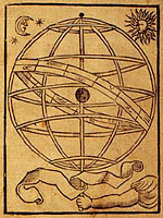
Texts about the Americas produced in Europe from the 15th through the 19th centuries are examined in this well-organized online exhibit. Over 100 images of printed texts, drawings, artwork, and maps from published and unpublished sources are arranged into six thematic categories. Categories are named: "Promotion and Possession," "Viewers and the Viewed," "Print and Native Cultures," "Religion and Print," "New World Lands in Print," and "Colonial Fictions, Colonial Histories."

Five scholarly essays (5,000 to 7,000 words each) contextualize the documents. A bibliography and list of links accompany the presentation. A visually attractive, thoughtfully arranged site that explores connections between colonization and representation.
Archive of Early American Images

Image
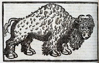
Buffalo, Archive of Early American Images
Annotation

The images in this collection, focusing on the Americas, come from books printed or created in Europe between about 1492 and 1825. Images include woodcuts, copper engravings, and paintings. The database, still being compiled, currently contains 6,685 images and will eventually contain some 7,500 images. Image viewing software is available from the site.

The visitor can browse the entire archive or search by time period, geographical area, keyword, or subject, including indigenous peoples, flora and fauna, artifacts, industry, human activities, geography, maps, city views and plans, and portraits. Some images, such as Ptolemy's map of the world, may be familiar. Others are reproduced for the first time. Navigation requires some practice, but is worth the effort.

Exporting Democracy? The United States and the World

Description

The rhetoric and practice of supporting democracy around the world has been a part of American diplomacy for more than a century. Alongside episodes of hypocrisy and horrible failure, one can also observe moments of sincerity and spectacular success. This course will consider both, with a particular emphasis on American policy and Latin America during the 20th century.

Contact email
Sponsoring Organization
Newberry Library
Phone number
312-255-3700
Start Date
Cost
$200
Duration
Nine weeks
End Date

Geography Awareness Week Workshop

Description

This Geography Awareness Week workshop will begin with a lecture on migration to the U.S. from Latin America. Lessons from the Geography Action! packet will then be introduced. The session will conclude with guided tours of four Latin-American art exhibits at the Fowler Museum.

Contact name
Miller, Mary
Contact email
Sponsoring Organization
California History-Social Science Project
Phone number
310-825-7749
Target Audience
preK-12
Start Date
Duration
Four and a half hours

Atlantic Slave Trade and Slave Life in the Americas: A Visual Record

Image
Annotation

This collection of more than 1,230 images depicts the enslavement of Africans, the Atlantic Slave Trade, and slave life in the New World. Images are arranged in 18 categories, including pre-Colonial Africa, capture of slaves, maps, slave ships, plantation scenes, physical punishment, music, free people of color, family life, religion, marketing, and emancipation.

Many of the images are from 17th- and 18th-century books and travel accounts, but some are taken from sketches within slave narratives, Harper's Weekly, and Monthly Magazine. Reference information and brief comments, often an excerpt from original captions, accompany each image. Although there is no interpretation or discussion of historical relevance, these images are valuable for learning about representations of slavery in American slave societies, especially in the Caribbean and Latin America.