Using Old Maps as Tools to Explore Our World

Image
Article Body
What Is It?

In this bulletin board activity, students work collaboratively to explore sections of old maps. By closely examining these unique historical documents, students learn to see maps as more than just tools for locating places. And, whatever the grade level, this activity prompts students to grapple with the basic elements of the social studies: people, space, time, meaning, and purpose.

Rationale

Maps are essential tools in modern life but they also are primary source documents reflecting the people, time, and culture that produced them. They can be read at different levels and used for various purposes. In every case, however, some fundamentals of social learning can come into focus when a class looks carefully at a single map. Visual literacy, critical analysis, synthetic learning, and interdisciplinary thinking all come into play. But, maps are often too large to use at student desks. So a bulletin board activity based on cutting the map into manageable section—a "divide and conquer" strategy—provides a way out. If the map is not too big, enlarging it on a copy machine to clarify its details will often increase its pedagogical value.

Description

After selecting a map, the teacher should photocopy it with two concerns in mind:

  1. It should be a suitable size for an available bulletin board or display area. AND
  2. It should be divisible into a number of equal parts.

In the classroom, groups of students will work with single sections of the map, using a specific procedure (see Handout 1) that will help them uncover meaning in the map. When the separate pieces are reassembled at the end of the activity, the class will have a unique final product: a historical map with accompanying narrative captions that explain its significance. The bulletin board display can then be read by others in the school’s community, including other classes, teachers, parents and the general public.

Teacher Preparation
Maps, after all, can be compelling visual resources offering various ways to turn a class into a learning community.
  1. Scheduling: Place this lesson into your school’s curriculum and your course calendar. Decide if you want to do it once or several times with a series of maps distributed throughout the academic year.
  2. Determining goals: Choose the type of map that would be most appropriate for your learning objectives. For example, if your goal is to use maps at several different scales, you could feature four activities in the    course of the year using maps of the world, nation, state, and local community.
  3. Finding a map: Although current maps might be readily available, old maps are preferred because students will be able to see how they are "dated." By "datedness" we mean how they reflect not only past geographies and technologies, but also a former cultural and historical context. Help in finding suitable maps is available both on web pages and at your local library, historical society, community college, or state university’s map library.
  4. Exploring meaning: Once you have selected a map, find out as much about it as possible for    your own benefit. Why did you select it? What intrigues you about it? Make a list of    questions it raises, and keep a record of how you went about gathering information to help    you understand the map. Remember that the essence of your preparation is to provide a model for your students.
  5. Enlarging and dividing it: Enlarge the map using a photocopy machine. At the same time, divide it into manageable sections. If you have 36 students in class and want them to work in groups of six, you will need six sections to the map. Make at least two copies of these board-size segments so you can proceed without interruption if one of them is damaged.
  6. Making copies: If you have enough resources, make a small 8½ x 11 inch version of the whole map for each group or student.
  7. Gathering supplies: Make sure you have enough supplies for coloring the map (if necessary); stiff paper for making panels for call outs; ribbons for connecting points on the map with these commentaries; and tacks, pins, or tape to attach everything.
  8. Practice makes perfect: A "trial" mounting of the bulletin board at least a day before the lesson will point out potential problems.
  9. Planning evaluation: Along with your lesson plan, develop some type of evaluation procedure so that you will be prepared to share this lesson with colleagues and interested parties (a curriculum director, parents, or even a local newspaper). Photographs of the end result as well as the lesson's stages of development might prove to be of great value. Maps, after all, can be compelling visual resources offering various ways to turn a class into a learning community. You will know you are on your way to success as students begin to see maps as more than devices to locate places.
In the Classroom

NOTE: The below steps are outlined in Handout 1 which students can use to guide their work.

A draft is seldom good enough for a presentation copy, both in the classroom and in real life.
  1. Preparing students: First take a few minutes to set up the lesson, show students the focus map, explain how it fits into the curriculum, outline the six stages of the lesson using Handout 1, and then describe the end result. Then the class as a whole should develop a context for the map    by addressing the four questions in part one of the handout.
  2. Student groups: During Part Two divide the class into small groups, each of which will focus on one part of the map, developing questions and searching for answers as directed on Handout 1.
  3. Calling out details: Part Three centers on students developing "call outs" to point to some detail of interest on the map. If this device is new to the class, start by providing an example of a call out ("look how small that state is" or "what is the strange symbol?"). Also help students realize the importance of questions in reaching for understanding. Pairing students is one possible way to encourage them to exchange ideas.
  4. Monitoring presentations: Part Four offers several opportunities for you to step back into a leadership role as needed, perhaps rephrasing a group's tentative statements or emphasizing that a map is constructed by selecting some details and omitting others (e.g., a map's "silences").
  5. Writing commentaries: At this stage each student should "read" the map in his or her own way and make a statement about the map's meaning or purpose. Extend the lesson by editing these commentaries. All of them could be made available (on a rotating basis) at the side or bottom of the display.
  6. Polishing the apple: A draft is seldom good enough for a presentation copy, both in the classroom and in real life. You will need to decide how much time to spend here. In any event, "Polishing the Apple" offers opportunities for evaluation, assessment, and involving students with special needs or talents.
Common Pitfalls
  • The map selected may prove too challenging for some classes. This might be a good time to walk the students through the lesson and then use the map bulletin board approach again later in the term with a different map.
  • Mounting an attractive bulletin board that collects input from every student can be a daunting task. Seek help and guidance from art and English teachers. A media specialist might also be very helpful.
  • This lesson has the potential to grow like Topsy, so careful advance planning and time management are essential.
Example Maps
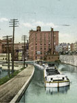
  • Community Map: Youngstown, OH, 1905-1906 This example is from an old "Quadrangle," map—a series produced by the U.S. Geological Survey since the 1890's. Every part of the nation is covered at once in this series of large-scale topographic maps. Other maps with this type of detailed local coverage can be found in county atlases, local history books, insurance atlases, and governmental records. Check with your community library to find a suitable map, especially one which includes the site of your school. This example is a detail from the Youngstown Quadrangle, edition of April 1908. It shows the Ohio city as it was in 1905-1906, the date of the survey. The small squares indicate residences.
  • State Map: Highway Map of Southern California, 1924 Secure an old highway map of your state. (These are often available at flea markets, second-hand shops, libraries, historical societies, on the internet, or from antique automobile enthusiasts.) This example is a detail from the "Highway Map of Southern California" given away by the Security Trust & Savings Bank of Los Angeles. The Automobile Club of Southern California produced the map in 1924 through the Clason Map Company of Los Angeles.
  • A Map of the United States, 1864 This map of the United States, entitled "Map of the Rebellion, As It Was in 1861 and As It Is in 1864" appeared in Harper’s Weekly, the leading news magazine of the time. The issue was dated March 19, 1864.
  • A World Map, 1792 The Abbe Gaultier developed this map in England. The author was a French educational reformer who believed that schools should be fun. It was produced in England because the author had fled from the French Revolution. Students can use this display copy to answer a series of questions asked by the teacher, receiving points according to the quality of their answers. Note that the map presents the geographical situation and knowledge of the time.
For more information

Cartography Associates. David Rumsey Map Collection. 2009. http//www.davidrumsey.com/. 20,000 antique maps.

Greenhood, David. Mapping. Chicago: University of Chicago Press, 1964. Originally published in 1944, this revised edition is still the best general introduction to maps.

Teachinghistory.org. "Featuring Maps!" History Education News 5, (2010). http://teachinghistory.org/files/HEN/HEN-05.pdf (accessed June 1, 2010).

Wood, Denis. The Power of Maps. New York: Guilford, 1992. An artist and designer looks at maps through modern eyes. In 2010 he will sharpen his perspective in Rethinking the Power of Maps.

And listen to Danzer explain map analysis at the Roy Rosenzweig Center for History and New Media's History Matters.

Building the Erie Canal

Teaser

Cutting through New York from the ocean to the Great Lakes, the Erie Canal changed lives.

lesson_image
Description

How would the Erie Canal have changed your life and the lives of those around you? Politics, trade, and the land itself were all affected.

Article Body

This lesson from Teachers’ Domain examines how the construction of the Erie Canal affected the geographic, economic, and political landscape of the United States. In exploring these issues, students are presented with four computer-based activities.

The first two activities—viewing documentary video clips—are engaging, brief, and informative. These clips could be projected to the whole class if a teacher does not have access to multiple computers.

The third—an interactive graphic organizer—allows students to categorize different consequences of the construction of the Erie Canal in terms of geographic, political, and economic effects. The interactive graphic organizer allows students to draw connections between consequences in different categories and explain how they are interconnected in a pop-up comment box. After they are done, students can print out the graphic organizer.

The final activity in the lesson, which requires students to read and write, can be done either on a computer or not. It asks students to synthesize information from the video clip and a background reading (available in two different reading levels), and students can choose from three different writing assignments.

Topic
Erie Canal
Time Estimate
1 day
flexibility_scale
5
Rubric_Content_Accurate_Scholarship

Yes
Featured video contains interviews with reputable scholars.

Rubric_Content_Historical_Background

Yes
Historical background provided in videos and handouts.

Rubric_Content_Read_Write

Yes
Students take notes throughout the assignment and write a short essay evaluating the major changes resulting from the construction of the Erie Canal.

Rubric_Analytical_Construct_Interpretations

Yes
Using evidence from the documentary video and a background reading, students assess and examine the economic, political, and geographic effects of the Erie Canal on the nation.

Rubric_Analytical_Close_Reading_Sourcing

No

Rubric_Scaffolding_Appropriate

Yes
Two versions of background handout are included for different grade levels.

Rubric_Scaffolding_Supports_Historical_Thinking

Yes
A graphic organizer helps students organize their ideas and draw connections between the various effects resulting from the Erie Canal’s construction.

Rubric_Structure_Assessment

Yes
Students can write an essay on the canal’s effects on America or New York State. Students can write a journal from the perspective of someone who experienced the effects of the Erie Canal five years after its construction.

Rubric_Structure_Realistic

Yes

Rubric_Structure_Learning_Goals

No
Requires access to multiple computers, but can be adapted for classroom use in which only one computer and a projector are needed to stream the video.

Geo-Literacy Project: Students Explore Their World

Image
Article Body

Edutopia's Geo-Literacy Project is an interdisciplinary, project-based, approach to teaching local history that can be adapted for different locations. The goal of the project was to develop students' literacies. Throughout the project, students were guided by the essential question, why is the preservation of a local historical site—in this case, Rush Ranch—important? They explored the site from a number of perspectives, working with local experts and community partners to understand the local environment. They then built websites using primary sources, images, videos, and student-created reports. Older students helped them prepare the content for this website and use the technologies. Specifically, this project demonstrates two promising practices:

  • Using local history resources and issues to engage and challenge students.
  • Using technologies in the history/social studies classroom to further learning
Throughout the extensive project, students were investigating, using primary sources of information, problem solving, and finally, communicating their findings.
What's Notable?

This project-based approach teaches students to think about how the past relates to their own lives and how geography, geology, and history interact. Further, because the project asks students to present their findings through multimedia, web-based accounts, the project presents an opportunity to meaningfully use technology in the history/social studies classroom and share what they have learned with a larger audience.

Viewing Instructions

To view this example, either play it directly on the website or download it for free in iTunes.

National Agricultural Statistics Service

Article Body

According to the service website, "The USDA's National Agricultural Statistics Service (NASS) conducts hundreds of surveys every year and prepares reports covering virtually every aspect of U.S. agriculture. Production and supplies of food and fiber, prices paid and received by farmers, farm labor and wages, farm finances, chemical use, and changes in the demographics of U.S. producers are only a few examples."

Helping students to conceptualize history is a goal (and a difficulty) for many teachers. How can what's past be presented in a manner that feels relevant to students? If you live in a somewhat rural area, NASS's charts and maps may provide a great point of comparison between the local past and the present. Say you are studying cotton production in the south. Why not find information on how much cotton we still produce? If you're from another part of the country, consider seeing how much corn your vicinity harvests today. You can select topics such as specific livestock or crops.

Also, be sure to check out the available multidisciplinary lesson plans. The K-3 option includes a reading on Washington and the first agricultural survey, as well as an activity involving counting, while the 9-12 activities include short excerpts of Washington's words. Subject emphases vary. Don't miss the glossary of terms.

Tennessee Valley Authority

Article Body

In 1933, President Franklin Roosevelt initiated a new agency which combined aspects of governmental and private organizations. Over time, the resulting agency, the Tennessee Valley Authority or TVA, has researched issues as far-ranging as malaria, reforestation, power, flooding, navigation, and erosion. In their own words, the TVA serves the "valley through energy, environment, and economic development."

Admittedly, the TVA website was not designed for K-12 education. However, as a major initiative of the New Deal, it is an important milestone in U.S. history. For that reason, if you need to teach the New Deal, you may want to read From the New Deal to the a New Century: A Short History of TVA, which includes a link to the original TVA Act. The TVA Heritage archive focuses on more specific snippets of TVA history.

Also worth a look is the TVA kids' site, which includes answers to questions like "Who developed the Cherokee alphabet?" and "In 1930, how many Americans living on farms had electricity?" Resources specifically developed for teachers lean toward the sciences.

Voices of the Colorado Plateau

Image
Annotation

Offers more than 40 multimedia presentations featuring oral history excerpts and photographs that document aspects of life in the Colorado Plateau--encompassing parts of Utah, Arizona, New Mexico, and Colorado--during the past half century. Also presents audio files of 10 complete oral histories and transcripts of the interviews ranging from 2,200 to 19,000 words in length. A joint project of eight libraries and museums in the four Colorado Plateau states and Nevada, the site is organized into three sections--People, Places, and Topics--with subheadings that allow visitors to access the audio excerpts, many of which are accompanied by slide shows of photographs. The people interviewed include a Navajo language interpreter, the son of homesteaders, a schoolteacher, a pioneer in commercial river running, and an administrative officer for a town built for dam workers. Topics range from sociocultural concerns, such as growing up, education, families, food, and leisure, to work- and environment-related subjects, including ranching, timber, and tourism. Valuable for those studying the American West and the use of oral history for exhibit presentations.

Surveyors of the West: William Henry Jackson and Robert Brewster Stanton

Image
Annotation

This site presents the journals and photographs of two men who surveyed the western states in the second half of the 19th century. William Henry Jackson was a photographer, artist, and writer who traveled along the route of the Union Pacific Railway in 1869. The site provides access to his journal of the expedition, 36 stereoscopic photographs he took along the way, and 13 mammoth prints Jackson made of sites in Colorado and Wyoming. Jackson's diary describes how he took and developed photographs during the expedition. Robert Brewster Stanton was a civil engineer who surveyed canyons in Colorado for the Colorado Canyon and Pacific Railroad Company between 1889 and 1890. Visitors to the site can read a facsimile of his typed field notes in four volumes. The notes and 36 photographs provide geologic information, but also give a sense of the everyday life of the expedition. The site includes a 500-word biographical essay for each man and finding aids for the larger collections of their papers housed at the New York Public Library. This site is easy to navigate and is useful for studying western states, the environment, and photography in the 19th century.

Pioneering the Upper Midwest: Rare Books c. 1820-1910

Image
Annotation

This American Memory website traces the history of the Upper Midwest (Michigan, Minnesota, and Wisconsin) from the 17th century to the early 20th century, through 138 volumes drawn from the Library of Congress General Collection and the Rare Books and Special Collection Division. Selected works include first-person accounts, biographies, promotional literature, local histories, ethnographic and antiquarian texts, and colonial archival documents that depict the region's land and resources, cross-cultural encounters, experiences of pioneers and missionaries, soldiers, immigrants, reformers, growth of communities, and development of local culture and society. Each work is available in full-text transcription or page image, and is accompanied by notes giving the title, author, publication information, and a 300–350 word summary of the contents.

The site also offers a 2,000-word essay on the history of the Upper Midwest that covers the discovery, exploration, settlement, and development of the region from pre-contact to the early 20th century; a regional map dated 1873; links to more than 40 related websites; and a bibliography of nine related works, three of which are ideal for younger readers. The site can be searched by keyword and browsed by author, subject, and title. For those interested in the history of the Upper Midwest and Great Lakes region, this site offers some informative resources.