Lewis and Clark: Same Place, Different Perspectives
Teaser

How geography influenced interactions among Lewis, Clark, & Native Americans.

lesson_image
Description

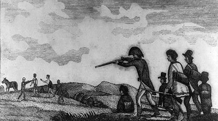
In small groups, students analyze short excerpts from primary sources and secondary information that describe an encounter between the Lewis and Clark expedition and a Native American tribe. They share their analysis with the class and consider how varied locations influenced the ways in which the explorers and the various Native tribes interacted.

Article Body

Encouraging students to work collaboratively in groups, this lesson asks students to think and write about history from multiple viewpoints. The primary source excerpts, primarily from the expedition members’ journals, are a bit challenging, but they are brief and informative. Short expository passages describe different Native American groups and their encounter with the expedition. The absence of primary documents from the Native American perspective provides an opportunity to discuss what sources of information make up the historical record.

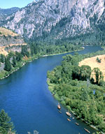
Additionally, and maybe more importantly, the lesson engages students in geographic analysis. Using geographic indicators, students must locate each encounter at a specific site on expedition maps. Students consider the varied physical environments that Lewis and Clark encountered and how these connect to cultural variations between the Native American tribes whom they met. This lesson pays special attention to the differences between Native American cultures, countering a common student belief that all Indians lived alike.

We like the closing activity where each group reports back to the whole class before a large group discussion on the similarities and differences between the encounters. The suggested assessment asks students to write about one of the encounters from the perspective of Sacagawea, Lewis and Clark’s Native American guide, or York, a slave on the expedition. Unless this lesson is taught in conjunction with the film or other rich resources providing additional background information, this assessment seems ill-suited as students likely need more background to complete these essays successfully.
Topic
Lewis and Clark Expedition
Time Estimate
1 class period
flexibility_scale
4
Rubric_Content_Accurate_Scholarship

Yes Uses primary sources from the Lewis and Clark expedition.

Rubric_Content_Historical_Background
No We recommend that teachers include additional background information.
Rubric_Content_Read_Write

Yes Students read about environments, resources, and daily life in different places and write about how and why people from different groups perceived events differently.

Rubric_Analytical_Construct_Interpretations

Yes Students' historical and geographic analysis skills are fostered through interpretation of primary and informational texts and maps.

Rubric_Analytical_Close_Reading_Sourcing

Yes Students must read documents and maps closely in order to compare different perspectives.

Rubric_Scaffolding_Appropriate

Yes Some of the document prose is challenging, but grouping students by mixed ability can help address comprehension issues.

Rubric_Scaffolding_Supports_Historical_Thinking

No Teachers may need to create scaffolding questions to guide their students during group work.

Rubric_Structure_Assessment

No Assessment is vague. Teachers may wish to design their own assessments that involve students in viewing the expedition from multiple viewpoints or considering how location influences cultural variation.

Rubric_Structure_Realistic

Yes The directions are clear and all of the materials available on the web are easily reproducible for classroom use

Rubric_Structure_Learning_Goals

Yes Activities require students to examine an event from multiple viewpoints. Students also have the opportunity to see how geography influenced both Native American groups and the expedition members .
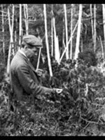
American Environmental Photographs, 1891-1936

Image
Annotation

These approximately 4,500 photographs document natural environments, ecologies, and plant communities in the United States at the end of the 19th and the beginning of the 20th century. Produced by American botanists between 1891 and 1936, the photos describe various ecosystems and landforms across the United States. Users can search for specific plants and some animals as well as for landforms, natural events, and weather patterns.

The collection is a bit odd in that it mixes genres and types. Clicking on the region "Pennsylvania" produces eight images, ranging from pictures of dogwoods to a photo of tree rings to three pictures of the Pittsburgh flood. A timeline and an essay on "Ecology and the American Environment" provide valuable background information as well as a bibliography. These materials are useful as record of early environmental thinking as well as a document of vanished landscapes.

Rivers, Edens, Empires: Lewis and Clark and the Revealing of America

Image
Annotation

Thomas Jefferson outlined three motivating factors in his instructions to Lewis and Clark: a search for navigable rivers to span the continent; a quest for Edenic beauty and riches; and the competitive desire to acquire a continental empire. These 180 documents and artifacts interpret 19th-century westward exploration from this perspective. The range of materials is striking. In addition to maps, plans, and charts, the site offers images (sketches, watercolors, etchings, and engravings), texts (letters, diaries, speeches, newspapers, and books), and tools (surveying and medical instruments, cooking utensils, armaments). The exhibit opens with an examination of the "imperial mentality" common to Virginia's aristocratic class in the late 18th century and then focuses on the Lewis and Clark journey. It ends with the subsequent expeditions of Zebulon Pike, Stephen H. Long, Charles Wilkes, John Charles Fremont, and the mid-19th century transcontinental railroad plan that supplanted the search for a water route.

Using Maps as Primary Sources

Image
Article Body

This website shows a 4th-grade teacher in northern Virginia teaching a lesson focused on a map drawn by John Smith that was published in 1612. Source Analysis, a feature created for the Loudoun County (Virginia) (TAH) website, has three sections focused on this primary source: scholar analysis, teacher analysis, and classroom practice. The latter two sections show a standards-based lesson that asks students to answer the question: What is important to John Smith? The teacher carefully plans activities so students look closely at the map and consider how this primary source helps them answer the central question. The site provides examples of two promising practices:

  • Engaging young students in close, careful observation and reading of a primary source document (using student pairs and a comparative document); and
  • Using students' observations to inform and guide analysis and connect the source to larger questions and topics in the curriculum.
The Lesson in Action

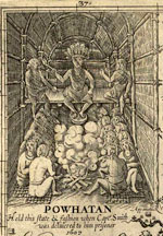
In the Classroom Practice section, we see the lesson in action. The teacher introduces the lesson question and then takes time to ensure that students understand the question by introducing synonyms for "important" and reviewing word meanings. She passes out the maps to assigned student pairs and asks them, "What do you see?" Students have time to look carefully at the map and notice words (e.g., "Jamestown" and "Powhatan"), the Chesapeake Bay and its tributaries, living structures, trees, how particular words vary in size and spacing, and so on. The teacher further facilitates the students' observation by juxtaposing the 1612 map with a contemporary textbook map of the same region. This juxtaposition helps students see the choices John Smith made in drawing this map that they might have missed without the comparative source. The teacher then uses what students notice about these maps to help them think about what the details and differences mean. Students start to identify what was important to John Smith and subsequently to the Virginia Company, given the evidence in front of them. Throughout this instruction, the teacher uses feedback, a logical sequencing of activities, and clear and accessible questions to ensure access to the learning activities for all of her students.

Thinking Like Historians

This teacher shows how carefully structured lessons that use primary sources can engage students in the process of thinking like historians. Students slow down and carefully read and look at the map, noticing things that they might otherwise have missed. They then consider what the contents of the map mean and what the map tells us about John Smith and the Virginia Company's worldview. The 1612 map becomes a window into the past that only reveals its slice of the landscape with close reading. Also on this site is a Teacher Analysis section in which the teacher explains some of what preceded this lesson and her instructional choices—a useful complement to the classroom videos. Each of these sections presents information in a set of videos that are clearly titled and visually interesting.

Reclaiming the Everglades: South Florida's Natural History, 1884-1934 Anonymous (not verified) Fri, 01/25/2008 - 22:21
Image
Annotation

This archive contains primary and secondary sources relating to reclamation efforts of the Everglades and the history of south Florida from 1884 to 1934. Comprising nearly 10,000 pages and images, the compilation includes personal correspondence; government publications, reports, and memos; and images, such as photographs, maps, and postcards. Materials document issues relating to the creation of national parks, including conflicting interests—public, private individual, and corporate—and government accountability.

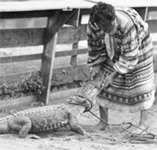
The website also presents a photo exhibit, "The Everglades: Exploitation and Conservation," accompanied by a 1,000-word essay. Two additional features, an interactive timeline and 31 biographies of South Florida's most notable personalities, complete this project. This site will be of interest for those exploring the establishment of the Everglades National Park, the conservation movement, and the treatment of Native Americans, particularly the Seminoles.