Springfield Historical Society [PA]

Description

The Springfield Historical Society owns and operates the Springfield Heritage Museum, which houses an immense collection of vintage maps, memorabilia, historic photographs, deeds, legal documents, historic artifacts, and a "cornucopia" of Springfield Township school milestones and military mementos. In addition to the museum, the society works to preserved historic structures in and around Springfield Township.

The site offers visitor information for the museum, an online gift shop, historical information regarding Springfield Township, and an events calendar.

Martin Luther King, Jr., Part Two

Description

Professor Lucas E. Morel reviews the life and views of Martin Luther King, Jr., focusing on the March on Washington and King's "I Have a Dream" speech. This lecture continues from the lecture Martin Luther King, Jr., Part One.

For the lecture, scroll down to the third seminar of Wednesday, August 4. Readings, available for download, accompany the lecture.

An older version of this lecture can be found here.

Gilded Age Plains City

Image
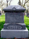
Gravestone of John Sheedy, Gilded Age Plains City
Annotation

Gilded Age Plains City: The Great Sheedy Murder Trial and the Booster Ethos of Lincoln, Nebraska tackles the issue of urban development through the lens of a nationally-followed murder case.

A document archive provides a rich variety of related primary sources—39 legal documents, 225 newspaper articles, 39 newspaper illustrations, 129 photographs, and 42 postcards. Documents range from items directly related to the Sheedy murder trial to sources depicting parts of the city or describing Lincoln culture and society.

One practice worth applauding on this site is it's loyalty to the concept of scaffolding. The first page offers links to vocabulary, an extensive list of Lincoln personages, and a similarly detailed timeline.

Selecting "Explore the City" brings up an introductory essay on Lincoln, Nebraska in the 1890s, as well as an interactive map. The map shows many buildings in red or yellow. Yellow buildings offer period images of the structure, as well as a description of its purpose. Red buildings only have the explanation. The most fascinating feature of the map is that it allows you to select a subsection of the city, such as "demimonde," "physician," "boosters," or "transportation." Each of these options alters the map so that only buildings within that particular subcategory are shown in red or yellow. This lets you see how food distribution and transportation, for example, are grouped in different parts of the city. Each subcategory also has an accompanying essay offering more on the social clime of 1890s Lincoln, Nebraska.

"Spatial Narratives" offers a series of texts on the location and nature of various city subcultures—practitioners of law, boosters, men, African Americans, women, the working class, and university students. Obviously, these subcultures overlapped both in body and in spatial terms within the city.

At this point, one might wonder where the Sheedy case comes into the picture. The third major site section "Interpretation and Narrative" introduces the murder. The narrative includes links to relevant newspaper articles.

Taken as a whole, the site is likely not particularly useful in the K-12 classroom. However, when used in pieces, it can be seen as an example of the ways in which cities develop, racial and moral tensions of the 1890s, or media "spin" of the period versus that of today.
1904 World's Fair: Looking Back at Looking Forward

Image
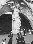
Photo, Entrance to Creation on the Pike, Louisiana Purchase Exposition, LoC
Annotation

Marking the 100th anniversary of the 1904 World's Fair in St. Louis, an event designed to commemorate the 100th anniversary of the Louisiana Purchase, this site documents the extensive preparation for the event that saw 20 million visitors.

Virtual Fair recreates the original layout of the fair and allows visitors to see many of the original sights and structures through 100 contemporary photographs. Artifacts allows viewers to see 32 items significant to the fair and the subsequent Olympic Games. Short, 500- to 1,000-word essays detail the enormous preparations required for hosting the fair. Educators provides some useful materials for teachers, but is designed primarily for teachers planning to bring students to the site of the exhibition.

William Steinway Diary, 1861-1896

Image
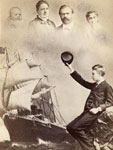
Photo, William Steinway and family, 1882, Napoleon Sarony, Henry Z. Steinway Ar.
Annotation

Who is William Steinway, and what makes his diary so noteworthy? From some perspectives, Steinway is a perfectly average person, giving readers a view into daily life in the 1800s. However, he also happened to be a partner in the newly formed (and later famed) family business Steinway and Sons, a name likely familiar to readers who have played the piano. Another point in the favor of the importance of the diary is that its 2,500 pages begin just eight days after the beginning of the Civil War and three days before William's wedding—a time of personal and national change. While William was not a soldier, his younger brother Albert was, giving the diary a perspective on both home and military life in the Civil War. The diary continues until November 8, 1896, within a month of William's death.

The website offers a digitized and fully transcribed version of William's diary. For any page, you can view both the original and the transcribed text. It's also possible to enter any date of your choosing, and go straight to that page. Users can also find a family tree with short biographies of William and Albert Steinway, as well as William's first wife Elizabeth Roos Steinway; more than 50 photos of the family, useful for putting faces to William's story; and Resources such as scholarly articles on the piano industry of the day and lists of abbreviations and German words and phrases found within the diary.

Eventually, users will be able to search the diary by topic as well.

Los Angeles Public Library Photo Collection

Image
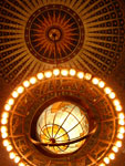
Photo, Central Public Library Rotunda, December 30, 2005, Night Owl City, Flickr
Annotation

This vast collection of more than 275,000 digitized images sheds light on many aspects of 20th-century life in Los Angeles, especially the entertainment industry, politics and public issues, and suburban life. The collection is especially strong in images depicting the growth of LA from the turn of the century through its growth spurt between 1920 and 1939, including a series of promotional images designed to attract Midwesterners and east coast businesses to "the City with Promise."

The sheer quantity of photographs—including churches, municipal buildings, streets, and homes—allows users to track the evolution and growth of LA neighborhoods, making this collection especially useful for urban history courses. The collection also includes more than 10,000 photographs drawn from the family albums of a diverse group of Los Angeles residents.

Images can be accessed through a keyword search and limited by date range, though browsing is not yet available. In addition, users can add images to a "personal list" which can then be sorted by author, title, or call number and emailed/printed.

PhilaPlace

Image
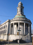
Photo, Former City Hall, Germantown, Philadelphia, 2009, eli.pousson
Annotation

A project of the Historical Society of Pennsylvania, PhilaPlace explores the history of two neighborhoods in Philadelphia—Old Southwark and the Greater Northern Liberties—historically home to immigrants and the working class. Using an interactive map and more than 1,240 primary sources and audio and video clips, visitors to the site may navigate the neighborhoods and learn more about their development from 1875 to the present day.

Visitors may navigate the interactive map using filters found under two tabs to the left of the map: "Places" and "Streets."

Under "Places," click on marked points of interest to bring up photographs or audio or video clips describing the history of the location. These points of interest may be filtered by 14 topics (such as "Food & Foodways," "Education & Schools," and "Health") or by contributor (the Historical Society of Pennsylvania, its partners, or visitors to the site). The map may be set to show the city's streets in 1875, 1895, 1934, 1962, or the present day—note that points of interests from all time periods appear on all maps. Two virtual tours through the points of interest are available, one for Greater Northern Liberties/Lower North and South Philadelphia.

Under "Streets," visitors can view demographics for four streets—S. 4th St., S. 9th St., I-95, and Wallace Street—from 1880-1930. Buildings on each street are color-coded to show land use, the number of residents per building, and the ethnicity and occupation of each building's residents.

Collections allows visitors to search the more than 1,240 primary sources and audio and video clips available on the site. Filter them by topic, neighborhood, type, or contributor.

The site's blog presents mini-features on certain locations, notifications of updates, and information on professional development and other PhilaPlace-related events. Educators provides a timeline for each of the neighborhoods and four suggested lesson plan/activities, while My PhilaPlace lets visitors create free accounts and save favorite materials to them—or create their own up-to-25-stop city tour. The Add a Story feature allows visitors to tag locations on the maps with their own short descriptions or memories (up to 600 words long), and accompany them with an image or audio or video clip.

Attractive, interactive, and accessible, PhilaPlace may appeal to Pennsylvania educators looking for a tool to help students explore urban history.

Sanborn Fire Insurance Maps of South Carolina

Image
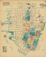
Map, Charleston, May 1884
Annotation

The 580 maps of more than 80 South Carolina towns and cities in this archive reveal urban landscapes and the locations of businesses, mills, colleges, depots, and other buildings between 1884 and 1923. The collection includes 232 unpublished, hand-drafted maps from the years 1899 to 1937. All maps are displayed with original color coding. Users can zoom in and out of maps and can pan right, left, up, or down to examine details. Every map is accompanied by bibliographic data. The full collection can be browsed or the user can choose to browse just the unpublished maps. The collection can be searched by city, year of publication, and county. The maps provide many details about mills and are particularly useful in revealing spatial relationships and location of railroad lines. There is also a link to the Union List of Sanborn and other fire insurance maps. An extremely useful resource for those researching the business or urban history of South Carolina in the decades around 1900.

Museum of the City of San Francisco: The Great 1906 Earthquake and Fire

Image
Logo, Virtual Museum of the City of San Francisco
Annotation

This site provides images and text about the 1906 San Francisco earthquake and fire. A timeline, from April 18 to April 23, covers major events and a facsimile of a roster lists names and addresses of those who died. There are 27 photographs of earthquake damage and 31 personal accounts, 1,200 to 8,000 words, that include Jack London's "Story of an Eyewitness." Among 67 transcriptions of articles from 1906 about the earthquake are 12 that discuss the relocation of Chinatown and the treatment of Chinese San Franscicans. There are 31 transcribed fire department reports, including an article about the reorganization of the department in the wake of the disaster, and a facsimile of the 1910 police report on the quake and fire. Army operations are discussed in 29 pieces of correspondence and navy evacuation operations are detailed in seven. In addition, a 700-word article describes the evacuation of the city by train. Engineering and scientific reports include 24 articles, letters, and reports about infrastructure issues, such as water supply and structural stability. A section about relief efforts includes a flier accusing the Red Cross of corruption and a resolution by a local plumbers union to volunteer their services. The site will be very useful for anyone interested in the earthquake and in urban and California history.

Integrated Public Use Microdata Series

Image
Logo, Integrated Public Use Microdata Series (IPUMS) USA Logo
Annotation

Currently provides 22 census data samples and 65 million records from 13 federal censuses covering the period 1850-1990. These data "collectively comprise our richest source of quantitative information on long-term changes in the American population." The project has applied uniform codes to previously published and newly created data samples. Rather than offering data in aggregated tabular form, the site offers data on individuals and households, allowing researchers to tailor tabulations to their specific interests. Includes data on fertility, marriage, immigration, internal migration, work, occupational structure, education, ethnicity, and household composition. Offers extensive documentation on procedures used to transform data and includes 13 links to other census-related sites. A complementary project to provide multiple data samples from every country from the 1960s to 2000 is underway. Currently this international series offers information and interpretive essays on Kenya, Vietnam, Mexico, Hungary, and Brazil. Of major importance for those doing serious research in social history, the site will probably be forbidding to novices.