Around the World in the 1890s: Photographs, 1894-1896 Anonymous (not verified) Fri, 01/25/2008 - 22:21
Image
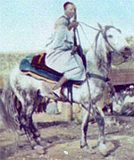
Photo, North African man on horseback, W H Jackson, 1894, Around the World...
Annotation

This photograph archive contains more than 900 images made by American photographer William Henry Jackson (1843–1942) during his tour of North Africa, Asia, Russia, Australia, and Oceania from 1894 to 1896. The World's Transportation Commission, an organization formed to aid American business interests abroad, commissioned Jackson for this trip.

The photographs, originally exhibited in Chicago's Field Columbian Museum, focus on transportation systems, especially railroads, as well as tourist sites, indigenous life, wildlife, and locations of natural beauty. Nearly 687 of the images are from lantern slides, many of which were hand-colored. Many of the photographs appeared in Harper's Weekly. This collection is valuable for those interested in late 19th-century photography, colonialism, and industrialization.

EASE History: An Experience Acceleration Support Environment

Image
Photo, A boy reads a comic book, Dorothea Lange, 1942, Ease History
Annotation

This collection of video clips and photographs focuses on 20th-century historical events and political campaigns. "Historical Events" presents 470 items from 1900 to the present that the visitor can explore by decade or by 13 thematic topics that include presidential administrations, the environment, politics, war, the economy, and science/technology. "Campaign advertisements" offers 229 campaign ads from 1952 to 2004. The visitor can explore the items by year, candidate, party, and issue, or by thematic topics such as ad themes or positive/negative ads. "Core values" allows visitors to explore the values at the center of presidential political campaigns. All the clips can be displayed one, two, or four at a time.

The learning guide offers activity suggestions and provides more than 100 questions tied to the themes on the site. The site also offers "learning segments" on the Cold War and campaign ads. The search feature offers the ability to search all themes in the campaign ads, history events, and core values sections; select individual film clips from a full listing; conduct a keyword search; or select from 32 classroom topics such as communities, culture, war, the Great Depression, the New deal, and the Great Society.

Early Washington Maps: A Digital Collection

Image
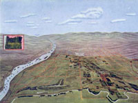
Map, "Hermiston Oregon," Umatilla Project Development League, 1910
Annotation

The nearly 1,000 maps available on this site document the conflict between Great Britain and America for ownership of the region. They also illustrate the transformation of the physical boundaries of the Pacific region and the efforts of its inhabitants to control the land. The site includes a valuable interactive timeline that presents the maps in historical perspective. The collection contains large-scale geographic maps of the land and sea and small hand-drawn sketches of settlements. The maps are very detailed and most were created in the late-19th- and early-20th-century. Maps are primarily concerned with geography, transportation, climate, population, culture, politics, and tourism and there is a searchable index that is organized according to 21 themes, such as forests, Puget Sound, railroads, Seattle, Washington State University, and Native American reservations.

A drop-down menu allows users to examine and enlarge thumbnail images of each map. Biographical and detailed descriptive text (most between 20 and 500 words) is presented with each image, and the text is searchable by keyword. Created as a resource to help students, teachers and researchers understand the history and development of the state of Washington, this site will appeal to those interested in Washington, historical geography, and the development of cartography.

Tennessee Electronic Atlas

Image
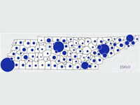
Map graphic, Tennessee Electric Atlas
Annotation

This site provides information about the state of Tennessee and offers a gateway for learning more about the state. One of the main goals is to disseminate data through thematic maps and interactive mapping (which contains tutorial exercises that introduce the basic concepts involved in geographic information systems). For those interested in utilizing the full capabilities of the site, the Metro GIS service area of the site allows users to look at the main metropolitan regions in the state and to customize the themes (such as churches, golf courses, and hospitals) to their preferences. Included are data concerning agriculture, education, physical landscape, economics, and society. The site includes information from the 2000 national census, as well as state legislative districts. There is also detailed information about education in Tennessee. Visitors can check out the school system report cards to see results of standardized tests, both in raw numbers and in comparative terms versus other districts. Although the site contains no historical maps, the site allows visitors to compare some change over time, and visitors can use the site to compare the size and shape of the 106th and 108th Congressional districts.

Parkin Archaeological State Park [AR]

Description

The Park preserves and interprets the Parkin site on the St. Francis River where a 17-acre Mississippi Period American Indian village was located from A.D. 1000 to 1550. A large platform mound on the river bank remains. There were once many archaeological sites similar to Parkin throughout this region, but they did not survive as eastern Arkansas was settled. Visitors can watch research in progress, and see firsthand the results of careful excavations and laboratory analysis. Along with including an archaeological research laboratory, the park visitor center includes an interpretive exhibit area and auditorium. The park interpretive staff offers audiovisual programs, site tours, workshops, and other educational programs and special events and activities. When archaeological excavations are underway, visitors on guided tours can observe them. Visitors experiencing Parkin Archeological State Park can also tour the circa 1910 Northern Ohio Schoolhouse. By the beginning of World War II, there were 15 one-room and two-room schoolhouses providing education for children in Parkin, a town of less than 2,000 citizens. Today, the Northern Ohio School is the only one of these early Parkin structures still standing. The stories it tells of what took place here in the early 20th century in and around the Sawdust Hill community are parts of the historic fabric of Parkin, just as is the park’s interpretation of the prehistoric village of Casqui.

The site offers exhibits, tours, workshops, and educational and recreational programs and events.

Roosevelt Campobello International Park

Description

"For many years, Franklin D. Roosevelt summered on Campobello Island. As an adult, he shared with his family the same active pursuits he enjoyed on the island as child. Although he visited less frequently after contracting polio, Campobello remained important to FDR. Today, Roosevelt Campobello International Park serves as a memorial to FDR and a symbol of cooperation between the U.S. and Canada." Visitors to Campobello Island can enjoy viewing the restored FDR-era buildings as well as learn more about the Roosevelt presidency and family.

The site offers basic visitor information, a brief history of Campobello Island, and a link to http://www.fdr.net/, the official website of Roosevelt Campobello International Park.

Presidio of San Francisco [CA] Anonymous (not verified) Tue, 01/08/2008 - 13:28
Description

The Presidio of San Francisco has served as a barracks for 218 years, and has been occupied by three countries. Now, visitors can enjoy the stunning architecture of the Presidio, as well as see the historic airfields and national cemetery also located in the park. In addition to the impressive history and culture of the Presidio, the park also serves as a haven for endangered species and features beautiful and expansive views of the Golden Gate Bridge, the city of San Francisco, and Marin County.

The site offers historic information about the Presidio, visitor information, a photo-gallery containing 92 photographs of the Presidio and its surrounding grounds, and resources for educators, including an interactive field trip planner and educational online games for students.

Kaloko-Honokohau National Historical Park

Description

Along the western coastline of the Island of Hawai'i lies the hot, rugged lava of Kaloko-Honokohau. Some people find it difficult to understand why the ancient Hawaiians chose to settle upon these stark lava fields. The reason was, perhaps, a spiritual one, for there was a spirit in Kaloko-Honokohau. The Hawaiians who first came to the area felt its presence in every rock and tree, in the gentle waters of shallow bays, and in the tradewinds that gently swept across the lava flow. Visitors to the park can see the ancient heiau (temple) that stands at the end of the beach, as it did in times when Hawaiian settlements thrived in the area, and the 'Aiopi'o Fishtrap, where reef fish were captured for food.

The site offers exhibits and tours.

Marsh-Billings-Rockefeller National Historical Park

Description

Visitors can walk through one of Vermont's most beautiful landscapes, under the shade of sugar maples and 400-year-old hemlocks, across covered bridges, and alongside rambling stone walls. Ranger-guided tours of the historic 1869 Marsh-Billings-Rockefeller Mansion and gardens explore the history of conservation; the stewardship ethic of the Marsh, Billings, and Rockefeller families' and community-based conservation in a more modern context. In addition to original furnishings and personal items, the mansion displays works of art that include some of America's finest landscape paintings, highlighting the influence painting and photography had on the conservation movement.

The site offers exhibits, research library access, tours, and educational and recreational programs.

Casa Grande Ruins National Monument [AZ]

Description

Casa Grande Ruins National Monument preserves an ancient Hohokam farming community and "Great House." Created as the nation's first archeological reserve in 1892, the site was declared a National Monument in 1918 "in order that better provision may be made for the protection, preservation, and care of the ruins and the ancient buildings and other objects of prehistoric interest thereon."

The site offers a short film, exhibits, tours, and educational programs.