Touring Turn-of-the-Century America

Image
Annotation

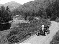
The Detroit Publishing Company mass produced photographic images—especially color postcards, prints, and albums—for the American market from the late 1890s to 1924. This collection offers more than 25,000 glass negatives and transparencies and about 300 color photolithographs from this company. It also includes images taken prior to the company's formation by landscape photographer William Henry Jackson, who became the company's president in 1898. Jackson's work documenting western sites influenced the conservation movement. Although many images were taken in eastern locations, other areas of the U.S., the Americas, and Europe are represented. The collection specializes in views of buildings, streets, colleges, universities, natural landmarks, and resorts, as well as copies of paintings. Nearly 300 photographs were taken in Cuba during the Spanish-American War. About 900 Mammoth Plate Photographs include views of Hopi peoples and their crafts and landscapes along several railroad lines in the 1880s and 1890s.

Using Maps as Primary Sources

Image
Article Body

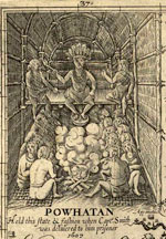
This website shows a 4th-grade teacher in northern Virginia teaching a lesson focused on a map drawn by John Smith that was published in 1612. Source Analysis, a feature created for the Loudoun County (Virginia) (TAH) website, has three sections focused on this primary source: scholar analysis, teacher analysis, and classroom practice. The latter two sections show a standards-based lesson that asks students to answer the question: What is important to John Smith? The teacher carefully plans activities so students look closely at the map and consider how this primary source helps them answer the central question. The site provides examples of two promising practices:

  • Engaging young students in close, careful observation and reading of a primary source document (using student pairs and a comparative document); and
  • Using students' observations to inform and guide analysis and connect the source to larger questions and topics in the curriculum.
The Lesson in Action

In the Classroom Practice section, we see the lesson in action. The teacher introduces the lesson question and then takes time to ensure that students understand the question by introducing synonyms for "important" and reviewing word meanings. She passes out the maps to assigned student pairs and asks them, "What do you see?" Students have time to look carefully at the map and notice words (e.g., "Jamestown" and "Powhatan"), the Chesapeake Bay and its tributaries, living structures, trees, how particular words vary in size and spacing, and so on. The teacher further facilitates the students' observation by juxtaposing the 1612 map with a contemporary textbook map of the same region. This juxtaposition helps students see the choices John Smith made in drawing this map that they might have missed without the comparative source. The teacher then uses what students notice about these maps to help them think about what the details and differences mean. Students start to identify what was important to John Smith and subsequently to the Virginia Company, given the evidence in front of them. Throughout this instruction, the teacher uses feedback, a logical sequencing of activities, and clear and accessible questions to ensure access to the learning activities for all of her students.

Thinking Like Historians

This teacher shows how carefully structured lessons that use primary sources can engage students in the process of thinking like historians. Students slow down and carefully read and look at the map, noticing things that they might otherwise have missed. They then consider what the contents of the map mean and what the map tells us about John Smith and the Virginia Company's worldview. The 1612 map becomes a window into the past that only reveals its slice of the landscape with close reading. Also on this site is a Teacher Analysis section in which the teacher explains some of what preceded this lesson and her instructional choices—a useful complement to the classroom videos. Each of these sections presents information in a set of videos that are clearly titled and visually interesting.

Reclaiming the Everglades: South Florida's Natural History, 1884-1934

Image
Annotation

This archive contains primary and secondary sources relating to reclamation efforts of the Everglades and the history of south Florida from 1884 to 1934. Comprising nearly 10,000 pages and images, the compilation includes personal correspondence; government publications, reports, and memos; and images, such as photographs, maps, and postcards. Materials document issues relating to the creation of national parks, including conflicting interests—public, private individual, and corporate—and government accountability.

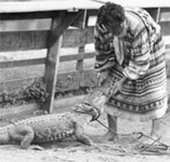
The website also presents a photo exhibit, "The Everglades: Exploitation and Conservation," accompanied by a 1,000-word essay. Two additional features, an interactive timeline and 31 biographies of South Florida's most notable personalities, complete this project. This site will be of interest for those exploring the establishment of the Everglades National Park, the conservation movement, and the treatment of Native Americans, particularly the Seminoles.