Historical Maps of the United States
Image
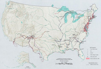
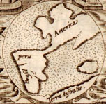
Map, Exploration Before 1675
Annotation

This division of the Perry-Castaneda Map Collection provides access to 500 historical maps of the U.S. Maps are sorted thematically and include three maps of early inhabitants, 11 of exploration and early settlement from 1675 to 1854, and 15 of territorial growth from 1775 to 1970. Of the 95 military history maps covering engagements from 1763 to 1967, 50 are about World War II alone.

Among 183 late 19th- and 20th-century maps, there are 146 of U.S. cities produced around 1920. Historic sites, memorials, and battlefields are represented in 191 maps of sites such as Aztec ruins in New Mexico, the Bering land bridge in Alaska, and the Vicksburg battle site in Mississippi. Most of the maps are excerpted from 20th-century historical atlases. The site will be particularly useful for research in military history and early 20th-century urban history.
Envisaging the West: Thomas Jefferson and the Roots of Lewis and Clark

Image
Image for Envisaging the West: Thomas Jefferson and the Roots of Lewis and Clark
Annotation

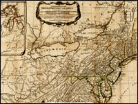
By the time Thomas Jefferson became the third President of the United States in 1801, interest in exploring the West had begun to shape U.S. policy. This chronological narrative traces Jefferson's life, participation in politics, and accumulation of scientific geographical knowledge from 1735 to 1804. There are four main sections: "The Jeffersons and Their Frontier Virginia Neighborhood," "From Colony to Commonwealth," "Science and Statecraft at Home and Abroad," and "Public Servant to the Early Republic."

This narrative is accompanied by an archive of 169 letters, statues, books, treaties, maps, and journals providing primary source insight into Jefferson's thoughts about the West and the Lewis and Clark expedition in particular. Three interactive maps from the 1700s, overlaid with historical data about cities, private dwellings, natural features, courthouses, and waterways, provide important insight into the geographic and social environment at the time.

Map Collections: 1500-2003

Image
Image, Historia general..., Antonio de Herrera y Tordesillas, c. 1601-1615, LoC.
Annotation

This large collection of maps from the 16th century to the present day focuses on Americana and cartographic treasures.

Materials are organized into seven thematic categories—Cities and Towns, Conservation and Environment, Discovery and Exploration, Cultural Landscapes, Military Battles and Campaigns, Transportation and Communication, and General Maps. Sections include five special presentations.

Users may download maps or zoom in to view details. Seventeen specific map collections contained within this larger site that are of particular importance for the study of American history include "Discovery and Exploration," "The American Revolution and Its Era," "Railroad Maps, 1828–1900," "American Colonization Society Collection: Maps of Liberia, 1830–1870," "Panoramic Maps, 1847–1929," "Civil War Maps," and "Mapping the National Parks."

Cultural Readings: Colonization and Print in the Americas

Image
Image for Cultural Readings: Colonization and Print in the Americas
Annotation

Texts about the Americas produced in Europe from the 15th through the 19th centuries are examined in this well-organized online exhibit. Over 100 images of printed texts, drawings, artwork, and maps from published and unpublished sources are arranged into six thematic categories. Categories are named: "Promotion and Possession," "Viewers and the Viewed," "Print and Native Cultures," "Religion and Print," "New World Lands in Print," and "Colonial Fictions, Colonial Histories."

Five scholarly essays (5,000 to 7,000 words each) contextualize the documents. A bibliography and list of links accompany the presentation. A visually attractive, thoughtfully arranged site that explores connections between colonization and representation.

Archive of Early American Images

Image
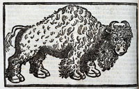
Buffalo, Archive of Early American Images
Annotation

The images in this collection, focusing on the Americas, come from books printed or created in Europe between about 1492 and 1825. Images include woodcuts, copper engravings, and paintings. The database, still being compiled, currently contains 6,685 images and will eventually contain some 7,500 images. Image viewing software is available from the site.

The visitor can browse the entire archive or search by time period, geographical area, keyword, or subject, including indigenous peoples, flora and fauna, artifacts, industry, human activities, geography, maps, city views and plans, and portraits. Some images, such as Ptolemy's map of the world, may be familiar. Others are reproduced for the first time. Navigation requires some practice, but is worth the effort.

Understanding the Battle of Gettysburg Using GIS

Description

Dr. Anne Knowles of Middlebury College answers the question "What could Lee see at Gettysburg?" Dr. Knowles builds two digital terrain models of the battlefield, one from 1996 data derived from aerial photographs, the other based on contour lines extracted from an 1874 map of the battlefield. Using a technique called viewshed analysis, she investigates how lines of sight and real-time geographic information may have influenced commanders' decisions and terrain perceptions. The results suggest that historical maps and evidence from the physical landscape can shed new light on even the most familiar historical subjects.

The Lewis and Clark Expedition and the Making of American Imperialism Anonymous (not verified) Fri, 01/04/2008 - 14:04
Description

Professor William Wagner considers the actual significance of the Lewis and Clark Expedition to and in U.S. history. He seeks to remove the voyage from obscuring popular myths and into the realm of historical fact, while also looking at how popular understanding of the Expedition has changed over time.

The Mariners' Museum [VA]

Description

The Mariner's Museum presents information and artifacts relevant to the field of maritime history. Highlights include more than 150 small vessels from over 36 countries; August F. Crabtree's miniature ships; displays on shipbuilding, cartographic, and navigational advancements between 1400 and 1700; the largest international maritime library in the western hemisphere; and the USS Monitor Center. The center includes a full-scale replica of the Monitor, the first U.S. Navy ironclad warship, used in the Civil War. The museum also owns and maintains a 550-acre park.

The museum offers exhibits, maritime science and history educational programs which complement state educational standards, scavenger hunts, distance learning programs, outreach speakers, lectures, research library access, research assistance, paddle boat rental, and fishing boat rental. Payment is required for research assistance. The website offers virtual exhibits, artifact of the month, and images for educational use.

Developing Cartographic Literacy with Historic Maps

Description

This 3-week seminar led by James Akerman (The Newberry Library) and Gerald Danzer (Emeritus, The University of Illinois at Chicago) is designed to develop cartographic literacy and encourage effective use of map documents in the classroom through study in the history of cartography. A program of seminars based on recent scholarship in the history of cartography and guided individual research will allow teachers to explore the relevance of map study to their own interests and curricular needs. Workshops will serve as forums for refining and applying the skills necessary to read maps as products of science, artistic creations, storytellers, wayfinding tools, and expressions of power; and as representations of worldviews and local landscapes.

Contact name
Frank, Sarah
Contact email
Registration Deadline
Sponsoring Organization
Newberry Library
Phone number
312-255-3659
Target Audience
K-12
Start Date
Cost
Free; $2,600 stipend
Contact Title
Program Assistant
Duration
Nineteen days
End Date

Seeing is Believing: Google Earth in the Social Studies

Description

Google Earth lets students see the world around them in brand-new ways: travel to the Great Pyramids, analyze live current events, compare before and after images of deforestation, and integrate literature and social studies. But how best can teachers use it to improve learning? This workshop spends a day adapting existing Google Earth tours and creating new ones.

Contact name
Pam
Contact email
Sponsoring Organization
Educational Services and Staff Development Association of Central Kansas (ESSDACK)
Phone number
620-663-9566
Target Audience
3-12
Start Date
Duration
Seven hours