Teaching Your Local Community History 2008-2009 (3 of 6)

Description

Top-notch teachers will demonstrate how to teach the California local community history—including geography of the local region, the culture of the Gabrielino Indians, the daily life and economic legacy of the local ranchos, the development of the harbor, local government, and the community. Participants will each receive instructional materials kit with model lessons, maps, primary source materials, and literature books.

Contact name
Hutton, Lisa
Contact email
Sponsoring Organization
California History-Social Science Project
Phone number
310-243-2748
Target Audience
3
Start Date
Cost
$90
Course Credit
An optional two semester units credit are available for an additional $90 fee.
Duration
Two and a half hours

Teaching Your Local Community History 2008-2009 (2 of 6)

Description

Top-notch teachers will demonstrate how to teach local California community history—including geography of the local region, the culture of the Gabrielino Indians, the daily life and economic legacy of the local ranchos, the development of the harbor, local government, and the community. Participants will each receive instructional materials kit with model lessons, maps, primary source materials, and literature books.

Contact name
Hutton, Lisa
Contact email
Sponsoring Organization
California History-Social Science Project
Phone number
310-243-2748
Target Audience
3
Start Date
Cost
$90
Course Credit
An optional two semester units credit are available for an additional $90 fee.
Duration
Two and a half hours

Geography Awareness Week Workshop

Description

This Geography Awareness Week workshop will begin with a lecture on migration to the U.S. from Latin America. Lessons from the Geography Action! packet will then be introduced. The session will conclude with guided tours of four Latin-American art exhibits at the Fowler Museum.

Contact name
Miller, Mary
Contact email
Sponsoring Organization
California History-Social Science Project
Phone number
310-825-7749
Target Audience
preK-12
Start Date
Duration
Four and a half hours

The Great Plains: America's Crossroads

Description

"To many, the Great Plains are part of the Great Flyover, whose landscape and history alike are flat and featureless. But in this region in the middle of the nation, cultures have mingled and clashed for thousands of years. This seminar will focus on the 19th century, though also examining the first peoples and the continuing cultural exchanges of the 20th century. It will begin with the physical setting, plants, and animals, and consider early humans in both Native American traditions and anthropological/archeological studies. Europeans arriving in the 16th century accelerated the long history of change and evolution, initiating more than three centuries of converging peoples and cultures, new centers of power, flourishing trade, calamitous epidemics, and cultural and material intrusions from across the planet. Participants will visit Bent’s Fort to see a cultural crossroads illustrated through one family. The seminar will also examine cattle ranching, homesteading, scientific explorations, and the depiction of the plains in art."

Registration Deadline
Sponsoring Organization
Gilder Lehrman Institute of American History
Phone number
1 646-366-9666
Target Audience
Secondary
Start Date
Cost
None ($400 stipend)
Course Credit
"Participants who complete the seminar in a satisfactory manner will receive a certificate. Teachers may use this certificate to receive in-service credit, subject to the policy of their district. No university credit is offered for the course."
Duration
One week
End Date

Building America: Minnesota's Iron Range, U.S. Industrialization, and the Creation of a World Power

Description

"Offered in Summer 2008, the workshop will focus on the history and activities that took place on the Vermilion and the Mesabi Iron Ranges. Participants will be provided with resources and new content knowledge for introducing the history of Minnesota's Iron Range region, its contributions, and its people into their current American history curriculum. In order to make this easier, the workshops will be based on national history standards and the national social studies standards and will be organized around three central themes that align with those standards. These three themes are: 1) Natural History of the Landmark: Geography and Geology; 2) The Mines and their Contributions to American History; 3) and the People and the Mines (indigenous peoples, ethnicity, and immigration)."

Contact name
Eilers, Rebecca
Registration Deadline
Sponsoring Organization
National Endowment for the Humanities
Phone number
1 651-772-4257
Target Audience
Kindergarten through Twelfth Grade
Start Date
Duration
Six days
End Date

Google Earth

Image
What is it?

Google Earth uses images obtained from satellite imagery and aerial photography to map the Earth and compliment its Google Maps tool. Users with computers that run Windows XP (and above), Mac OS X 10.5 (and above), and Linux 4.0 (and above) can download the latest version of Google Earth to their desktops for free.

Google Earth's main benefit is its ability to put the world's geographic information in the reach of students and educators, allowing them to manipulate and create their own geography-based visuals to augment historical learning. In the Showcase section, history teachers can browse through products focusing on "U.S. Presidents" or "Historical Imagery" to familiarize themselves with Google Earth.

The Google Earth for Educators site also contains classroom activities that apply geographic concepts in order to better teach history, culture, literature, and other disciplinary areas—perfect for integrating history across many other curriculum areas. This section also provides tips and tricks for using Google Earth as a teaching tool and student work showcase, as well as ideas for how to integrate Google Earth into grant projects. Of particular note is the classroom resources section, which provides a basic overview of how Google Earth can be used by history students and teachers, as well as links to lesson plans. Additionally, teachers can use the forum to discuss with fellow teachers how to use Google Earth in innovative ways.

Getting Started

The first step is to install Google Earth on computers that will be used by students. Teachers should consult with the Instructional Technology specialist at school, or at the school district office, before trying to install Google Earth on school computers.

Examining New Orleans between 2005 to the present helps students understand the destruction of Hurricane Katrina and the recovery efforts that have helped the city prosper once again.

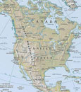
Once installed, it can be easy to become overwhelmed with all the tools available. The historical imagery tool is a good place to begin. Google provides simple and effective web tutorials for each tool, and the tutorial video for historical imagery will help users become familiar with what can they can learn by viewing cities and how they change over time. For example, satellite images of Washington DC, dating back to 1948, reveal the growth of the Smithsonian museums and the national monuments on the Mall. As mentioned in the tutorial video, images of Las Vegas from the last 60 years reveal the city's growth and can open up conversations about urban planning, 20th-century migration to the "Sun Belt," or even Las Vegas's history of gambling and organized crime in the post-Prohibition era. Examining New Orleans between 2005 and the present helps students understand the destruction of Hurricane Katrina and the recovery efforts that have helped the city prosper once again. Another useful feature to explore is the "layers" function. After selecting a location, expand the "layers" menu on the left panel to reveal 10 categories (borders & labels, places, photos, roads, 3D buildings, ocean, weather, gallery, global awareness, and more)—eight of which contain several subcategories. The "gallery" category, in particular, provides educators with a seemingly endless list of possibilities by taking advantage of the resources provided by National Geographic, NASA, New York Times, the Discovery network and many other partners. Displaying layers of streets, landmarks, and photos, for example, would help elementary social studies teachers enrich lessons about the community in the early grades. High school teachers can use these layers to examine military battlefields such as Gettysburg, or urban areas of historical interest such as New York post-9/11. Google Earth also allows users to create new placemarks, polygram shapes, and pathways, and to import images as an overlay. In addition to using the historical imagery tool, users can also select the day/night function to visualize locales at different times of day. Other functions found on the top row include viewing selections in Google Maps, emailing Google Earth images to other people, and printing visualizations. Teachers can use these tools to email students specific geographic visuals ahead of a particular lesson or to print Google Earth images for a handout or worksheet. Finally, the recorded tour feature is helpful for student presentations and projects. Students can prepare their tour by creating historical placemarks and pathways, as well as inserting historical images as overlays. Once all the pieces are in place, they can select the "record a tour" function from the top row of menus. Students can also select layers they would like to be visible, such as the name of roads or photos, and then zoom in to their desired view. At the bottom of the screen a record button will appear to begin recording. If students would like to provide a voice recording for an audio tour, a second button is also available (note: teachers should test any built-in or plug-in microphones beforehand). The "tour" tutorial is a must-see video before working with students on developing their own tour.

Examples

Although it has bot been updated for a few years, Google Earth Lessons has quite a list of ideas on how to use Google Earth and Google Maps in the classroom. One good use for the elementary classroom is to use Google Earth to map out a "Flat Stanley" project. This can be easily modified to a treasure hunt, "where's Waldo?", or other scavenger activities. Both Google Earth and Google Maps allow students to create place marks and pathways that can follow Stanley or Waldo in their travels.

Lesson plans can also make use of geo-mapping tools like Google Earth. In "Slavery, Exploitation, and Slave Trade Routes," a 5th-grade lesson plan guides students in analyzing the slave trade. It includes a structure for developing the final product in Google Maps. From this lesson, students can create an interactive map with placemarks for key areas in the Atlantic slave trade, as well as routes for slave ships and transportation of goods between Africa, Europe, and the Americas. By inserting images that illustrate slave ship conditions and sugar mills in the Caribbean, for example, students can make good use of the tools in Google Earth.

Teachers may want to explore both Google Earth and Google Maps in order to see what each tool offers. Because Google Earth is a bit more complex for younger students and requires installation on computers, teachers may choose to use Google Maps as an alternative tool if they are planning on using basic map functions in their lesson activities.

A gallery of Google Earth products is also available for teachers and students to view and use for brainstorming project ideas.

For more information

Locate Yourself on a Map of the Americas

Teaser

Young students locate themselves on a map and explore spatial relationships among geographic features.

lesson_image
Description

Young students locate themselves on a map and explore spatial relationships among geographic features.

Article Body

This is a straightforward lesson that introduces K-2 students to the concept of geographical location and scale. Using a variety of different maps, the lesson helps students understand the way that countries are situated within continents, states within countries, and cities within states.

Designed for a single-period, the lesson begins with students identifying the continent and country in which they live. Then, students begin to move to progressively more specific scales, locating the state or district in which they live, and eventually their school. Along the way, the plan calls for discussion of the number and size of states and districts, and the relative scale of different cities and towns.

The lesson is built around National Geographic’s MapMaker kit for the Americas—part of their larger MapMaker kit collection. For first-time users, video tutorials are available, and each kit enables the user to download, print, and assemble maps of varying scales. Map sizes range from “mega maps” designed for walls to one-page outline maps designed for individual study.

The strength of this lesson is that it introduces a key concept in historical thinking: geographical location and spatial relationships. By helping students understand the relationships between and among various locations, it establishes an important foundation for students in early elementary grades to learn about historical context. The website isn’t always the most intuitive to navigate, but persistence pays off with high-quality free resources.

Topic
Geographical location and spatial relationships
Time Estimate
50 Minutes
flexibility_scale
3
Rubric_Content_Accurate_Scholarship

N/A, the focus of this K-2 lesson is geography.

Rubric_Content_Historical_Background

N/A

Rubric_Content_Read_Write

No

Rubric_Analytical_Construct_Interpretations

No

Rubric_Analytical_Close_Reading_Sourcing

Yes, requires close reading of maps.

Rubric_Scaffolding_Appropriate

Yes

Rubric_Scaffolding_Supports_Historical_Thinking

Yes

Rubric_Structure_Assessment

Assessment checks for understanding of geographical relationships, no criteria.

Rubric_Structure_Realistic

Yes

Rubric_Structure_Learning_Goals

Yes

Lewis and Clark: Same Place, Different Perspectives

Teaser

How geography influenced interactions among Lewis, Clark, & Native Americans.

lesson_image
Description

In small groups, students analyze short excerpts from primary sources and secondary information that describe an encounter between the Lewis and Clark expedition and a Native American tribe. They share their analysis with the class and consider how varied locations influenced the ways in which the explorers and the various Native tribes interacted.

Article Body

Encouraging students to work collaboratively in groups, this lesson asks students to think and write about history from multiple viewpoints. The primary source excerpts, primarily from the expedition members’ journals, are a bit challenging, but they are brief and informative. Short expository passages describe different Native American groups and their encounter with the expedition. The absence of primary documents from the Native American perspective provides an opportunity to discuss what sources of information make up the historical record.

Additionally, and maybe more importantly, the lesson engages students in geographic analysis. Using geographic indicators, students must locate each encounter at a specific site on expedition maps. Students consider the varied physical environments that Lewis and Clark encountered and how these connect to cultural variations between the Native American tribes whom they met. This lesson pays special attention to the differences between Native American cultures, countering a common student belief that all Indians lived alike.

We like the closing activity where each group reports back to the whole class before a large group discussion on the similarities and differences between the encounters. The suggested assessment asks students to write about one of the encounters from the perspective of Sacagawea, Lewis and Clark’s Native American guide, or York, a slave on the expedition. Unless this lesson is taught in conjunction with the film or other rich resources providing additional background information, this assessment seems ill-suited as students likely need more background to complete these essays successfully.

Topic
Lewis and Clark Expedition
Time Estimate
1 class period
flexibility_scale
4
Rubric_Content_Accurate_Scholarship

Yes Uses primary sources from the Lewis and Clark expedition.

Rubric_Content_Historical_Background
No We recommend that teachers include additional background information.
Rubric_Content_Read_Write

Yes Students read about environments, resources, and daily life in different places and write about how and why people from different groups perceived events differently.

Rubric_Analytical_Construct_Interpretations

Yes Students' historical and geographic analysis skills are fostered through interpretation of primary and informational texts and maps.

Rubric_Analytical_Close_Reading_Sourcing

Yes Students must read documents and maps closely in order to compare different perspectives.

Rubric_Scaffolding_Appropriate

Yes Some of the document prose is challenging, but grouping students by mixed ability can help address comprehension issues.

Rubric_Scaffolding_Supports_Historical_Thinking

No Teachers may need to create scaffolding questions to guide their students during group work.

Rubric_Structure_Assessment

No Assessment is vague. Teachers may wish to design their own assessments that involve students in viewing the expedition from multiple viewpoints or considering how location influences cultural variation.

Rubric_Structure_Realistic

Yes The directions are clear and all of the materials available on the web are easily reproducible for classroom use

Rubric_Structure_Learning_Goals

Yes Activities require students to examine an event from multiple viewpoints. Students also have the opportunity to see how geography influenced both Native American groups and the expedition members .

American Shores: Maps of the Middle Atlantic Region to 1850

Image
Annotation

This attractive site explores the mid-Atlantic region and history with maps created before 1850. An extensive collection offers more than 1,852 historical maps of many different types. In addition to numerous regional and state maps, these include land surveys, coast surveys, nautical charts, military maps, ornamental maps, and city maps.

An overview provides historical context for reading the maps of the geographic regions. In addition, the site offers several special features. "Basics of Maps" explains such cartographic terms and features as orientation, scale, and the cartouche. "Maps Through History" highlights particular maps and map genres from the collection, including a look at New York Harbor, the Hudson River, nautical charts, maps revealing early transportation routes, and maps of American Revolution battle sites. "Geographical Areas" highlights many kinds of maps and what information they offer. Visitors can click on thumbnail images to view enlarged maps and pan and zoom the maps.