Florida Folklife Collection
Image
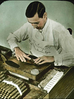
Photo, Tampa tobacco industry, 1920s, Florida Folklife Collection
Annotation

This extensive archive offers more than 10,300 photographs of Florida folklife from the 1930s through 2001. The archive can be browsed or searched by keyword. The site also makes available 17 interviews with folklorists and folk artists and 24 recordings of performances by Florida blues, gospel, shape-note, and folk singers. Additionally there are also 10 "voices of Florida" collections that include recordings of performances by or interviews with folk musicians, crafters, storytellers, and folklife interpreters on subjects such as children's lore, religious traditions, Seminole culture, maritime traditions, ethnic folk culture, material culture, and occupational lore. There are also 29 brief profiles of prominent Florida folklorists.

For teachers, the site offers five educational units that offer a history section with an interview, documents and audio, photographs, and lesson plans. Unit subjects include Zora Neale Hurston's 1939 recording expedition to the turpentine camps in Cross City, the history and practices of the net-making trade, the tradition of white oak basket making, and Seminole doll making. The visitor can also search the full catalog of photos and audio recordings (46,000 photographs and 5,000 audio recordings). Also available are five film clips from early Florida Folk Festivals and the Florida Folk Arts Conference. And the website provides 30 links to related websites on folklife programs and collections.
The Lives and Writings of Antebellum Students at UNC

Image
Letter, John and Ebenezer Pettigrew. . . , May 4, 1795, page 1, True and. . .
Annotation

This site offers 121 edited documents written by students at the University of North Carolina between 1795 and 1868. Documents include letters, speeches, diary excerpts, compositions, and poems. Annotated transcriptions and images of handwritten pages are provided. The collection can be explored through 15 essays divided into six chapters, each covering a different period with links to the associated primary documents. Essay titles include "Early Student Rebellions," "Slaves and Servants," "Writing in the Academy," and "The Debating Societies."

The collection can also be browsed in its entirety or by name, topic, events, organizations, places, publications, genres, or authors. The collection can be searched by keyword or advanced search. Four introductory essays offer an overview of the collection as well as short essays on the value of documentary histories and possibilities for future research. Links to 20 published sources are provided as well as a bibliography of source materials. See also Documenting the American South.

Thar's Gold in Them Thar Hills: Gold and Gold Mining in Georgia, 1830s-1940s

Image
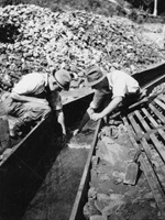
Photo, Two men searching for gold in a sluice flume, Thar's Gold in. . . site
Annotation

This website examines gold mining in Georgia's Lumpkin County from the late 1830s through the early 1940s with 90 primary sources, including letters, memoranda, photographs, picture postcards, and selected legal, financial, and promotional documents, including company prospectuses. The main concentration is the period between Reconstruction and the turn of the 20th century. Subjects include account collection, companies, leases, machinery, mineral rights, operations and techniques, and ore handling. An essay on Georgia gold mining history with links to primary documents discusses the Georgia Gold Rush, the "Great Intrusion" and Cherokee Removal, the U.S. branch mint in Dahlonega, gold mining in Georgia during the second half of the 19th century, the Second Georgia Gold Rush, 20th-century gold mining activity, and gold tourism. "Players and Places" provides brief descriptions of the people and places involved. "Suggested Readings" lists 38 related books, articles, and web essays as well as 14 mining company prospectuses and reports available at various archives and libraries. There is also a list of related archival collections.

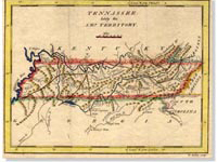
Tennessee Documentary History Collection, 1796-1850

Image
Map, Introductory graphic, 1796-1850, Tennessee Documentary History. . . site
Annotation

This archive assembles more than 1,600 primary sources, including letters, family papers, reports, and images, relating to the history of antebellum Tennessee. Visitors can browse the archive by collection or author, or they can use the simple keyword search or a variety of advanced searches to locate specific documents. Included in the collections are 142 letters, reports, and other documents, including the correspondence of Cherokee chiefs and officials such as John Ross. The archive also includes letters of such antebellum Tennessee figures as Sam Houston, James K. Polk, John Sevier, and Andrew Jackson, as well as letters to and from 12 antebellum Tennessee governors. The archive offers 79 images, many of various aspects of Cherokee village life in the mid-18th century. Though primarily focused on an audience of K-12 teachers of Tennessee history, academic historians and researchers in antebellum political and social history will also find this material useful.

Panoramic Maps, 1847-1929

Image
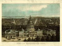
Image, View of Washington City, E. Sachse & Co., 1871
Annotation

This site presents more than 1,000 original panoramic maps, "a popular cartographic form" during the late 19th and early 20th centuries. The maps, often prepared for civic organizations, such as chambers of commerce and real estate agents, to promote an area's commercial potential, cover the contiguous 48 states and four Canadian provinces of British Columbia, Nova Scotia, Ontario, and Quebec between 1847 and 1929. While most of these maps were not drawn to scale, viewers can zoom in to find artists' renderings of individual streets, buildings, and landscape features. The site also includes a 1,200-word history of panoramic mapping; a bibliography comprised of 24 titles; and background essays (1,000 words) and images relating to five prominent panoramic artists: Albert Ruger (1829-1899), Thadeus Mortimer Fowler (1842-1922), Oakley H. Bailey (1843-1947), Lucien R. Burleigh (1853-1923), and Henry Wellge (1850-1917). This site is an excellent resource for those studying urbanization, cities, business growth, and the art of mapmaking.

Alabama Maps

Image
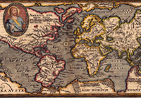
Image, "Typus Orbis Terrarum" Matthais Quad,1596
Annotation

This site contains more than 3,500 scanned and digitized maps divided into two indexes—historical and contemporary. The historical maps index contains several sections. The most voluminous section, "Alabama," is divided into time periods, geological features, Alabama counties, rivers, and state highways. Another section indexes 13 other southeastern states, including Texas, the Carolinas, and Florida. There are also maps of the Western Hemisphere, North America, Mexico, and the Caribbean, some dating before 1700.

An especially valuable feature of the historical index is the "Special Topics" which contains maps of the Civil War, including the battles in Gettysburg and Antietam, railroad routes, and ten Native American maps, mostly illustrating the boundaries of Cherokee territories. The contemporary map index is divided into eighteen themes, including education, housing, politics, federal expenditures, climate, and recreation. There are more than 100 world maps of Africa, Asia, Europe, the Middle East, and the South Pacific. Users will also find links to the University of Alabama's Department of Geography and the publications of the Cartographic Laboratory. Created for educators and the business community, this is valuable resource for those researching the history of Alabama or contemporary themes in Alabama, the United States, and the world.

First Century of the First State University: The Creation of UNC

Image
Image, Original Seal of the University of North Carolina, 1893-94
Annotation

The University of North Carolina at Chapel Hill opened its doors to students in 1789, becoming the first public university in the U.S. Part of the larger Documenting the American South website, this collection illuminates the first century of UNC's operation. Close to 500 primary source documents—letters, speeches, architectural drawings, account ledgers, meeting minutes, sermons, and General Assembly acts—are available, including previously unpublished materials. Topics include: Buildings, Campus, Creation and Governance, Curriculum, Faculty, Student Life, Town and Gown, The University During the Civil War and Reconstruction, and The University in the Life of the State. These broad topics, in turn, shed light on smaller dramas within the history of the university, such as the 1856 dismissal of a professor for expressing anti-slavery views to students. Contextual essays and an extensive timeline accompany these materials, rendering them accessible to specialists and generalists alike interested in the histories of the Civil War, North Carolina, and higher education in the United States.

Center for Archaeological Studies

Image
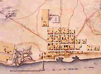
Image for Center for Archaeological Studies
Annotation

Designed to showcase the work of archaeologists and their excavations at Mobile and elsewhere in Alabama, this website offers images and exhibits from several digs. Visitors can "virtually visit" archaeological sites in the town of Old Mobile, capital of the French colony of Louisiane [sic] from 1702 to 1711; the Mississippian Indian city of Bottle Creek (1100–1400); and the Indian fishing site of Dauphin Island Shell Mounds (1100–1550).

Additional sites include the French village of Port Dauphin (1702–1725); the Dog River Plantation site, home to a French-Canadian immigrant family, numerous Indians, and slaves (1720s–1848); and sites in downtown Mobile, including a Spanish colonial house (ca. 1800), an early 19th-century riverfront tavern, and antebellum cotton warehouses.

Artifacts features more than 250 images of pottery shards with accompanying descriptions. Great Links presents 30 additional websites that focus on preservation, archaeology, and Alabama history. The site also includes images and information on seven additional French colonial sites in Nova Scotia, New York, Michigan, Illinois, Mississippi, and Louisiana.

Henry Hill: First Manassas (Bull Run)

Description

This walking tour covers the July 21, 1861 Battle of First Manassas, the first notable battle of the war. It focuses on "the intense fighting on Henry Hill where the tide of the battle turned from Union success to a decisive Confederate victory. The fighting on the hill was marked by charges and counter charges, often ending in hand-to-hand fighting. One of the Confederate leaders on Henry Hill was Gen. Thomas J. Jackson, who would become 'Stonewall' that day."

Scroll down on the "Podcasts" page to "Henry Hill: First Manassas (Bull Run)" to find the tour.

Virginia Military Institute

Description

This 5-stop audio tour looks at the role of the Virginia Military Institute, founded in 1839, in the Civil War—many of the cadets trained here would go on to fight in the war. The tour can be listened to for useful information, even without visiting the Institute.

Scroll down on the "Podcasts" page to "Virginia Military Institute" to find the tour.