Integrating History and Maps

Video Overview
Terri Ruyter and Michele Yokell discuss their experiences with the Becoming Historians TAH Grant project, in which they sought creative ways to help urban New York City students understand the natural landscape traversed by colonists and pioneers.
Video Clip Name
LL_Terri1.mov
LL_Terri3.mov
LL_Terri2.mov
LL_Terri4.mov
Video Clip Title
Mapping Western Expansion
Integrating History and Maps
Mapping Colonial New York
Learning Outside the Classroom
Video Clip Duration
3:45
3:37
1:54
1:46
Transcript Text

We work with a Teaching American History Grant called Becoming Historians. It's working with elementary school kids, and one of the units of study in the New York City curriculum for 5th grade is this idea of westward expansion, and we came up with this—we realized that we had a bit of a stumbling block because when you're talking westward expansion, it's a pretty traditional model and teachers are doing Oregon Trail. And our kids who live in New York City have no conceptual knowledge of what a plain is or a mountain or a mountain pass. They have very little understanding, even, of what happens upriver. So while we were getting ready to do this work around westward expansion and what's out there, we wanted to help the kids make pictures in their minds to really have good empathy and historical imagination of what's going on. We realized we needed to do some foundational work on mapping.

. . . when you're talking westward expansion, it's a pretty traditional model and teachers are doing Oregon Trail. And our kids who live in New York City have no conceptual knowledge of what a plain is or a mountain or a mountain pass.

So I contacted an elementary-school/middle-school teacher at Bank Street College of Education, Sam Brian, who's done a lot of work on geography teaching and young children. And he does this terrain model map and it's a generic model with mountains and valleys and you flood it and you can see how islands are formed from mountains that are connected to the land, but then they become submerged. So the kids can see all this stuff actually happening.

So they're getting that kind of general vocabulary, but then they're also getting specific vocabulary about mountains and peaks and passes and ranges and river valleys and estuaries and all that other kind of language that our children need.

So we had Sam work with us on the terrain models, and then the idea is you go from the terrain model to a map that the children draw, a two-dimensional map the children draw, of the terrain model.

They look at maps of the actual physical world and they trace river routes and they figure out where the Continental Divide is, because you have rivers draining into one ocean or the other, and so there must be something high up in between that's causing the water to flow downhill. So: "Aha! Those must be mountains." So then you draw in the mountains and then you label all the places. So there's a lot of really rich background work that takes place.

And from that point we went into maps of the Oregon Trail, historic maps from 1843 that we found on the Library of Congress website. And so the kids are doing critical map reading because now they have the knowledge to say, “Oh, it's a pass. It's a butte. It's a bluff.” They're reading those labels on the map and it means something to them because they've seen pictures of it and a three-dimensional model of it. Because it's hard for us in the city to take our kids to places that represent these things.

They're reading those labels on the map and it means something to them because they've seen pictures of it and a three-dimensional model of it.

So then we looked at the Oregon Trail maps and talked about those maps and used the NARA forms to analyze the map: Who is the author? What was the purpose? What was happening at the time? And then we took diaries of peoples' westward journeys and traced those journeys along the maps so the kids could start making the connection between, "Oh, on June first, July second, we passed Independence Rock." And on, "We went through Devil's Gate." And all those places are labeled on the maps, so the kids are then tracing the progression of the individual who wrote the diary along the map and trying to get in their head what it's all about.

Rethinking the Oregon Trail

Terri: We had a plan for the content, but it was kind of vague. And then coming out of conversations with teachers and making observations in classrooms and figuring out what resources we could pull together, we—like, my original idea for westward expansion was not to do the Oregon Trail, it was to crack it open and do stuff about black pioneers and Exodusters and stuff, but all the teachers are doing this Oregon Trail thing. So I decided to, like, put my desires aside, and then focus on the Oregon Trail thing to think about: How can we make this a more rich experience? How can we enhance what they're already doing in the classroom, so that they're not, like, tossing the baby out with the bathwater? To start with something totally new, or just going to my workshop and learning about the Exodusters and then filing it away and continuing on with their Oregon Trail stuff.

I mean, that's what—the resources in their classroom are largely Oregon Trail, which is why it's taught. So we use that to retool it and then we brought in this idea of mapping and that came from talking with teachers about what their kids needed and me trying to think about what resources I knew were in the city and how could we make this more engaging, more interesting.

Preventing Learning Fragmentation

We're really working on mapping the curriculum to see how it spirals up, so that you're introducing this idea of a grid maybe in 3rd or 4th grade, and then in 5th grade you're starting to introduce the ideas of latitude and longitude. When you're looking at the Oregon Trail maps, the grid becomes not "A, B, C, 1, 2, 3," it's "degrees north and south" that the kids are actually using to orient themselves on the map.

So it's a way of, you know—they understand the idea of grid, and then they go into the more complicated thing of latitude and longitude. And then we're trying to think about—break it apart. What's on the maps, the historic maps that they're actually using, and then how do we scaffold that so that it aligns with the history curriculum and the geography curriculum so that the kids are not doing the geography unit and then it's, like, done with that, knock that one off the list, let's go to history now.

. . . the kids are not doing the geography unit and then it's, like, done with that, knock that one off the list, let's go to history now.

'Cause Sam's been doing this work since the early mid-90s, I think, and he says that that's the one thing that he's consistently struggling with teachers to get them to do is to make that transition between the work that you do with the terrain models and the imaginary land maps, and then taking it back into social studies and having the teachers actually use it and have the kids apply the information and the ideas that they've gotten from the first part of the work. And so that's really what we're trying to make a little bit more obvious and to make it more articulate.

Michele: To give the teachers the knowledge, the actual content knowledge, to reinforce that because it's not just their field. You know, you have to really study up on it and know what you're teaching and know it in depth so that you actually understand yourself what you're teaching the kids and not be afraid to go a little bit further. We know how to do this very well in the language arts, because that's what New York City has been really focusing on, and understandably. But now it's time to put that focus into history, into geography, and to integrate it.

Terri: The Wildlife Conservation Society has a very cool project happening using historic maps to determine what New York City, Manhattan in particular, looked like in 1609 when Henry Hudson sailed up for the first time.

So Sam came and did the same work with the 4th-grade teachers. Instead of focusing on interior landforms, they focused on coastal landforms. So they thought about peninsulas and coves and bays and the river systems, so that that's all very immediately transferred to New York City and New York State geography, and it leads the kids very nicely into 5th grade. And then they did—they looked at historic maps of early colonial New Amsterdam and New York.

Bringing History Home

Michele: Kids are working in partnerships, we put transparencies over the flat version and then we actually go over where the rivers were, where the bluffs were, where the canyons are, where the coast is, so that they get a three-dimensional view on this flat map of what it was like before the skyscrapers, and also where our school is, where their houses are in relation to this. And then we look at it next to Manhattan now. Like: what’s happening now, what happened then.

Terri: Right. And since you did it on transparency, you can take this—

Michele: Right.

Terri: And lay it on top, and you can see how the shape of Manhattan has changed over time. 'Cause you can see that all the hills that were down on the Lower East Side are flattened and the marshes are filled in and the coastline has changed and the rivers are paved over, and you can see all that stuff on the map.

Michele: Along with the mapping, the idea of taking them on trips that reinforce what they're learning two-dimensionally.

Terri:: There's a living museum along the Hudson River called Philipsburg Manor, and it interprets colonial New York history from an enslaved person's perspective. So we thought of, like, taking the train up along the Hudson. You get to see the width of the Hudson. You see the Palisades on the New Jersey side. You can see that there are hills on the New York side, so that there's stuff you can see to, like, "Oh, right. That's a river. And there's a really long bridge going over that river. A couple of them."

Michelle: And also even when we got there, there are, like, sort of culverts where you see that the—go underneath the sidewalks. I mean, you can actually tell that there was water under there, you know? And when you look at these huge expanses of land, except for Central Park, we don't really have huge expanses of land. So—

Terri: Right. And all our rivers are—all of the rivers that are on these British headquarter maps are all gone.

I think that when you do tie together these 3D models and you actually have them make their own maps and you have them take the trips and then tie in the history that goes with it, it gives a much better experience than just trying to read a standard text. . .

Michele: I think that when you do tie together these 3D models and you actually have them make their own maps and you have them take the trips and then tie in the history that goes with it, it gives a much better experience than just trying to read a standard text, which really is what people failed with. And because of this previous failure, I think teachers shied away. And now we're really giving alternatives to text, which are much better.
Nature Transformed: The Environment in American History

Image
Detail, Nature Transformed
Annotation

This collection of essays, commissioned from distinguished scholars, is designed to deepen content knowledge and offer fresh ideas for teaching. Essays begin with a thorough overview of the topic. “Guiding Discussion” offers suggestions on introducing the subject to students, and “Historians Debate” notes secondary sources with varied views on the topic. Notes and additional resources complete each essay. Essays include links to primary sources in the National Humanities Center’s Toolbox Library and are part of the larger TeacherServe project.

Visitors can browse 17 essays, divided into "Native Americans and the Land," "Wilderness and the American Identity," and "The Use of the Land." These focus on the changing ways in which North Americans have related to the natural world and its resources. Topics include, among others, “The Columbian Exchange,” “The Effects of Removal on American Indian Tribes,” “Cities and Suburbs,” and “Environmental Justice for All.”

Useful for teachers looking to expand their content knowledge beyond the information and viewpoints presented in textbooks, and to get a taste of historians' debate over the interpretation of history.

U.S. Fish and Wildlife Service

Article Body

As stated on the U.S Fish and Wildlife Service (FWS) website, the organization's "mission is to work with others to conserve, protect and enhance fish, wildlife and plants and their habitats for the continuing benefit of the American people."

While the menu for the FWS website is daunting, skip the "Kids, Educators, Parents" section, and try "History." The former is aimed toward the exploration of nature and the biological sciences, and would need modification for the history classroom.

For starters, under "History," educators can find four virtual exhibits, covering the National Conservation Training Center, Pelican Island, conservationists Olaus and Mardie Murie, and an FWS vessel, the Otter. The exhibits are small and largely text-based, although the exhibit on Pelican Island provides historical images. While specialized, the exhibits may prove of use for regional West Virginia history or information on conservation movement founders.

Additional resources include nine small historical images; period documents related to Rachel Carson, the U.S. Commission of Fisheries, and professional jargon; articles on topics ranging from fishery history to the limits of agroecology; law enforcement and FSW timelines; lists, including individual stations' centennial time capsule contents (what did employees feel best represented their station?); and oral history transcripts. Note that there are links to larger document databases, including FWS news releases dating as far back as 1914, under documents. This is easy to overlook, as other featured items are more prominent.

The Fallen Comrades list also provides insight into historical events. Listed deaths include the 1958 disappearance of the F.W.S. Grumman Goose N-720 and an employee, Lindgren, murdered by Italian hunters in 1922. Lindgren's death was used by journalistic factions to increase anti-immigration fervor.

Additional information of historical significance, particularly statistics, is tucked throughout the site. Try reading about climate change, wildfires, and wetlands trends.

If your students are animal lovers, consider having them select an endangered species, perhaps from their state. Each species' page includes federal documents related to their identification and recovery. These documents display how government interacts, not just with society, but with the country's fauna, a component of history which often goes unremarked.

Evolution of the Conservation Movement, 1850-1920

Image
Image for Evolution of the Conservation Movement, 1850-1920
Annotation

These published works, manuscripts, images, and motion picture footage address the formation of the movement to conserve and protect America's natural heritage. Materials include 62 books and pamphlets, 140 Federal statutes and Congressional resolutions, 34 additional legislative documents, and excerpts from the Congressional Globe and the Congressional Record. An additional 360 presidential proclamations, 170 prints and photographs, two historic manuscripts, and two motion pictures are available.

Materials include Alfred Bierstadt paintings, period travel literature, a photographic record of Yosemite, and Congressional acts regarding conservation and the establishment of national parks. An annotated chronology discusses events in the development of the conservation movement with links to pertinent documents and images.

National Park Service

Article Body

The National Park Service oversees a wealth of places and resources to visit and for hands-on and classroom instruction in American history.

For Teachers introduces educational materials focusing on history and culture available through the National Park Service.

Teaching with Historic Places offers lesson plans, classroom activities, and professional development opportunities to help educators bring places on the National Register of Historic Places into the classroom and to prepare for local field trips. Curriculum modules are based on national U.S. History Standards.

Teaching with Museum Collections is a guide to teaching history with material culture.

Teacher Resources for Archaeology show how to explore archaeology to bring the earliest history of North America alive.

Discover Our Shared Heritage lists America's historic places, alphabetically and state-by-state.

A Place for Kids and Teachers links to professional development opportunities for educators.

Traveling Trunks names hands-on artifacts and describes learning kits to borrow and/or purchase for classroom use.

History: The National Park Service

Image
Logo, NPS History and Culture website
Annotation

Historical aspects of many of the 384 areas under the National Park Service's stewardship are presented in this expansive site. A "Links to the Past" section contains more than 25 text and picture presentations on such diverse history-related topics as archeology, architecture, cultural groups and landscapes, historic buildings, and military history. Of particular interest to teachers, a section entitled "Teaching with Historic Places" features more than 60 lesson plans designed "to enliven the teaching of history, social studies, geography, civics, and other subjects" by incorporating National Register of Historic Places into educational explorations of historic subjects. Examples include an early rice plantation in South Carolina; the lives of turn-of-the-century immigrant cigar makers near Tampa, Florida; a contrast between the Indianapolis headquarters of African-American businesswoman Madam C. J. Walker and a small store in Kemmerer, Wyoming, that grew into the J. C. Penney Company, the first nationwide department store chain; the Civil War Andersonville prisoner of war camp; President John F. Kennedy's birthplace; the Liberty Bell; Finnish log cabins in Iowa; and the Massachusetts Bay Colony's Saugus Iron Works. Especially useful for teachers interested in connecting the study of history with historic sites.

Conservation and Environmental Maps

Image
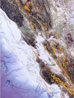
Map, Earthquakes and faults in the San Francisco Bay Area (1970-2003)
Annotation

A collection of historical and modern maps, this site features more than 150 maps showing early exploration and subsequent land use. The maps show a variety of information, including landscape changes over time, natural and man-made features, recreation and wilderness areas, geologic features, topography, wetlands, vegetation, and wildlife. A series of conservation maps focuses especially on the growth and development of national parks.

The maps have been categorized by purpose, and fit into one of seven categories: Conservation and Environment, Discovery and Exploration, Immigration and Settlement, Military Battles and Campaigns, Transportation and Communication, Cities and Towns, and General Maps.

U.S. Geological Survey

Article Body

The U.S. Geological Survey exists as a federal organization created to study the nation's flora, fauna, biology, geography, bodies of water, geology, and geospatial information.

The USGS provides access to their entire photographic collection, which is sub-divided into portraiture, photographers, "pioneer photographers," and images of earthquakes; mines, mills, and quarries; national parks; and Mt. St. Helens.

In addition, educators can access nine sub-sites and resources optimal for K-6 education, covering land use and exploration. Sample topics include "A Satellite View of the Journey of Lewis and Clark" and "Urban Growth in American Cities." Twelve resources, also addressing land use and exploration, are available for grades 7-12.

Available teacher packets, like the majority of the site, will primarily be of use to science educators. However, the three packets on maps could be used in conjunction with units on westward expansion or exploration.

National Oceanic and Atmospheric Administration

Article Body

The National Oceanic and Atmospheric Administration (NOAA) provides online exhibits, video clips, photographs, artifacts, interviews, and essays to provide a glimpse into maritime history, the history of science and technology, and its pivotal role in peace and war.

Hurricane History tracks the path of selected notable hurricanes since 1900; each description includes an interactive map.

NOAA administers the Monitor National Marine Sanctuary, preserving the wreck of the Civil War ironclad USS Monitor at Hampton Roads, VA.

Other historical resources are scattered around the NOAA site, retrievable through the search feature using the basic keyword, "history."

The Early Conservation Movement

Article Body
Conservation and Environmental Change

Textbooks celebrate the conservation movement as an unalloyed success: New forestry laws prevented widespread clear-cutting, erosion, and fires. Game preservation laws protected wildlife from overhunting. Reclamation laws reformed the haphazard use of scarce water resources in the American West, enabling agricultural expansion. Preservation laws protected areas of scenic beauty from privatization and tacky commercial development. Yet historians have depicted the conservation movement much more broadly—and have assessed its legacy more critically. Why?

What Textbooks Say

Most textbook discussions of conservation begin by describing how industrialization marred the environment and wasted natural resources. They then describe how President Theodore Roosevelt secured new laws that gave the federal government power to curb environmental abuses and manage natural resources.

. . . [T]he conservation movement was significantly more diverse, both geographically and politically, than textbook accounts suggest.

To illustrate a key tension-dividing conservationists, most textbooks describe the competing influence of two men who influenced Roosevelt’s thinking. John Muir, a famous writer and wilderness advocate, took Roosevelt camping in Yosemite in 1903, where they discussed the value of wilderness and the need for government protections. By contrast, Gifford Pinchot—one of Roosevelt’s trusted advisers and the first Chief of the U.S. Forest Service—advocated managing natural resources to conserve them for future generations. Roosevelt chose Pinchot’s hands-on “conservation” over Muir’s hands-off “preservation,” and vigorously built the government’s capacity to manage timber, wildlife, and water resources more sustainably. This approach to conservation’s history captures several important truths. First, it highlights how new legislation and policies gave federal agencies and administrators the power to curb destructive practices and to manage natural resources. Second, it highlights the powerful influence of individuals like Theodore Roosevelt, John Muir, and Gifford Pinchot, who helped shape national debates and priorities. Third, it describes some of the environmental issues that motivated the conservation agenda, particularly in the West and on public lands.

Conservation in Context

Yet the conservation movement was significantly more diverse, both geographically and politically, than textbook accounts suggest. First, conservation was deeply enmeshed within the larger Progressive movement of the time. Progressives favored dropping older laissez-faire practices in favor of a more active federal role in managing the economy. They also sought to limit some of the harsher effects of industrial capitalism. The impulse to protect natural resources from waste, destruction, and despoliation at the hands of unregulated economic enterprise reflected this much broader push to reign in the many abuses of unfettered industrialization. Second, conservation activity flourished in areas not directed by the federal government, tied to federal legislation, or led by national figures. Textbooks focus overwhelmingly on federal activities in the American West, for example, but the conservation movement was national in scope, drawing support and generating activity in other regions of the country. Conservationists in industrial cities—many of whom were women—launched vigorous campaigns to limit air pollution. They also championed improved “municipal housekeeping” through activities like sewer installation, street sweeping, regular garbage pickup, and better street lighting (see Primary Source Mildred Chadsey, "Municipal Housekeeping" [1915]).

Human Costs

In addition to being much broader in scope than textbook accounts portray, the conservation movement also placed unequal and sometimes severe burdens on certain groups. Conservation laws that criminalized some uses of natural resources, for example, imposed harsh limits on socially and economically marginal segments of the population. Cutting down trees on public land to build log cabins became “timber theft.” Burning forests to clear land for agriculture or underbrush to attract game became “arson.” Hunting game for meat, except under carefully regulated conditions, became “poaching.” Not surprisingly, poor rural Americans often objected to conservation laws for cutting off access to natural resources that had long been a central (and celebrated) component of frontier life (see Primary Source Theodore Basselin, Testimony, 1891). According to these critics, conservation laws seemed designed to take from poor rural folks in order to benefit wealthy urban sightseers and sport hunters.

. . . [T]he conservation movement also placed unequal and sometimes severe burdens on certain groups.

Officially protecting public lands also had harsh effects on Native Americans, particularly when the boundaries of new national forests, parks, and monuments placed their traditional hunting, fishing, and gathering territories off limits. In some cases, as in Yosemite and the Grand Canyon, the new boundaries encompassed established Indian towns and villages, and insensitive officials used conservation laws to restrict Indian mobility, to alter traditional subsistence practices like hunting, fishing, gathering, and burning forest undergrowth, and even to evict Indians entirely from their homes (see Primary Source Captain Jim, Letter to Commissioner of Indian Affairs [1915]). Dam and irrigation projects in the American West also came with a price. Justified as a way to transfer the public domain to individual farm families, it was land speculators and established landowners—not new settlers—who reaped the most significant rewards from federal reclamation projects. When settlers did come, looking for an “irrigated Eden,” they often found instead a bureaucratically managed “hydraulic society” that served the “haves” much better than the “have-nots” (see Primary Source Thomas Means, “Discussion of Irrigation” [1909]).

Unintended Environmental Consequences

In addition to their human costs, conservation practices also had unanticipated ecological consequences. The U.S. Forest Service, for example, applied scientific principles to manage forests in ways they hoped would improve their health and ensure a sustained maximum yield of wood products. Yet even seemingly well-founded practices sometimes produced ecologically destructive results. In the Blue Mountains of eastern Oregon and Washington, for example, fire-suppression policies designed to prevent the needless waste of lumber irrevocably altered ecosystem dynamics in unexpected ways, making the forests more susceptible to disease, insect infestations, and catastrophic fires.

In addition to their human costs, conservation practices also had unanticipated ecological consequences.

Scientific game management practices designed to protect animals from the fate suffered by once-vast flocks of passenger pigeons and herds of bison also ran into problems. Game managers who killed off predators to ensure robust animal populations for hunters, also encountered problems. In the Grand Canyon National Game Preserve, for example, predator control caused deer populations to skyrocket in the early 1920s. Large herds overbrowsed their range, caused ecological damage, and ultimately undermined their own subsistence, causing mass starvation and a population collapse (see Primary Source “Report on Kaibab Deer Problem” [1931]). Game managers also learned that park boundaries did not always line up with the seasonal grazing ranges of animals. When they erected fences to keep elk and bison inside parks, they created unexpected problems during harsh winters, when limiting animals’ mobility threatened their very survival.

Conservation’s Legacy

Lessons from the conservation movement continue to animate modern-day environmentalists. Conservation illustrated the power of strong federal laws to protect nature, but also highlighted the capabilities of grassroots organizations. In addition, the conservation movement’s human costs underlined the need for socially equitable environmental policies, while conservation’s unintended environmental consequences have inspired environmentalists to emphasize more ecologically informed practices.

Source 1 Title

Mildred Chadsey, “Municipal Housekeeping” (1915)

Source 1 Annotation

In this article, Mildred Chadsey outlined the principles of municipal housekeeping. In an increasingly modern, interdependent world, she wrote, American cities had begun to face the same sorts of “housekeeping” tasks that homemakers faced every day. In crowded, polluted, unsanitary industrial areas, how could citizens work together to making cities “clean, healthy, comfortable, and attractive”?

Source 2 Title

Theodore Basselin, Testimony (1891)

Source 1 Text

Excerpt from "Municipal Housekeeping":
Housekeeping is the art of making the home clean, healthy, comfortable and attractive. Municipal housekeeping is the science of making the city clean, healthy, comfortable and attractive. Many tasks of housekeeping that were formerly performed by the individual householder are now performed by city officials. So gradually has the city taken over tasks that were once performed by the individual householders, and so many other tasks have been put upon it as it has grown into the complex and intricate thing that it is, and living in it has become such a co-related and interdependent process, that it is now confronted in a very real sense by the same problem on a highly magnified scale that confronts the individual housekeeper in making the home a clean, healthy, comfortable and attractive place in which to live.

Under modern conditions the homemaker does right to buy the household necessities, the furniture, the food, the clothes from the factory because they are made more cheaply and better there than she can have them made at home. She would be a social and economic failure if she did not adjust herself to the new industrial order of the factory system. She has not less human kindness and sympathy because she allows her sick to be cared for in the hospital, nor has she less maternal love because she sends her children out of the home to be educated. She merely recognizes that she is living in an age of specialization, and because she wants the best care and the best training for those she loves, she entrusts them to the care of specialists. It is not that she has failed to make home attractive that the older children seek their pleasure outside the home. It is because of their growing sociability, the result of the community life which leads them into broader fields of human interest and human endeavor than those set by the confines of the home. Such a home implies not independence, but interdependence. It establishes new bonds of human relationship, coordinated endeavor and community interests. Therefore many of the tasks that the individual housekeeper performed for her household have been projected into the community, both for the advantage of mutual service and of collective bargaining. . . .

The first and most important function of any housekeeper is to keep the home clean. The disposal of waste, such as garbage, rubbish, sewage, the cleaning of its street, the prevention of smoke and other noxious substances in the air, are all important measures in keeping the city clean. Yearly new methods of sewage disposal and sewage treatment are being devised by one group of experts while the dangers which result from failure to properly dispose of waste matter are being studied by another group. New problems in keeping the city clean are constantly presenting themselves for solution. Not only does the city in its effort to keep itself clean, establish departments that perform these duties, but it passes laws requiring individual property owners to maintain their premises in a cleanly condition and it restrains individuals from uncleanly acts, such as dumping refuse on streets or on other people's property, committing nuisances or expectorating on streets, and it employs inspectors whose duties it is to enforce these laws. Some one has said that the same God that wrote the decalogues wrote the sanitary code. Surely an efficient enforcement of it is a God-like task, and one that is just about as difficult to perform as other God-like tasks are when performed by mere man.

Source 2 Annotation

In his testimony before the New York State legislature in 1891, Theodore B. Basselin—a wealthy lumber magnate who had been appointed to New York’s Forest Commission—described the difficulties that government officials encountered in trying to implement new forest-protection laws. Locals long accustomed to cutting timber from public lands did not take kindly to the Forest Commission’s efforts to “educate those people” that “the State had assumed a different line of policy, the protecting of the forest, instead of cutting it off.”

Source 2 Text

Excerpt from Theodore Basselin's testimony:
[W]e also found that the people around about the borders of this wilderness had been educated from time immemorial, that is, from the first settlement of the country, that what belonged to the State was public property, and that they had a right to go in there and cut as they wanted to; that their fathers and forefathers had been doing that, and that they had a birthright there that no one could question; our endeavor and our efforts were all placed toward trying to educate those people in a different line; the State had assumed a different line of policy, the protecting of the forest, instead of cutting it off; now, in regard to the small depredators along the borders of the wilderness, who had looked upon it as a birthright, it was necessary for us to proceed carefully, as no one knew better than I did what danger an enemy or a man who had a spite could cause to the State by fires….

Source 3 Title

Captain Jim, Letter to Commissioner of Indian Affairs (1915)

Primary Source Annotated Bibliography

Roosevelt, Theodore. “Utilizing Our Natural Resources: Address Delivered Before the National Editorial Association in Jamestown, Virginia, June 10, 1907.” In The Roosevelt Policy: Speeches, Letters and State Papers, Relating to Corporate Wealth and Closely Allied Topics, of Theodore Roosevelt, President of the United States, Volume 2, 546-560. New York: Current Literature Publishing Company, 1908. President Theodore Roosevelt’s speech before the National Editorial Association in 1907 declared that “the reckless waste and destruction of much of our natural wealth” was “the fundamental problem which underlies almost every other problem of our national life.” Without the foresight, careful planning, and scientific management embodied in his conservation policies, Roosevelt predicted that the nation would “undermine [the] material basis” for the nation’s institutions and economic growth.

Pinchot, Gifford. The Fight for Conservation. New York: Doubleday, Page, and Company, 1910. This insider’s account of the conservation movement, written by the first Chief of the U.S. Forest Service, who was also one of President Theodore Roosevelt’s trusted advisers, offers perhaps the most-used definition of conservation: “Conservation means the greatest good to the greatest number for the longest time.”

Muir, John. The Yosemite. New York: The Century Co., 1912. John Muir, another towering figure in the conservation movement, was a prolific and eloquent writer. His books and essays about wild nature—including this one on his ramblings through the Yosemite Valley—profoundly influenced American ideas about conservation in general and the importance of preserving wild areas in particular.

Crane, Caroline Bartlett. “Municipal Housekeeping.” Reprinted from Proceedings of Baltimore City-Wide Congress, March 8, 9, 10, 1911. In this 1911 speech, Caroline Bartlett Crane—a Unitarian minister, reformer, and journalist who was widely known as “America’s housekeeper”—makes the case for the importance of keeping urban environments safe and clean, proclaiming that “housekeeping is, in fact, an extremely important function of city government.”

Leopold, Aldo. “Thinking Like a Mountain.” In A Sand County Almanac. New York: Oxford University Press, 1949. In this classic essay, a leading conservationist and wildlife manager tells the story of a day when he killed a wolf in the name of conservation—only to realize that his actions might not serve his actual goals. “I was young then, and full of trigger-itch,” he wrote; “I thought that because fewer wolves meant more deer, that no wolves would mean hunters’ paradise. But after seeing the green fire [in the wolf’s eyes] die, I sensed that neither the wolf nor the mountain agreed with such a view.”

Source 1 Citation

Chadsey, Mildred. "Municipal Housekeeping," The Journal of Home Economics, 7 (Feb. 1915).

Source 3 Annotation

When Congress created the Grand Cañon Forest Reserve, its boundaries completely surrounded the Havasupai reservation and encompassed the tribe’s traditional hunting, gathering, and grazing territories. Suddenly, when Native Americans hunted deer on their traditional lands, they were committing the crime of “poaching.” As state efforts to enforce game protection laws increased, they prompted this letter from a tribe member to the Commissioner of Indian Affairs, demanding permission to hunt so that there would “be no trouble with the Game Wardens.”

Secondary Source Annotated Bibliography

Hays, Samuel P. Conservation and the Gospel of Efficiency: The Progressive Conservation Movement, 1890-1920. Pittsburgh: University of Pittsburgh Press, 1999. First published 1959. This classic history of the conservation movement, which continues to influence historians today, focuses on the rise of technocratic expertise and the ways that conservation policies and their emphasis on the efficient use of natural resources reflected new ideas about political power and political structure in the United States.

Stradling, David, ed. Conservation in the Progressive Era: Classic Texts. Seattle: University of Washington Press, 2004. This edited collection pairs an introductory essay with primary documents written by activists within the conservation movement. Emphasizing the diversity of the movement, the documents reflect the ways that race, class, gender, and geography shaped the issues and concerns that motivated conservationists during the Progressive Era.

Warren, Louis. The Hunter’s Game: Poachers and Conservationists in Twentieth-Century America. New Haven: Yale University Press, 1997. Mixing social and environmental history, Warren analyzes the role that wildlife conservation laws—together with ecological change—played in catalyzing conflict between conservationists and locals, including Native Americans and poor whites.

Jacoby, Karl. Crimes Against Nature: Squatters, Poachers, Thieves, and the Hidden History of Conservation. Berkeley: University of California Press, 2001. Jacoby argues that conservation laws regulating cutting timber, setting fires, hunting animals, and claiming unsettled land created a host of new “crimes against nature”: timber theft, arson, poaching, and squatting. He also demonstrates how these new regulations benefited affluent tourists and professional land managers by placing disproportionate burdens on already marginalized groups.

Spence, Mark David. Dispossessing the Wilderness: Indian Removal and the Making of the National Parks. New York: Oxford University Press, 1999. In case studies of three national parks—Yellowstone, Glacier, and Yosemite—Spence documents the ways that the push to “preserve” these areas for national enjoyment required the eviction of their long-term Native American residents.

Langston, Nancy. Forest Dreams, Forest Nightmares: The Paradox of Old Growth in the Inland West. Seattle: University of Washington Press, 1995. Langston examines the history of professional forestry practices in the Blue Mountains of eastern Washington and Oregon, unpacking the paradoxes of how scientific land-management practices went awry in the face of rapid and unexpected ecological changes.

Fiege, Mark. Irrigated Eden: The Making of an Agricultural Landscape in the American West. Seattle: University of Washington Press, 1999. Fiege’s case study of Idaho’s Snake River Valley focuses on the hopes, labors, and dreams of settlers as they laid out a vast irrigation system to create a new agricultural order, emphasizing the ways the unexpected ecological changes compromised and sometimes short-circuited the best-laid plans of the irrigators.

Worster, Donald. Rivers of Empire: Water, Aridity, and the Growth of the American West. New York: Pantheon, 1985. This classic environmental history offers a history of the American West written through the lens of its water-management practices, emphasizing their role in structuring the environment and society of the West.

Steinberg, Ted. Down to Earth: Nature’s Role in American History. New York: Oxford University Press, 2002. This influential textbook account of American environmental history includes a concise chapter on “Conservation Reconsidered.”

Source 2 Citation

Basselin, Theodore. Testimony, February 17, 1891, in “Testimony Taken by the Assembly Committee on Public Lands and Forestry Concerning the Administration of Laws in Relation to the Forest Preserve by the Forest Commission, Etc,” Documents of the Assembly of the State of New York, Volume 114, Issues 74-82, New York State Legislature (Albany, NY: James B. Lyon, 1891).

Source 3 Text

Excerpt from Captain Jim's letter of September 15, 1915:
A long time ago the Gods gave the deer to the Indian for himself. The women and children all like deer meat very much. The Indian men like buckskins to trade for grub, saddles, horses, saddles, blankets, and money. A long time ago . . . the Indians all go out on the plateau and hunt deer for two or three months and then all come back to Supai [village] to stay. . . . Now the Indians are all afraid about the hunting and never go far away. I want you to send me a hunting license and tell me good and straight that I may hunt deer. . . . The white man should now help the Indians by giving him permission to hunt deer as there be no trouble with the Game Wardens. . . . This is all.

Source 4 Title

Thomas Means, "Discussion of Irrigation" (1909)

Source 3 Citation

Captain Jim. Letter to Commissioner of Indian Affairs, September 25, 1915, File 115, Havasupai Agency, Central Classified Files, 1907-39, Records of the Bureau of Indian Affairs, RG 75, National Archives, as quoted in Karl Jacoby, Crimes Against Nature (Berkeley, CA: University of California Press, 2001).

Source 4 Annotation

Federal reclamation projects in the arid West promised to transform unwatered land into an agricultural Eden, but settlers often found the work, expense, and risks of life on the irrigated frontier much more demanding than they expected.

Source 5 Title

“Report on Kaibab Deer Problem” (1931)

Source 4 Text

Excerpt from "Discussion of Irrigation":
The man in the gloomy back office in Chicago, who reads of the sunshine and freedom of the West, where a man can wear overalls and a flannel shirt and yet be respected, often overlooks the fact that he will have to wield the business end of a pitchfork in the hot sun, instead of a pen beneath the cheerful buzz of an electric fan. He thinks of the cool shade of a grape arbor and has an idea that, by sitting on the back porch, he can pull a string which will lift a gate and irrigate the back lot. When he gets into the real practice of irrigation, and his ditch breaks down and drowns half his crop and the other half dries up before the ditch is fixed, and his whole year's work is gone; or when, in the middle of a hot afternoon, the blinding sweat is pouring over his face as he pitches a few more tons of hay on the wagon, he thinks of that Chicago office with the electric fan as one of the most attractive places, and it is no wonder he becomes a bit discouraged.

Source 5 Annotation

Conservation-inspired predator control programs in the Grand Canyon National Game Preserve caused deer populations to skyrocket in the early 1920s. Large herds overbrowsed their range, caused ecological damage, and ultimately undermined their own subsistence, causing mass starvation and a population collapse.

Source 5 Text

Excerpt from "Report on Kaibab Deer Problem":
The Kaibab Investigative Committee has traveled approximately six hundred and fifty miles in the actual field examination of the Kaibab area during a period of eight days. Travel was greatly facilitated because of the numerous motor trails traversing the Kaibab Forest. The party, however, rode horses from Swamp Point in making the Powell Plateau trip, which is within the Grand Canyon National Park. The committee has observed practically every forest type and condition within the Kaibab area. . . .

The territory had long been a famous hunting ground for Indians and the settlers came here for much of their wild meat supply. Campaigns for the destruction of predatory animals were extended. Several hundred cougars, thousands of coyotes, as well as many wildcats, and the few gray wolves of the region were destroyed. The deer, relieved of the destructive effect of their wild and human enemies, swiftly began to show a marked increase in number.

By 1920 the officers of the Forest Service in charge of the Kaibab became concerned at the progressive deterioration of the range. In 1924 a committee of men not connected with the Forest Service was appointed to study the range conditions of the territory and determine whether there were more deer on the Kaibab than the food supply would sustain. This investigating committee reported that not only were there too many deer in the territory to subsist on the available food, but that the range had been so largely depleted that it was in imminent danger of being totally destroyed over large areas. It, therefore, recommended the removal of at least one-half of the deer at once. Although their recommendations were not immediately carried out by the State and Federal authorities, some reductions have been made every year by these agencies. In addition there has been much loss to the herd due to starvation on the winter range. . . .

It is the conclusion of the committee, after carefully reviewing the general condition of the Kaibab range, and also observing the degree of recovery within the fenced experimental plots that the Kaibab area is not now producing more than 10% of the available and nutritious forage that this range once produced. . . .

The forage of the entire Kaibab area is yet in a deplorable condition and with the exception of the east side winter range, it is doubtful whether there has been any considerable range recovery due to the reduction of the deer herd. It is believed, however, by those who have studied Kaibab conditions over several years, that in places there is a slight suspension of range deterioration because of the reduction of the deer and domestic stock.

Source 4 Citation

Means, Thomas. “Discussion of Irrigation,” Transactions of the American Society of Civil Engineers, 62 (1909): 44, as quoted in Donald Worster, Rivers of Empire (New York: Oxford University Press, 1985).

Source 5 Citation

Kaibab Investigative Committee. “Report on Kaibab Deer Problem.” 1931.