Archival Research Catalog (ARC)

Image
Annotation

ARC offers more than 78,000 digital government resources. Materials include textual records, photographs, maps, architectural drawings, artifacts, sound recordings, and motion pictures dating from the colonial period to the recent past. ARC includes items on presidents, the military, war, immigration, Japanese-American internment, slavery, science, prisons, federal programs, the environment, the National Park Service, foreign affairs, civil rights, African Americans, and American Indians.

To begin a search, click on the yellow "search" button near the top left of the ARC webpage. The search engine is clearly organized and invites queries on specific historical materials or general themes. To access digitized materials only, check the box marked "Descriptions of Archival Materials linked to digital copies." The site continues to expand, though, as it stands, it provides an exceptional collection of government material.

American Studies Crossroads Project

Image
Logo, Crossroads Project
Annotation

This impressive site presents a rich array of primary and secondary material designed to foster electronic learning. The site's "Reference and Research" section furnishes an annotated, searchable gateway to hundreds of links dealing generally with American history and life, including SiteScene, a biweekly journal that reviews websites, texts of recent articles published in American Quarterly; abstracts of American Studies dissertations from 1986 to 1999, organized alphabetically by author; and links to image and document archives. Three additional sections—entitled "Community," "Curriculum," and "Technology and Learning"—offer a wealth of material concerning developments in the field of American Studies and teaching with new technologies, including essays, syllabi, bulletin boards, and newsletters.

The Great War Society

Image
Logo, The Great War Society
Annotation

The homepage for an organization that "encourages discussion, learning, scholarship and independent research on the events surrounding the First World War." Currently presents four exhibits: "The Doughboy Center: The American Expeditionary Forces"; "La Grande Guerra: The Italian Front, 1915-1918"; "France at War"; and "Legends and Traditions of the Great War." A fifth exhibit, "Russian Revolution and Civil War," is scheduled for summer 2002. The site furnishes information about the society's activities and events and contains issues from its journal, Relevance. Also includes a listing of more than 400 links to resources about the war. Although the site contains few primary materials, it should prove useful to those interested in military and social aspects of the war.

Campaign Atlases

Image
Image for Campaign Atlases
Annotation

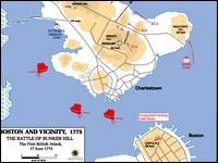
These 400 20th-century color maps of military campaigns cover a broad range of conflicts, from American colonial wars to U.S. involvement in Somalia in 1992—1993. Most of the maps represent conflicts in which the U.S. played a role, such as the "Battle of Bunker Hill" or the "Allied Landing in Normandy," although the collection also includes maps of the Napoleonic Wars, the Chinese Civil War, the Falkland Islands War, and Arab-Israeli conflicts.

Maps are indexed by war and may be enlarged, but are not annotated. The site is easy to navigate, although large maps may be slow to download. A bibliography lists eight atlases, published between 1959 and 1987, from which many of the maps were taken. The site is particularly useful for studying cartography and military history.

Indiana's Storyteller: Connecting People to the Past

Image
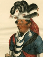
Image, Brewett, Chief of the Miami, James Otto Lewis, 1827, Indiana's. . . site
Annotation

The Indiana Historical Society's main digital archive site contains more than 34,000 images, most of which are directly related to Indiana's past, grouped into almost 30 themed collections that include photographs, prints, sheet music, manuscripts, old court documents, letters, Indiana ephemera, and maps. Also collected here are images from the Jack Smith Lincoln Graphics Collection (containing photographs, lithographs, and engravings of Abraham Lincoln) and the Daniel Weinberg Lincoln Conspirators Collection (containing newspaper clippings, manuscripts, and other material pertaining to the Lincoln assassination). A sampler of the other collections: digitized images of the Indianapolis Recorder; manuscripts and images of James Whitcomb Riley; a collection of 900 postcards of scenes from Indiana from the first two decades of the 20th century; and fascinating panoramic photographs from the early part of the 20th century, showing church groups, picnics, army recruits, and conventioneers.

Early Washington Maps: A Digital Collection

Image
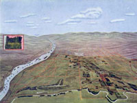
Map, "Hermiston Oregon," Umatilla Project Development League, 1910
Annotation

The nearly 1,000 maps available on this site document the conflict between Great Britain and America for ownership of the region. They also illustrate the transformation of the physical boundaries of the Pacific region and the efforts of its inhabitants to control the land. The site includes a valuable interactive timeline that presents the maps in historical perspective. The collection contains large-scale geographic maps of the land and sea and small hand-drawn sketches of settlements. The maps are very detailed and most were created in the late-19th- and early-20th-century. Maps are primarily concerned with geography, transportation, climate, population, culture, politics, and tourism and there is a searchable index that is organized according to 21 themes, such as forests, Puget Sound, railroads, Seattle, Washington State University, and Native American reservations.

A drop-down menu allows users to examine and enlarge thumbnail images of each map. Biographical and detailed descriptive text (most between 20 and 500 words) is presented with each image, and the text is searchable by keyword. Created as a resource to help students, teachers and researchers understand the history and development of the state of Washington, this site will appeal to those interested in Washington, historical geography, and the development of cartography.

New York, NY, Ellis Island: Immigration: 1900-1920

Image
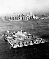
Photo, Ariel View of Ellis Island
Annotation

These 24 stereoscopic photographs of Ellis Island are produced for sale primarily to schools and libraries. Includes an "air" view of Ellis Island; boats unloading European immigrants; and American officials examining female immigrants. The photographs include captions, but no material accompanies them other than a 150-word introductory essay. The photographs are part of the Keystone-Mast Collection at the California Museum of Photography (UC Riverside), one of the world's largest holdings of historic stereographic negatives and prints. To access this collection, click on "Collections" and type "Ellis Island" into the search; or click here to access the archive directly.

Memories of the IWW by Elizabeth Gurley Flynn

Annotation

Transcription of 30-page address by Elizabeth Gurley Flynn in 1962 at Northern Illinois University discussing memories of the Industrial Workers of the World (IWW). Flynn talked about the Lawrence strike of 1912, Big Bill Haywood, Joe Hill, and the red scare of 1919. The words, music, and sheet music cover for Hill's song, "The Rebel Girl," are included in the transcription. The speech is illustrated with four photographs of Flynn, Haywood, and the Lawrence strike and followed by nine questions from the audience and Flynn's answers. Links throughout the text connect visitors to one to 15 pages of background information on names, events, and themes in Flynn's speech, but many do not work. A bibliography recommends four books and one movie about Flynn. The site will be interesting for anyone researching Flynn, labor or radicalism in the early 20th century, or the IWW.

Columbus and the Age of Discovery

Image
Logo, Columbus and the Age of Discovery
Annotation

Created to help mark the 500th anniversary of Columbus's 1492 voyage to America, this site is a "text-retrieval system," offering more than 1,110 scholarly and popular articles, drawn from journals, magazines, institutions, speeches, reviews, newspapers, student papers, and "other [secondary] sources relating to various encounter themes."

The search functions are cumbersome—the articles are both indexed by portions of the author's last name and arranged by underdeveloped category designations.

Tennessee Electronic Atlas

Image
Map graphic, Tennessee Electric Atlas
Annotation

This site provides information about the state of Tennessee and offers a gateway for learning more about the state. One of the main goals is to disseminate data through thematic maps and interactive mapping (which contains tutorial exercises that introduce the basic concepts involved in geographic information systems). For those interested in utilizing the full capabilities of the site, the Metro GIS service area of the site allows users to look at the main metropolitan regions in the state and to customize the themes (such as churches, golf courses, and hospitals) to their preferences. Included are data concerning agriculture, education, physical landscape, economics, and society. The site includes information from the 2000 national census, as well as state legislative districts. There is also detailed information about education in Tennessee. Visitors can check out the school system report cards to see results of standardized tests, both in raw numbers and in comparative terms versus other districts. Although the site contains no historical maps, the site allows visitors to compare some change over time, and visitors can use the site to compare the size and shape of the 106th and 108th Congressional districts.