From Slavery to Freedom: The African-American Pamphlet Collection, 1822-1909

Image
Address, Negro education not a failure, Booker T. Washington, 1904, LoC
Annotation

From Slavery to Freedom: The African-American Pamphlet Collection, 1822-1909 is precisely what it says, a collection of 396 pamphlets written by African Americans or by non-African Americans writing about slavery, Reconstruction, the colonization of Africa, and other pertinent topics.

According to the website, "[. . . t]he materials range from personal accounts and public orations to organizational reports and legislative speeches." Prominent authors include, but are certainly not limited to, Frederick Douglass and Booker T. Washington.

Material can be browsed by title, author, or subject; or you can run a key word search. If you need more material than what is available in the collection itself, there is a list of external resources with related content.

Roanoke Island Festival Park [NC]

Description

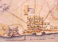
Roanoke Island Festival Park is a 27-acre state historic site and cultural center celebrating history, education, and the arts. Visitors can step aboard the Elizabeth II, a representative 16th-century sailing vessel; visit with Elizabethan explorers and soldiers in the Settlement Site; tour the Roanoke Adventure Museum, which explores 400 years of Outer Banks history; and view the docudrama, "The Legend of Two-Path."

The park offers exhibits, tours, demonstrations, performances, educational programs, research library access, and recreational and educational events (including living history events).

New World Encounters

Description

Donald L. Miller, with Stephen Ambrose; Virginia Scharff; Waldo E. Martin, Jr.; Pauline Maier; Louis P. Masur; and Douglas Brinkley, explores the pre-Contact and contact history of the Americas, beginning with the Ice Age migrations, through the corn civilizations of Middle America, to the explorations of Columbus, de Soto, and other Spaniards.

Fort King George Historic Site [GA]

Description

Fort King George is the oldest English fort remaining on Georgia's coast. The fort was in operation from 1721 until 1736, when it was abandoned. Later, in the 19th century, the location was used as a major export center for lumber. Today, visitors can explore the reconstructed Fort King George, as well as three sawmills and tabby ruins which showcase the history of the location as a lumber exporter. The site is also home to a museum.

The fort offers visitors guided tours, interpretive events, a brief historical film, and a variety of exhibits and special events. The website offers a link to the Georgia Teacher's Resource for Touring Historic Sites, specific lesson plans for touring Fort King George, a brief history of the fort, a 15-photo photograph gallery, an event calendar, and visitor information.

France in America

Image
Image for France in America
Annotation

This bilingual website (English and French) explores the history of the French presence in North America from the early 16th century to the end of the 19th century through more than 360 manuscripts, books, maps, and other documents. Each thematic presentation—"Exploration and Knowledge," "The Colonies," "Franco-Indian Alliances," "Imperial Struggles," and "The French and North America after the Treaty of Paris"—includes a title exhibit and additional exhibits that highlight particular items in the collection. Materials can also be browsed in the collections section.

A timeline (1515–1804) organizes events in French America by explorations, colonization and development, and conflicts and diplomacy, and places them in the context of events in France. Additionally, there are eight descriptive maps that show various Indian groups in contact with the French and the changes in political boundaries in North America from before 1763 to the era of the Louisiana Purchase.

Center for Archaeological Studies

Image
Image for Center for Archaeological Studies
Annotation

Designed to showcase the work of archaeologists and their excavations at Mobile and elsewhere in Alabama, this website offers images and exhibits from several digs. Visitors can "virtually visit" archaeological sites in the town of Old Mobile, capital of the French colony of Louisiane [sic] from 1702 to 1711; the Mississippian Indian city of Bottle Creek (1100–1400); and the Indian fishing site of Dauphin Island Shell Mounds (1100–1550).

Additional sites include the French village of Port Dauphin (1702–1725); the Dog River Plantation site, home to a French-Canadian immigrant family, numerous Indians, and slaves (1720s–1848); and sites in downtown Mobile, including a Spanish colonial house (ca. 1800), an early 19th-century riverfront tavern, and antebellum cotton warehouses.

Artifacts features more than 250 images of pottery shards with accompanying descriptions. Great Links presents 30 additional websites that focus on preservation, archaeology, and Alabama history. The site also includes images and information on seven additional French colonial sites in Nova Scotia, New York, Michigan, Illinois, Mississippi, and Louisiana.

Cultural Readings: Colonization and Print in the Americas

Image
Image for Cultural Readings: Colonization and Print in the Americas
Annotation

Texts about the Americas produced in Europe from the 15th through the 19th centuries are examined in this well-organized online exhibit. Over 100 images of printed texts, drawings, artwork, and maps from published and unpublished sources are arranged into six thematic categories. Categories are named: "Promotion and Possession," "Viewers and the Viewed," "Print and Native Cultures," "Religion and Print," "New World Lands in Print," and "Colonial Fictions, Colonial Histories."

Five scholarly essays (5,000 to 7,000 words each) contextualize the documents. A bibliography and list of links accompany the presentation. A visually attractive, thoughtfully arranged site that explores connections between colonization and representation.

Archive of Early American Images

Image
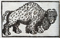
Buffalo, Archive of Early American Images
Annotation

The images in this collection, focusing on the Americas, come from books printed or created in Europe between about 1492 and 1825. Images include woodcuts, copper engravings, and paintings. The database, still being compiled, currently contains 6,685 images and will eventually contain some 7,500 images. Image viewing software is available from the site.

The visitor can browse the entire archive or search by time period, geographical area, keyword, or subject, including indigenous peoples, flora and fauna, artifacts, industry, human activities, geography, maps, city views and plans, and portraits. Some images, such as Ptolemy's map of the world, may be familiar. Others are reproduced for the first time. Navigation requires some practice, but is worth the effort.

English Settlement

Description

Two dramatically different English settlements, New England in the North and Virginia in the South, develop in the 17th century, beginning a collision of values, cultures, and economies that prevails throughout U.S. history. This presentation explores the founding of these settlements and their development.

To view this video, click the small "VoD" graphic in the left hand column. In the new window, if you cannot see the play button, try clicking near the left corner just under the video.