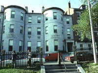
Sanborn Fire Insurance Maps of South Carolina
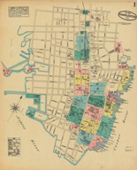
Image
Map, Charleston, May 1884
Annotation

The 580 maps of more than 80 South Carolina towns and cities in this archive reveal urban landscapes and the locations of businesses, mills, colleges, depots, and other buildings between 1884 and 1923. The collection includes 232 unpublished, hand-drafted maps from the years 1899 to 1937. All maps are displayed with original color coding. Users can zoom in and out of maps and can pan right, left, up, or down to examine details. Every map is accompanied by bibliographic data. The full collection can be browsed or the user can choose to browse just the unpublished maps. The collection can be searched by city, year of publication, and county. The maps provide many details about mills and are particularly useful in revealing spatial relationships and location of railroad lines. There is also a link to the Union List of Sanborn and other fire insurance maps. An extremely useful resource for those researching the business or urban history of South Carolina in the decades around 1900.

Hagley Digital Archives

Image
Logo, Hagley Digital Archives
Annotation

With a focus on business history and its connections to larger cultural, social, and political trends, the Hagley archive presents digital images on a range of topics, including "industrial processes; commercial landscapes; marketing and advertising; transportation facilities and methods; development of information technology; and, the social and cultural aspects of work and leisure." Pictured are bridges, dams, coalmines, and the testing and manufacturing of gunpowder and explosives, nylon, steel, railroads, automobiles, and airplanes. Also included are images of historic buildings, homes, and gardens in Delaware and Pennsylvania.

There are some images of advertisements, packaging, company brochures, trade catalogs, pamphlets, internal documents, letters, and other ephemera from various industrial enterprises. It includes, for example—under "nylon"—not only shots of machinery, product samples and images of the stages of melting and forming polymers, but also such treasures as ads and publicity shots of women modeling nylon stockings and swimsuits (including "Miss Chemistry" at the 1939 New York World's Fair), and news photos of the riotous early sales of nylon stockings.

Other topics include the early development and use of computers by Univac, IBM, and Remington Rand, aerial photos of the Mid-Atlantic seaboard; automobiles; Lukens Steel Company; ship building; and coal mining.

Classics in the History of Psychology

Image
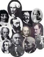
Photographs, influential people in the field of psychology
Annotation

This site contains a full-text archive of classic works (13 books and more than 65 articles and chapters) in the field of psychology sorted by topic and author, as well as links to over 120 other online documents related to the history of psychology. Some selections, including those from Freud, Watson, Koffka, Binet, and Terman, are introduced by original articles and commentaries, "written by some of the leading historians of psychology in North America." The site also offers primary source reading guides for history of psychology courses.

Map History/History of Cartography: The Gateway to the Subject

Image
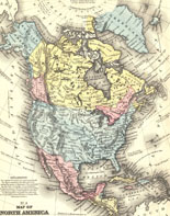
Map, North America, from <em>Mitchell's School Atlas</em>
Annotation

A comprehensive gateway to more than 3,000 links that provide historical maps and information about the history of cartography, with an emphasis on early maps. Searchable by an index with more than 400 alphabetically-arranged subject terms or by keyword. Includes sites offering listings for conferences, discussion lists, fellowships, map societies, journals, images of early maps, map collecting, web projects on early cartography, histories of maps, and articles on cartography. Now incorporated into the World Wide Web–Virtual Library and updated weekly. Extremely useful as a starting point for online cartographic resources.

Gardner's Photographic Sketch Book of the War

Image
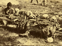
Photo, "Burial Party," John Reekie, Cold Harbor, VA, April, 1865
Annotation

This site presents the original photographic prints in Alexander Gardner's Photographic Sketch Book of the War. First published in 1865, the Sketch Book was Cornell University Library's seven-millionth acquisition, and they have presented in this site the very best of Gardner's wartime photographs. The book was created by Gardner to recount the history of the Civil War through images and they are displayed in this site with his original descriptive captions. Organized into seven compelling themes, many of the images capture the gruesome reality of war. They include President Lincoln, confederate prisoners, army quarters, soldiers collecting skeletal remains, and a photograph of a dead sharpshooter.

The first section, "The Blank Horror: War and its Victims," consist of seven images, some captured in the immediate aftermath of battle. "Devastated by the Armies: The Changed Landscape" reveals the impact of war on the American landscape, while "Faithful Servants: the Administration of War" shows the government officials behind the war, such as scouts attached to the Secret Service Department of the Army. The monotonous aspects of soldiers' lives are depicted in "The Very Life of Camp" and images within "Advantageous Auxiliaries: Warfare & Technology" focus on how new technologies, such as the telegraph, had an extraordinary impact on warfare during the Civil War. The final sections "To the Memory of the Patriots" and "Gettysburg" are exemplary of the important role Gardener believed he and his colleagues played in recounting the history of the Civil War. Although there is little attempt to interpret the images, those studying the Civil War will find these images striking.

Federal Township Plats of Illinois, 1804-1891

Image
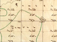
Plat, Virgil, 27-59
Annotation

Designed as both an archive and an online exhibit, this site features 3,457 hand-drawn township maps of Illinois. When the government began surveying in 1803 what would later become Illinois, they divided the land into squares six by six miles (36 square miles) called townships. This site includes a 1,000-word introductory history describing the surveying process and introducing the methods and tools of surveyors. Also included here are the maps, available to researchers and the public. A 1,000-word narrative outlines the role of the United States Surveyor General, and traces the custody of these records through the years.

Visitors use a map of Illinois to locate the region and county of the plat they wish to view, and can pan left and right or zoom in and out. A legend helps users decipher early 19th-century symbols. In addition, the site links to an Illinois state website (Illinois Public Domain Land Tract Sales), where researchers can search for the first owners of plats. This site is a great place to view original, early-19th-century maps of Illinois.

Cleveland Digital Library

Image
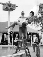
Photo, A man standing on a ladder holds a..., Cuyahoga County Fair, 1964
Annotation

Featuring primarily maps, texts, and images, this gateway site is designed to be a resource for those interested in the history of the greater Cleveland area. The site includes approximately 35 journal articles (from journals such as the Saturday Evening Post) on the history of Cleveland, its newspapers, its railroads and industries, and a few prominent citizens; 36 digitized books; seven manuscript collections (three merely describe the contents of the collection, while four offer digitized resources); an audio file and a video file; two cartoon collections; and nine photograph collections, containing about 600 photographs. Although many of the collections are located on outside websites, visitors can access the collections by subject, date, geographic location, or format.

For educators, the site includes 20 lesson plans, under such categories as American Heritage and Democratic Process. The classroom activities are well-conceived; they feature problem solving and critical thinking exercises like the Mystery Photo Album, in which students attempt to figure out where in the Cleveland area historical photographs were taken, and By the Neck Until Dead, an e-book that details the history of Cuyahoga County, OH, hangings. The site also maintains a list of local history websites.

Digital Archive of American Architecture

Image
Sears House, Boston, A. Parris, 1818
Annotation

Provides nearly 1,500 images of 280 architecturally significant American buildings from the colonial era to the present, compiled by Professor Jeffery Howe for classroom use. Images are arranged according to period, location, architect, building type, and style. The site offers examples of houses, churches, public buildings, commercial buildings, and skyscrapers. It includes images from three World's Fairs, as well as sections on urban planning and comparative materials. Professor Howe also has digitized images and text from two mid-19th century books on design and ornament. Although image annotations are minimal, in conjunction with other materials, the images in this site will be useful to those studying American architectural history and urban history.

Meeting of Frontiers

Image
Chromolithograph, "Attack on Port Money," 1904
Annotation

In conjunction with the Russian State Library in Moscow, the National Library of Russia in St. Petersburg, and the Rasmuson Library of the University of Alaska in Fairbanks, the Library of Congress has digitized more than 2,500 items, comprising approximately 70,000 images, and provided transcriptions and commentaries in English and Russian to offer a comparative history of American and Russian expansion through frontier territories in each nation's continent. The site presents an overview of expansion into Siberia and the American West in six sections: Exploration, Colonization, Development, Alaska, Frontiers and National Identity, and Mutual Perceptions. Each section contains from two to 11 modules that call attention to similarities and differences between the two histories with regard to subjects such as migration—forced and otherwise, missionaries, religious flight, mining, railroads, agriculture, cities, popular culture, and tourism, and even compares Cossacks with cowboys.

The site offers more than 40 complete books, including manuals, handbooks, fiction, and travelers accounts; 77 maps and one atlas; 438 items from the Russian-Ukrainian Pamphlet and Brochure Collection; materials from six complete manuscript collections, regarding exploration, trade, and commercial activities; four tour-of-the-century films; 125 newspaper articles; 11 dime novel covers; five photographic collections; and one sound recording of a Russian folk song. Provides a 500-title bibliography and links to 30 related sites. Valuable for those studying the American West and Russian history and investigating ways to explore frontiers of comparative histories in order to expand beyond limits of national history narratives. Listen to the audio review: .

Industrial Research and Development Information System

Image
Logo and website graphic (edited), National Science Foundation
Annotation

Provides data from more than 2,500 statistical tables on historical trends in expenditures on research and development (R&D) conducted in the U.S. from 1953-1998 by industrial firms, domestic and foreign-owned. Tables are accessed as downloaded Excel spreadsheets. Data for more recent years, presented under a new coding scheme, can be found in a linked site. Compiled by the National Science Foundation's Annual Survey of Industrial Research and Development. Statistics available include expenditures by industry, size of R&D programs, types of cost, comparison by states, comparison of R&D to net sales by industry, comparison by size of company, federal amounts of R&D, and cost of R&D per scientist and engineer. The site does not contain data for individually specified firms. Provides links to approximately 15 publications and sites on national patterns of R&D resources. Of great value to those studying business history, history of science, and government, in addition to policy makers.