Minnesota Maps Online
Image
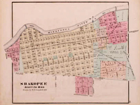
Map, 1874, Alfred Theodore Andreas, Minnesota Maps Online
Annotation

This site allows the visitor to search and view Minnesota's original public land survey plats created by the U.S. Surveyor General's Office during the years 1848 to 1907 and the later General Land Office and Bureau of Land Management maps of the state. The collection includes more than 3,500 original land survey maps; an 1873 map book of Hennepin County; late-19th-century plat books of Dakota, Hennepin, Ramsey, and Winona counties; and an 1871 illustrated historical atlas of Minnesota. Browse all the maps and plats or search the collection by county, township/range, or keyword. The advanced search feature allows the researcher to search the collection by title, subject, description, creator, publisher, date, source, or coverage. A useful resource for those researching the social, economic, environmental, or political history of Minnesota and its counties and towns.
Lawrence Denny Lindsley Photographs

Image
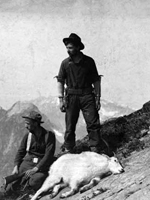
Photo, Victor Denny and Lawrence Lindsley. . . , 1901, Lawrence Denny. . . site
Annotation

This website presents 472 black and white photographs taken by Lawrence D. Lindsley, grandson of Seattle pioneer David Denny. Born in 1878, Lindsley began taking photographs as a child, and eventually joined a photography studio in Seattle in 1903. He continued taking photographs until his death in 1974, though most of the photographs here date from the 1880s through the 1920s. In addition to photography, Lindsley held a variety of jobs in Washington State—mining, hunting, and guiding wilderness expeditions—activities all well-documented here.

The collection is especially rich in photographs of the landscape, wildlife and settlements of Mount Rainier, Grand Coulee, Lake Chelan, the Olympic Peninsula, and Old Gold Creek. Lindsley also photographed sites around King County, revealing a Seattle that had not yet experienced the urbanization of the early-20th century. A long list of subject headings reveals that Lindsley also frequently photographed family members and friends, producing images useful for examining turn-of-the-century portraiture.

Panoramic Maps, 1847-1929

Image
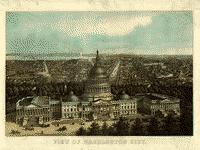
Image, View of Washington City, E. Sachse & Co., 1871
Annotation

This site presents more than 1,000 original panoramic maps, "a popular cartographic form" during the late 19th and early 20th centuries. The maps, often prepared for civic organizations, such as chambers of commerce and real estate agents, to promote an area's commercial potential, cover the contiguous 48 states and four Canadian provinces of British Columbia, Nova Scotia, Ontario, and Quebec between 1847 and 1929. While most of these maps were not drawn to scale, viewers can zoom in to find artists' renderings of individual streets, buildings, and landscape features. The site also includes a 1,200-word history of panoramic mapping; a bibliography comprised of 24 titles; and background essays (1,000 words) and images relating to five prominent panoramic artists: Albert Ruger (1829-1899), Thadeus Mortimer Fowler (1842-1922), Oakley H. Bailey (1843-1947), Lucien R. Burleigh (1853-1923), and Henry Wellge (1850-1917). This site is an excellent resource for those studying urbanization, cities, business growth, and the art of mapmaking.

California Gold: Northern California Folk Music from the Thirties

Image
Photo, John Stone playing fiddle, 1939
Annotation

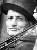
This site features 35 hours of folk and popular music sound recordings from several European, Slavic, Middle Eastern, and English- and Spanish-speaking communities. The Work Projects Administration California Folk Music Project collected these 817 songs, in 12 languages and representing 185 musicians, in Northern California between 1938 and 1940. The collection also includes 168 photographs of musicians, 45 scale drawings and sketches of instruments, and numerous written documents, including ethnographic field reports and notes, song transcriptions, published articles, and project correspondence.

Organized by folk music collector Sidney Robertson Cowell, sponsored by the University of California, Berkeley, and cosponsored by the Archive of the American Folk Song, this was one of the earliest ethnographic field projects to document folk and popular music of such diverse origin in one region. In addition to folk music of indigenous and immigrant groups, the collection includes popular songs from the Gold Rush and Barbary Coast eras, medicine show tunes, and ragtime numbers. In addition, short essays describe the California Folk Music Project and the ethnographic work of Sidney Robertson Cowell. This collection is an excellent resource for learning about ethnographic research practices as well as about cultures of various California ethnic groups.

History of the American West, 1860-1920

Image
Image for History of the American West, 1860-1920
Annotation

More than 30,000 photographs of Colorado towns, landscapes, mining scenes, and American Indian tribes, taken between 1860 and 1920, are featured on this website. Approximately 4,000 images deal with the mining industry, including labor strikes, while 3,500 photographs depict Indian communities from more than 40 tribes west of the Mississippi River.

Special presentations include a gallery of over 40 photographs depicting the dwellings, children, and daily lives of Native American women; more than 30 images of buildings, statues, and parks in Denver built in conformance with the turn-of-the-century "City Beautiful" movement; and 20 World War II-era photographs of the Tenth Mountain Division, ski troops from Colorado who fought in Italy. Each image in these special exhibits is accompanied by a brief description. There are also biographies of three Western photographers.

Nineteenth-century California Sheet Music

Image
Image for Nineteenth-Century California Sheet Music
Annotation

These scanned images come from more than 2,700 pieces of sheet music published between 1852 and 1900 in California. The website also includes more than 800 illustrated covers, 48 audio selections, eight video clips of singers, and a handful of programs, posters, playbills, periodicals, catalogs, broadsheets, books on music, and maps. More than 350 items contain advertising.

Explanatory essays of 1,000 to 2,000 words in length provide general information on music from more than a dozen ethnic cultures, and with reference to specific topics, including buildings, composers, dance, disasters, gender, mining, performers, politics, product ads, railroads, and sports. Provides 14 links to additional sheet music collections and reference sources. These resources are valuable to those studying popular culture, California history, music history, advertising, and depictions of ethnicity, gender, and race in 19th-century America.

First American West: The Ohio River Valley, 1750-1820

Image
Image for First American West: The Ohio River Valley, 1750-1820
Annotation

Significant European migration into the Ohio River Valley occurred from the mid-18th century to the early 19th century and this website presents approximately 15,000 pages of related materials. Resources include books, pamphlets, newspapers, periodicals, journals, letters, legal documents, images, maps, and ledgers. The site includes a special presentation with a 6,500-word essay on contested lands, peoples and migration, empires and politics, Western life and culture, and the construction of a Western past.

Materials address encounters between Europeans and native peoples, the lives of African American slaves, the role of institutions such as churches and schools, the position of women, the thoughts of naturalists and other scientists, and activities of the migrants, including travel, land acquisition, planting, navigation of rivers, and trade. These are valuable resources for studying early American history, cross-cultural encounters, frontier history, and the construction of the nation's past.

Making the Macintosh: Technology and Culture in Silicon Valley

Image
Image, Apple II Reference Manual, 1978, Making the Macintosh
Annotation

The history of the Macintosh computer is presented on this website. Rather than profile Apple Computer's leader, Steve Jobs, and well-publicized software and hardware developers, materials include 13 interviews with designers, technical writers, Apple employees, a Berkeley user group organizer, and a San Francisco journalist who covered early developments.

In addition, nearly 90 documents from the late 1970s to the present chart company and user group developments, beginning with roots in the 1960s counterculture philosophy. Documents include "From Satori to Silicon Valley," a lecture by Theodore Roszak first delivered in 1985 with afterthoughts added in 2000. There are 13 texts by the first Mac designer, Jef Raskin, press releases and other marketing materials, and texts relating to user groups.

More than 100 images include patent drawings and product photographs.

Los Alamos National Laboratory

Article Body

Los Alamos National Laboratory exists as a major development center for engineering and scientific national security features. To date, their major responsibility is developing and maintaining systems related to national nuclear determent.

Sadly for history teachers, although not particularly unexpectedly, the laboratory's offerings appropriate to K-12 education are nearly all focused on the sciences. That said, a couple of resources may still be of use to history educators, and teachers should feel welcome to pass on the site information to their science co-workers, particularly those within New Mexico, where the laboratory is located.

What history teachers should take a look at is a history of Los Alamos National Laboratory and national security. Sections include the "Road to Los Alamos," "People of Wartime Los Alamos," "Building the Atomic Bomb," "Postwar to H-Bomb," and "H-Bomb to Stewardship." Each section offers related materials, often primary sources, such as Einstein's letter to President Roosevelt, under "Related Reading." Also included are several image galleries, including one with pictures of the Trinity Test. On the history home page, teachers should also be aware that the "Some Staff" list to the right includes J. Robert Oppenheimer, scientific director of the Manhattan Project, and Stan Ulam, a mathematician and another major figure in the project.

Classes located near Los Alamos, NM, may also be interested in the Bradbury Science Museum, which presents the laboratory's history and current research.

Westward Trails

Description

This animated presentation from The Map as History traces the routes of westwards trails in the 19th century, including the Oregon Trail, Santa Fe Trail, Old Spanish Trail, and Mormon Trail.