David Rumsey Map Collection

Image
Image for David Rumsey Historical Map Collection
Annotation

This private collection presents more than 15,800 rare historical maps with a focus on North and South America. The collection is accessible via several formats. A standard browser (the "directory") is designed for use by the general public. In addition to two browsers and a "collections ticker" requiring Insight software (available for free download), a GIS browser shows detailed overlays of maps and geospatial data for the more serious researcher.

Many of the U.S. maps are from the late 19th and early 20th centuries and are often notable for their craftsmanship. Materials include atlases, globes, books, maritime charts, pocket and wall maps, and children's maps. Users can zoom in to view details. Overlay capabilities make this site valuable for its ability to convey how locations have changed over time.

Osher Map Library

Image
Image for Osher Map Library
Annotation

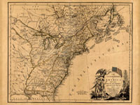
These 14 exhibitions include more than 600 maps and related documents on aspects of history revealed through the study of maps. The website provides well-integrated essays of up to 8,000 words for each exhibit and some annotated bibliographies.

Exhibits focusing on American history include "Mapping the Republic," on conflicting conceptualizations of the U.S. from 1790 to 1900; "Exodus and Exiles," on Diaspora experiences of Jews and African Americans; "The American Way," a collection of 20th-century road maps and guidebooks; "Carto-Maine-ia," on popular uses of maps; and "Maine Wilderness Transformed," that examines "the creation of a landscape of exploitation."

In addition, "The Cartographic Creation of New England," addresses European exploration and settlement, "The 'Percy Map,'" presents a significant Revolutionary War map; and "John Mitchell's Map" offers insight into diplomatic disputes. These maps are especially valuable for studying exploration and cartography in American history.

Lewis and Clark: Maps of Exploration 1507-1814

Image
Logo, Lewis & Clark, The Maps of Exploration
Annotation

This 1995 exhibition presents approximately 70 maps designed to help "understand [Thomas] Jefferson's views of the West and the nature of the quest to the Pacific," and to "show the evolution of cartographic knowledge of North America up to the time that [Meriwether] Lewis and [William] Clark set out."

Arranged into five sections, it treats the period from the arrival of Columbus in North America to Lewis and Clark's 1803 voyage.

Well-written background essays describe relevant monographs and journals, explain the role of technology in mapmaking, and elucidate the social and intellectual contexts of Western exploration.

The site, which offers both European and American perspectives, also furnishes eight related links and a 31-title bibliography.

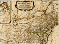
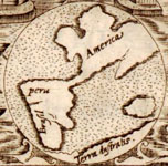
Particularly useful for understanding the evolution of geographic knowledge about North America and for tracing the history of cartography during this period.

Envisaging the West: Thomas Jefferson and the Roots of Lewis and Clark

Image
Image for Envisaging the West: Thomas Jefferson and the Roots of Lewis and Clark
Annotation

By the time Thomas Jefferson became the third President of the United States in 1801, interest in exploring the West had begun to shape U.S. policy. This chronological narrative traces Jefferson's life, participation in politics, and accumulation of scientific geographical knowledge from 1735 to 1804. There are four main sections: "The Jeffersons and Their Frontier Virginia Neighborhood," "From Colony to Commonwealth," "Science and Statecraft at Home and Abroad," and "Public Servant to the Early Republic."

This narrative is accompanied by an archive of 169 letters, statues, books, treaties, maps, and journals providing primary source insight into Jefferson's thoughts about the West and the Lewis and Clark expedition in particular. Three interactive maps from the 1700s, overlaid with historical data about cities, private dwellings, natural features, courthouses, and waterways, provide important insight into the geographic and social environment at the time.

Map Collections: 1500-2003

Image
Image, Historia general..., Antonio de Herrera y Tordesillas, c. 1601-1615, LoC.
Annotation

This large collection of maps from the 16th century to the present day focuses on Americana and cartographic treasures.

Materials are organized into seven thematic categories—Cities and Towns, Conservation and Environment, Discovery and Exploration, Cultural Landscapes, Military Battles and Campaigns, Transportation and Communication, and General Maps. Sections include five special presentations.

Users may download maps or zoom in to view details. Seventeen specific map collections contained within this larger site that are of particular importance for the study of American history include "Discovery and Exploration," "The American Revolution and Its Era," "Railroad Maps, 1828–1900," "American Colonization Society Collection: Maps of Liberia, 1830–1870," "Panoramic Maps, 1847–1929," "Civil War Maps," and "Mapping the National Parks."

Boone Station State Historic Site

Description

"Daniel Boone (1734-1820), known for his role in the exploring and settling of the Kentucky frontier decided that the settlement of Boonesborough had become far too crowded. In December 1779, Boone and his family established Boone’s Station. At its height, the community had 15 to 20 families, including the Boone, Barrow, Hays, Morgan, Muir, Scholl and, Stinson families.

Daniel Boone and his family endured many hardships while living at Boone's Station. Both his son Israel, and nephew Thomas Boone were killed at the Battle of Blue Licks in 1781. By 1781, Boone’s claim to Boone Station proved to be invalid. He and other members of the settlement continued to live there for a brief period. However, by 1791 Boone Station had ceased to exist. In 1795, Robert Frank purchased 500 acres that included the Station site.

Eventually Boone and his family moved to Missouri where the famous pioneer died in 1820. In 1845, the Governor, and General Assembly of Kentucky requested that the remains of Daniel Boone and his wife Rebecca Bryan Boone be reburied in Kentucky. They are buried in the State Cemetery in Frankfort, Kentucky."

Resources for Columbus Day

Date Published
Image
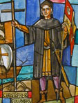
Design drawing for stained glass window of Christopher Columbus, LoC
Article Body

How do you prepare for Columbus Day (October 10)? Is it a day off for your students, just another school day, or a teachable moment? You may be tempted to leave the holiday alone in the classroom. It can bring up issues related to colonization and colonialism, global contact, the definition of heroism, and the purpose of holidays—and that's just scratching the surface.

But it also presents an opportunity to discuss and explore these issues, and to ask what we know about history. How do we know about Columbus's voyages? About the man himself? About the lands and peoples he encountered? What primary sources passed this information down to the present day, and who created them? What information and viewpoints are missing? How have views of Columbus and his voyage changed over time? What materials record those changing views? When was Columbus Day first celebrated as a holiday?

Detail, spotlight page

We've gathered all of our resources on Columbus, Columbus Day, and his voyages in one Columbus Day Spotlight page to help you and your students answer these questions and more. Take a look at Learning Resources for primary and secondary sources, Teaching Resources for strategies from other teachers, and Quizzes to test your knowledge!

(And remember, the 9/11 and Constitution Day spotlights are still available. We'll continue to add new resources to all of our spotlights throughout the year, so bookmark them and check back frequently. Keep your eye out for new spotlights on Veterans Day and Thanksgiving next month!)

American Journeys

Image
Image for American Journeys
Annotation

These 181 firsthand accounts of North American and Canadian exploration range from Viking stories such as The Saga of Eric the Red from circa 1,000 CE to journal entries written in the early 19th century on a trapping expedition in the Southwest. Documents include the Original Journals of the Lewis and Clark Expedition, 1804–1806. Materials include rare books, original manuscripts, and classic travel narratives.

Users can browse the full archive or by expedition, settlement, geographic region, and U.S. state or Canadian province. Each document is individually searchable and accompanied by a short background essay and a reference map. There are also 150 images available, including woodcuts, drawings, paintings, and photographs. Highlights follows the collection chronologically and connects moments in American history with eyewitness accounts.

Amy Trenkle's Columbus in the Capital

Date Published
Image
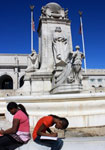
Students at DC Columbus memorial
Article Body
Columbus in Context

When I first started teaching a little more than 10 years ago, very few of my students knew why they were getting Columbus Day off. Now, I find a lot more know why they have the day off and have a pretty strong opinion as to whether or not it should be celebrated as a national holiday. I've enjoyed watching my students be able to express their opinions better and better throughout the years.

While my U.S. History state standards do not cover Columbus's voyages and exploration, I find it is a lesson worth teaching, and very timely with the holiday. As my students have grown in their knowledge and understanding of Columbus, I have had to change my lesson to contain more depth. One way I like to do that is by integrating a local monument into our discussion.

Preparing for the Site Visit

I start the lesson out by reading several chapters from Joy Hakim's A History of US, Book 1. The chapters talk about Columbus's character, his experiences, and effect on the "New World." While most of my students cite that Columbus shouldn't have a holiday because he didn't "find" anything new—that there were inhabitants living there already—they are unaware of the details of his encounters with Native Americans. They also do not know about the Columbian Exchange or Columbus's use of scientific knowledge to aid his survival.

After our reading, complete with guiding questions, I ask the students why we have memorials. Most say that it is to remember a person or an event. Here in DC, student examples range from the Washington Monument to the Lincoln Memorial to the Vietnam Wall. I tell them that we are going to go see a memorial to Christopher Columbus. I ask them what a 'symbol' is and work with the definition until there is an understanding among the students. We talk about how memorials and monuments convey their message through words and symbols. I tell the students that we are going to be looking at this memorial for symbols.

While the Columbus Memorial is only a few blocks from our school, and many of my students pass it twice a day, most do not know about it. Those that do, usually do because they had a sibling in my class in previous years.

After a quick reminder on memorial etiquette and general good behavior expectations, I have the students get their jackets, take a handout that I provide, and a pen or pencil. . . .and we're off!

On-site with Christopher Columbus

The five-block walk to Union Station is quick, and as we come up to it, I can hear many of my students say that they know this memorial, but they never knew what it was about or who it was to.

I tell the students they have between 10 and 15 minutes to look at the memorial and to answer the questions on their paper. They may work individually or in small groups. I remind them to look for symbols.

The question sheet is not difficult, but it does make them look at the memorial. The questions on the sheet are:

  1. What is your first impression of this monument?
  2. Have you seen this monument before? If you have, did you know that it was a monument to Christopher Columbus?
  3. What symbols do you see on this monument that give you clues to what Columbus did in his life? (List them here.)
  4. Are there any words on the monument? If so, what are they?
  5. Do you think anything is missing from this monument? If so, what? If not, what makes it complete?
  6. Does this monument portray Columbus in a positive or a negative way? How do you know?
  7. Do you think this is an appropriate monument? Why or why not? Give evidence (from our reading yesterday and from your own feelings) to support your answer.

I give them a few minutes to look and then I begin to circulate to see what they have come up with, what questions they have, and maybe to point out a symbol or two they may have missed.

What Do You See?

After 10 or 15 minutes, I call them back together at the front of the memorial and I ask them to share what symbols they have found. Some of them include:

  • lions (for the courage to sail into the unknown)
  • the Native American (on one side of Columbus, to represent the New World)
  • the European man (on the other side of Columbus, to represent the Old World)
  • the bow of the ship (for his means of travel)
  • the three flag poles behind the memorial (to represent the three ships he first sailed on)
  • the medallion of King Ferdinand and Queen Isabella on the back (in recognition of who he sailed for and who funded his expeditions)

The students really enjoy being able to share what they found. Some students believe that some of Columbus's crewmates should be added to the memorial because, my students say, he couldn't have done it alone. Some believe that goods from the Columbian Exchange should be integrated into the memorial. Others believe that chains, to represent the start of slavery in the New World, should be added.

Before we go, we always take a group photo.

Responding to the Experience

Upon return to the classroom (my double block is almost up by this time), I ask my students to now write one complete paragraph, taking a definitive stand (no wishy-washy yes and no answers) as to whether or not Columbus should be celebrated with a holiday. Students may not state the day off as a reason for celebrating it. If time permits, I like to have a volunteer for each side of the debate share his/her paragraph. If we have run out of time, then I start my next class with this activity.

It's a great way for my students to think about the holiday, memorials in their community, and to evaluate history. It also provides a great gateway for me to use other memorials and monuments in my teaching as the year continues.
For more information

Maybe you teach earlier grades, or your middle-school or high-school students haven't yet thought to analyze the mythology of Columbus. In her blog entry, 1st-grade teacher Jennifer Orr guides students in engaging with early exploration history.

New to the idea of teaching with monuments and memorials? U.S. history teacher James A. Percoco shows you how he approaches these public memories in this video.

Every picture or sculpture of Columbus looks different. Ever wondered why? No portraits of Columbus taken from life exist today. Take our quiz on images of Columbus, and consider why each artist chose to make Columbus look as they did.

France in America

Image
Image for France in America
Annotation

This bilingual website (English and French) explores the history of the French presence in North America from the early 16th century to the end of the 19th century through more than 360 manuscripts, books, maps, and other documents. Each thematic presentation—"Exploration and Knowledge," "The Colonies," "Franco-Indian Alliances," "Imperial Struggles," and "The French and North America after the Treaty of Paris"—includes a title exhibit and additional exhibits that highlight particular items in the collection. Materials can also be browsed in the collections section.

A timeline (1515–1804) organizes events in French America by explorations, colonization and development, and conflicts and diplomacy, and places them in the context of events in France. Additionally, there are eight descriptive maps that show various Indian groups in contact with the French and the changes in political boundaries in North America from before 1763 to the era of the Louisiana Purchase.