Madison: Celebrating 150 Years
Image
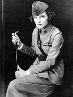
Photo, Irene Castle in Uniform, WWI or later, Madison: Celebrating 150 Years
Annotation

In 2006, Madison, WI, celebrated the 150th anniversary of its incorporation as a city. To mark the occasion, this website features 6,952 images, several articles and documents, maps and information on Madison's buildings, and links to virtual exhibits, entreating users to investigate Madison's past. This diverse collection of materials highlights both the experiences of the American Indian groups that had lived in the Madison area for many thousands of years, as well as those of the Yankee, English, Irish, German and Scandinavian settlers who began to arrive in 1837.

Visitors can view a map of American Indian village and mound sites, built for burial and ceremonial purposes, which are still visible around the city today. Also available are the recollections of George W. Stoner, one of the first settlers to arrive in Madison, through which one can learn about the construction of the city's first buildings and businesses, its first election, and its first suicide. Moving into the 20th century, visitors can also learn of the Federal Government's attempts to enforce Prohibition in Madison, which one official described as "queen of the bootleggers." This website is useful for those interested not only in Wisconsin history, but also in the history of urbanization in the United States more generally.
Panoramic Maps, 1847-1929

Image
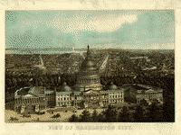
Image, View of Washington City, E. Sachse & Co., 1871
Annotation

This site presents more than 1,000 original panoramic maps, "a popular cartographic form" during the late 19th and early 20th centuries. The maps, often prepared for civic organizations, such as chambers of commerce and real estate agents, to promote an area's commercial potential, cover the contiguous 48 states and four Canadian provinces of British Columbia, Nova Scotia, Ontario, and Quebec between 1847 and 1929. While most of these maps were not drawn to scale, viewers can zoom in to find artists' renderings of individual streets, buildings, and landscape features. The site also includes a 1,200-word history of panoramic mapping; a bibliography comprised of 24 titles; and background essays (1,000 words) and images relating to five prominent panoramic artists: Albert Ruger (1829-1899), Thadeus Mortimer Fowler (1842-1922), Oakley H. Bailey (1843-1947), Lucien R. Burleigh (1853-1923), and Henry Wellge (1850-1917). This site is an excellent resource for those studying urbanization, cities, business growth, and the art of mapmaking.

New York Public Library Picture Collection Online

Image
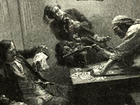
Engraving, "Capture of the Galleon," Howard Pyle, 1887
Annotation

This image resource site contains 30,000 digitized images from books and periodicals, as well as original photographs, prints, and postcards, mostly dated before 1923. There are cartoons and illustrations from the well known Harper's Weekly and Century Magazine, as well as images from the Library of Congress Prints and Photograph division. In addition many of the vibrant images of Native Americans were collected from the Department of War Indian Gallery. Covering more than 12,000 subjects, the site features images of Jamestown settlers, Pocahontas and John Smith, American presidents, 19th-century New York architecture, slave life, American and European women's costumes, streetcars and trains, and even insects and snakes.

Bibliographical information accompanies each image, and users may also save images of interest in their own "gallery" for viewing or purchase. Thumbnail sketches enlarge for full-page viewing. Searchable by keyword or by browsing a variety of indexes, the collection is a useful visual resource for teachers and researchers.

Alabama Maps

Image
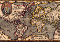
Image, "Typus Orbis Terrarum" Matthais Quad,1596
Annotation

This site contains more than 3,500 scanned and digitized maps divided into two indexes—historical and contemporary. The historical maps index contains several sections. The most voluminous section, "Alabama," is divided into time periods, geological features, Alabama counties, rivers, and state highways. Another section indexes 13 other southeastern states, including Texas, the Carolinas, and Florida. There are also maps of the Western Hemisphere, North America, Mexico, and the Caribbean, some dating before 1700.

An especially valuable feature of the historical index is the "Special Topics" which contains maps of the Civil War, including the battles in Gettysburg and Antietam, railroad routes, and ten Native American maps, mostly illustrating the boundaries of Cherokee territories. The contemporary map index is divided into eighteen themes, including education, housing, politics, federal expenditures, climate, and recreation. There are more than 100 world maps of Africa, Asia, Europe, the Middle East, and the South Pacific. Users will also find links to the University of Alabama's Department of Geography and the publications of the Cartographic Laboratory. Created for educators and the business community, this is valuable resource for those researching the history of Alabama or contemporary themes in Alabama, the United States, and the world.

First Century of the First State University: The Creation of UNC

Image
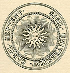
Image, Original Seal of the University of North Carolina, 1893-94
Annotation

The University of North Carolina at Chapel Hill opened its doors to students in 1789, becoming the first public university in the U.S. Part of the larger Documenting the American South website, this collection illuminates the first century of UNC's operation. Close to 500 primary source documents—letters, speeches, architectural drawings, account ledgers, meeting minutes, sermons, and General Assembly acts—are available, including previously unpublished materials. Topics include: Buildings, Campus, Creation and Governance, Curriculum, Faculty, Student Life, Town and Gown, The University During the Civil War and Reconstruction, and The University in the Life of the State. These broad topics, in turn, shed light on smaller dramas within the history of the university, such as the 1856 dismissal of a professor for expressing anti-slavery views to students. Contextual essays and an extensive timeline accompany these materials, rendering them accessible to specialists and generalists alike interested in the histories of the Civil War, North Carolina, and higher education in the United States.

Emergence of Advertising in America: 1850-1920

Image
Image for Emergence of Advertising in America: 1850-1920
Annotation

These 9,000 advertising items and publications date from 1850 to 1920. Selected items illustrate the rise of consumer culture in America and the development of a professionalized advertising industry.

Images are grouped into 11 categories: advertising ephemera (trade cards, calendars, almanacs, postcards); broadsides for placement on walls, fences, and buildings; advertising cookbooks from food companies and appliance manufacturers; early advertising agency publications created to promote the concepts and methods of the industry; promotional literature from the nation's oldest advertising agency, J. Walter Thompson; early Kodak print advertisements; Lever Brothers Lux (soap) advertisements; R.C. Maxwell advertising company images; outdoor advertising; scrapbooks; and tobacco ads.

Each category contains a brief overview, and each image is accompanied by production information. The site, searchable by keyword or ad content, includes a timeline on the history of advertising from the 1850s to 1920. This easy-to-use collection is ideal for researching consumer culture and marketing strategies.

History of the American West, 1860-1920

Image
Image for History of the American West, 1860-1920
Annotation

More than 30,000 photographs of Colorado towns, landscapes, mining scenes, and American Indian tribes, taken between 1860 and 1920, are featured on this website. Approximately 4,000 images deal with the mining industry, including labor strikes, while 3,500 photographs depict Indian communities from more than 40 tribes west of the Mississippi River.

Special presentations include a gallery of over 40 photographs depicting the dwellings, children, and daily lives of Native American women; more than 30 images of buildings, statues, and parks in Denver built in conformance with the turn-of-the-century "City Beautiful" movement; and 20 World War II-era photographs of the Tenth Mountain Division, ski troops from Colorado who fought in Italy. Each image in these special exhibits is accompanied by a brief description. There are also biographies of three Western photographers.

Dime Novels and Penny Dreadfuls

Image
Image for Dime Novels and Penny Dreadfuls
Annotation

More than 2,300 covers of American "dime novels," and their British counterparts, the "penny dreadfuls," are available on this website. In addition, the full text of nine books and a series entitled Secret Service (1899–1912) are available.

The site offers "guided tours" with images and essays of approximately 1,500 words on print processes and dime novel covers. The full-text selections include stories featuring such heroes as Nick Carter, Buffalo Bill, Jesse James, Deadwood Dick, Fred Fearnot, and Calamity Jane. A full-text search is available only for those affiliated with Stanford University.

The site provides basic information on each title and indexes books according to subject, genre, setting, intended audience age and gender, and type of graphic material. Subject indexing of cover iconography is especially valuable. Listings are organized according to depictions of ethnicity/nationality, occupation, types of places, types of sports and recreations, types of violence, and types of gestures and actions classified according to gender of character portrayed.

Alexander Graham Bell Family Papers

Image
Image for Alexander Graham Bell Family Papers
Annotation

The papers of telephone inventor Alexander Graham Bell (1847–1922), more than 4,600 items, are presented on this website. Materials include family papers, general correspondence, laboratory notebooks from 1891 to 1893 and 1910, scientific notebooks, blueprints, journals, articles, lectures, and photographs.

Writings address a range of subjects, including the telephone, deaf education, experiments with aeronautics, and other inventions. There are more than 100 letters to and from Helen Keller, family correspondence, and material on life in Washington, DC and Nova Scotia, where Bell had a summer home and conducted experiments. Ten "collection highlights," including notebook pages, document his first success with the telephone, essays on Bell's career and on the telephone, an annotated timeline, a 19-title bibliography, and a list of related sites.

Nineteenth-century California Sheet Music

Image
Image for Nineteenth-Century California Sheet Music
Annotation

These scanned images come from more than 2,700 pieces of sheet music published between 1852 and 1900 in California. The website also includes more than 800 illustrated covers, 48 audio selections, eight video clips of singers, and a handful of programs, posters, playbills, periodicals, catalogs, broadsheets, books on music, and maps. More than 350 items contain advertising.

Explanatory essays of 1,000 to 2,000 words in length provide general information on music from more than a dozen ethnic cultures, and with reference to specific topics, including buildings, composers, dance, disasters, gender, mining, performers, politics, product ads, railroads, and sports. Provides 14 links to additional sheet music collections and reference sources. These resources are valuable to those studying popular culture, California history, music history, advertising, and depictions of ethnicity, gender, and race in 19th-century America.