Western History Photography Collection
Image
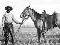
Photo, Black cowboy and horse, c. 1890-1920, Western History Collection
Annotation

This combined archive and exhibit contains more than 100,000 images, including photographs, broadsides, posters, maps, advertisements, and other documents. There is a keyword search but no feature for browsing the entire collection. Many of the images can be browsed, however, through nine "galleries," or thematic collections of selected images. "Scenic Rails of the West" is a large exhibit with seven image galleries that include towns, touring, railroads, native culture, and national parks. The "Photos West Classics" gallery is also large and includes the most frequently requested images. Topics include children, saloons, trails and covered wagons, famous Westerners, famous Native Americans, Wild West shows, and Western life. Other galleries include "Railroads," "Building Histories," and "Native American Women." All images are accompanied by a descriptive catalog record and are available for purchase. A learning page (accessed through "news") offers 18 lessons. This website is a valuable source of images on Western figures, culture, environment, politics, and economic development. Teachers of the American West will also find valuable instructional resources.
Encyclopedia of Chicago, Historical Sources

Image
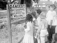
Photo, Children standing in front. . . , 1917, Encyclopedia of Chicago
Annotation

This archive brings together more than 1,300 images on a wide array of topics related to Chicago, its people, and its culture. The material in the collection spans both the 19th and 20th centuries and includes photographs, advertisements, broadsides, maps, letters, newspaper articles, illustrations, and engravings. The photographs include aerial views of the Chicago cityscape, Chicago places, Chicago industries and workers performing their trades, historic photographs, Chicago events, and photographs of Chicago's people. The more than 100 maps can be browsed separately. Each item is cross-referenced to related items in the collection and many of the images are accompanied by explanatory text. The images can be enlarged and there are features for rotation and magnification.

Additionally, the site offers interpretive essays on the Plan of Chicago of 1909, "one of the most noted documents in the history of city planning" and the importance of water in Chicago's history. Other special features are a biographical dictionary, a dictionary of leading Chicago businesses from 1820-2000, and a presentation on how Chicagoans remember their history with images and brief interpretations. In addition, the entire contents of Encyclopedia of Chicago can be searched. A useful resource on the history of Chicago or urban history.

Turning Points in Wisconsin History

Image
Photo, Arthur M. Vinje, April 4, 1947
Annotation

This website allows visitors to explore the history of Wisconsin through essays, primary source documents, lesson plans, and maps. The main feature is 53 presentations grouped under 10 overall topics: early native peoples; early explorers, traders, and settlers; territory to statehood; immigration and settlement; Civil War era; mining, lumber, and agriculture; Progressive Era; 20th-century wars and conflicts; prosperity, depression, industrialization, and urbanization; and response to 20th-century change. Each topic offers four or more presentations with a short introductory essay; primary sources available on the site; primary sources available elsewhere; and related links.

Documents available on the site include more than 140 books, tracts, pamphlets, or papers; more than 100 images; more than 260 articles; and more than 35 manuscripts. The site also offers 95 reference maps. There are more than 45 elementary and 36 secondary lesson plans searchable by keyword, grade level, and/or topic. The advanced search allows visitors to search by fields such as agriculture, intellectual life, and politics; or by keyword, education level, topic, presentation, or type of document. Additionally, there is a tutorial on using primary documents. This website is a good starting point for teaching or researching Wisconsin or the mid-Western region.

Walt Whitman Archive

Image
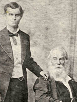
Photo, Walt Whitman with Harry Stafford, Morand, c. 1878, Walt. .  site
Annotation

This site presents the work of one of America's most influential poets, bringing together the various editions of Whitman's major work, Leaves of Grass, as well as Whitman's notebooks, poetry manuscripts, prose essays, letters, and journal articles. It also makes available the introductions to each edition of Leaves of Grass, an extended biography of Whitman with links to short essays about Whitman's friends and historical events, and a chronology of Whitman's life from 1819 to 1892. All known contemporary reviews of the poet's work are available as well.

An image gallery contains 129 photos of Whitman from the 1840s through the 1890s. The site's searchable bibliography offers more than 200 books, essays, notes, and reviews about Whitman. Additionally, links are provided to Whitman's recently recovered notebooks from the 1850s and 1860s housed at the Library of Congress. A 36-second wax cylinder recording provides what is thought to be Whitman's voice reading four lines from the poem "America." A guide to Whitman's poetry manuscripts and a finding aid for Whitman manuscripts at individual repositories are also included. A teaching syllabus on Dickinson, Whitman, and American culture is available. An excellent resource for any scholar interested in Walt Whitman or his poetry.

Thar's Gold in Them Thar Hills: Gold and Gold Mining in Georgia, 1830s-1940s

Image
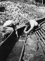
Photo, Two men searching for gold in a sluice flume, Thar's Gold in. . . site
Annotation

This website examines gold mining in Georgia's Lumpkin County from the late 1830s through the early 1940s with 90 primary sources, including letters, memoranda, photographs, picture postcards, and selected legal, financial, and promotional documents, including company prospectuses. The main concentration is the period between Reconstruction and the turn of the 20th century. Subjects include account collection, companies, leases, machinery, mineral rights, operations and techniques, and ore handling. An essay on Georgia gold mining history with links to primary documents discusses the Georgia Gold Rush, the "Great Intrusion" and Cherokee Removal, the U.S. branch mint in Dahlonega, gold mining in Georgia during the second half of the 19th century, the Second Georgia Gold Rush, 20th-century gold mining activity, and gold tourism. "Players and Places" provides brief descriptions of the people and places involved. "Suggested Readings" lists 38 related books, articles, and web essays as well as 14 mining company prospectuses and reports available at various archives and libraries. There is also a list of related archival collections.

Minnesota Maps Online

Image
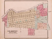
Map, 1874, Alfred Theodore Andreas, Minnesota Maps Online
Annotation

This site allows the visitor to search and view Minnesota's original public land survey plats created by the U.S. Surveyor General's Office during the years 1848 to 1907 and the later General Land Office and Bureau of Land Management maps of the state. The collection includes more than 3,500 original land survey maps; an 1873 map book of Hennepin County; late-19th-century plat books of Dakota, Hennepin, Ramsey, and Winona counties; and an 1871 illustrated historical atlas of Minnesota. Browse all the maps and plats or search the collection by county, township/range, or keyword. The advanced search feature allows the researcher to search the collection by title, subject, description, creator, publisher, date, source, or coverage. A useful resource for those researching the social, economic, environmental, or political history of Minnesota and its counties and towns.

Stephen Foster's Sketchbook

Image
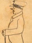
Sketch, Over the Calm. . . , 1851, Stephen Foster, Stephen Foster's. . . site
Annotation

This website makes available the full contents of the sketchbook of 19th-century American composer Stephen Foster. It contains handwritten drafts of 64 Foster songs, including some that were never published. Selecting "Song List" brings up the full list of songs contained in the sketchbook and clicking on the links takes the visitor to the pages with the draft of the song. Clicking on the thumbnail image of the page brings up a transcript, a larger image, and bibliographic data. Drafts of several of Foster's most popular songs appear here including "Old Folks Home" (or "Way Down Under the Swanee River"), "My Old Kentucky Home," and "Jeanie with the Light Brown Hair." The unpublished songs are indicated in brackets. The visitor can browse all 250 page images individually or search by keyword. A useful resource for those researching Foster or the history of 19th-century American music and culture.

Lawrence Denny Lindsley Photographs

Image
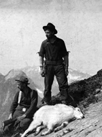
Photo, Victor Denny and Lawrence Lindsley. . . , 1901, Lawrence Denny. . . site
Annotation

This website presents 472 black and white photographs taken by Lawrence D. Lindsley, grandson of Seattle pioneer David Denny. Born in 1878, Lindsley began taking photographs as a child, and eventually joined a photography studio in Seattle in 1903. He continued taking photographs until his death in 1974, though most of the photographs here date from the 1880s through the 1920s. In addition to photography, Lindsley held a variety of jobs in Washington State—mining, hunting, and guiding wilderness expeditions—activities all well-documented here.

The collection is especially rich in photographs of the landscape, wildlife and settlements of Mount Rainier, Grand Coulee, Lake Chelan, the Olympic Peninsula, and Old Gold Creek. Lindsley also photographed sites around King County, revealing a Seattle that had not yet experienced the urbanization of the early-20th century. A long list of subject headings reveals that Lindsley also frequently photographed family members and friends, producing images useful for examining turn-of-the-century portraiture.

Madison: Celebrating 150 Years

Image
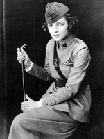
Photo, Irene Castle in Uniform, WWI or later, Madison: Celebrating 150 Years
Annotation

In 2006, Madison, WI, celebrated the 150th anniversary of its incorporation as a city. To mark the occasion, this website features 6,952 images, several articles and documents, maps and information on Madison's buildings, and links to virtual exhibits, entreating users to investigate Madison's past. This diverse collection of materials highlights both the experiences of the American Indian groups that had lived in the Madison area for many thousands of years, as well as those of the Yankee, English, Irish, German and Scandinavian settlers who began to arrive in 1837.

Visitors can view a map of American Indian village and mound sites, built for burial and ceremonial purposes, which are still visible around the city today. Also available are the recollections of George W. Stoner, one of the first settlers to arrive in Madison, through which one can learn about the construction of the city's first buildings and businesses, its first election, and its first suicide. Moving into the 20th century, visitors can also learn of the Federal Government's attempts to enforce Prohibition in Madison, which one official described as "queen of the bootleggers." This website is useful for those interested not only in Wisconsin history, but also in the history of urbanization in the United States more generally.

Panoramic Maps, 1847-1929

Image
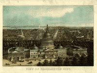
Image, View of Washington City, E. Sachse & Co., 1871
Annotation

This site presents more than 1,000 original panoramic maps, "a popular cartographic form" during the late 19th and early 20th centuries. The maps, often prepared for civic organizations, such as chambers of commerce and real estate agents, to promote an area's commercial potential, cover the contiguous 48 states and four Canadian provinces of British Columbia, Nova Scotia, Ontario, and Quebec between 1847 and 1929. While most of these maps were not drawn to scale, viewers can zoom in to find artists' renderings of individual streets, buildings, and landscape features. The site also includes a 1,200-word history of panoramic mapping; a bibliography comprised of 24 titles; and background essays (1,000 words) and images relating to five prominent panoramic artists: Albert Ruger (1829-1899), Thadeus Mortimer Fowler (1842-1922), Oakley H. Bailey (1843-1947), Lucien R. Burleigh (1853-1923), and Henry Wellge (1850-1917). This site is an excellent resource for those studying urbanization, cities, business growth, and the art of mapmaking.