Historical Maps of the United States

Image
Map, Exploration Before 1675
Annotation

This division of the Perry-Castaneda Map Collection provides access to 500 historical maps of the U.S. Maps are sorted thematically and include three maps of early inhabitants, 11 of exploration and early settlement from 1675 to 1854, and 15 of territorial growth from 1775 to 1970. Of the 95 military history maps covering engagements from 1763 to 1967, 50 are about World War II alone.

Among 183 late 19th- and 20th-century maps, there are 146 of U.S. cities produced around 1920. Historic sites, memorials, and battlefields are represented in 191 maps of sites such as Aztec ruins in New Mexico, the Bering land bridge in Alaska, and the Vicksburg battle site in Mississippi. Most of the maps are excerpted from 20th-century historical atlases. The site will be particularly useful for research in military history and early 20th-century urban history.

Odden's Bookmarks: The Fascinating World of Maps and Mapping

Image
Logo, Universiteit Utrecht
Annotation

A gateway to more than 14,000 sites on and about cartography and geography. Allows searching by keyword and browsing by countries and categories—including maps and atlases, collections, societies, departments, government cartography, libraries, and literature. Provides links to 585 sites that offer historical maps and atlases. Valuable for those studying cartography and geography, and useful for others as an easy-to-use reference source.

The New World: A Stage for Cultural Interaction

field_image
Engraving, The Natives of Florida, 1591, Jacques Le Moyne de Morgues, LOC
Question

During European colonization, how did the French, Spanish, and Dutch view the Native Americans and how did their interaction differ? What affect did their interaction have on colonization?

Answer

Interactions among Europeans and Native Americans varied from place to place, and members of each nation forged relationships with Indians in very different ways, depending on a variety of economic, social and political factors. While we should be mindful of this diversity, we can still make certain generalizations. Few Europeans considered Native Americans their equals, because of differences in religion, agricultural practice, housing, dress, and other characteristics that—to Europeans—indicated Native American inferiority. However, the French, Spanish, and Dutch sought profit through trade and exploitation of New World resources, and they knew that the native people would be important to their success. Europeans also wanted to convert Native Americans to Christianity. Therefore, economic gain and religion were the two factors that most affected the dynamics of European and indigenous American relationships.

The Spanish:
Spain, the most powerful monarchy in Europe and the Americas, wished to enrich themselves with the New World’s natural resources. After enslaving indigenous peoples in the Caribbean and the southern parts of the Americas to grow crops and mine for gold, silver, and other valuables, the Spanish moved into North America where they concentrated their efforts in what is now the southwestern and southeastern United States. In Florida, for example, Spain established a military post at San Augustín, (today called St. Augustine) but only a small number of Spaniards settled there. Catholic missionaries labored to convert the Indians to Christianity, and they experienced some success baptizing and transforming the Guale and Timucuan peoples into farmers. But even the most cooperative Indians continued to maintain their own religious and cultural traditions, and many priests concluded that the Indians were inferior and incapable of understanding Christianity. Indigenous populations declined over the seventeenth century as epidemics brought by the Spanish killed large numbers of natives. San Augustín remained a small outpost throughout the Spanish colonial period; a sort of multicultural crossroads where indigenous peoples came to trade with Spaniards and intermarriage between Spanish men and American Indian women was common.

The French:
Like the Spanish colonies in North America, New France did not attract many French settlers. Instead of enslaving Native Americans in farming and mining operations, the French exploited existing inter-tribal alliances and rivalries to establish trade relationships with the Huron, Montagnais, and Algonquins along the St. Lawrence River and further inland toward the Great Lakes. These Native Americans competed for exclusive status as intermediaries between other Indian traders and the French. Although Native Americans did most of the work, tracking, trapping, and skinning the animals and transporting the pelts to French traders, they drove hard bargains for their furs. French traders exchanged textiles, weapons, and metal goods for the furs of animals such as beavers, bears, and wolves. The trade strengthened traditional clan leaders' positions by allowing them to distribute these trade goods to their clan members as they saw fit. Jesuit (Catholic) missionaries managed to convert considerable numbers of Huron because the priests learned the local languages and exhibited bravery in the face of danger. French officials offered additional incentive for conversion by allowing Christian Hurons to purchase French muskets. In the eighteenth century, the Dutch and English competed with the French for trade and territory, which gave local Indians continued economic, diplomatic, and military leverage as Europeans competed for their trade and military alliances through the seventeenth century.

The Dutch:
Unlike the French and Spanish, the Dutch did not emphasize religious conversion in their relationships with Native Americans. Instead, they focused on trade with American Indians in present-day New York and New Jersey. They established a fur trade alliance with the Iroquois confederacy, the most powerful Native American empire in 17th-century North America. Although smallpox and other European diseases drastically reduced the Iroquois population, the confederation remained strong because they negotiated an advantageous alliance with the Dutch. Dutch weapons helped the Iroquois to defeat the Huron, who were leaders of the other major pan-Indian confederacy in the area.

Native Americans:
As often as possible, Native Americans took advantage of rivalries among European powers to maintain or enhance their own political and economic positions. Wars between England and the Netherlands spilled into North America, and in 1664 during the Second Anglo-Dutch War, England seized control over New Netherland and renamed the colony New York. The Iroquois quickly signed an alliance and trade treaty with the English. However, they also maintained friendly relations with the French and welcomed Jesuit missionaries into their midst. The Iroquois were generally successful at playing the French and English off one another until the English drove the French out of North America at the end of the French and Indian War (1763).
For more information

Axtell, James. Natives and Newcomers: The Cultural Origins of North America. New York: Oxford University Press, 2001.

Richter, Daniel K., Ordeal of the Longhouse: The Peoples of the Iroquois League in the Era of European Colonization. Chapel Hill, NC: University of North Carolina Press, 1992.

White, Richard. The Middle Ground: Indians, Empires, and Republics in the Great Lakes Region, 1650-1815. New York: Cambridge University Press, 1991.

Bibliography

Richter, Daniel. Facing East from Indian Country: A Native History of Early America. Cambridge, MA.: Harvard University Press, 2001.

Steele, Ian K. Warpaths: Invasions of North America. New York: Oxford University Press, 1994.

Van Zandt, Cynthia. Brothers Among Nations: The Pursuit of Intercultural Alliances in Early America, 1580-1660. New York: Oxford University Press, 2008.

Fort Hill State Memorial [OH]

Description

Fort Hill State Memorial is a nature preserve containing one of the best preserved Indian hilltop enclosures in North America. The Hopewell Indians (100 B.C.–A.D. 500) constructed the 1 1/2 mile long earthwork hilltop enclosure as well as at least two ceremonial buildings and probably a village in the Brush Creek Valley.

The site is open to the public.

Piqua Historical Area [OH]

Description

The Piqua Historical Area State Memorial celebrates 2,000 years of Ohio's rich history from prehistoric Indians to Ohio's canal era. The focal point of the peaceful 200-acre park is John Johnston—farmer, public official, and United States Indian Agent for western Ohio from 1812 to 1829. Today, visitors enjoy the home and farm of this most extraordinary man much as it appeared in 1829. Preserved and furnished structures include Johnston's two-story mixed Dutch Colonial/Georgian style farmhouse, a unique two-story spring house, and a cider house. Costumed interpreters and craft demonstrators provide farm tours and display activities in the summer kitchen and fruit kiln areas. A mammoth double-penned log barn, constructed in 1808, is reputed to be the oldest and largest of its type in Ohio, and is still in use on the grounds. Nearby a ring-shaped mound earthwork discovered and preserved by Johnston was constructed by people of the Adena culture over 2,000 years ago. Not far from Johnston's farm is a modern museum, which was constructed to resemble the blockhouse style of Fort Piqua, General Anthony Wayne's 18th-century supply post. In 2001 the museum was renovated with updated exhibits that trace the story of the Eastern Woodland Indians of Ohio and the newly acquired Fort Pickawillany site. Artifacts from Ohio's canal era are also on exhibit. The patio portion of the museum building allows visitors the opportunity to view a restored mile-long section of the Miami and Erie Canal, which extended the length of Ohio from Toledo to Cincinnati. An array of outdoor interpretive panels explore Johnston's later role as a state canal commissioner and provide an introduction to how canals helped in the development and expansion of frontier Ohio. Afterwards, guests may enjoy a ride aboard the General Harrison of Piqua, a replica 70-foot-long mixed cargo canal boat often used for transportation of passengers and cargo in the 19th century. Costumed guides direct the mule-drawn boat to provide an authentic and memorable experience for all.

The site offers exhibits; tours; demonstrations; boat rides; and recreational and educational events, including living history events.

Flint Ridge [OH]

Description

Flint Ridge contains quarry pits where all of the ancient people of Ohio came to get flint for both tools and weapons. The flint was also a trade item for many of these people. The flint was especially prized by the Hopewell Culture for its quality and beauty. A walk through the site brings home how hard people labored to remove this material from the earth. The museum at Flint Ridge is built around a restored prehistoric quarry pit and explains both the digging and shaping of flint. The unique geology of the area is also a feature of the displays.

The site offers exhibits, tours, and educational programs.

Graham Cave State Park [MO]

Description

Nestled in the hills above the Loutre River in Montgomery County, Graham Cave State Park features an unusual sandstone cave that contained evidence that rewrote history books. Once used for shelter, Graham Cave became historically significant when archaeologists discovered how long ago human occupancy had occurred. University of Missouri archaeologists uncovered artifacts revealing human use of the cave dating back to as early as 10,000 years ago. Clues to the lifestyle of the ancient Dalton and Archaic period Native Americans were uncovered. Today, visitors are allowed in the entrance of the cave, where interpretive signs point out interesting discoveries.

The park offers exhibits and occasional recreational and educational events.

Slavery and the Making of America

Image
Image, Graphic from Religion, Slavery and the Making of America
Annotation

This extensive companion to the PBS documentary of the same name provides interpretive and primary material on the history of African-Americans during slavery and Reconstruction, including essays, personal narratives, original documents, historical readings, and lesson plans. The "Time and Place" chronology of slavery and Reconstruction places the main events of U.S. history relating to African Americans between 1619 and 1881 in their historical context. "Slave Memories" allows visitors to hear the voices of African Americans recorded by the Works Progress Administration (WPA) on their experiences in slavery and Reconstruction. "Resources" includes 17 print resources, 23 books for children, and 30 websites related to slavery. "Slave Experience" allows users to explore slave life through the themes of legal rights and government; family; men, women, and gender; living conditions; education, arts, and culture; religion; responses to enslavement; and freedom and emancipation. Each features essays, historical overviews, original documents, and personal narratives.

A K-12 learning section features historical readings of narratives, slave stories and letters, student plays, links to 19 sites with primary sources, and six lesson plans for middle and high school. This website is a valuable resource for teachers as well as an excellent introduction and overview for those with an interest in the history of slavery and slave life in America.

Oxford African American Studies Center

Image
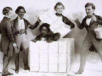
Lithograph c. 1850
Annotation

(Note: This website is now subscription-only.)

Designed for students, scholars, and librarians, this site provides access to thousands of primary source documents, maps, images, bibliographic entries, and subject entries drawn from reference resources in African American studies. Six published volumes furnish the majority of the resources: the Encyclopedia of African American History 1619-1895; Black Women in America, Second Edition; Africana, a five-volume history of the African and African American experience; the African American National Biography project, edited by Henry Louis Gates, Jr.; the Encyclopedia of African American Art and Architecture; and the Concise Oxford Companion to African American Literature.

These sources present a wealth of primary source documents, more than 1,000 images, and close to 100 maps, which illustrate events from 1500s South America through the Clinton Presidency. The site also includes more than 5,000 biographies and 3,000 subject entries on events and people, such as 19th-century African American midwives in the Western United States, prominent abolitionists, and charts on African American professional baseball. Useful for research, reference, and class projects on all aspects of African American history.

Lest We Forget: The Triumph Over Slavery

Image
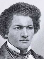
Image, Frederick Douglass, c. 1817-1895, NYPL
Annotation

This attractive exhibit utilizes essays and more than 140 images to explore the 400-year history of slavery in the Americas. The site reminds us that together "the slave trade and slavery represented one of the longest, most sustained assaults on the dignity and self-worth of human beings in the history of humankind." The site's home page offers an introductory essay that presents the central themes of the exhibit. The site is centered around nine thematic presentations on the forging of common identities in slavery; the enslavement process in Africa; the transatlantic slave trade; slave labor and slave systems; the struggle against slavery and the abolition of slavery; family life and social development; religion; language, literacy, and education; and culture. Each image is accompanied by an explanatory caption. There is no search feature available on the site. An informative overview of slavery in the Americas, the site is also of interest to those studying African-American culture.