New York Public Library Picture Collection Online

Image
Engraving, "Capture of the Galleon," Howard Pyle, 1887
Annotation

This image resource site contains 30,000 digitized images from books and periodicals, as well as original photographs, prints, and postcards, mostly dated before 1923. There are cartoons and illustrations from the well known Harper's Weekly and Century Magazine, as well as images from the Library of Congress Prints and Photograph division. In addition many of the vibrant images of Native Americans were collected from the Department of War Indian Gallery. Covering more than 12,000 subjects, the site features images of Jamestown settlers, Pocahontas and John Smith, American presidents, 19th-century New York architecture, slave life, American and European women's costumes, streetcars and trains, and even insects and snakes.

Bibliographical information accompanies each image, and users may also save images of interest in their own "gallery" for viewing or purchase. Thumbnail sketches enlarge for full-page viewing. Searchable by keyword or by browsing a variety of indexes, the collection is a useful visual resource for teachers and researchers.

Alabama Maps

Image
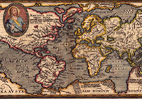
Image, "Typus Orbis Terrarum" Matthais Quad,1596
Annotation

This site contains more than 3,500 scanned and digitized maps divided into two indexes—historical and contemporary. The historical maps index contains several sections. The most voluminous section, "Alabama," is divided into time periods, geological features, Alabama counties, rivers, and state highways. Another section indexes 13 other southeastern states, including Texas, the Carolinas, and Florida. There are also maps of the Western Hemisphere, North America, Mexico, and the Caribbean, some dating before 1700.

An especially valuable feature of the historical index is the "Special Topics" which contains maps of the Civil War, including the battles in Gettysburg and Antietam, railroad routes, and ten Native American maps, mostly illustrating the boundaries of Cherokee territories. The contemporary map index is divided into eighteen themes, including education, housing, politics, federal expenditures, climate, and recreation. There are more than 100 world maps of Africa, Asia, Europe, the Middle East, and the South Pacific. Users will also find links to the University of Alabama's Department of Geography and the publications of the Cartographic Laboratory. Created for educators and the business community, this is valuable resource for those researching the history of Alabama or contemporary themes in Alabama, the United States, and the world.

Built in America: Historic American Buildings Survey and Engineering

Image
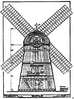
Image for Built in America:
Annotation

These facsimile images of measured drawings, photographs, and written documentation cover 35,000 significant historic sites dating from the 17th to the 20th century. The Historic American Buildings Survey (HABS) started in 1933 as a work relief program and became a permanent part of the National Park Service the following year to document "our architectural heritage of buildings," in the words of project founder Charles E. Peterson. The Historic American Engineering Record (HAER) was established in 1969 to similarly survey engineering works and industrial sites.

For each structure, the site provides from one to ten drawings, from one to 30 photographs, and from one to 50 pages of HABS text detailing the structure's history, significance, and current physical condition. The collection displays building types and engineering technologies from a farmhouse to a pickle factory, from churches to the Golden Gate Bridge.

First American West: The Ohio River Valley, 1750-1820

Image
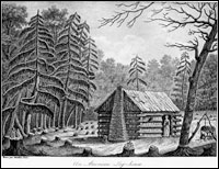
Image for First American West: The Ohio River Valley, 1750-1820
Annotation

Significant European migration into the Ohio River Valley occurred from the mid-18th century to the early 19th century and this website presents approximately 15,000 pages of related materials. Resources include books, pamphlets, newspapers, periodicals, journals, letters, legal documents, images, maps, and ledgers. The site includes a special presentation with a 6,500-word essay on contested lands, peoples and migration, empires and politics, Western life and culture, and the construction of a Western past.

Materials address encounters between Europeans and native peoples, the lives of African American slaves, the role of institutions such as churches and schools, the position of women, the thoughts of naturalists and other scientists, and activities of the migrants, including travel, land acquisition, planting, navigation of rivers, and trade. These are valuable resources for studying early American history, cross-cultural encounters, frontier history, and the construction of the nation's past.

Core Historical Literature of Agriculture

Image
Image for Core Historical Literature of Agriculture
Annotation

Currently this website presents full-text, searchable facsimiles of 1,850 monographs and 288 journal volumes related to agriculture in the U.S. All were published between 1806 and 1989. Evaluations and 4,500 core titles are detailed in the seven volume series The Literature of the Agricultural Sciences. Fields of study covered include agricultural economics, agricultural engineering, animal science, forestry, nutrition, rural sociology, and soil science.

Types of materials include memoirs and transactions of early agricultural societies, newspapers, almanacs, agricultural periodicals, governmental publications, and archives of families, communities, and corporations. Users can search by author, title, subject, or keyword, then access the title page, table of contents, index, or pages of the text. These resources are valuable for studying the profound social, cultural, and economic effects of shifts in the history of American farming.

Los Alamos National Laboratory

Article Body

Los Alamos National Laboratory exists as a major development center for engineering and scientific national security features. To date, their major responsibility is developing and maintaining systems related to national nuclear determent.

Sadly for history teachers, although not particularly unexpectedly, the laboratory's offerings appropriate to K-12 education are nearly all focused on the sciences. That said, a couple of resources may still be of use to history educators, and teachers should feel welcome to pass on the site information to their science co-workers, particularly those within New Mexico, where the laboratory is located.

What history teachers should take a look at is a history of Los Alamos National Laboratory and national security. Sections include the "Road to Los Alamos," "People of Wartime Los Alamos," "Building the Atomic Bomb," "Postwar to H-Bomb," and "H-Bomb to Stewardship." Each section offers related materials, often primary sources, such as Einstein's letter to President Roosevelt, under "Related Reading." Also included are several image galleries, including one with pictures of the Trinity Test. On the history home page, teachers should also be aware that the "Some Staff" list to the right includes J. Robert Oppenheimer, scientific director of the Manhattan Project, and Stan Ulam, a mathematician and another major figure in the project.

Classes located near Los Alamos, NM, may also be interested in the Bradbury Science Museum, which presents the laboratory's history and current research.

Federal Highway Administration

Article Body

The Federal Highway Administration is a division of the Department of Transportation. The administration's overall goal, according to their website, is to "improve mobility on our nation's highways." Priorities include reduction of traffic congestion, environmental awareness, and roadway safety.

The primary feature of FHWA web resources available to educators is a wide variety of statistical data. Using the information offered will require preparation, as lessons or activities will need to be built around the offered information. Possibilities include asking your students to look at older and recent statistics and make suggestions for the differences between the two data sets. How has U.S. daily life and technology changed in ways which support altered transportation trends?

Two sources which would be optimal for the above suggested activity include Traffic Volume Trends, which date from 1970 through 2009, and the National Household Travel Survey. The latter includes vehicle occupancy, public transportation availability, household travel, mode of transportation, characteristics of drivers with licenses, and more. The years covered are 1969, 1977, 1983, 1990, 1995, and 2001.

Other options exist to find articles and data which fit your classroom's needs. These include the National Transportation Library, the FHWA's Publications and Products page, and the Bureau of Transportation Statistics.

Mourning, Celebrating, Revisiting: Alexander von Humboldt in the United States, 1859-2009

Description

From the Library of Congress website:

"Alexander von Humboldt achieved cultural hero status in the United States in the second half of the 19th century. His travels, experiments and knowledge transformed Western science. A lecture at the Library of Congress examined the influence and legacy of the German naturalist and explorer."

Looking North

Description

From the Maine Humanities Council website:

"Donna Cassidy is Professor of American & New England Studies and Art History at the University of Southern Maine. Her most recent book, Marsden Hartley: Race, Region, and Nation, led to her current research on U.S. artists in Quebec and Atlantic Canada from 1890 to 1940. In this talk, co-sponsored by the Yarmouth and North Yarmouth historical societies, Cassidy describes the travels of those artists in the region, and discusses the influence of the landscape and people on their work."