Meeting of Frontiers

Image
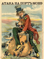
Chromolithograph, "Attack on Port Money," 1904
Annotation

In conjunction with the Russian State Library in Moscow, the National Library of Russia in St. Petersburg, and the Rasmuson Library of the University of Alaska in Fairbanks, the Library of Congress has digitized more than 2,500 items, comprising approximately 70,000 images, and provided transcriptions and commentaries in English and Russian to offer a comparative history of American and Russian expansion through frontier territories in each nation's continent. The site presents an overview of expansion into Siberia and the American West in six sections: Exploration, Colonization, Development, Alaska, Frontiers and National Identity, and Mutual Perceptions. Each section contains from two to 11 modules that call attention to similarities and differences between the two histories with regard to subjects such as migration—forced and otherwise, missionaries, religious flight, mining, railroads, agriculture, cities, popular culture, and tourism, and even compares Cossacks with cowboys.

The site offers more than 40 complete books, including manuals, handbooks, fiction, and travelers accounts; 77 maps and one atlas; 438 items from the Russian-Ukrainian Pamphlet and Brochure Collection; materials from six complete manuscript collections, regarding exploration, trade, and commercial activities; four tour-of-the-century films; 125 newspaper articles; 11 dime novel covers; five photographic collections; and one sound recording of a Russian folk song. Provides a 500-title bibliography and links to 30 related sites. Valuable for those studying the American West and Russian history and investigating ways to explore frontiers of comparative histories in order to expand beyond limits of national history narratives. Listen to the audio review: .

George Washington: A National Treasure

Image
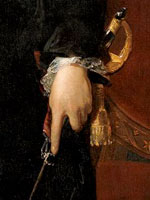
Oil on canvas, "George Washington," Gilbert Stuart, 1796
Annotation

This national exhibit focuses on the Lansdowne portrait of George Washington, painted by Gilbert Stuart in 1796 (the last painting of Washington before his death). An historic tour from the Smithsonian's National Portrait Gallery, this painting traveled across the country to eight major cities—Houston, Las Vegas, Los Angeles, Seattle, Minneapolis, Oklahoma City, Little Rock, and New York City—for the first time. Currently, Internet users may explore this historical portrait at the above listed site using three different filters: symbolic, biographic, and artistic. Each filter highlights a distinct component of the portrait, provides background information, and offers an interpretation of each individual element. In addition, the site contains biographical information on Washington's life and a teaching section for kids.

HistoryWired: A Few of Our Favorite Things

Image
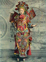
Postcard, "Chinese Actor Impersonating a Female Character," San Francisco
Annotation

An experimental presentation of 450 items in the Smithsonian Institution's American History collections, many of which are not on public display. Visitors to this virtual tour will find a map divided into regions representing broad subject categories that contain smaller rectangles standing for individual objects. Moving a mouse to a particular square results in the appearance of the name of the object, a thumbnail image, a date projected onto a timeline, and lines emanating out to relevant subject areas. Users can then click to learn more, finding a 100-200 word description, an option to zoom in closer, and often links to further information in other Smithsonian sites. Also searchable by keyword and category. Objects selected by curators "include famous, unusual, and everyday items with interesting stories to tell. They are not intended to be representative of the Museum's entire collection."

Categories reflect the wide range of the Institution's holdings, including clothing, arts/entertainment, business, science/medicine, photography, home, print/communications, transportation, military, computers, and sports. Includes audio and video items. Users can submit ratings for each object that will affect the future relative size of each square. Although innovative in design, the site may be disappointing to those searching for in-depth information about American history and culture; this is history-lite, with bells and whistles given more prominence than context and meaning.

Historical Atlas of the Twentieth Century

Image
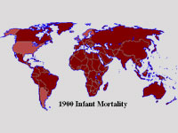
Map, "1900 Infant Mortality"
Annotation

Through a series of maps of the world, continents, and specific countries, users can trace large-scale demographic, economic, and political trends and developments covering the twentieth century. Topics charted on these maps include changes in agricultural workforce, infant mortality rates, life expectancy, literacy, persons with telephones, systems of government, alliances, borders between countries, and political violence, including wars. While examining any one map, click on buttons to find contextual information from additional maps. The site also includes informative timelines. Created by a librarian, the atlas provides a quick and easy way to see comparative change over time on a worldwide basis. Users should be aware, however, that the categorization scheme does not necessarily reflect the views of professional historians.

Florida Heritage Collection

Image
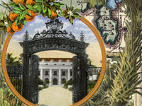
Graphic, Florida Heritage Collection
Annotation

This project provides a collection of more than 280 digitized materials documenting the history of Florida from pre-contact to the present. It includes materials relating to Florida history, culture, arts, literature, and social sciences in a number of major thematic areas, including Native American and minority populations, exploration and development, tourism, natural environment, and regional interests. These materials are drawn from the archives, special collections, and libraries of the 10 state universities in the Florida system.

Items include family papers, local history books and booklets, diaries, advertising materials, and Civil War letters, business records, maps, and photographs. Many of the materials are regional or local in scope.

The site also includes an extensive (5000-word) Florida history narrative timeline from pre-contact (before 1492) to the present. A user guide and tutorial are provided, and the documents are searchable by county name, keyword, subject, author, or title. The search engine has an option for listing either electronic holdings only or all collection holdings under a particular subject. Entries in the electronic catalog include the archive in which the original is located as well as a 20-word description of the item and its contents.

Note that a few links are still under construction with no completion date indicated. The site is ideal for researching Florida's state and local history.

Earliest Voices: A Gallery from the Vincent Voice Library

Image
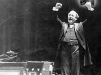
Photo, William Jennings Bryan delivering the Cross of Gold speech...
Annotation

A collection of 19 audio clips of speeches recorded by seven turn-of-the-century public figures—William Jennings Bryan, Eugene V. Debs, Thomas Edison, Samuel Gompers, William McKinley, William Howard Taft, and Booker T. Washington. The clips last between one and seven minutes each; all but one were made between 1900 and 1920. Subjects of the speeches include politics, reform, socialism, isolationism, trusts, the gold standard, U.S. military force, labor issues, and race relations. The site includes transcripts of the speeches as well as 150-word biographies and three photographs of each speaker.

Through digitization, technicians have improved the sound quality of these recordings, some of which had become nearly inaudible. An opportunity for users to experience the oratorical powers of influential men from the early 20th century.

Military Campaign Maps

Image
Annotation

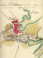
This collection offers more than 1,000 digitized maps that show troop movements, defensive structures, roads, campsites and local buildings, topography, and vegetation. They are invaluable in studying battles and military history. Divided into three sections, "The American Revolution and its Era" (390 maps), "Civil War Maps" (nearly 850 maps), and "Additional Military Battles and Campaigns" (31 maps), the site also includes maps of non-American battle sites (including Iraq and Afghanistan). The maps are not modern; they were drawn at the time of or just after the conflict they illustrate.

Maps open in separate browser windows, and users can zoom in and out of the maps or download high-quality versions. Visitors can search the collection by keyword, or can browse by subject, creator, geographic location, or title. The site includes a section illustrating the map digitizing process. The availability and ease of use of these primary sources make this site a tremendous resource for student, teachers, and historians, especially those interested in maps or military history.

American Photography: A Century of Images

Image
Photo, Dodge, Nikloas Murray, 1933
Annotation

This site, designed as a companion to the PBS film, is quite useful in its own right. Among other themes, the site explores the role of photography in American history, beginning with the role of photography as a relative newcomer to art.

In addition, the site examines the ways in which photography has impacted warfare, politics, and advertising. Moreover, the site raises important questions about whether photographs portray a subjective reality and whether photographers influence viewers' perceptions through cropping or digital manipulation. An Image Lab allows visitors to explore the ways that camera perspective and cropping can change the meaning of a photograph. Visitors can use the tool to manipulate stock photographs and view the results.

A Teacher's Guide provides five lesson plans, asking students to decide whether censorship is a worthwhile practice and to consider ethical issues related to altering photographs.

Not a particularly deep collection of images, this site's strength is the way it teaches how to evaluate and understand photographs, especially historical photographs.

Cold War: Postwar Estrangement

Image
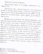
Letter, Khrushchev to John F. Kennedy, Cuban Missile Crisis
Annotation

One "showcase" within a multi-part exhibit that presents Soviet archival documents, this site offers three items related to Cold War politics and ideology: a 1945 telegram from Stalin to Harry Truman; a 1971 document from the Communist party's Central Committee, "Additional Measures To Expose Imperialist Policies"; and a 1962 telegram from Khrushchev to John Kennedy protesting American policy in Cuba.

The documents, available as both untranslated images and translated texts, are accompanied by a useful introduction of 1,036 words.

Visitors should consider using the site's "guided tour," which incorporates these materials within the larger exhibit.

Crisis at Fort Sumter

Image
Print, Fort Sumter
Annotation

This site provides documents, essays, and questions about the events leading up to the Confederate attack on Fort Sumter in 1861 and places the events within a broader context of secession and southern independence.

There are nine chronological sections and students must make decisions at five "critical junctures," soliciting advice from official and unofficial advisors. Students can compare their choices with Lincoln's, and a commentary section challenges students to explore multiple interpretations of events. "Hotwords" provide additional information on topics throughout the simulation.

Provides over 200 references in the bibliographic section.

Well-designed activity for helping students at the high school and college level explore the issues surrounding the Civil War.