PhilaPlace

Image
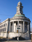
Photo, Former City Hall, Germantown, Philadelphia, 2009, eli.pousson
Annotation

A project of the Historical Society of Pennsylvania, PhilaPlace explores the history of two neighborhoods in Philadelphia—Old Southwark and the Greater Northern Liberties—historically home to immigrants and the working class. Using an interactive map and more than 1,240 primary sources and audio and video clips, visitors to the site may navigate the neighborhoods and learn more about their development from 1875 to the present day.

Visitors may navigate the interactive map using filters found under two tabs to the left of the map: "Places" and "Streets."

Under "Places," click on marked points of interest to bring up photographs or audio or video clips describing the history of the location. These points of interest may be filtered by 14 topics (such as "Food & Foodways," "Education & Schools," and "Health") or by contributor (the Historical Society of Pennsylvania, its partners, or visitors to the site). The map may be set to show the city's streets in 1875, 1895, 1934, 1962, or the present day—note that points of interests from all time periods appear on all maps. Two virtual tours through the points of interest are available, one for Greater Northern Liberties/Lower North and South Philadelphia.

Under "Streets," visitors can view demographics for four streets—S. 4th St., S. 9th St., I-95, and Wallace Street—from 1880-1930. Buildings on each street are color-coded to show land use, the number of residents per building, and the ethnicity and occupation of each building's residents.

Collections allows visitors to search the more than 1,240 primary sources and audio and video clips available on the site. Filter them by topic, neighborhood, type, or contributor.

The site's blog presents mini-features on certain locations, notifications of updates, and information on professional development and other PhilaPlace-related events. Educators provides a timeline for each of the neighborhoods and four suggested lesson plan/activities, while My PhilaPlace lets visitors create free accounts and save favorite materials to them—or create their own up-to-25-stop city tour. The Add a Story feature allows visitors to tag locations on the maps with their own short descriptions or memories (up to 600 words long), and accompany them with an image or audio or video clip.

Attractive, interactive, and accessible, PhilaPlace may appeal to Pennsylvania educators looking for a tool to help students explore urban history.

Bubbles, Panics, and Crashes: A Century of Financial Crises, 1830s-1930s

Image
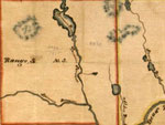
Detail, Somerset County, Maine map, Baker Library Historical Collections
Annotation

One year after the sub-prime mortgage crisis, this website presents a small collection of historical materials and information surrounding four financial crises in the 19th and early 20th century: the Panic of 1837, the Panic of 1873, the Bankers' Panic of 1907, and the Great Crash of 1929. Each section includes a brief explanation of the crisis, including causes and consequences, and between four and six primary sources, including maps, images of bank notes, title deeds, and letters. These sources highlight the complexity of crises and their increasing internationalization over time, as well as issues surrounding historical interpretation of the crises.

The website also includes sections on the Waltham Watch Company, which drew on lessons learned during the Panic of 1937 to mechanize the production of watches; and the real-estate boom of the early 1920s, which has been used recently by economists and historians to better understand current connections between real estate markets and financial crisis. Finally, a bibliography of close to 30 works on the history of these crises, links to manuscript collections, trade publications, and financial databases, give website visitors suggestions for further study.

Sanborn Fire Insurance Maps of South Carolina

Image
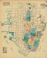
Map, Charleston, May 1884
Annotation

The 580 maps of more than 80 South Carolina towns and cities in this archive reveal urban landscapes and the locations of businesses, mills, colleges, depots, and other buildings between 1884 and 1923. The collection includes 232 unpublished, hand-drafted maps from the years 1899 to 1937. All maps are displayed with original color coding. Users can zoom in and out of maps and can pan right, left, up, or down to examine details. Every map is accompanied by bibliographic data. The full collection can be browsed or the user can choose to browse just the unpublished maps. The collection can be searched by city, year of publication, and county. The maps provide many details about mills and are particularly useful in revealing spatial relationships and location of railroad lines. There is also a link to the Union List of Sanborn and other fire insurance maps. An extremely useful resource for those researching the business or urban history of South Carolina in the decades around 1900.

Trial of The Chicago Seven

Image
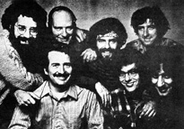
Photo, The Chicago Seven
Annotation

One of the Famous American Trials sites created by Douglas Linder of the University of Missouri, Kansas City, School of Law, this site explores the 1969-1970 trial of the Chicago Seven, a group of radicals accused of conspiring to incite a riot at the 1968 Democratic National Convention in Chicago. Linder provides a 1500-word account of the trial, which includes links to brief (100-word) explanations of specific terms and biographies of some of the key figures. The site provides a chronology of the lives of those involved in the trial from 1960 to 1998; images of two Yippie posters; a map of the key Chicago riot sites; and roughly 350-word biographies of 15 of the defendants, lawyers, and other figures in the trial. There are ten audio clips of defendants, prosecutors, and witnesses discussing various aspects of the riots and the trial. The site offers full-text versions of the indictment against the Chicago Seven, the trial manuscript, the contempt of court specifications against two of the defendants, and the appellate decision that overturned the contempt convictions and the convictions for intent to incite a riot. Additionally, there are 16 images of the riots and key figures and 14 quotations. A bibliography of 13 websites and 15 scholarly works leads to other sources for studying the Chicago Seven's trial and their lives as radical activists. This is an ideal site for researching 1960s activism and culture.

Museum of the City of San Francisco: The Great 1906 Earthquake and Fire

Image
Logo, Virtual Museum of the City of San Francisco
Annotation

This site provides images and text about the 1906 San Francisco earthquake and fire. A timeline, from April 18 to April 23, covers major events and a facsimile of a roster lists names and addresses of those who died. There are 27 photographs of earthquake damage and 31 personal accounts, 1,200 to 8,000 words, that include Jack London's "Story of an Eyewitness." Among 67 transcriptions of articles from 1906 about the earthquake are 12 that discuss the relocation of Chinatown and the treatment of Chinese San Franscicans. There are 31 transcribed fire department reports, including an article about the reorganization of the department in the wake of the disaster, and a facsimile of the 1910 police report on the quake and fire. Army operations are discussed in 29 pieces of correspondence and navy evacuation operations are detailed in seven. In addition, a 700-word article describes the evacuation of the city by train. Engineering and scientific reports include 24 articles, letters, and reports about infrastructure issues, such as water supply and structural stability. A section about relief efforts includes a flier accusing the Red Cross of corruption and a resolution by a local plumbers union to volunteer their services. The site will be very useful for anyone interested in the earthquake and in urban and California history.

Civil War Maps

Image
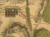
Map, The Battle of Gettysburg
Annotation

Presents approximately 2,240 Civil War maps and charts and 76 atlases and sketchbooks. The materials, primarily Union and Confederate "reconnaissance, sketch, coastal, and theater-of-war maps which depict troop activities and fortifications," also include commercially-produced maps. Provides 210 maps and three atlases belonging to General William Tecumseh Sherman, and 341 maps and sketchbooks prepared by Confederate topographical engineer Major Jedediah Hotchkiss. A "Special Presentation" offers a 10,000-word essay illustrated with 17 photographs and maps on the history of mapping the war. Maps can be viewed with the Library of Congress's excellent map viewing software. Very useful for Civil War specialists and those interested in historical geography.

Band Music from the Civil War Era

Image
Logo, Band Music from the Civil War
Annotation

Examples of brass band music from the 1850s through the 19th century. "Bands of this kind served in the armies of both the North and the South during the Civil War, in the field as well as for the entertainment of the officers." Including both printed and manuscript music, the collection features more than 700 musical compositions, as well as eight full-score modern editions, 19 recorded examples of brass band music in performance, and a gallery of 37 photographs taken of bands during the Civil War.

Also provides a 10,000-word "Special Presentation" entitled, "The American Brass Band Movement: A Historical Overview," that includes 15 drawings and photographs. Useful primarily to music specialists, the site may also be of interest to those studying the popular culture of the Civil War era.

Baseball Cards, 1887-1914

Image
Logo, Baseball Cards from 1887-1914
Annotation

A collection of 2,100 early baseball cards, featuring more than 1,000 major and minor league players who represented teams in 13 leagues and 75 cities. Includes legendary players, such as Ty Cobb, Tris Speaker, Cy Young, and Walter Johnson, in addition to managers and owners, such as Connie Mack, John McGraw, and Charles Comiskey. Provides a nine-title bibliography. Searchable by keyword for material written on the cards, and by name, team, league, and city. Primarily of interest to sports historians, the cards, originally distributed as advertising material in cigarette packs, can also be used in the study of commercial advertising and printing processes.

Material History of American Religion Project

Image
Logo, The Material History of American Religion Project
Annotation

In 1996, eight historians of religion and three advisors embarked on a five-year project to illuminate ways that material culture and economic history can be used in the study of American religion, a discipline traditionally dominated by ideas. The site presents annotated photographs of 39 objects, including an evangelical coffee bar, chewing gum packed with biblical verses, artwork in a family Bible, and a church stick used to awaken sleeping congregants. Thirty-eight documents from the 1850s to the 1960s, range from an 1854 book steward report for the African Methodist Episcopal Church to a chain e-mail from the 1990s. The site also includes 23 essays and interviews by the project's participants on such eclectic subjects as "Material Christianity," religious architecture, how Catholic practice has shaped children's experiences, the role of costume in the Salvation Army, how to practice economic history of religion, and "what makes a Jewish home Jewish." Includes eight issues of the project's newsletter; a bibliography of 22 titles; and links to 18 related sites. This site will be especially valuable to university students interested in evaluating the value of material culture scholarship in religious studies, students of economic history curious about applying their discipline to non-traditional fields of inquiry, and scholars within the field of material culture and the broad discipline of American cultural history.

Death of the Dream: Farmhouses in the Heartland

Image
Photo, Midwestern Farmhouse
Annotation

This website is a companion to the one-hour Public Broadcasting System documentary Death of the Dream: Farmhouses in the Heartland, produced by Chuck Olsen of Twin Cities Public Television. The film and website were inspired by photographer and essayist William Gabler's book of the same title, and depict the first settlements, rise, flourishing, and decline of the farm houses of the midwestern prairie. The Homes on the Prairie section includes a lengthy (roughly 1500-word) narrative about the history of the settlement and rural culture that developed in the midwest, along with descriptions and 15 images of the different kinds of architecture found on the prairie. The Literary Collection category provides 13 links to poems, essays, and excerpts from novels that capture the character of the midwest farm life. Another section offers a virtual tour of a classic "L" shaped farmhouse, from the porch to the kitchen, parlor, and bedrooms. The site also contains a bibliography of five scholarly books on the midwest and rural farm life, links to seven websites on similar topics, and a bibliography of ten essays and photographic essay works about rural midwestern life. Though this site provides no primary documents, it is a good site for gathering general information on the midwest, rural life, and vernacular architecture.