Reclaiming the Everglades: South Florida's Natural History, 1884-1934
Image
Annotation

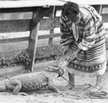
This archive contains primary and secondary sources relating to reclamation efforts of the Everglades and the history of south Florida from 1884 to 1934. Comprising nearly 10,000 pages and images, the compilation includes personal correspondence; government publications, reports, and memos; and images, such as photographs, maps, and postcards. Materials document issues relating to the creation of national parks, including conflicting interests—public, private individual, and corporate—and government accountability.

The website also presents a photo exhibit, "The Everglades: Exploitation and Conservation," accompanied by a 1,000-word essay. Two additional features, an interactive timeline and 31 biographies of South Florida's most notable personalities, complete this project. This site will be of interest for those exploring the establishment of the Everglades National Park, the conservation movement, and the treatment of Native Americans, particularly the Seminoles.
South Texas Border, 1900-1920: The Robert Runyon Collection

Image
Annotation

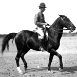
These more than 8,000 images document the history and development of South Texas and the border. The collection features the life's work of commercial photographer Robert Runyon (1881–1968). Topics include the U.S. military presence in the area prior to and during World War I and the growth and development of the Rio Grande Valley in the early 1900s.

A special section presents nine of Runyon's 350 photographs of the Mexican Revolution (1910–1920) in Matamoros, Monterrey, Ciudad Victoria, and the Texas border area from 1913 through 1916. "Maps of the Lower Rio Grande" offers a number of topographical and military maps depicting the region. The website also offers essays on the revolution and on Runyon.

The 1906 San Francisco Earthquake and Fire

Image
Annotation

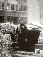
Created to commemorate the 100-year anniversary of the San Francisco earthquake, this exhibit and archive features an extensive collection of primary source material, an interactive map, and a 360-degree view of the damage to the city. The primary sources include thousands of images and text files available, offering more than 8,000 photographs, 500 cityscapes, and 500 letters, as well as a host of additional resources, such as broadsides, oral history texts, periodical articles, photomechanical prints, reports, and stereographs. Visitors can browse the archive by genre or subject or search by keyword, subject, genre, or geographic location.

The exhibit has five galleries, each with several text/photograph displays: San Francisco before the fire; the earthquake; the fire, including a map showing burned districts; the story of refugees and survivors; and reconstruction. The interactive map divides San Francisco into 10 regions, each of which can be browsed or searched for images taken in that region. It also includes 11 aerial cityscape views. The 360-degree panoramic view of San Francisco shortly after the disaster is composed of 11 separate photographs taken from the roof of the Fairmont Hotel.

Valley of the Shadow: Two Communities in the American Civil War

Image
Annotation

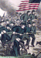
This massive, searchable archive compares two Shenandoah Valley counties during the Civil War period—Augusta County, VA and Franklin County, PA. These two counties were divided by 200 miles and the institution of slavery. Thousands of pages of maps, images, letters, diaries, and newspapers, in addition to church, agricultural, military, and public records provide data, experiences, and perspectives from the eve of the war until its aftermath. The site furnishes timelines, bibliographies, and other materials intended to foster research into the Civil War and the lives of those affected by it. The website includes a section on John Brown and one entitled "Memory of the War," presenting postwar writings on battles, the lives of soldiers, reunions, obituaries and tributes, and politics.

Atlantic Slave Trade and Slave Life in the Americas: A Visual Record

Image
Annotation

This collection of more than 1,230 images depicts the enslavement of Africans, the Atlantic Slave Trade, and slave life in the New World. Images are arranged in 18 categories, including pre-Colonial Africa, capture of slaves, maps, slave ships, plantation scenes, physical punishment, music, free people of color, family life, religion, marketing, and emancipation.

Many of the images are from 17th- and 18th-century books and travel accounts, but some are taken from sketches within slave narratives, Harper's Weekly, and Monthly Magazine. Reference information and brief comments, often an excerpt from original captions, accompany each image. Although there is no interpretation or discussion of historical relevance, these images are valuable for learning about representations of slavery in American slave societies, especially in the Caribbean and Latin America.