Mapping the National Parks

Image
Graphic, Mapping the National Parks
Annotation

Funded by the Rockefeller Corporation and part of the Library of Congress American Memory Project, this site features approximately 200 maps that document the history, cultural aspects, and geological features of the areas that became the Acadia, Grand Canyon, Great Smoky Mountains, and Yellowstone National Parks. The maps date from the 17th century to the present and include early European, exploration, geological, environmental, United States Geological Survey, and National Park Service maps.

The site is divided into four sections, one for each of the featured national parks. Each section includes a 1200-word essay describing the history of the area and the process by which it became a national park, illustrated with five to seven maps.

The site also includes a bibliography of over 200 scholarly works on related topics. Other links include a 750-word general history of the mapping of national parks and a "Learn More About It" section that offers links to 14 Library of Congress Special Presentations and related collections and exhibits. The collection is keyword searchable and can be browsed by geographic location, subject, creator, and title. This easily navigable site is ideal for students and teachers interested in cartography, the National Parks system, and conservation in America.

Florida Heritage Collection

Image
Graphic, Florida Heritage Collection
Annotation

This project provides a collection of more than 280 digitized materials documenting the history of Florida from pre-contact to the present. It includes materials relating to Florida history, culture, arts, literature, and social sciences in a number of major thematic areas, including Native American and minority populations, exploration and development, tourism, natural environment, and regional interests. These materials are drawn from the archives, special collections, and libraries of the 10 state universities in the Florida system.

Items include family papers, local history books and booklets, diaries, advertising materials, and Civil War letters, business records, maps, and photographs. Many of the materials are regional or local in scope.

The site also includes an extensive (5000-word) Florida history narrative timeline from pre-contact (before 1492) to the present. A user guide and tutorial are provided, and the documents are searchable by county name, keyword, subject, author, or title. The search engine has an option for listing either electronic holdings only or all collection holdings under a particular subject. Entries in the electronic catalog include the archive in which the original is located as well as a 20-word description of the item and its contents.

Note that a few links are still under construction with no completion date indicated. The site is ideal for researching Florida's state and local history.

Belgian-American Research Collection

Image
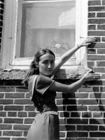
Photo, Alex Parins farm, Woman displaying lay of the bricks, 1976
Annotation

Designed to document the presence of Belgian immigrants in three Wisconsin counties, this site contains a variety of primary and secondary sources. Legal documents, diaries, letters, photographs, and oral histories are included, totaling some 1,500 resources. The site includes 400 architectural surveys, 54 oral histories (many given in Walloon, a primarily oral French patois spoken by generations of Belgian immigrants to Wisconsin), and approximately 500 pages of Immigration Histories.

The entire collection (with the exception of a few documents that have defied OCR translation) is searchable by keyword and can be browsed. This is a unique collection of primary sources, easily accessed, and usable by students, teachers, or researchers.

Club Kaycee, Golden Age of Kansas City Jazz

Image
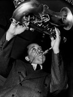
Photo, Lester Young
Annotation

These 43 audio files present Kansas City jazz recordings that span the years 1906–1954. Most were recorded during the city's "Golden Age"—from the late 1920s to the early 1940s. Provides 100- to 500-word profiles on 28 jazz artists including Count Basie, Charlie Parker, Lester Young, Big Joe Turner, Benny Moten, and Andy Kirk.

Also includes a 1,700-word article on the 18th and Vine district, "internationally recognized as one of the cradles of jazz"; a 1,500-word article on the first Kansas City jazz band to become known nationwide in the 1920s, the Coon-Sanders Original Nighthawks Orchestra; shorter essays on Kansas City clubs and nightspots; a 26-title annotated bibliography; and a 45-title discography. Small photos of people and places accompany some of the essays. A good introduction to this important center of jazz creation that will be of interest not only to jazz aficionados, but to those studying 20th-century urban and cultural history.

Boston Streets: Mapping Directory Data

Image
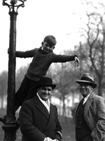
Photo, MacJannet student up a lamp post as Emory Foster, ca. 1930, 1930
Annotation

This website uses photographs, historical maps and atlases, and city directories to contextualize "the people, places, and events that have shaped the city from the years before the American Civil War through 20th-century urban renewal." The site has four exhibits, each accompanied by an introduction. Moments is a searchable collection of more than 2,500 historic maps and photographs that includes some of the earliest urban photography in the country. Places presents three historic atlases of the city, from 1874, 1898, and 1928. Each of the 94 plates in the atlases can be viewed individually. People offers nine city directories from 1845 to 1925 and five examples of how people's histories can be traced in the directories and how the directories can be combined with the images and maps from the site to "contextualize in time and place a single history or the history of millions."

Cowpaths allows users to plot information gathered from the images and directories on a map as an aid to tracing the history of the city and its people. Users can define their own data layers, query the data, and have results mapped on historical maps. An illustrated primer on how to use "Cowpaths" is available.

Each exhibit is individually searchable with basic or advanced searches. This site is a useful resource for those interested in the history of Boston and is also of interest to those studying urban history.

Military Campaign Maps

Image
Annotation

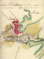
This collection offers more than 1,000 digitized maps that show troop movements, defensive structures, roads, campsites and local buildings, topography, and vegetation. They are invaluable in studying battles and military history. Divided into three sections, "The American Revolution and its Era" (390 maps), "Civil War Maps" (nearly 850 maps), and "Additional Military Battles and Campaigns" (31 maps), the site also includes maps of non-American battle sites (including Iraq and Afghanistan). The maps are not modern; they were drawn at the time of or just after the conflict they illustrate.

Maps open in separate browser windows, and users can zoom in and out of the maps or download high-quality versions. Visitors can search the collection by keyword, or can browse by subject, creator, geographic location, or title. The site includes a section illustrating the map digitizing process. The availability and ease of use of these primary sources make this site a tremendous resource for student, teachers, and historians, especially those interested in maps or military history.

American Photography: A Century of Images

Image
Photo, Dodge, Nikloas Murray, 1933
Annotation

This site, designed as a companion to the PBS film, is quite useful in its own right. Among other themes, the site explores the role of photography in American history, beginning with the role of photography as a relative newcomer to art.

In addition, the site examines the ways in which photography has impacted warfare, politics, and advertising. Moreover, the site raises important questions about whether photographs portray a subjective reality and whether photographers influence viewers' perceptions through cropping or digital manipulation. An Image Lab allows visitors to explore the ways that camera perspective and cropping can change the meaning of a photograph. Visitors can use the tool to manipulate stock photographs and view the results.

A Teacher's Guide provides five lesson plans, asking students to decide whether censorship is a worthwhile practice and to consider ethical issues related to altering photographs.

Not a particularly deep collection of images, this site's strength is the way it teaches how to evaluate and understand photographs, especially historical photographs.

Connecticut History Online

Image
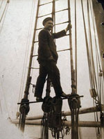
Photo, Captain George Comer of East Haddam in rigging..., 1907
Annotation

This site is a collaborative effort between the Connecticut Historical Society, the Thomas H. Dodd Research Center at the University of Connecticut, and the Mystic Seaport Museum, funded by a National Leadership Grant from the Institute of Museum and Library Services. It offers approximately 14,000 images depicting Connecticut's history from the beginning of the 19th century to the middle of the 20th century.

The images are divided into categories: "Artifacts," "Manuscripts and Documents," Maps, Charts, and Bird's-eye Views," "Newspapers and Magazines," "Photographs, Prints, and Drawings," "Posters/Broadsides," and "Sound Recordings and Transcripts." Each image includes notes on the creator, date, and place created, medium, repository information, and a brief (40-word) description of the subject. Visitors can search the site by keyword, subject, creator, title, and date.

The site also includes four sample lesson plans for middle school classes comparing and contrasting two Connecticut families and the roles of men and women through exercises interpreting the site's images, a list of ideas for future topics, and themes for secondary-level classrooms. This site is ideal for teachers and students interested in the history of Connecticut and its communities.

Chicago Imagebase

Image
Map, Chicago
Annotation

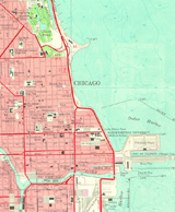
Dedicated to "enhancing knowledge about the built environment of the Chicago region," this site hopes to offer a comprehensive "system for indexing, storing, retrieving, comparing, and analyzing images, maps, data, literature, and other geographically-based materials" on Chicago.

Contains an array of historical and recent maps, photographs, and illustrations, plus textual information about Chicago's history and architecture.

Includes approximately 600 aerial photographs taken in 1996 by Alex S. MacLean; 83 photographs by C. William Brubaker; 14 by Robert Thall; multiple images of 55 buildings and historic sites; four Works Progress Administration land use maps; more than 30 images dealing with the Chicago Fire of 1871; 20 photographs by William Henry Jackson and Charles Dudley Arnold of the 1893 World's Columbian Exposition; 22 Rand McNally "Bird's Eye Views" from 1893; and numerous additional maps and images.

An animated map shows the city's expansion and the development of neighborhood communities from 1850 to 1990.

Presently, the site focuses on four Chicago areas: the "Loop," Lawndale, Armour Square, and Bridgeport. Though not updated since 1999, the site contains useful materials documenting Chicago's development.

American Museum of Photography

Image
Photograph, Woman with Daisies and Spirit
Annotation

Photographs from 1839 to the late 20th century are on view in 12 exhibits that offer 100- to 600-word introductory essays and a diverse range of images.

"The Face of Slavery" presents 10 photographs of African Americans from 1855 to 1905.

The work of Southworth and Hawes, a photography team active between 1843 and 1862, is represented by eight daguerreotypes of women.

In "Do You Believe?" visitors may consider evidence of ghostly existence offered by 22 "spirit photographs" taken between 1875 and 1932.

In "Photography as a Fine Arf!," 16 photos from the 1850s to the 1950s "explore the complex relationships of people and dogs."

In "At Ease," nine photographs from around 1850 refute the popular notion that early portraiture was stiff.

An exhibit of the trick photography of William H. "Dad" Martin presents eight photos produced between 1894 and 1912 that show exaggerated ordinary objects.

In "Of Bricks and Light," the museum exhibits 33 architectural photographs.

Business executive and photographer Shotaro Shimomura took pictures of his trip around the world in 1934-35; nine of these are exhibited in "An Eye for the World."

An interactive exhibit of nine cartes de visite allows visitors to investigate details such as the hats worn by men in Abraham Lincoln's funeral procession.

"Scott Mutter: A More Perfect World" presents 11 "hyper-realistic" photomontages by the acclaimed image maker.

"Masterworks of Photography" includes 25 images produced from 1840 to 1975, including English inventor William Henry Fox Talbot's "The Footman," of 1840, considered the earliest photograph on paper of a human being.

In addition, the museum showcases 42 of its favorite pieces.

The site also provides a 1,700-word explanatory essay on photographic processes and links to 25 other resources concerning the history and art of photography. This site cannot be searched by subject, however, which limits its usefulness for research.