Arizona State Museum
Image
Annotation

Presenting a virtual alternative to the museum in Tucson, this site allows visitors to experience the indigenous cultures of Arizona and the greater southwest. The Online Exhibitions section offers a plethora of digital programs and resources, including Paths of Life: American Indians of the Southwest, With an Eye on Culture: The Photography of Helga Teiwes, and The Pottery Project: Explore the Arnold and Doris Roland Wall of Pots.

The Paths of Life section features a virtual reality tour of the exhibit that consists of 22 panoramas of the museum space with accompanying text. This presentation enables online visitors to vividly examine the origins, lifestyles, and contemporary lives of 10 Native American Indian tribes from the American Southwest and/or northern Mexico.

The With an Eye on Culture photography exhibit features more than 50 photographs, along with explanatory notes and video footage of interviews with some Native American subjects.

The Pottery Project enables vistors to virtually explore the Arizona State Museum's Wall of Pots. According to the Museum, the primary purpose of this exhibit is to "illustrate continuity and change over nearly two millennia of pottery making in the Southwest." For this reason, the Wall of Pots showcases both protohistoric and contemporary pottery. Visitors can view the collection column by column, and even explore individual shelves.

However, these are just a few examples of the resources complied by the Arizona State Museum. Younger students might enjoy the What Would Frida Wear? section, which allows users to dress a virtual paper doll of the Mexican artist, Frida Kahlo, in indigenous clothing and read about her life. Interested in more games like this? Pop over to the Explore Culture Online page for informative podcasts, videos, reading lists, and a ton of other engaging activities and useful information.
Selected Historical Decennial Census Population and Housing Counts

Image
Annotation

More than 40 historical census reports, including decennial reports dating back to 1790, are available for download on this website as PDFs. Historical statistics address topics such as population totals by race, urban or rural status, educational attainment, and means of transportation to work, among others.

There are also histories of the 21 U.S. census questionnaires produced from 1790 to 2000, including instructions to census marshals dating back to 1820. Comparative tables show which censuses included specific questions on subjects, such as ancestry and mental disabilities, and whether respondents were deaf, blind, insane, feeble-minded, paupers, literate, or convicts. Additional information includes state and territorial censuses, mortality schedules produced for a number of 19th-century censuses, population at the time of each census, and supplemental censuses taken at various times on free and slave inhabitants, Indian populations, unemployment, and housing.

Because of the PDF format, the reports take a number of minutes to download. These materials are useful for those needing demographic information or researching the history of census taking and the development of census categories.

Worthington Memory, Online Scrapbook

Image
Annotation

Currently provides more than 122 images of objects, documents, and photographs pertaining to the history of the town of Worthington, OH, founded in 1803 by a group of families migrating from western Connecticut and Massachusetts. The site creators plan to add more materials in the future, including digitized versions of 19th- and 20th-century newspapers and oral histories. Users may search by subject, title, or keyword in bibliographic records—which include abstracts of up to 100 words for each item—or browse the collection by decade or 27 categories covering aspects of the social, economic, cultural, civic, and environmental history of the town. Includes links to 22 related sites. Useful for those studying local history.

Kiowa Drawings

Image
Annotation

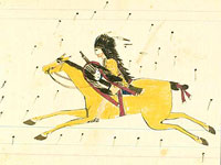
Presents more than 600 drawings by Kiowa Indians—a tribe originally from the Southern Plains—from the 19th and 20th centuries. While many are on traditional buffalo hide, more recent drawings are on paper. These drawings illustrate "tribal social and artistic traditions" as well as the history of contact and conflict. The first of five sections includes 45 drawings created by Kiowa, Cheyenne, and Arapahoe warriors imprisoned in the 1870s. The largest section offers more than 400 images commissioned by anthropologist James Mooney in the late 19th century as illustrations for his field notes. Additional sections include the Silver Horn pictorial calendar, composed of images used to track time and illustrate stories, and Silver Horn Target Record Book, with images of "warfare, courting, personal dress, the Sun Dance, and stories of the mythical trickster figure, Saynday." The final section offers material by the "Kiowa Five," artists who studied at the University of Oklahoma in the late 1920s and helped establish contemporary Indian painting. Useful for those studying American Indian history, culture, life, and art.

World War I History Commission Questionnaires

Image
Annotation

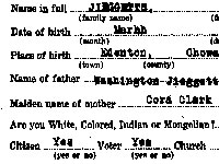
Beginning in 1919, the Virginia War History Commission compiled more than 14,900 surveys of World War I veterans in Virginia. Images of these four-page questionnaires—with additional material submitted by veterans or family members, including 1,046 photographs—have been digitized and made accessible on this site. The surveys provide basic demographic information on the soldiers and their families, as well as details of their war records, including descriptions of engagements, citations, injuries, and deaths.

In addition, the last page of the survey poses questions regarding the effect of the war and military service on states of mind and religious beliefs, as well as effects of disabilities on employment after the war. A valuable source for historians and students researching military history and the war experience.

Encyclopedia Britannica: The 1911 Edition

Image
Annotation

Presents the full text of the 11th edition of the Encyclopedia Britannica, published in 1911, with approximately 30,000 articles by more than 1,500 authors. According to PageWise, an Internet information resource responsible for digitizing the Encyclopedia, the 11th edition marked a shift to a more journalistic writing style than existed previously. The site will provide a wealth of material for those studying the state of commonly available knowledge at the time of this edition's circulation.

The Yale Map Collection: Online Maps

Image
Annotation

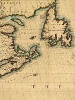
A selection of approximately 200 historical maps covering all parts of the world and ranging in time from the early 16th to the late 19th centuries. Provides more than 50 maps of the Americas, with 16 of American cities. Includes a 1641 map showing the layout of the New Haven community and a 1770 "New Map of the Cherokee Nation." Links to five previous exhibitions with 60 maps and explanatory texts of between 1,600 and 2,800 words each on road maps, three-dimensional maps, and fanciful maps. The site also includes listings for 19 reference sources and links to 48 other sites for maps and cartographic studies. A modest, but useful collection for those studying the history of cartography and exploration, and those needing cartographic aids for other historical subjects.

Voices of the Colorado Plateau

Image
Annotation

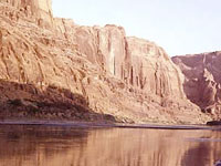
Offers more than 40 multimedia presentations featuring oral history excerpts and photographs that document aspects of life in the Colorado Plateau--encompassing parts of Utah, Arizona, New Mexico, and Colorado--during the past half century. Also presents audio files of 10 complete oral histories and transcripts of the interviews ranging from 2,200 to 19,000 words in length. A joint project of eight libraries and museums in the four Colorado Plateau states and Nevada, the site is organized into three sections--People, Places, and Topics--with subheadings that allow visitors to access the audio excerpts, many of which are accompanied by slide shows of photographs. The people interviewed include a Navajo language interpreter, the son of homesteaders, a schoolteacher, a pioneer in commercial river running, and an administrative officer for a town built for dam workers. Topics range from sociocultural concerns, such as growing up, education, families, food, and leisure, to work- and environment-related subjects, including ranching, timber, and tourism. Valuable for those studying the American West and the use of oral history for exhibit presentations.

Today in History Web Resources

Image
Annotation

Gateway to more than 100 links, most of which provide visitors with the capability to search for events that occurred on specific days. "Specialty sites" link to resources dealing with specific ethnic groups, entertainment forms, politics, professions, regions, and countries. Users can find hundreds of holidays, birthdays of famous people, and calendar-related quotations, as well as links to events involving African Americans, American Indians, popular culture, sports, radical history, psychology, health, and the literary world. No depth, mostly trivia, but still of use to students and teachers who need to check a date.

The Capital and the Bay, ca. 1600-1925

Image
Annotation

This site offers published books selected from the Library of Congress' general and rare book collections in an "attempt to capture in words and pictures a distinctive region as it developed between the onset of European settlement and the first quarter of the twentieth century." Contains 139 books, a few by well-known figures, such as Edwin Booth, Frederick Douglass, and Thomas Jefferson, but most by little-known residents and visitors to the region. Includes memoirs, autobiographies, biographies, books of letters, journals, poems, addresses, reports, speeches, travel books, sermons, books of photographs, and promotional brochures. In addition to Washington, D.C., the cities of Baltimore, MD, and Richmond, VA, are featured.

A special presentation entitled "Pictures of People and Places from the Collection" consists of selected illustrations organized in three sections of 10 images each on Maryland, the District of Columbia, and Virginia. The site includes 10 works dealing with slavery—a number of which were written by former slaves—and approximately 10 works dealing with encounters between whites and Native Americans. Includes links to 22 related sites. A valuable collection for those studying ways that Washington, D.C., and neighboring regions have been described in print over several centuries.