Harvesting the River

Image
Color offset lithograph, "Whistling In," Bartlett Kassabaum, 1980
Annotation

Presents a narrative in exhibit format—with hyperlinks to archival documents and photographs—on the cultural and economic life of the people who came to the Central Illinois River region from 1875 to 1950. Organized into three sections on the harvesting of fish, waterfowl, mussels, and natural ice; transportation by boat, railroad, and plank roads; and the settlement and development of six area river towns. The site delivers oral histories (audio and video), as well as illustrations and photographs. It may serve as a useful introduction to those studying this particular region and regional history in general.
Historic USGS Maps of New England

Image
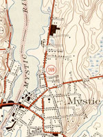
Map, "Mystic, CT-NY-RI Quadrangle," 1944
Annotation

A collection of more than 1,100 topographical maps created by the United States Geological Survey from the 1890s to the 1950s covering all of New England—Maine, New Hampshire, Vermont, Rhode Island, Massachusetts, and Connecticut—and selected areas of New York. The maps—which reveal roads, buildings, rail lines, bodies of water, and elevations—occur in 15-minute and 7.5-minute quadrangle series (a minute is one-sixtieth of a degree of latitude or longitude). In addition, the collection includes six maps with 30-minute quadrangles.

For states other than New York, users can view a state image map and select a point within a grid marked off in 15-minute increments to find listings for available images accompanied by dates the maps were surveyed, created, and revised. Towns within each quadrangle are also listed along with names of adjacent areas. Users also may search an alphabetical list of towns within each state. For New York, only an index of quadrangles names is available. Maps are presented in JPEG format. According to the site, "Each image is typically 2 megabytes, so download times are likely to be slow." A useful site for those studying changes in the New England landscape during the first half of the 20th century.

Historical Maps of the United States

Image
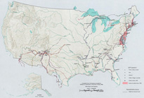
Map, Exploration Before 1675
Annotation

This division of the Perry-Castaneda Map Collection provides access to 500 historical maps of the U.S. Maps are sorted thematically and include three maps of early inhabitants, 11 of exploration and early settlement from 1675 to 1854, and 15 of territorial growth from 1775 to 1970. Of the 95 military history maps covering engagements from 1763 to 1967, 50 are about World War II alone.

Among 183 late 19th- and 20th-century maps, there are 146 of U.S. cities produced around 1920. Historic sites, memorials, and battlefields are represented in 191 maps of sites such as Aztec ruins in New Mexico, the Bering land bridge in Alaska, and the Vicksburg battle site in Mississippi. Most of the maps are excerpted from 20th-century historical atlases. The site will be particularly useful for research in military history and early 20th-century urban history.

Historic Topographic Maps of California

Image
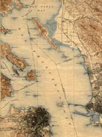
Map, San Francisco 15-minute Quadrangle, 1895
Annotation

Provides historical United States Geological Survey maps of the San Francisco Bay area, from Point Reyes in the north to Half Moon Bay, and east to San Jose. Includes maps from different time periods—the earliest is from 1895, the latest 1997—covering each 7.5-minute and 15-minute quadrangle of the area. Users may zoom in to see minute details. Searchable by quadrangle or place name. Of value for those studying change over time in the development of the Bay Area during the 20th century.

Historical Maps Online

Image
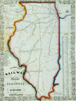
Map, D.B. Cooke & Co.'s railway guide for Illinois...
Annotation

This website offers more than 400 images of historic maps charting 400 years of development in Illinois and the northwest territory. The collection of maps can be browsed by state or geographic area or by categories such as early maps, topographic maps of Illinois, Indians of North America, waterways, and transportation. Types of maps include maps showing roads and canals, topographical maps, French and Spanish colonial maps, maps of railways, city maps, county and township maps, maps showing regions of settlement, and sectional state maps.

A zoom and pan feature allows the map images to be examined in detail and bibliographic information is provided with each map image. A keyword search is available. An excellent source of historic maps.

U.S. Geological Survey

Article Body

The U.S. Geological Survey exists as a federal organization created to study the nation's flora, fauna, biology, geography, bodies of water, geology, and geospatial information.

The USGS provides access to their entire photographic collection, which is sub-divided into portraiture, photographers, "pioneer photographers," and images of earthquakes; mines, mills, and quarries; national parks; and Mt. St. Helens.

In addition, educators can access nine sub-sites and resources optimal for K-6 education, covering land use and exploration. Sample topics include "A Satellite View of the Journey of Lewis and Clark" and "Urban Growth in American Cities." Twelve resources, also addressing land use and exploration, are available for grades 7-12.

Available teacher packets, like the majority of the site, will primarily be of use to science educators. However, the three packets on maps could be used in conjunction with units on westward expansion or exploration.

A Portion of the People: Three Hundred Years of Southern Jewish Life

Image
Oil on canvas, Mary Olivia Lucas Harby. . . , c. 1830, A Portion of the People
Annotation

This exhibit tells "the story of Southern Jewish settlers and their descendants from the late 1600s through the 21st century." It currently consists of two presentations, each with more than 50 pages presenting an image from the exhibit's collection with accompanying explanatory text. Images include portraits, maps, historical documents, photographs of Jewish ritual books and religious and cultural objects, paintings and photographs of synagogues, and photographs of Jewish businesses. "First Families" explores the period from the 1600s to the 1820s through more than 50 images and "This Happy Land" explores the antebellum and Civil War years through more than 90 images. (The presentation "Pledging Allegiance," recounting the story of Jewish migration to the South in the first half of the 20th century, is under construction.) Visitors can listen to six interviews featuring voices from the past (transcripts are available). Additionally, a photographic essay with more than 40 photographs, "Palmetto Jews" by Bill Aron, examines Jewish life in South Carolina over the past 50 years. There is no site search capability.

Architecture and Interior Design for America: 1935-1955

Image
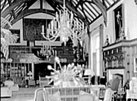
Photo, Charles E.F. McCann residence, Oyster Bay, Long Island, New York, LoC
Annotation

A photo archive of more than 29,000 images, produced by architectural photographers Samuel Gottscho and William Schleisner. Gottscho and Schleisner were commissioned to document the work of architects, sculptors, and artists for individuals and institutional clients, such as House Beautiful and House and Garden magazines. The collection specializes in views taken primarily in the northeastern United States--many in the New York City area--and in Florida. Subjects include homes, stores, offices, factories, and historic buildings. Also of note are 100 color images of the 1939-1940 New York World's Fair. As the introductory text points out, the assembled group of photographs can "serve as a document of social change from a particular vantage point of the middle and upper classes of society."

The Urban Landscape

Image
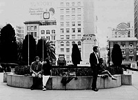
Photo, San Francisco
Annotation

A searchable database of approximately 1,000 historical images from 14 collections at Duke University, focusing mainly on cities and towns in the American South from the late 19th century to the 1980s. Includes 41 aerial views taken by the U.S. Army Signal Corps in 1918 of towns in Florida, Georgia, Alabama, and South Carolina; 150 picture postcards of southern towns from the turn of the century to the 1960s; 22 photos of the 1886 earthquake in Charlotte, SC; 32 photographs taken in Savannah, GA around the turn of the century; 28 taken in Cheraw, SC, in the early 20th century; 112 shot in Durham, NC, from the turn of the century up to 1950; and 66 photos, taken mostly in Durham, for 18 Duke University undergraduate documentary photography projects created between 1979 and 1985. The site also includes a series of 97 photographs taken in Salem, MA, in the 1890s; 31 images from the Philippine Islands and other Far East locations taken between 1899 and 1902; and four series of 218 photographs by documentarist William Gedney taken in New York, San Francisco, and Benares, India. Especially of value for students of urban architecture and for those interested in images of southern street life.

Benjamin H. Marshall: Architect and Bon Vivant

Description

From the Chicago Amplified website:

"Benjamin H. Marshall's designs included vast country estates, palatial residential buildings, sumptuous hotels, and innovative high-rise structures. His circle included anyone with intelligence, style, and wit.

Benjamin Marshall Society docent and lecturer Steven Monz paints a portrait of the architect and highlights several of his projects in Chicago, including residential buildings along East Lake Shore Drive, and the Drake and Blackstone Hotels."