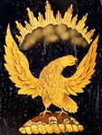
Old Stone House [NY]

Description

The Old Stone House is a reconstruction of the 1699 Vechte-Cortelyou House, a Dutch farmhouse. The site interprets the role of the structure in the Revolutionary War and in shaping both Brooklyn, NY and the nation. During the August 22, 1776 Battle of Brooklyn, British forces seized the building, effectively cutting off American retreat. The Continental Army, outnumbered five to one, managed to regain control of the structure twice before finally losing ground. The bravery of the troops heartened George Washington and his men.

The site offers exhibits, tours, and 90-minute curriculum-based student programs. Pre- and post-visit materials are provided for all educational programs. Reservations are required for tours and student programs.

Elizabeth Glynn's Student-Led Monuments and Memorials Tour

Date Published
Image
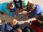
Photo, 6th Grade DC Trip - Day 2, March 25, 2009, climbnh2003, Flickr, cc
Article Body

Five years ago, during my first year of teaching Advanced Placement U.S. History in Leesburg, VA, I created a final exam for my students that I hoped would change the way they thought about monuments and memorials.

Preparation

For the students to fully execute this project, they first had to understand the purposes of monuments and memorials. We spent two days reading materials that discussed the goals of monuments and memorials. Students also read an article from the Washington Post Magazine that detailed a failed attempt to build a monument on the National Mall. The third day we watched History Channel videos on the presidential monuments and war memorials and critiqued the information that was presented on each. After our discussion on the videos was completed, I introduced the students to the final exam project.

The project was to create a 45-minute tour of a monument or memorial in Washington, DC. Each year, I pre-selected 15 monuments and memorials that were in walking distance of each other. I divided the students into groups of three or four and gave them five class days to plan the tours and accompanying brochures. Each tour and brochure had to explain the purpose of the monument and memorial and help visitors understand its role in history. Both the tour and the brochure had to use at least one primary as well as one secondary source for the information presented.

Throughout the year in my classroom, we had worked with primary and secondary sources, which prepared students to work with sources on their own for this project.

The students also had to create an activity that reinforced the information they presented to the audience. This activity had to be something that everyone could participate in and that incorporated the sources from the tour the group presented. I purposely did not give much guidance on the activities beyond emphasizing the need for primary and secondary sources. I wanted students to create their own activity that they believed helped to explain the monument or memorial to the group.

Sources

Throughout the year in my classroom, we had worked with primary and secondary sources, which prepared students to work with sources on their own for this project. To the students, primary and secondary sources are generally items that they use for research purposes—not incorporate into an active event like a tour—so this stretched their understanding of how to use sources and of how to create historical meaning.

I made sure that there were no duplicate groups and that students had plenty of resources available to use. Before assigning the project, I made a trip to the National Park Service Ranger Station in Washington, DC, to pick up brochures on individual monuments and memorials and a trip to my local library to take out books on the monuments and memorials. (It was near the end of the school year, so computer labs and the school library were in high demand).

The sources and books ranged from children's books and nonfiction sources to historical association publications. When the students were researching for their tours, I wanted them to have a mix of sources available so that they could create a unique tour.

I wanted the students to realize that primary and secondary sources of a historic site are not just the building plans but anything that deals with the site!

I researched each monument and memorial to make sure they had primary and secondary sources available that the students could find through the different National Park Service websites. I explained, though, that the primary and secondary sources did not have to be just about the monument and memorial—they could be from a spectator, newspaper, fundraising committee, or a schedule of opening day events. I wanted the students to realize that primary and secondary sources of a historic site are not just the building plans but anything that deals with the site!

When the students were researching, finding, and printing their sources, they analyzed sources in terms of usefulness for the tour and accessibility for the audience. Many found that the primary sources they selected allowed them to weave a story into their tour. I didn't have any guiding activities for their primary/secondary sources so the students had to analyze and synthesize the information on their own.

Plans Come to Fruition

I was nervous to let the students go like this, but I knew they had to do the analysis on their own to be able to speak intimately of the monument or memorial on their tour. The Vietnam Veterans Memorial group did this with ease. Although they were excellent students in my class, they had not been comfortable with primary source analysis in our previous in-class activities. The group began by searching for only primary sources dealing with the building of the monument, letters from veterans, legislation in Congress, and the plans from Maya Lin.

They were able to find a common thread between all the sources but they were still missing a piece that would connect the audience to the memorial personally.

I kept encouraging this group to look through the books I had checked out from the private library, but they were determined to sort through what they had found online and in journals in the school library. The group took the approach of observing the materials, seeing who wrote them, finding bias, and trying to connect the sources all together. They were able to find a common thread between all the sources but they were still missing a piece that would connect the audience to the memorial personally.

When the students finally started going through the public library material, they found a book that changed the focus of their tour. The book was Offerings at the Wall: Artifacts from the Vietnam Veterans Memorial. One student made a decision—she was going to let the offerings (primary sources left behind at the wall) take the lead. The group laid their sources out on a desk. They had photocopied offerings that they liked from the book and placed them with the other primary sources they had collected to construct a narrative for their tour. This was an extremely effective way to demonstrate the connection between the memorial and its visitors.

I collected the brochures the students created before we went on the field trip to Washington, DC. I did this for two reasons: one, so that I had time to grade the brochures, and two, so that the students could not rely on their brochures to present the tours. I didn't want them to just walk through the sites using their brochures; I wanted them to add to them with additional information that they had found through their research.

The day we left for the trip, the students came prepared with props, primary sources, handouts, and prizes for their activities. Each student received a response booklet that they were to fill out for each tour. My questions in the booklet aimed at what the students learned and the strengths and weaknesses that they saw. I had my own grading rubric to use and the chaperones who came with me were also assigned rubrics to grade with so that I could reference them later.

I had high expectations for the tours and the students knew this.

The first presentation was the hardest for the students but once one group went, the rest were relieved and couldn't wait to present. I had high expectations for the tours and the students knew this. My secondary goal of this project was to impart my passion for historical sites and discussing them to the students, and I could see that my passion had passed on to several of the students.

For each tour, every student had to talk for at least 15 minutes (for groups of three, or 11 minutes for groups of four) and had to draw on one source in his or her portion. The groups that brought pictures or documents to hold or pass around to the audience were usually the ones that the other students enjoyed most.

The best part for all of us was the activities that went along with each tour. The students really went above and beyond in planning activities to review what they talked about. Many of the groups found additional primary sources for this portion. They would either do a card sort where you mix and match the picture to a person or you would have to put pictures in chronological order based on the building of the monument or memorial. Several students also planned scavenger hunts around their monument or memorial.

The activities were usually based on the size of the monument and memorial.

The activities were usually based on the size of the monument and memorial. For example, the Washington Monument usually had a matching activity due to the limited access to the monument and the structure of it. The 56 Signers of the Declaration of Independence Memorial had a scavenger hunt based on the information on each plate since it was a smaller memorial with full access.

One memorial that invoked a lot of emotion for the students and for which students found primary sources easily is the National Japanese American Memorial to Patriotism During World War II by Union Station. This site is beautiful and the students really loved exposure to this piece of history. The site is dedicated to Japanese Americans' participation in World War II from military service to the internment camps.

The best tour site for a group of four was the Franklin D. Roosevelt Memorial, which is divided into four sections. The World War II Memorial was good for a larger group because I could divide the students into the Atlantic and Pacific fronts.

Having students base the tour on primary sources forced them to look in the past and find out about the monument or memorial as it was being built and presented to the public.

To talk for 45 minutes about a monument or memorial is not easy if you do not know the information well. Having students base the tour on primary sources forced them to look in the past and find out about the monument or memorial as it was being built and presented to the public.

My overall goal was to expose students to the resources and history that surround them. These students may or may not go back to these sites, but they will remember their stories and the stories monuments and memorials can tell. A few, I feel, will return and be able to tell the people they are with a little bit about what they are seeing.
Bibliography

Books and Articles
Ashabranner, Brent K. Their Names to Live By: What the Vietnam Veterans Memorial Means to America. Bookfield, CT: Twenty-First Century Books, 1998.

Katz, Leslie George. "The American Monument." Eakins Press Foundation, 1976.

Kelly, John. "A Mom-umental Failure." The Washington Post Magazine, May 11, 2008: 14 – 18, 23 – 26

Walton, Eugene. "Philip Reid and the Statue of Freedom." Middle Level Learning. 24. (2005): M2 – M4.

Documentaries
Great Monuments of Washington, DC. The History Channel: 2005.

Monuments to Freedom - The Presidential Memorials. The History Channel: 2005.

The War Memorials. The History Channel: 2005.

For more information

Eighth-grade teacher Amy Trenkle also uses DC monuments and memorials with her students. What do her students make of one of the city's less-famous statues—a memorial to Christopher Columbus?

The History Box

Image
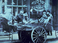
Photo, Pushcart peddler in Lower East Side, NY, early 1900s, The History Box
Annotation

A gateway and an archive of numerous articles on New York history, this site "focuses a particularly long lens on the early history of political and economic events, panics, riots and other related matters affecting or contributing to New York City's development and growth." Its main feature is the New York state and New York City directories. (The U.S. directory is currently unavailable.) The New York state directory offers more than 700 links and more than 60 articles organized under 21 topics that include the arts, cities and counties, ethnic groups, military, societies and associations, transportation, women and their professions, and worship.

The New York City directory offers more than 5,200 links and more than 700 articles organized under 58 topics that include architecture, the arts, business matters, city government, clubs and societies, crime and punishment, education, ethnic groups, 5th Avenue, Harlem, immigration, New York City panics, real estate, temperance and prohibition, and Wall Street. The visitor can search the entire site or each directory by keyword. This site is a good starting point for researching the history of New York. It should also be useful for literary scholars, writers, and historical societies.

Causing the Civil War

Question

Was economic difference—manufacturing in the North and slave-driven agriculture in the South—the primary cause of the Civil War?

Textbook Excerpt

Textbooks have traditionally taught that incompatibility between northern and southern economies caused the Civil War. Everything else was tied to that economic difference, anchored by cotton.

Source Excerpt

Census data from 1860 shows farms, manufacturing, and cities in the North and the South, as well as the location of slaves and cotton in southern states, all of which challenge the notion of a purely agricultural South and industrialized North.

Historian Excerpt

The Civil War was fought for many reasons, not solely or even primarily because of the growing importance of cotton on southern farms. Moving away from economic differences and cotton as simplistic causes leads to a more accurate, and far more interesting, understanding of the causes of the Civil War.

Abstract

For years, textbook authors have contended that economic difference between North and South was the primary cause of the Civil War. The northern economy relied on manufacturing and the agricultural southern economy depended on the production of cotton. The desire of southerners for unpaid workers to pick the valuable cotton strengthened their need for slavery. The industrial revolution in the North did not require slave labor and so people there opposed it. The clash brought on the war.

Economic divergence is certainly one of the reasons for the Civil War, but neither the major one nor the only one. Many factors brought about the war. Focusing only on different economies would be like arguing that one professional football team will always win because it has taller players.

The true causes of the Civil War are downright intriguing and just as complex as the conflict itself.

Material Culture: More Than Just Artifacts

Article Body

Coca-Cola ads used to say “Can’t beat the real thing.” At the Jewish Historical Society of Greater Washington, the real thing is our historic synagogue, and indeed, nothing can beat it for educating students about immigrant and neighborhood history in the nation’s capital city.

Originally built by Adas Israel Congregation in 1876, the 25-foot by 60-foot synagogue was a simple house of worship that served German and Eastern European Jewish immigrants in downtown Washington. President Ulysses S. Grant attended its dedication. Because of the building’s significance, the Society moved it three blocks in 1969 to save it from the wrecker’s ball. Today we run the Lillian & Albert Small Museum there.

Among our primary visitors are school groups, mainly from Jewish congregational schools and day schools, but private and public schools visit as well. The building is the focal point of all youth programs.

. . . 3rd–7th graders look for clues about the building's function in its architecture.

In Synagogue Story, K–2nd graders compare the restored 19th-century sanctuary with the 21st-century sanctuaries (or even theaters!) they know—and then make a model of the building to take home with them. In Building Detective, 3rd–7th graders look for clues about the building's function in its architecture. A separate balcony for women teaches them about gender roles in 19th-century American Judaism. A cobalt blue window and a photo of a crucifix in the sanctuary offer a glimpse into the synagogue's later life as a Greek Orthodox Church. Walking by the front façade, then seeing a photo of it with a pork barbecue sign, conveys the story of a continually changing urban neighborhood.

While we could just lecture about late 19th- and early 20th-century Jewish life in Washington, having students physically present in the space, sitting on wooden pews similar to those used over a century ago, seeing photos of how the same space once looked, walking on the old, creaking floors, and studying artifacts used in the space—nothing can top that experience, those sensations, that visceral connection to the past, and the power of the authentic. One teacher said her students will "remember the pews and the bench for President Grant and that he stayed for the entire three-hour service and wore a hat the entire time."

Using material culture—whether a building, a historic artifact, or even a photograph—engages the senses and thus enhances learning.

On walking tours, middle and high school students travel the same streets where Jewish, Italian, German, and Chinese immigrants lived, worked, and worshiped. They traverse blocks of modern office buildings and courthouses, then react with surprise to photos of brick row houses, the four surviving former synagogues, and other physical remnants of the past. Out-of-town students connect with Washington as a city, beyond the monuments and museums on the National Mall.

This is the educational theory of constructivism at work. Using material culture—whether a building, a historic artifact, or even a photograph—engages the senses and thus enhances learning. As we've seen by watching students beholding the synagogue's original ark and simple woodwork, they gain an emotional connection to the history. Another teacher told us that his students, spurred by the experience, asked "great follow-up questions" on the ride home.

So for teachers, we strongly recommend bringing students to historic sites—particularly those off the beaten path—and taking them on walking tours. We know that's not always possible, with school budgets being what they are. Alternatively, many teachers make effective use of "treasure boxes" sent out by museums. These include replica artifacts and photos, which still accomplish the most important goal: helping students connect to the past in a tangible way.

Teaser

Using material culture—whether a building, a historic artifact, or even a photograph—engages the senses and enhances learning.

Maryland Historical Society Collections Online

Image
Painted tin hat shield, Maryland Historical Society, 1940.23.1
Annotation

The Maryland Historical Society owns millions of objects which could be key to bringing history to life for your class. A growing number of these items can be found in their digital collections.

The collections can be searched by title, creator, individual collection, or subject. At the time of writing, there are nine collections—the American Civil War; War of 1812; Paintings; African American History; Women's History; Mining the Museum (items on exhibit); Benjamin Henry Latrobe, an architect known for design the U.S. Capitol and the Baltimore Basilica; and works on paper. Artifacts include photographic images, engravings, broadsides, handwritten documents, a flag, a shadowbox, a knife, sketches, clothing, paintings, swords, a shield, a canteen, and more.

The original handwritten version of "The Star-Spangled Banner" may be of particular interest.

Historic USGS Maps of New England

Image
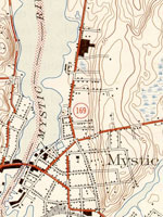
Map, "Mystic, CT-NY-RI Quadrangle," 1944
Annotation

A collection of more than 1,100 topographical maps created by the United States Geological Survey from the 1890s to the 1950s covering all of New England—Maine, New Hampshire, Vermont, Rhode Island, Massachusetts, and Connecticut—and selected areas of New York. The maps—which reveal roads, buildings, rail lines, bodies of water, and elevations—occur in 15-minute and 7.5-minute quadrangle series (a minute is one-sixtieth of a degree of latitude or longitude). In addition, the collection includes six maps with 30-minute quadrangles.

For states other than New York, users can view a state image map and select a point within a grid marked off in 15-minute increments to find listings for available images accompanied by dates the maps were surveyed, created, and revised. Towns within each quadrangle are also listed along with names of adjacent areas. Users also may search an alphabetical list of towns within each state. For New York, only an index of quadrangles names is available. Maps are presented in JPEG format. According to the site, "Each image is typically 2 megabytes, so download times are likely to be slow." A useful site for those studying changes in the New England landscape during the first half of the 20th century.