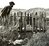
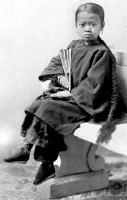
Chinese in California, 1850-1925

Image
Annotation

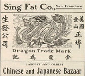
These 8,000 items document the immigrant experience of Chinese who settled in California during the 19th and early 20th centuries. Materials include photographs, letters, diaries, speeches, business records, legal documents, pamphlets, sheet music, cartoons, and artwork.

Access is provided through nine galleries, each containing an introductory essay and 70 to 575 items. Four galleries present materials on San Francisco's Chinatown, including architectural space, business and politics, community life, and appeal to outsiders. Additional galleries deal with Chinese involvement in U.S. expansion westward; communities outside San Francisco; agricultural, fishing and related industries; the anti-Chinese movement and Chinese exclusion; and sentiments concerning the Chinese. Visitors may search by keyword, name, subject, title, group, and theme. The site will be useful for studying ethnic history, labor history, and the history of the West as well as Chinese-American history.

Prairie Settlement: Nebraska Photographs and Family Letters

Image
Annotation

These two collections illuminate life on the Great Plains from 1862 to 1912. The nearly 3,500 glass plate negatives depict everyday life in central Nebraska, with images of businesses, farms, people, churches, and fairs in four counties. Approximately 318 letters describe the sojourn of the Uriah Oblinger family through Indiana, Nebraska, Minnesota, Kansas, and Missouri as they traveled to establish a homestead. Letters discuss such topics as land, work, neighbors, crops, religious meetings, grasshoppers, financial troubles, and Nebraska's Easter Blizzard of 1873.

A 1,000-word essay describes the letter collection and the lives of the principal correspondents. Biographical notes are available for more than 120 of the people who corresponded with the Oblingers or who were mentioned in the letters.

Sanborn® Fire Insurance Maps, UT

Image
Annotation

These 1,275 detailed historical maps depict cities in the state of Utah. D. A. Sanborn Company, a pioneer producer of insurance maps on a national scale, designed maps that depicted commercial, industrial, and residential sections of Utah cities. The collection of large-scale detailed maps dating from 1867 through 1969 is an ongoing project, and currently contains maps of 40 cities. Users may download compressed images to view and enhance the maps. Maps are arranged alphabetically by city and date, although the years available for each city are inconsistent.

The maps outline the site, size, shape, construction, and building materials of dwellings, commercial buildings, and factories. In addition, the maps detail building use, sidewalks, property boundaries, house and block numbers, and even the locations of hydrants and wells. The collection presents an opportunity to study Utah history, architectural history, and the development of cartography.

Trails to Utah and the Pacific: Diaries and Letters, 1846-1869

Image
Annotation

Diaries documenting the westward treks of 45 men and four women during the period of the California Gold Rush and the westward migration of Mormonism are presented in this site. Although most of these travelers took either the California or Mormon trails, a few diaries provide accounts describing life on trails to Oregon and Montana.

The diaries are complemented by 82 photographs and illustrations in addition to 43 maps, including an interactive map displaying trails, cities, rivers, and landmarks. There are seven published guides, two essays on the Mormon and California trails, brief biographies of most of the diarists, and a list of suggested readings. This is an excellent collection of materials that documents 49 individual perspectives on a movement that encompassed an estimated 500,000 people.

Museum of the City of San Francisco

Image
Annotation

These 11 exhibits address the history of California and San Francisco. Topics include the Gold Rush of 1849; earthquakes of 1906 and 1989; the history of the city's fire department; construction of the Golden Gate and Bay Bridges; and the internment of Japanese Americans during World War II. These exhibits provide timelines and links to more than 200 primary documents and images, including newspaper articles, diary entries, oral histories, photographs, political cartoons, and engravings. Two exhibits are hyperlinked chronologies pertaining to San Francisco during World War II and the rock music scene in the city from 1965 to 1969.

Documents can be accessed according to subject, with more than 25 documents listed on the Chinese-American community, fairs and expositions, and labor issues. The site also contains more than 150 biographies of prominent San Franciscans.

South Texas Border, 1900-1920: The Robert Runyon Collection

Image
Annotation

These more than 8,000 images document the history and development of South Texas and the border. The collection features the life's work of commercial photographer Robert Runyon (1881–1968). Topics include the U.S. military presence in the area prior to and during World War I and the growth and development of the Rio Grande Valley in the early 1900s.

A special section presents nine of Runyon's 350 photographs of the Mexican Revolution (1910–1920) in Matamoros, Monterrey, Ciudad Victoria, and the Texas border area from 1913 through 1916. "Maps of the Lower Rio Grande" offers a number of topographical and military maps depicting the region. The website also offers essays on the revolution and on Runyon.

The 1906 San Francisco Earthquake and Fire

Image
Annotation

Created to commemorate the 100-year anniversary of the San Francisco earthquake, this exhibit and archive features an extensive collection of primary source material, an interactive map, and a 360-degree view of the damage to the city. The primary sources include thousands of images and text files available, offering more than 8,000 photographs, 500 cityscapes, and 500 letters, as well as a host of additional resources, such as broadsides, oral history texts, periodical articles, photomechanical prints, reports, and stereographs. Visitors can browse the archive by genre or subject or search by keyword, subject, genre, or geographic location.

The exhibit has five galleries, each with several text/photograph displays: San Francisco before the fire; the earthquake; the fire, including a map showing burned districts; the story of refugees and survivors; and reconstruction. The interactive map divides San Francisco into 10 regions, each of which can be browsed or searched for images taken in that region. It also includes 11 aerial cityscape views. The 360-degree panoramic view of San Francisco shortly after the disaster is composed of 11 separate photographs taken from the roof of the Fairmont Hotel.