Gold Rush!

Image
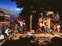
Painting, Sunday Morning in the Mines, Charles Nahl
Annotation

In commemoration of the 1848 California Gold Rush, the Oakland Museum opened a series of exhibitions and created this online companion site. Sponsored by Kaiser Permanente, this virtual tour of the museum's exhibition offers an extensive (roughly 5,000-word) narrative of the Gold Rush and its history, illustrated with over 50 images of posters, photographs, artifacts, and art related to the Gold Rush. Three audio narratives discuss details of the discovery of gold and the resulting massive westward migration. Also included on the site are 28 images of artwork and 22 photographs of related subjects.

Site visitors can explore the experiences of Chinese, Latino/Californio, Native American, and African American peoples who participated in the Rush. Links to three curriculum sites and sample curriculum materials are available for grades 4, 5, 8, and 11; five curriculum units and 18 lesson plans can be purchased from the museum. The site is ideal for researching California history and westward expansion.

Adopted by the Shawnee

Description

From the Colonial Williamsburg: Past and Present Podcasts website—

"Runaway slave Elizabeth found freedom, family, and equality when she was adopted into the Shawnee tribe. After ten years, she returned to slavery. Hope Smith shares the heartbreaking story behind this selfless act."

The Indian War of 1812

Description

Professor David Henkin examines the ongoing war between Native American nations and the United States in 1812 and prior to and following 1812. He also considers popular memory of Native American history and failure to integrate it into U.S. history as a whole.

U.S. Coast Guard

Article Body

The United States Coast Guard, one of the five U.S. military branches, protects the environment and U.S. citizens, economic interests, and security in the world's oceans and bodies of inland water. Specific duties include rescue operations and maritime law.

The Coast Guard's home on the web is certainly not the easiest to navigate of the Armed Forces sites. However, it does contain a noteworthy amount of content which could be put to use in the classroom, particularly background information for teachers or for student reports.

Items worth your attention include a Coast Guard blog with posts on the organization's history; a list of Coast Guard historical events, organized by day of the year; overall and regional history overviews, most in the form of PowerPoint presentations or articles; and histories of Coast Guard assets, missions, and personnel, including women and minorities.

Primary sources are also available in abundance. These include oral histories divided by theme and military engagement, back issues of official magazines, a selection of documents dating from 1791 through the late 20th century, and galleries of historic photographs. The photographs can be compared to recent images and artworks located within the Coast Guard multimedia gallery. Of the magazines, the majority offer back issues from the 2000s. However, The Reservist offers issues dating as far back as the 1950s.

If you are looking specifically for children's activities, check out "Just for Kids (and Teachers!)", which offers coloring books, information on animal mascots adopted by various Coast Guard units, teacher's guides for lighthouse and Coast Guard history, and images of lighthouses. You may also want to peruse the suggested reading list for even more in depth preparation.

Another item worth your attention is a page devoted to U.S. revenue cutters during the War of 1812. On this page, you can find paintings, ship's plans, and illustrations of the cutters and their personnel; histories of individual cutters, Captain Frederick Lee, and prisoners of war; brief overviews of the role played by the cutters; and a bibliography to assist further research.

Finally, if you want to get the kids out of the classroom and you are in the Connecticut area, you could try the U.S. Coast Guard Museum. Not in New England? Try the artifact finder to pinpoint museums in your state with Coastie artifacts.

History: The National Park Service

Image
Logo, NPS History and Culture website
Annotation

Historical aspects of many of the 384 areas under the National Park Service's stewardship are presented in this expansive site. A "Links to the Past" section contains more than 25 text and picture presentations on such diverse history-related topics as archeology, architecture, cultural groups and landscapes, historic buildings, and military history. Of particular interest to teachers, a section entitled "Teaching with Historic Places" features more than 60 lesson plans designed "to enliven the teaching of history, social studies, geography, civics, and other subjects" by incorporating National Register of Historic Places into educational explorations of historic subjects. Examples include an early rice plantation in South Carolina; the lives of turn-of-the-century immigrant cigar makers near Tampa, Florida; a contrast between the Indianapolis headquarters of African-American businesswoman Madam C. J. Walker and a small store in Kemmerer, Wyoming, that grew into the J. C. Penney Company, the first nationwide department store chain; the Civil War Andersonville prisoner of war camp; President John F. Kennedy's birthplace; the Liberty Bell; Finnish log cabins in Iowa; and the Massachusetts Bay Colony's Saugus Iron Works. Especially useful for teachers interested in connecting the study of history with historic sites.

Journals of the Lewis and Clark Expedition

Image
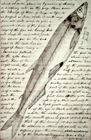
Image, Page from the journals, Journals of the Lewis and Clark Expedition
Annotation

This well-designed site presents the Nebraska edition of the Lewis and Clark journals, edited by Gary E. Moulton. The site provides the complete text of all the journals from the 1803–1806 expedition, as well as introductions, prefaces, and sources. The material is searchable by keyword and phrase.

There are 29 scholarly essays about the expedition. An image gallery offers 124 images of pages from the journals, 95 images of people and places, and 50 images of plants and animals encountered on the expedition. The maps section includes 12 explanatory maps and nine images of maps from the journals. Additionally, there are 27 audio excerpts of journal readings and eight video interviews with the editor of the project. The website stands as an outstanding resource for researching the history of the Lewis and Clark expedition.

American Notes: Travels in America, 1750-1920

Image
Title graphic, American Notes: Travels in America, 1750-1920
Annotation

This site is a collection of 253 travel narratives written between 1750 and 1920. The narratives were written by American citizens and foreign visitors about their travels in America. Some of the accounts were written by famous Americans (James Fenimore Cooper and Washington Irving, for example), but most of the authors were not famous. The narratives include their observations and opinions about American people, places, and society; and are valuable sources for the study of early American attitudes. Most accounts are viewable either as scanned images or as transcribed texts. Also included is the 32-volume set of manuscript sources entitled Early Western Travels, 1748-1846. The collection is searchable by keyword, and may be browsed by subject, author, and title. Students and teachers will find these primary sources invaluable for research and study of the late 18th and 19th centuries.

Historical Maps of the United States

Image
Map, Exploration Before 1675
Annotation

This division of the Perry-Castaneda Map Collection provides access to 500 historical maps of the U.S. Maps are sorted thematically and include three maps of early inhabitants, 11 of exploration and early settlement from 1675 to 1854, and 15 of territorial growth from 1775 to 1970. Of the 95 military history maps covering engagements from 1763 to 1967, 50 are about World War II alone.

Among 183 late 19th- and 20th-century maps, there are 146 of U.S. cities produced around 1920. Historic sites, memorials, and battlefields are represented in 191 maps of sites such as Aztec ruins in New Mexico, the Bering land bridge in Alaska, and the Vicksburg battle site in Mississippi. Most of the maps are excerpted from 20th-century historical atlases. The site will be particularly useful for research in military history and early 20th-century urban history.

Historical Maps Online

Image
Map, D.B. Cooke & Co.'s railway guide for Illinois...
Annotation

This website offers more than 400 images of historic maps charting 400 years of development in Illinois and the northwest territory. The collection of maps can be browsed by state or geographic area or by categories such as early maps, topographic maps of Illinois, Indians of North America, waterways, and transportation. Types of maps include maps showing roads and canals, topographical maps, French and Spanish colonial maps, maps of railways, city maps, county and township maps, maps showing regions of settlement, and sectional state maps.

A zoom and pan feature allows the map images to be examined in detail and bibliographic information is provided with each map image. A keyword search is available. An excellent source of historic maps.