Pioneering the Upper Midwest: Rare Books c. 1820-1910

Image
Annotation

This American Memory website traces the history of the Upper Midwest (Michigan, Minnesota, and Wisconsin) from the 17th century to the early 20th century, through 138 volumes drawn from the Library of Congress General Collection and the Rare Books and Special Collection Division. Selected works include first-person accounts, biographies, promotional literature, local histories, ethnographic and antiquarian texts, and colonial archival documents that depict the region's land and resources, cross-cultural encounters, experiences of pioneers and missionaries, soldiers, immigrants, reformers, growth of communities, and development of local culture and society. Each work is available in full-text transcription or page image, and is accompanied by notes giving the title, author, publication information, and a 300–350 word summary of the contents.

The site also offers a 2,000-word essay on the history of the Upper Midwest that covers the discovery, exploration, settlement, and development of the region from pre-contact to the early 20th century; a regional map dated 1873; links to more than 40 related websites; and a bibliography of nine related works, three of which are ideal for younger readers. The site can be searched by keyword and browsed by author, subject, and title. For those interested in the history of the Upper Midwest and Great Lakes region, this site offers some informative resources.

The American Revolution and Its Era: Maps and Charts

Image
Annotation

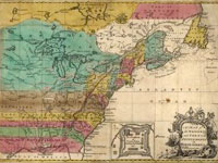
This American Memory site records the mapping of North America and the Caribbean from 1750 to 1789 through images of maps in the Geography and Map Division of the Library of Congress. Most items on the site are also included among the 2,000 images in Maps and Charts of North America and the West Indies, 1750-1789: A Guide to the Collections of the Library of Congress, compiled by John R. Sellers and Patricia Molen van Ee (1981).

Currently the site contains roughly 500 images. Maps and charts will be added to the online exhibit gradually. Selected images include original manuscript drawings by famous mapmakers like Samuel Holland, John Hills, and John Montresor; maps from the personal collections of men like Admiral Richard Howe and the Comte de Rochambeau; and large groups of maps by three major 18th-century London publishers: Thomas Jeffreys, William Faden, and Joseph Frederick Wallet des Barres.

The online collection allows visitors to compare editions, styles, and techniques of mapmakers from Great Britain, France, Germany, Spain, Holland, Italy, and the United States; and to follow the development of specific maps from the manuscript sketch to the finished, printed version. Each image is accompanied by descriptive notes (100–150 words) and a list of the medium, date and place of publication, condition, call number, and repository. The site also includes a 1,500-word essay on mapmaking during the American Revolutionary era and links to 12 other American Memory sites containing related materials.

Visitors can browse this site by geographic location, subject, creator, and title, and can search the site by keyword. This site is ideal for students and teachers interested in mapmaking in the 18th century and in exploring how maps helped to illustrate American culture.

Puerto Rico at the Dawn of the Modern Age

Image
Annotation

This Library of Congress American Memory site, a collaborative effort of the Library of Congress Hispanic Division and the National Digital Library Program, was created to help commemorate the centennial of the Spanish American War (1898). It traces the early history of the Commonwealth of Puerto Rico through first-person accounts, political writings, and histories.

The selections consist of 39 Spanish-language political pamphlets, 13 monographs, and one journal that highlight topics such as land, natural resources, relations with Spain, political rivalries, and reform efforts. A brief (200–250 word) summary of the item and notes about the author, publication date and place, and repository information accompany each item. The Spanish-language pamphlets are not translated into English.

The online exhibit also features reminiscences of 12 soldiers who fought in the Spanish American War. A special presentation of downloadable cartographic items from the Library's Geography and Map Division includes two maps of the West Indies dating from 1806 and 1898; seven maps of Puerto Rico (1886–1915); maps of the cities of Bayamon, Mayaguez, and San Juan, Puerto Rico; and three Puerto Rican maps from the Spanish American War era.

The site also offers links to nine other American Memory sites on related topics and a bibliography lists more than 50 related works, approximately 20 of which are suitable for younger readers. This site will appeal to a small audience because of the number of untranslated Spanish documents; additionally, the selected documents only depict a narrow slice of Puerto Rican culture and society, primarily that of political, military, and foreign relations history. But for students interested in Puerto Rican history or the history of Spanish and American relations, this is a useful site.

The 19th Century in Print: Periodicals

Image
Annotation

Part of the Library of Congress American Memory Project, this site offers full-text transcriptions of 23 popular 19th-century periodicals digitized by the Cornell University Library and the Preservation Reformatting Division of the Library of Congress. Among the periodicals on this site are literary and political magazines, as well as journals like Scientific American, Manufacturer and Builder, Garden and Forest, and the North American Review.

Each periodical is accompanied by very brief (10–15 word) notes on the name and location of the publisher and the years and volumes covered. Each periodical's full text is searchable by keyword and phrase.

A special presentation offers roughly 750-word essay on the historical background of Garden and Forest by Sheila Connor, the Horticultural Research Archivist at the Arnold Arboretum. There are also links to five related American Memory resources. The site's broad sampling of periodicals provides an easily navigated source for articles and editorials on a number of 19th-century political, cultural, and social issues.

Drawing the Western Frontier: The James E. Taylor Album

Image
Annotation

This site explores James E. Taylor's legacy as a recorder of western culture. A professional artist, Taylor's newspaper illustrations served to popularize stereotypes of the Western frontier during the post-Civil War years. Like other illustrators and writers of the period, he depicted Indian-White relations in terms of savagery versus civilization and encouraged Americans to visualize the nation's Westward expansion in heroic terms. Taylor made his own illustrations, collected photographs taken by others, and constructed scrapbooks. Following Taylor's lead, the producers of this site use albums to display his work. The site includes about 750 items, taken from the 1,100 items that appeared on Taylor's 118 album pages.

Visitors can search for images by keyword, or can browse by subject or album theme. Each album image is annotated with the date the image was made, the subject, and the creator of the image, and there is an 1,800-word introductory essay for those unfamiliar with Taylor and his work. Visitors should beware that these are high-quality images, and are therefore large files. High-speed connections will make downloading much more manageable. The photographs and images in this collection are a very useful resource for researching westward expansion.

WTO History Project

Image
Annotation

Designed to provide access now and in the future to documents created by groups that protested the World Trade Organization's "Ministerial Week," held in Seattle from November 29–December 3, 1999. Offers texts of more than 80 oral histories of organizers and participants, 73 photographs, and images of 224 fliers, posters, and leaflets. Also includes 46 planning documents, 18 signs carried by protesters, two audio files, three videos, and a timeline documenting 520 events from March to December 1999. A second timeline covers the week of protests and a table with contact information for more than 1,400 organizations that opposed the meetings. Documents in the collection can be searched by keyword, organizations, and issues—labor, environment, trade, democracy, direct action, food, agriculture, health, and independent media.

The site's creators state they are "dedicated to ensuring that any account ever written of the WTO protests be attentive to the range of people who turned out, the varieties of strategies and issues they brought to the streets and the meeting rooms, and the coalitions that emerged and failed." As a result, the site will be of great value to those studying social protest movements in the late 20th century.

The Wright Brothers in Photographs

Image
Annotation

More than 400 items, including approximately 380 photographs, on the Wright Brothers' "early inventive period documenting their experimental gliders and flight testing in both North Carolina and Ohio." Most of the materials date from 1897 to 1908. Approximately half of the photographs were taken in the Outer Banks, NC. In addition to recording the Wrights' aviation trials, these images provide "a valuable record of their home life, camp life, and the flora and fauna" of the area.

More than 70 images were taken at Le Mans, France, and approximately 25 at Fort Myer, VA. The Wrights themselves produced more than 180 photos, and fellow flight pioneer Octave Chanute shot approximately 35. The site, which promises future additions, allows browsing by date, object type, place, and creator, and is fully searchable. Primarily of interest for those studying early flight history.

The History of Sanitary Sewers

Image
Annotation

Documenting more than 5,000 years of sewage history, this site contains a plethora of sources addressing the historical, cultural, engineering, and even literary aspects of sewers. Beginning in roughly 3,500 BCE and continuing into the 20th century, the site includes a detailed timeline of major sewage developments, as well as links to histories of 14 major cities' sewage systems, including Washington, DC and Los Angeles.

In addition to two histories of the modern toilet, there are more than two dozen articles about aspects of sewage design, including short (500–1,000 word) introductions, engineering text, and even PDF diagrams. As well, there is a feature highlighting the many animals found living in metropolitan sewers and a virtual tour of the Paris, France, sewer system. A bibliography introduces users and researchers to major secondary works on sewage and sewer history. A Miscellaneous area collects literary references to sewers, including works by Robert Frost and Ben Jonson.

New France, New Horizons: On French Soil in America

Image
Annotation

Designed to commemorate the 400th anniversary of the French landing in North America, this site is a collection of primary sources related to the French presence in what would later become Canada, the Great Lakes region, and Louisiana. Exhibition features 350 primary sources, including engravings, portraits, other artwork, as well as documents. They are organized by theme and are easy to find and view.

Database includes a database of more than 6,500 documents, including correspondence, reports, and maps. A special viewer allows visitors to zoom in and out of documents, making close viewing possible.

The collection is searchable by date, author, subject, or keyword. Visitors should keep in mind that although the site is written in English and French, the documents are written exclusively in French. The wealth of primary sources makes this a valuable resource for researchers, but language may prove a barrier for students and teachers.

Seneca Village

Image
Annotation

An introduction to Seneca Village, a multi-ethnic community of African Americans and Irish and German immigrants destroyed by New York city officials in 1857 to clear land for Central Park.

Through a selection of materials, currently limited to maps, images, and secondary essays, the site furnishes background on both Seneca Village and Central Park more generally. Also suggests "classroom activities" and provides a list of 63 related titles.

Based on The Park and the People—an award-winning history of Central Park by Roy Rosenzweig and Elizabeth Blackmar—the site promises to expand significantly (but, as of October 2000 had not changed significantly from when it was launched a few years earlier). "Primary documents will include the New York State Manuscript Census for 1855; birth and death records; church registers and records; newspaper articles; political cartoons, drawings, illustrations, photographs, and maps. Many of these will be interactive, so that students can query the data directly. "