American Shores: Maps of the Middle Atlantic Region to 1850
Image
Annotation

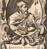
This attractive site explores the mid-Atlantic region and history with maps created before 1850. An extensive collection offers more than 1,852 historical maps of many different types. In addition to numerous regional and state maps, these include land surveys, coast surveys, nautical charts, military maps, ornamental maps, and city maps.

An overview provides historical context for reading the maps of the geographic regions. In addition, the site offers several special features. "Basics of Maps" explains such cartographic terms and features as orientation, scale, and the cartouche. "Maps Through History" highlights particular maps and map genres from the collection, including a look at New York Harbor, the Hudson River, nautical charts, maps revealing early transportation routes, and maps of American Revolution battle sites. "Geographical Areas" highlights many kinds of maps and what information they offer. Visitors can click on thumbnail images to view enlarged maps and pan and zoom the maps.

Small-Town America: Images from the Robert Dennis Collection, 1850-1920

Image
Annotation

More than 12,000 stereoscopic photographs depict life in small towns, villages, rural areas, and cities throughout New York, New Jersey, and Connecticut from 1850 to 1920 on this website. Materials include pictures of buildings, street scenes, natural landscapes, agriculture, industry, transportation, homes, businesses, local celebrations, natural disasters, and people.

Each grouping of photographs offers a short description of the contents as well as notes on the locations, medium, collection names, and digital identification information. The site also features an essay on the history of stereoscopic views and nine related website links. The site is searchable by keyword and can be browsed by subject and image name. These revealing illustrations are valuable for examining rural and urban development as well as everyday life.

September 11 Digital Archive

Image
Annotation

This archive records the histories of people affected by the terrorist attacks of September 11, 2001 (9/11), including more than 150,000 stories and more than 40,000 emails from around the world. The site is constantly growing and the sources are viewable through galleries. Items include still images, with photographs, digital art, and artwork; moving images, with video files and digital animations; documents, including flyers, reports, and articles; and stories, emails, and voicemails.

The supporting information is strong as well. The FAQ section includes numerous links with information about the chronology and a timeline, including flight paths and building collapses; information about hijackers, victims, and rescuers; memorials and rebuilding efforts; and the 9/11 Commission Report. Visitors are invited to submit their own recollections.

Valley of the Shadow: Two Communities in the American Civil War

Image
Annotation

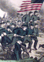
This massive, searchable archive compares two Shenandoah Valley counties during the Civil War period—Augusta County, VA and Franklin County, PA. These two counties were divided by 200 miles and the institution of slavery. Thousands of pages of maps, images, letters, diaries, and newspapers, in addition to church, agricultural, military, and public records provide data, experiences, and perspectives from the eve of the war until its aftermath. The site furnishes timelines, bibliographies, and other materials intended to foster research into the Civil War and the lives of those affected by it. The website includes a section on John Brown and one entitled "Memory of the War," presenting postwar writings on battles, the lives of soldiers, reunions, obituaries and tributes, and politics.