Chronicling America: Historic American Newspapers
Image
Scott and Bowne, Chemists, The FL Agriculturist, Dec 6, 1905, p. 790, LoC
Annotation

This website serves as a comprehensive resource for information on newspapers published in the United States from 1690 to the present. Its digital content comprises more than 680,000 individual newspaper page images drawn from close to 100 newspapers published in California, the District of Columbia, Florida, Kentucky, Minnesota, Nebraska, New York, Texas, Utah, and Virginia, between 1880 and 1910. Large cities are well-represented (for example, Washington D.C., and New York), as are medium-sized cities (Richmond, VA, and Louisville, KY) and smaller towns (Berea, KY).

This content is fully keyword searchable, and search terms appear highlighted on each newspaper page. Newspaper pages can then be zoomed for detailed viewing and downloaded in high-quality .jpg or .pdf format. By 2011, the website plans to include newspaper page images dating back to 1836. The website also provides basic publication information about more than 11,500 newspapers published from 1690 to the present. This information includes date, place, and frequency of publication, as well as holdings information for researchers interested in visiting the libraries where these newspapers are kept. The database can be searched by keyword, language, ethnic audience, or labor focus (from "agricultural industries" to "woodworkers").
Wisconsin Local History and Biography Articles Collection

Image
From Historic Picture Tells of Father. . . , Sheboygan Press, 1918, WHS
Annotation

This extensive archive assembles some 16,000 historical and biographical articles preserved in scrapbooks at the Wisconsin Historical Society in the late 19th and 20th centuries. The primary focus of the collection is the people and communities of Wisconsin. Most of the articles were published between 1860 and 1940 in hundreds of local Wisconsin newspapers. Together the articles contain more than 50,000 pages, all of which are available in the archive. Articles are displayed as page images, but transcripts are not provided. Visitors can search the collection by keyword or search by dropdown menus of counties, newspapers, or topics. Topics include agriculture, architecture, education, government and politics, Indians and Native Peoples, industry, and transportation. Full-text searching of the articles is not possible. An excellent resource for researching the social, cultural, and political history of Wisconsin and its people.

Folkstreams

Image
Introductory graphic, The Angel that Stands by Me. . ., Folkstreams
Annotation

The declared mission of this film archive "is to build a national preserve of documentary films about American folk or roots culture." The archive contains more than 50 independent films and videos "depicting American folk, traditional, regional, and vernacular culture." Films include Dry Wood, a "glimpse into the life, food, and Mardi Gras celebrations of black Creoles in French Louisiana, featuring the stories and music of 'Bois Sec' Ardoin and Canray Fontenot" and New England Fiddles, presenting seven "traditional musicians as they play in their homes and at dances and contests, passing their styles to younger fiddlers, and commenting on their music."

All films are available in streaming video and can viewed with Quicktime or Realplayer. The site also provides background material on each film, explaining the subject and aesthetic importance. Transcripts are available for some films. Visitors can browse the collection by title, filmmaker, subject, region, or people. They can also search for films or search the available transcripts of films as well as essays about the films. This site should be of interest to those studying the history of American folk culture or the history of documentary film.

Encyclopedia of Chicago, Historical Sources

Image
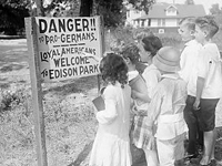
Photo, Children standing in front. . . , 1917, Encyclopedia of Chicago
Annotation

This archive brings together more than 1,300 images on a wide array of topics related to Chicago, its people, and its culture. The material in the collection spans both the 19th and 20th centuries and includes photographs, advertisements, broadsides, maps, letters, newspaper articles, illustrations, and engravings. The photographs include aerial views of the Chicago cityscape, Chicago places, Chicago industries and workers performing their trades, historic photographs, Chicago events, and photographs of Chicago's people. The more than 100 maps can be browsed separately. Each item is cross-referenced to related items in the collection and many of the images are accompanied by explanatory text. The images can be enlarged and there are features for rotation and magnification.

Additionally, the site offers interpretive essays on the Plan of Chicago of 1909, "one of the most noted documents in the history of city planning" and the importance of water in Chicago's history. Other special features are a biographical dictionary, a dictionary of leading Chicago businesses from 1820-2000, and a presentation on how Chicagoans remember their history with images and brief interpretations. In addition, the entire contents of Encyclopedia of Chicago can be searched. A useful resource on the history of Chicago or urban history.

Turning Points in Wisconsin History

Image
Photo, Arthur M. Vinje, April 4, 1947
Annotation

This website allows visitors to explore the history of Wisconsin through essays, primary source documents, lesson plans, and maps. The main feature is 53 presentations grouped under 10 overall topics: early native peoples; early explorers, traders, and settlers; territory to statehood; immigration and settlement; Civil War era; mining, lumber, and agriculture; Progressive Era; 20th-century wars and conflicts; prosperity, depression, industrialization, and urbanization; and response to 20th-century change. Each topic offers four or more presentations with a short introductory essay; primary sources available on the site; primary sources available elsewhere; and related links.

Documents available on the site include more than 140 books, tracts, pamphlets, or papers; more than 100 images; more than 260 articles; and more than 35 manuscripts. The site also offers 95 reference maps. There are more than 45 elementary and 36 secondary lesson plans searchable by keyword, grade level, and/or topic. The advanced search allows visitors to search by fields such as agriculture, intellectual life, and politics; or by keyword, education level, topic, presentation, or type of document. Additionally, there is a tutorial on using primary documents. This website is a good starting point for teaching or researching Wisconsin or the mid-Western region.

Minnesota Maps Online

Image
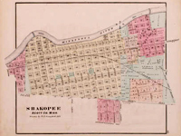
Map, 1874, Alfred Theodore Andreas, Minnesota Maps Online
Annotation

This site allows the visitor to search and view Minnesota's original public land survey plats created by the U.S. Surveyor General's Office during the years 1848 to 1907 and the later General Land Office and Bureau of Land Management maps of the state. The collection includes more than 3,500 original land survey maps; an 1873 map book of Hennepin County; late-19th-century plat books of Dakota, Hennepin, Ramsey, and Winona counties; and an 1871 illustrated historical atlas of Minnesota. Browse all the maps and plats or search the collection by county, township/range, or keyword. The advanced search feature allows the researcher to search the collection by title, subject, description, creator, publisher, date, source, or coverage. A useful resource for those researching the social, economic, environmental, or political history of Minnesota and its counties and towns.

Madison: Celebrating 150 Years

Image
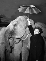
Photo, Irene Castle in Uniform, WWI or later, Madison: Celebrating 150 Years
Annotation

In 2006, Madison, WI, celebrated the 150th anniversary of its incorporation as a city. To mark the occasion, this website features 6,952 images, several articles and documents, maps and information on Madison's buildings, and links to virtual exhibits, entreating users to investigate Madison's past. This diverse collection of materials highlights both the experiences of the American Indian groups that had lived in the Madison area for many thousands of years, as well as those of the Yankee, English, Irish, German and Scandinavian settlers who began to arrive in 1837.

Visitors can view a map of American Indian village and mound sites, built for burial and ceremonial purposes, which are still visible around the city today. Also available are the recollections of George W. Stoner, one of the first settlers to arrive in Madison, through which one can learn about the construction of the city's first buildings and businesses, its first election, and its first suicide. Moving into the 20th century, visitors can also learn of the Federal Government's attempts to enforce Prohibition in Madison, which one official described as "queen of the bootleggers." This website is useful for those interested not only in Wisconsin history, but also in the history of urbanization in the United States more generally.

Panoramic Maps, 1847-1929

Image
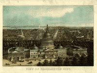
Image, View of Washington City, E. Sachse & Co., 1871
Annotation

This site presents more than 1,000 original panoramic maps, "a popular cartographic form" during the late 19th and early 20th centuries. The maps, often prepared for civic organizations, such as chambers of commerce and real estate agents, to promote an area's commercial potential, cover the contiguous 48 states and four Canadian provinces of British Columbia, Nova Scotia, Ontario, and Quebec between 1847 and 1929. While most of these maps were not drawn to scale, viewers can zoom in to find artists' renderings of individual streets, buildings, and landscape features. The site also includes a 1,200-word history of panoramic mapping; a bibliography comprised of 24 titles; and background essays (1,000 words) and images relating to five prominent panoramic artists: Albert Ruger (1829-1899), Thadeus Mortimer Fowler (1842-1922), Oakley H. Bailey (1843-1947), Lucien R. Burleigh (1853-1923), and Henry Wellge (1850-1917). This site is an excellent resource for those studying urbanization, cities, business growth, and the art of mapmaking.

First American West: The Ohio River Valley, 1750-1820

Image
Image for First American West: The Ohio River Valley, 1750-1820
Annotation

Significant European migration into the Ohio River Valley occurred from the mid-18th century to the early 19th century and this website presents approximately 15,000 pages of related materials. Resources include books, pamphlets, newspapers, periodicals, journals, letters, legal documents, images, maps, and ledgers. The site includes a special presentation with a 6,500-word essay on contested lands, peoples and migration, empires and politics, Western life and culture, and the construction of a Western past.

Materials address encounters between Europeans and native peoples, the lives of African American slaves, the role of institutions such as churches and schools, the position of women, the thoughts of naturalists and other scientists, and activities of the migrants, including travel, land acquisition, planting, navigation of rivers, and trade. These are valuable resources for studying early American history, cross-cultural encounters, frontier history, and the construction of the nation's past.

Say Cheese!

Description

From the Kansas Museum of History website:

"A century ago, photography was much more difficult than point-and-shoot. In this podcast we hear about the challenges faced by a pioneering woman photographer. Alice Gardiner Sennrich documented her town—Valley Falls, Kansas—through the lens of a massive camera."