Eye of the Storm

Image
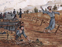
Watercolor, The Dead Line, Andersonville Prison, Ga., Knox Sneden
Annotation

In 1994, a rare book dealer brought to the Virginia Historical Society a most remarkable find—over 500 watercolor drawings and maps by Union Army Private Knox Sneden. Sneden's art depicting life as a Civil War soldier, along with his diary/memoir, was recently published by The Free Press.

This website features images and diary entries drawn from the book, entitled Eye of the Storm; and details in vivid watercolors, maps, and journal entries, events from the Civil War as witnessed by Sneden. The site offers over 40 entries from Sneden's diaries from 1861 to December 1864, accompanied by 20 of his watercolors depicting battle scenes, camp life, and maps of the areas in which Sneden served.

There is a roughly 500-word overview of Sneden's life before the Civil War and as a soldier during the war. There are also four Flash presentations of approximately 40 more watercolors depicting particular incidents Sneden witnessed. These feature comments about the scenes by Charles F. Bryan, Jr., Director of the Virginia Historical Society, and related descriptions from Sneden's journals. Incidents featured include a surprise artillery attack by Rebels against a Union fortification, views of battles, and sabotage operations.

This site gives unique insight into the war through the eyes of a talented soldier and is an ideal source for illustrations and firsthand accounts of the Civil War.
Sanborn® Fire Insurance Maps for Georgia Towns and Cities, 1884-1922

Image
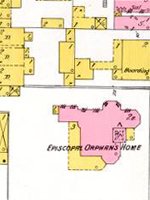
Map, Savannah, GA, Sheet 27, 1898, Sanborn Fire Insurance Maps. . .
Annotation

This extensive archive offers detailed color maps for more than 130 Georgia towns and cities between 1884 and 1922. The maps reveal urban landscapes and the locations of businesses, mills, colleges, depots, and other buildings. There are 540 sets of maps and most sets have several or more map sheets. For instance, Atlanta for 1911 has 395 map sheets covering the entire city with three index maps and Savannah for 1916 has 137 map sheets with two index maps. All maps are displayed with their original color coding.

Users can zoom in and out and pan right, left, up, or down to reveal details and every map is accompanied by full bibliographic data. Visitors can browse the collection by county or city or by year of publication; or they can search by keyword, title, city, county, or by address in listed cities. An advanced search feature is also available. Maps for each city are grouped by year with holdings indicated. There are also 17 related links that include two sites on how to read Sanborn maps and seven other digitized collections of Sanborn maps. The maps provide many details about the mills and other industries in these towns, and they are particularly useful in revealing spatial relationships and location of railroad lines. An extremely useful resource for researching the business or urban history of Georgia in the decades around 1900.

Brooklyn in the Civil War

Image
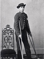
Photo, Private Charles Mitchell, Matthew Brady, c. 1862
Annotation

This website is focused on exploring and teaching the history of Brooklyn and Brooklyn's people during the Civil War through primary sources, essays, and instructional materials. More than 100 primary sources focus on Brooklyn's role in the Civil War, including letters, maps, newspaper articles, photographs, and illustrations. Additionally, the document collection can be explored through four thematic presentations on soldiers, women, slavery, and daily life. Each presentation features a short introduction and each document is accompanied by a brief description and links to related material.

Lesson plans, available as word or .pdf documents include 11 on soldiers, six on slavery, eight on women, and nine on daily life. There are also links to the Brooklyn Public Library's lists of books and related websites, resources for children, and resources for teenagers. An interactive map and timeline are also available. A useful resource for those teaching or researching Brooklyn, NY, or northern states during the Civil War.

Research & Reference Gateway: History - North America

Image
Logo, Rutger's University Libraries
Annotation

This site furnishes hundreds of links to primary and secondary sources on North American history. An eclectic collection, it includes links to library catalogs throughout the world, archival collections, texts, journals, discussion lists, bibliographies, encyclopedias, maps, statistics, book reviews, biographies, curricula, and syllabi. Materials are arranged by subject, period, and document type. Try "History-North America" for the widest variety of vetted sources. Special resource collections include "America in the 1950s," "New Americans: American Immigration History," "The Newark Experience," "U.S. Business History," "U.S. Labor and Working Class History," and "Videos on the U.S. and American Studies."

John Brown's Holy War

Image
Logo, John Brown's Holy War
Annotation

This companion site to the 1999 PBS documentary on John Brown uses special features, a timeline, an interactive map, short biographies and histories, and a teacher's guide to explain the story of Brown's life and times. The site offers special features on the Maryland farmhouse where John Brown assembled his men before their raid on Harpers Ferry, the Harpers Ferry firehouse where Brown's raiders were captured, a history of the famous song "John Brown's Body," and a short essay on Brown's failures as a businessman before he became a radical abolitionist. The timeline traces the major events of Brown's life from 1800 to 1865. An interactive map follows Brown's movements across the country from his birth in 1800 to his execution and burial in 1859. The "People and Events" section features short biographical essays on Brown, abolitionist Frederick Douglass, abolitionist newspaper editor James Redpath, writer Henry David Thoreau, 1859 Virginia Governor Henry A. Wise, and "The Secret Six"--the radical abolitionists who funded Brown's raid on Harpers Ferry. The section also features short histories of four events of Brown's radical abolitionist crusades: the Pottawatomie Massacre in Kansas, Brown's Missouri raid, the Harpers Ferry raid, and Brown's hanging. The teacher guide offers discussion questions and four classroom activities.

John Brown and the Valley of the Shadow

Image
Photo, Portrait of John Brown
Annotation

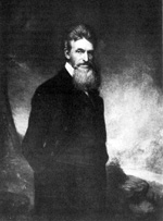
Using contemporary newspaper accounts, eyewitness testimonies, photographs, maps, drawings, and later texts, this site presents "narrative threads" linking the events leading up to John Brown's raid in 1859 on the Harper's Ferry arsenal to "the latent history of life in the two Shenandoah Valley towns of Staunton, Virginia, and Chambersburg, Pennsylvania." Includes 13 issues of newspapers from the towns; five eyewitness accounts ranging from 2,500 to 9,800 words in length; 30 images of the Brown family members and conspirators; approximately 25 additional photos, published drawings, and maps; a brief listing of Brown's day-to-day movements during the latter half of 1859; and short biographical entries of up to 500 words on each conspirator. This site, parts of which are presently under construction, will be of special interest to teachers who want to use contemporary images and written accounts in their classes on Brown and abolitionism, and for those looking to investigate local history perspectives on events of national importance.

American Journeys

Image
Image for American Journeys
Annotation

These 181 firsthand accounts of North American and Canadian exploration range from Viking stories such as The Saga of Eric the Red from circa 1,000 CE to journal entries written in the early 19th century on a trapping expedition in the Southwest. Documents include the Original Journals of the Lewis and Clark Expedition, 1804–1806. Materials include rare books, original manuscripts, and classic travel narratives.

Users can browse the full archive or by expedition, settlement, geographic region, and U.S. state or Canadian province. Each document is individually searchable and accompanied by a short background essay and a reference map. There are also 150 images available, including woodcuts, drawings, paintings, and photographs. Highlights follows the collection chronologically and connects moments in American history with eyewitness accounts.

History Matters: The U.S. Survey Course on the Web

Image
Image for History Matters: The U.S. Survey Course on the Web
Annotation

Providing a host of resources on U.S. history survey, the three main features are: WWW.History, Many Pasts, and Making Sense of Evidence.

WWW.History provides an annotated guide to more than 1,000 high-quality websites covering all of U.S. history. Users can browse websites by time period or topic and can search by keyword.

Many Pasts offers more than 1,000 primary sources in text, image, and audio, from an exchange between Powhatan and Captain John Smith to comments by the director of the Arab American Family Support Center in Brooklyn after the September 11, 2001, terrorist attacks.

Making Sense of Evidence offers eight guides with interactive exercises designed to help students learn to analyze various kinds of primary sources, including maps, early film, oral history, and popular song. These guides offer questions to ask and provide examples of how to analyze kinds of evidence. There are also eight multimedia modules that model strategies for analyzing primary sources, including political cartoons, blues, and abolitionist speeches.

DocsTeach

Image
Screenshot, Lewis & Clark's Expedition to the Complex West, DocsTeach
Annotation

DocsTeach, a National Archives and Records Administration project, recognizes the need to bring primary sources into your classroom. To assist in the effort, NARA has pulled together thousands of primary sources, as well as a selection of pre-made activities and tools for building your own primary-source-centric activities.

Documents offers exactly what it sounds like it would—primary sources. The sources are divided into chronological categories—Revolution and the New Nation, Expansion and Reform, Civil War and Reconstruction, Development of the Industrial United States, Emergence of Modern America, Great Depression and World War II, Postwar United States, and Contemporary United States. Results can then be narrowed further by selecting audio/visual, charts/graphics/data, image, map, or written document. If you prefer, you can use a keyword search. All search results are shown with thumbnails to give you a small preview of the sources for your consideration.

Activities provides pre-made classroom activities. These require access to a computer, and are based on the same tools which the site provides for making your own activities. You can also sort them by historical thinking skill—chronological thinking, comprehension, analysis and interpretation, research capabilities, and issues-analysis and decision-making. Registering gives you access to a much larger collection, many of which are created by other educators. There is no registration cost.

If you're registered, consider making your own activity for use by yourself and others. There are tools which help students to create sequences, participate in analytical discussion, connect documents, geographically map documents, use documents to gain an understanding of the bigger picture, weigh evidence, and examine source context.

Take a moment to peruse the Teacher Resources as well. Here, you can find information on national history standards, using DocsTeach activities in the classroom, Bloom's taxonomy, and the National Council of Social Studies.

Read our Digital Classroom article on DocsTeach for more detailed information on using the site.

Throughout the Ages

Image
Photo, A small boy with chicks on a farm. . . , 1932, New York State Archives
Annotation

Throughout the Ages was created to meet the primary source needs of New York state K-6 history teachers. The site collection includes more than 500 photographs, letters, paintings, advertisements, and maps.

To navigate the site, choose an area of interest and subtopic (for example "leisure" under the heading "community"), and scroll to a source of interest. The source will offer a caption. In some cases, historical context, focus questions, and the correlating New York state standards will also be listed. Be sure to click on each of these section titles, as items such as resources and historical background only display once selected.

One feature to look into is the automatic handout maker. For each image, you can automatically generate a handout by selecting any or all of the following categories: caption, historical background, standards/key ideas, historical challenge, interdisciplinary connections, and resources. For some images, these will already be filled out. For others, you can type anything you want for all, some, or one of those categories. Don't worry about deleting existing text if you don't want it on your handout. It will be back the next time you load your page.