Taking the Mystery out of Copyright

Image
Screenshot, Taking the Mystery out of Copyright
Annotation

Taking the Mystery out of Copyright provides a very brief introduction to copyright and the history of intellectual property. If you need anything beyond the very basics, unless you are interested in the major historical milestones leading to current copyright protection, this site probably will not meet your needs. However, if all you want to do is introduce the idea of copyright to very young students, you may find the site useful.

Visitors can select one of four sections. Copyright Exposed is a short animated video set to funk music which provides the basic idea that copyright "has got your back" when you produce a creative work. Files on Record provides a timeline of intellectual property history. Each milestone is accompanied by a primary source from the Library of Congress's collections. Here, you can read a few sentences on the Licensing Act of 1662 or the 1990 Architectural Works Copyright Protection Act. Reading the Fine Print offers two- to five-sentence answers on applications of copyright—protection of ideas, copyright on items you find, copyright on the Internet, when people can use your work without asking, the right to use a small sample of another work, and the reasons for registration. Steps to Copyright informs readers on how to register copyright (make something, fill out the form, pay the appropriate fee, and send nonreturnable copies).

Children and Youth in History Anonymous (not verified) Mon, 03/21/2011 - 15:15
Image
Detail, homepage
Annotation

This website presents historical sources and teaching materials that address notions of childhood and the experiences of children and youth throughout history and around the world. Primary sources can be found in a database of 200 annotated primary sources, including objects, photographs and paintings, quantitative evidence, and texts, as well as through 50 website reviews covering all regions of the world. More than 20 reviews and more than 70 primary sources relate to North American history.

The website also includes 20 teaching case studies written by experienced educators that model strategies for using primary sources to teach the history of childhood and youth, as well as 10 teaching modules that provide historical context, strategies for teaching with sets of roughly 10 primary sources, and a lesson plan and document-based question. These teaching resources cover topics ranging from the transatlantic slave trade, to girlhood as portrayed in the novel Little Women, to children and human rights. Eight case studies relate to North American history, as do two teaching modules.

The website also includes a useful introductory essay outlining major themes in the history of childhood and youth and addressing the use of primary sources for understanding this history.

PhilaPlace

Image
Photo, Former City Hall, Germantown, Philadelphia, 2009, eli.pousson
Annotation

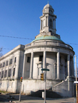
A project of the Historical Society of Pennsylvania, PhilaPlace explores the history of two neighborhoods in Philadelphia—Old Southwark and the Greater Northern Liberties—historically home to immigrants and the working class. Using an interactive map and more than 1,240 primary sources and audio and video clips, visitors to the site may navigate the neighborhoods and learn more about their development from 1875 to the present day.

Visitors may navigate the interactive map using filters found under two tabs to the left of the map: "Places" and "Streets."

Under "Places," click on marked points of interest to bring up photographs or audio or video clips describing the history of the location. These points of interest may be filtered by 14 topics (such as "Food & Foodways," "Education & Schools," and "Health") or by contributor (the Historical Society of Pennsylvania, its partners, or visitors to the site). The map may be set to show the city's streets in 1875, 1895, 1934, 1962, or the present day—note that points of interests from all time periods appear on all maps. Two virtual tours through the points of interest are available, one for Greater Northern Liberties/Lower North and South Philadelphia.

Under "Streets," visitors can view demographics for four streets—S. 4th St., S. 9th St., I-95, and Wallace Street—from 1880-1930. Buildings on each street are color-coded to show land use, the number of residents per building, and the ethnicity and occupation of each building's residents.

Collections allows visitors to search the more than 1,240 primary sources and audio and video clips available on the site. Filter them by topic, neighborhood, type, or contributor.

The site's blog presents mini-features on certain locations, notifications of updates, and information on professional development and other PhilaPlace-related events. Educators provides a timeline for each of the neighborhoods and four suggested lesson plan/activities, while My PhilaPlace lets visitors create free accounts and save favorite materials to them—or create their own up-to-25-stop city tour. The Add a Story feature allows visitors to tag locations on the maps with their own short descriptions or memories (up to 600 words long), and accompany them with an image or audio or video clip.

Attractive, interactive, and accessible, PhilaPlace may appeal to Pennsylvania educators looking for a tool to help students explore urban history.

Bubbles, Panics, and Crashes: A Century of Financial Crises, 1830s-1930s

Image
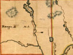
Detail, Somerset County, Maine map, Baker Library Historical Collections
Annotation

One year after the sub-prime mortgage crisis, this website presents a small collection of historical materials and information surrounding four financial crises in the 19th and early 20th century: the Panic of 1837, the Panic of 1873, the Bankers' Panic of 1907, and the Great Crash of 1929. Each section includes a brief explanation of the crisis, including causes and consequences, and between four and six primary sources, including maps, images of bank notes, title deeds, and letters. These sources highlight the complexity of crises and their increasing internationalization over time, as well as issues surrounding historical interpretation of the crises.

The website also includes sections on the Waltham Watch Company, which drew on lessons learned during the Panic of 1937 to mechanize the production of watches; and the real-estate boom of the early 1920s, which has been used recently by economists and historians to better understand current connections between real estate markets and financial crisis. Finally, a bibliography of close to 30 works on the history of these crises, links to manuscript collections, trade publications, and financial databases, give website visitors suggestions for further study.

Sanborn Fire Insurance Maps of South Carolina

Image
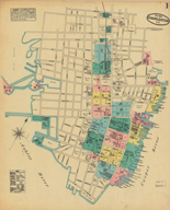
Map, Charleston, May 1884
Annotation

The 580 maps of more than 80 South Carolina towns and cities in this archive reveal urban landscapes and the locations of businesses, mills, colleges, depots, and other buildings between 1884 and 1923. The collection includes 232 unpublished, hand-drafted maps from the years 1899 to 1937. All maps are displayed with original color coding. Users can zoom in and out of maps and can pan right, left, up, or down to examine details. Every map is accompanied by bibliographic data. The full collection can be browsed or the user can choose to browse just the unpublished maps. The collection can be searched by city, year of publication, and county. The maps provide many details about mills and are particularly useful in revealing spatial relationships and location of railroad lines. There is also a link to the Union List of Sanborn and other fire insurance maps. An extremely useful resource for those researching the business or urban history of South Carolina in the decades around 1900.

Civil War Maps

Image
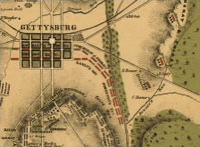
Map, The Battle of Gettysburg
Annotation

Presents approximately 2,240 Civil War maps and charts and 76 atlases and sketchbooks. The materials, primarily Union and Confederate "reconnaissance, sketch, coastal, and theater-of-war maps which depict troop activities and fortifications," also include commercially-produced maps. Provides 210 maps and three atlases belonging to General William Tecumseh Sherman, and 341 maps and sketchbooks prepared by Confederate topographical engineer Major Jedediah Hotchkiss. A "Special Presentation" offers a 10,000-word essay illustrated with 17 photographs and maps on the history of mapping the war. Maps can be viewed with the Library of Congress's excellent map viewing software. Very useful for Civil War specialists and those interested in historical geography.

Liberty! The American Revolution

Image
Logo, Liberty!: The American Revolution
Annotation

Sponsored by Norwest Corporation, this is the companion site to the 1997 PBS documentary series Liberty: The American Revolution. The site is divided into four categories. "The Chronicle of the Revolution" provides six descriptions of key events during the Revolutionary era, such as the Boston Tea Party and the Battle of Saratoga. Also offers a timeline of the Revolution and links to descriptions of related topics, a bibliography of 29 scholarly works on the Revolutionary period, and links to 45 other sites of interest. "Perspectives on Liberty" is a creative section that provides images linked to information about related places or objects. For example, a painting of a farmhouse provides information on everyday life in Revolutionary America. "Liberty, the Series" provides episode descriptions, text interviews on the making of the series, and brief, 25-word biographies of the scholars involved in creating the series. Finally, "The Road to Revolution" is an interactive trivia game with audio of specific people, speeches, and events. There are 15 images and 2 maps in this section. This site is ideal particularly for younger students who wish to learn more about America during the Revolution.

Hagley Digital Archives

Image
Logo, Hagley Digital Archives
Annotation

With a focus on business history and its connections to larger cultural, social, and political trends, the Hagley archive presents digital images on a range of topics, including "industrial processes; commercial landscapes; marketing and advertising; transportation facilities and methods; development of information technology; and, the social and cultural aspects of work and leisure." Pictured are bridges, dams, coalmines, and the testing and manufacturing of gunpowder and explosives, nylon, steel, railroads, automobiles, and airplanes. Also included are images of historic buildings, homes, and gardens in Delaware and Pennsylvania.

There are some images of advertisements, packaging, company brochures, trade catalogs, pamphlets, internal documents, letters, and other ephemera from various industrial enterprises. It includes, for example—under "nylon"—not only shots of machinery, product samples and images of the stages of melting and forming polymers, but also such treasures as ads and publicity shots of women modeling nylon stockings and swimsuits (including "Miss Chemistry" at the 1939 New York World's Fair), and news photos of the riotous early sales of nylon stockings.

Other topics include the early development and use of computers by Univac, IBM, and Remington Rand, aerial photos of the Mid-Atlantic seaboard; automobiles; Lukens Steel Company; ship building; and coal mining.

Map History/History of Cartography: The Gateway to the Subject

Image
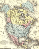
Map, North America, from <em>Mitchell's School Atlas</em>
Annotation

A comprehensive gateway to more than 3,000 links that provide historical maps and information about the history of cartography, with an emphasis on early maps. Searchable by an index with more than 400 alphabetically-arranged subject terms or by keyword. Includes sites offering listings for conferences, discussion lists, fellowships, map societies, journals, images of early maps, map collecting, web projects on early cartography, histories of maps, and articles on cartography. Now incorporated into the World Wide Web–Virtual Library and updated weekly. Extremely useful as a starting point for online cartographic resources.

Federal Township Plats of Illinois, 1804-1891

Image
Plat, Virgil, 27-59
Annotation

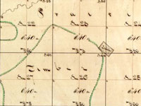
Designed as both an archive and an online exhibit, this site features 3,457 hand-drawn township maps of Illinois. When the government began surveying in 1803 what would later become Illinois, they divided the land into squares six by six miles (36 square miles) called townships. This site includes a 1,000-word introductory history describing the surveying process and introducing the methods and tools of surveyors. Also included here are the maps, available to researchers and the public. A 1,000-word narrative outlines the role of the United States Surveyor General, and traces the custody of these records through the years.

Visitors use a map of Illinois to locate the region and county of the plat they wish to view, and can pan left and right or zoom in and out. A legend helps users decipher early 19th-century symbols. In addition, the site links to an Illinois state website (Illinois Public Domain Land Tract Sales), where researchers can search for the first owners of plats. This site is a great place to view original, early-19th-century maps of Illinois.